Cow Pasture Wood

Wood, Forest in Yorkshire Craven

England

Cow Pasture Wood

Great Whernside summit The summit of Great Whernside at 704m.
Great Whernside summit Credit: T Eyre

Cow Pasture Wood is a picturesque woodland located in the county of Yorkshire, England. Spanning over a vast area of approximately 200 hectares, it is a popular destination for nature lovers and outdoor enthusiasts. The wood is situated near the village of Cow Pasture and is part of a larger forested area.

The wood is characterized by its dense canopy of towering trees, predominantly consisting of oak, birch, and beech. These trees provide a rich habitat for a diverse range of wildlife, including various species of birds, mammals, and insects. The forest floor is carpeted with lush green ferns and mosses, adding to its natural beauty.

Numerous walking trails crisscross the wood, offering visitors an opportunity to explore its tranquil surroundings. The paths wind through the trees, leading to open clearings, babbling brooks, and small ponds. There are also designated picnic areas and benches where visitors can relax and enjoy the peaceful atmosphere.

Cow Pasture Wood is not only a haven for wildlife but also serves as an important conservation site. The woodland is managed by the local authorities, who work tirelessly to preserve its natural ecosystem and protect the native flora and fauna.

Throughout the year, the wood undergoes seasonal changes, with vibrant displays of autumnal foliage and bursts of wildflowers in the springtime. This makes it a popular destination for nature photographers, artists, and those seeking solace in the beauty of nature.

Overall, Cow Pasture Wood is a captivating woodland that offers a sanctuary for both wildlife and humans alike. Its serene ambience, diverse vegetation, and abundant wildlife make it a must-visit destination for anyone seeking a connection with nature in the heart of Yorkshire.

If you have any feedback on the listing, please let us know in the comments section below.

Cow Pasture Wood Images

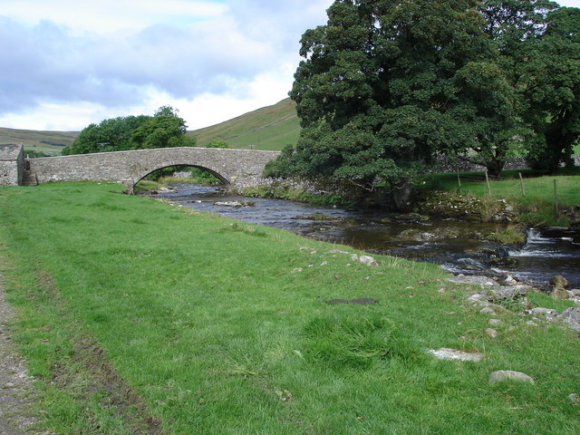
Images are sourced within 2km of 54.153141/-2.0202373 or Grid Reference SD9873. Thanks to Geograph Open Source API. All images are credited.

Great Whernside summit The summit of Great Whernside at 704m.
Great Whernside summit
The summit of Great Whernside at 704m.
Summit of Great Whernside
Great Whernside summit
Trig Point and Summit Cairn on Great Whernside All the requisite accoutrements one would expect on a major Yorkshire Dales summit.  The last time I was here it was possible to see York Minster - this time I think 15 yards was the limit.
Trig Point and Summit Cairn on Great Whernside
All the requisite accoutrements one would expect on a major Yorkshire Dales summit. The last time I was here it was possible to see York Minster - this time I think 15 yards was the limit.
Summit of Great Whernside A jumble of rocks support a trig point on Great Whernside - smothered in heavy cloud
Summit of Great Whernside
A jumble of rocks support a trig point on Great Whernside - smothered in heavy cloud
Summit Furniture on Great Whernside Someone has increased the size of the cairn, and thus the altitude of this particular fell since my last visit - roughly 18 months ago.
Summit Furniture on Great Whernside
Someone has increased the size of the cairn, and thus the altitude of this particular fell since my last visit - roughly 18 months ago.
Fence on Sweet Hill Fence striding across moorland on the southern flanks of Great Whernside
Fence on Sweet Hill
Fence striding across moorland on the southern flanks of Great Whernside
Great Whernside, cairn and trig point
Minor cairn at the south end of Great Whernside The path behind the cairn stretches to the main summit cairn on the horizon
Minor cairn at the south end of Great Whernside
The path behind the cairn stretches to the main summit cairn on the horizon
On Sweet hill, looking back towards Great Whernside
Low peat hags on the slope of Sweet Hill An extensive area of peat moorland forming the catchment to Mossdale Beck
Low peat hags on the slope of Sweet Hill
An extensive area of peat moorland forming the catchment to Mossdale Beck
Summit Cairn on Sweet Hill @686m Looking along the ridge to Great Whernside summit.
Summit Cairn on Sweet Hill @686m
Looking along the ridge to Great Whernside summit.
Cairn & Gritstone Slabs on Stone Head Crag @ 695m
Shelter on Blackfell Top
Great Whernside summit
On Great Whernside On the top. The wind was gale force.
On Great Whernside
On the top. The wind was gale force.
Halifax DT578 Handley Page Halifax Mk.II DT578 of No.1658 HCU crashed on Great Whernside after suffering structural failure on the 23rd November 1943.
Halifax DT578
Handley Page Halifax Mk.II DT578 of No.1658 HCU crashed on Great Whernside after suffering structural failure on the 23rd November 1943.
Mosquito RL197 Great Whernside Kettlewell
Mosquito RL197
Great Whernside Kettlewell
Show me another place!

Cow Pasture Wood is located at Grid Ref: SD9873 (Lat: 54.153141, Lng: -2.0202373)

Division: West Riding

Administrative County: North Yorkshire

District: Craven

Police Authority: North Yorkshire

What 3 Words

///fights.songbirds.baths. Near Grassington, North Yorkshire

Nearby Locations

Cow Pasture Wood

Related Wikis

Nearby Amenities

Located within 500m of 54.153141,-2.0202373
old shafts
Historic: mine
Source: NPE
Lat/Long: 54.1555613/-2.0232008
Historic: mine_shaft
Source: NPE
Lat/Long: 54.1557435/-2.023748
Historic: mine_shaft
Source: NPE
Lat/Long: 54.1554105/-2.0226644
disused mine
Historic: mine
Source: OS 1:25k
Lat/Long: 54.1509562/-2.0169118
old shafts
Historic: mine
Source: OS 1:25k
Lat/Long: 54.1532558/-2.0254734
Providence Pot
Natural: cave_entrance
Source: OS 1:25k
Lat/Long: 54.1516839/-2.013482
Cow Wood Pasture
Natural: fell
Source: OS 1:25k
Lat/Long: 54.1535323/-2.0207741
Historic: mine_shaft
Source: Bing
Lat/Long: 54.1545494/-2.0231466
Historic: mine_shaft
Source: Bing
Lat/Long: 54.156812/-2.0175459
Historic: mine_shaft
Source: Bing
Lat/Long: 54.1539337/-2.0272879
Historic: mine_shaft
Source: Bing
Lat/Long: 54.1558879/-2.0254533
Historic: mine_shaft
Note: not confirmed
Source: Bing
Lat/Long: 54.1494789/-2.019767
Historic: mine_shaft
Note: not confirmed
Source: Bing
Lat/Long: 54.1492087/-2.0166878
Historic: mine_shaft
Note: not confirmed
Source: Bing
Lat/Long: 54.1495166/-2.0207004
Historic: mine_shaft
Source: Bing
Lat/Long: 54.1556869/-2.0227711
Historic: mine_shaft
Note: not confirmed
Source: Bing
Lat/Long: 54.149542/-2.0209793
Historic: mine_shaft
Source: Bing
Lat/Long: 54.1550209/-2.026494
Historic: mine_shaft
Source: Bing
Lat/Long: 54.1558437/-2.0221595
Historic: mine_shaft
Source: Bing
Lat/Long: 54.1548073/-2.0264081
Historic: mine_shaft
Source: Bing
Lat/Long: 54.1557497/-2.0224599
Historic: mine_shaft
Source: Bing
Lat/Long: 54.1556366/-2.0229427
Historic: mine_shaft
Source: Bing
Lat/Long: 54.1567169/-2.0170955
Historic: mine_shaft
Note: not confirmed
Source: Bing
Lat/Long: 54.1495923/-2.0198206
Historic: mine_shaft
Source: Bing
Lat/Long: 54.1566795/-2.0175139
Historic: mine_shaft
Note: not confirmed
Source: Bing
Lat/Long: 54.1496988/-2.0231358
Historic: mine_shaft
Source: Bing
Lat/Long: 54.1558502/-2.0218376
Historic: mine_shaft
Source: Bing
Lat/Long: 54.1557934/-2.0225779
Historic: mine_shaft
Source: Bing
Lat/Long: 54.155674/-2.0213978
Historic: mine_shaft
Source: Bing
Lat/Long: 54.1554164/-2.0212368
Historic: mine_shaft
Note: not confirmed
Source: Bing
Lat/Long: 54.1495229/-2.0205073
Historic: mine_shaft
Source: Bing
Lat/Long: 54.1548605/-2.025503
Historic: mine_shaft
Source: Bing
Lat/Long: 54.1549296/-2.0257498
Historic: mine_shaft
Source: Bing
Lat/Long: 54.1549705/-2.0259214
Historic: mine_shaft
Mineral: lead
Source: OS 1852;Bing
Source Mineral: OS 1852
Lat/Long: 54.1538743/-2.0229187
Historic: mine_shaft
Source: Bing
Lat/Long: 54.1542641/-2.0146924
Historic: mine_shaft
Source: OS 1852;Bing
Lat/Long: 54.1531899/-2.0210385
Historic: mine_shaft
Source: Bing
Lat/Long: 54.1547072/-2.0133245
Historic: mine_shaft
Mineral: lead
Source: OS 1852;Bing
Source Mineral: OS 1852
Lat/Long: 54.1535793/-2.0196491
Historic: mine_shaft
Mineral: lead
Source: OS 1852;Bing
Source Mineral: OS 1852
Lat/Long: 54.1534789/-2.0200944
Historic: mine_shaft
Mineral: lead
Source: OS 1852;Bing
Source Mineral: OS 1852
Lat/Long: 54.1535323/-2.0198637
Whernside Pasture
Source: OS 1852
Lat/Long: 54.1530328/-2.0132282
Historic: mine_shaft
Note: not confirmed
Source: Bing
Lat/Long: 54.1500701/-2.016232
Historic: mine_shaft
Note: not confirmed
Source: Bing
Lat/Long: 54.1500577/-2.0159745
Historic: mine_shaft
Source: Bing;OS 1852
Lat/Long: 54.1510283/-2.0137054
Historic: mine_shaft
Note: tentative, Yorkshire 116 map shows a round symbol but not word "shaft"
Source: OS 1852
Lat/Long: 54.152786/-2.0220365
Historic: mine_shaft
Mineral: lead
Source: OS 1852
Lat/Long: 54.1522156/-2.0238573
Historic: mine_shaft
Note: tentative
Source: DigitalGlobe-Premium
Lat/Long: 54.1518968/-2.0240185
Historic: mine_shaft
Note: tentative
Source: DigitalGlobe-Premium
Lat/Long: 54.1515056/-2.0244799
Generator Method: photovoltaic
Generator Orientation: south_east
Generator Output Electricity: yes
Generator Solar Modules: 10
Generator Source: solar
Generator Type: solar_photovoltaic_panel
Power: generator
Lat/Long: 54.1558144/-2.0169016
Entrance: main
Lat/Long: 54.1557952/-2.0170596
Defibrillator
Emergency: defibrillator
Indoor: no
Lat/Long: 54.1559253/-2.0169174
The data included in this document is from www.openstreetmap.org. The data is made available under ODbL.

Have you been to Cow Pasture Wood?

Leave your review of Cow Pasture Wood below (or comments, questions and feedback).