Upper Ladypark Wood
Wood, Forest in Staffordshire Staffordshire Moorlands
England
Upper Ladypark Wood
Upper Ladypark Wood is a picturesque woodland located in Staffordshire, England. Situated near the village of Alrewas, it covers an area of approximately 30 hectares. The wood is renowned for its natural beauty and diverse range of flora and fauna.
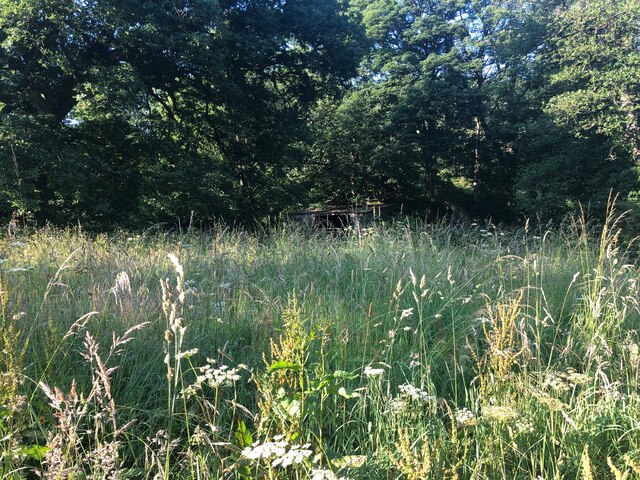
The woodland is predominantly composed of ancient oak and beech trees, providing a dense canopy that creates a tranquil and shaded environment. The trees are interspersed with patches of wildflowers, adding bursts of color to the woodland floor during spring and summer months. Upper Ladypark Wood is also home to a variety of wildlife, including deer, foxes, and a wide range of bird species.
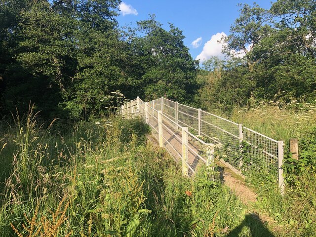
The wood has a network of well-maintained footpaths and trails, allowing visitors to explore its natural wonders at their own pace. These paths wind through the trees, offering glimpses of the surrounding countryside and the nearby River Trent. The wood is particularly popular among nature enthusiasts, walkers, and photographers, who are drawn to its serene atmosphere and abundant photo opportunities.
Upper Ladypark Wood is managed by the Forestry Commission, ensuring its conservation and protection for future generations. The commission periodically carries out tree maintenance and conservation work to maintain the health and vitality of the woodland.
Overall, Upper Ladypark Wood is a haven of tranquility and natural beauty, offering visitors the chance to immerse themselves in the stunning Staffordshire countryside. Whether it is for a leisurely stroll, wildlife spotting, or simply to escape the hustle and bustle of everyday life, this woodland provides a serene and captivating experience for all who visit.
If you have any feedback on the listing, please let us know in the comments section below.
Upper Ladypark Wood Images
Images are sourced within 2km of 53.028349/-2.0206245 or Grid Reference SJ9847. Thanks to Geograph Open Source API. All images are credited.
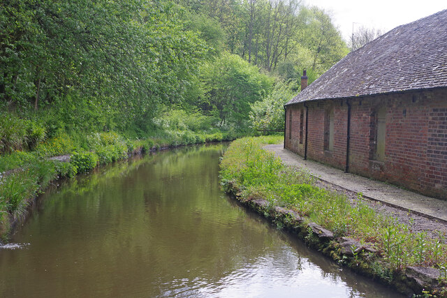

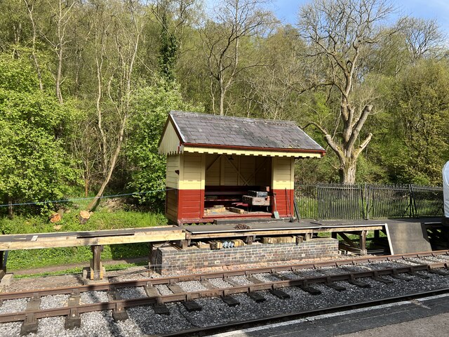
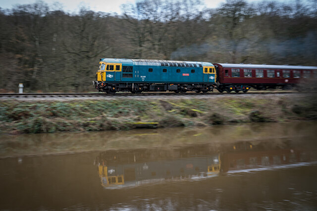
![Consall Station from the Caldon Canal towpath A preserved railway line near Leek in Staffordshire, running from Froghall up the valley to Cheddleton with one intermediate stop at Consall, and (since 2011) on an extension to a former quarry at Cauldon Low, where as of 2012 there is no station. The society has plans to connect to the national network at Stoke-on-Trent.
The lines were originally constructed by the North Staffordshire Railway (the &quot;Knotty&quot;). According to one writer, &quot;the buildings on the Churnet Valley line are of local stone, straightforwardly neo-Tudor, and effective&quot; [Lloyd &amp; Insall, &quot;Railway Station Architecture&quot;, David &amp; Charles 1978, p.17].](https://s1.geograph.org.uk/geophotos/07/51/43/7514373_0f9ef3fb.jpg)
![Consall Station A preserved railway line near Leek in Staffordshire, running from Froghall up the valley to Cheddleton with one intermediate stop at Consall, and (since 2011) on an extension to a former quarry at Cauldon Low, where as of 2012 there is no station. The society has plans to connect to the national network at Stoke-on-Trent.
The lines were originally constructed by the North Staffordshire Railway (the &quot;Knotty&quot;). According to one writer, &quot;the buildings on the Churnet Valley line are of local stone, straightforwardly neo-Tudor, and effective&quot; [Lloyd &amp; Insall, &quot;Railway Station Architecture&quot;, David &amp; Charles 1978, p.17].](https://s0.geograph.org.uk/geophotos/07/66/70/7667004_978b380e.jpg)
Upper Ladypark Wood is located at Grid Ref: SJ9847 (Lat: 53.028349, Lng: -2.0206245)
Administrative County: Staffordshire
District: Staffordshire Moorlands
Police Authority: Staffordshire
What 3 Words
///shall.observers.headset. Near Cheddleton, Staffordshire
Nearby Locations
Related Wikis

Consall
Consall is a small village situated in the Staffordshire Moorlands, Staffordshire, England. It is approximately 6 miles south of the market town of Leek...

Consall railway station
Consall railway station is a former passenger railway station of the North Staffordshire Railway (NSR) and is now a preserved station on the Churnet Valley...

Kingsley, Staffordshire
Kingsley is a small village in the Staffordshire Moorlands near to Cheadle, and situated on the A52 from Stoke on Trent to Ashbourne. The civil parish...
Wetley Rocks
Wetley Rocks is a village in Staffordshire, England, about 2 miles (3.2 km) south of Cheddleton and 6 miles (9.7 km) south of Leek. For population details...

Moorside High School, Werrington
Moorside High School is a coeducational secondary school located in Werrington, Staffordshire. == History == The school was opened in 1939 under the name...
Cheadle Coalfield
The Cheadle Coalfield is a coalfield in the United Kingdom. Centred on the town of Cheadle, Staffordshire and its outlying villages it lies to the east...

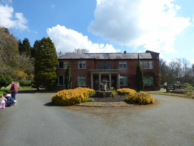
Ashcombe Park, Staffordshire
Ashcombe Park is a country house and estate near Cheddleton, in Staffordshire, England. The house is a Grade II* listed building, listed on 2 May 1953...

Dilhorne Park railway station
Dilhorne Park railway station is a heritage railway station in Staffordshire on the Foxfield Railway. The station is a halt set in woodland, and at 760...
Nearby Amenities
Located within 500m of 53.028349,-2.0206245Have you been to Upper Ladypark Wood?
Leave your review of Upper Ladypark Wood below (or comments, questions and feedback).