Abbey Wood

Wood, Forest in Staffordshire Staffordshire Moorlands

England

Abbey Wood

Newly layed hedge near Meerbrook The Derbyshire style of hedge laying where the brush (bushy growth) is placed to the livestock side of the hedge. Sawn timber stakes are used 24″ to 30″ apart. A strong, stock proof hedge is built by weaving the pleachers (layed stems) in front and behind the stakes – no binders are needed.
Newly layed hedge near Meerbrook Credit: Eirian Evans

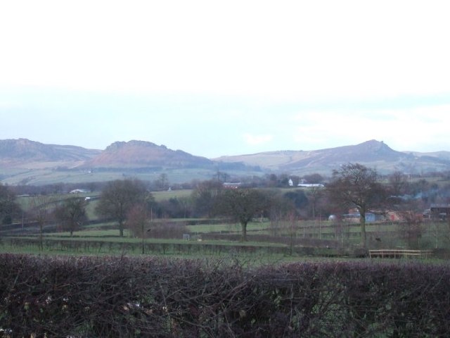
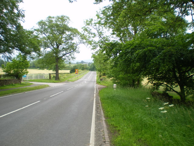
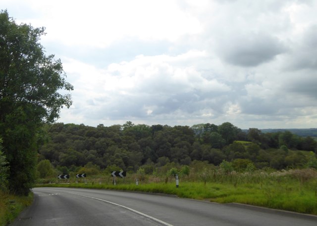
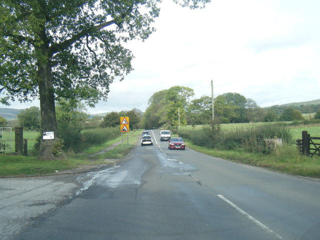
Abbey Wood, located in Staffordshire, England, is a picturesque area known for its abundant woodlands and natural beauty. Situated near the town of Stone, Abbey Wood is a popular destination for nature enthusiasts and hikers alike.

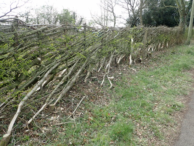
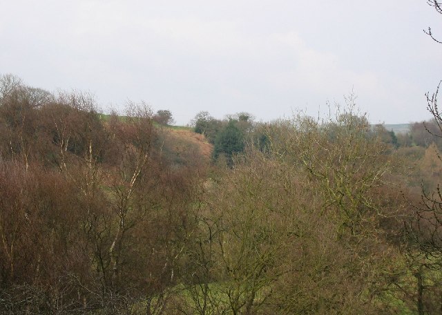
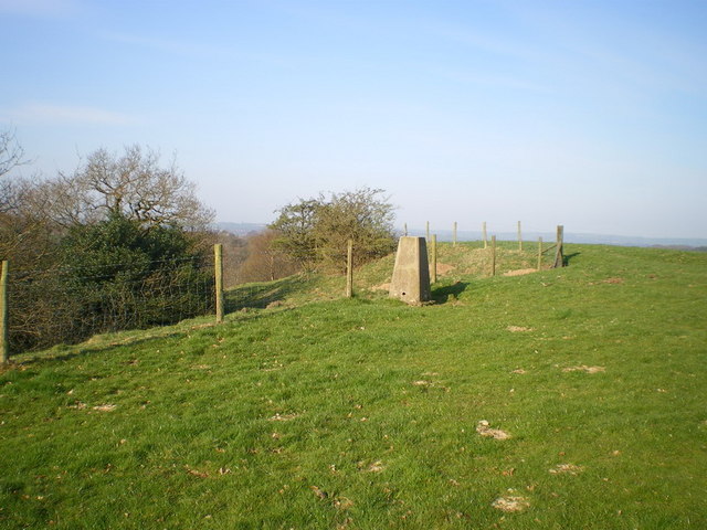
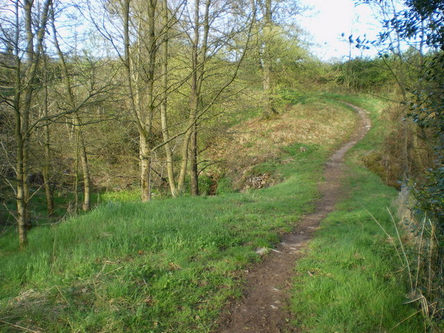
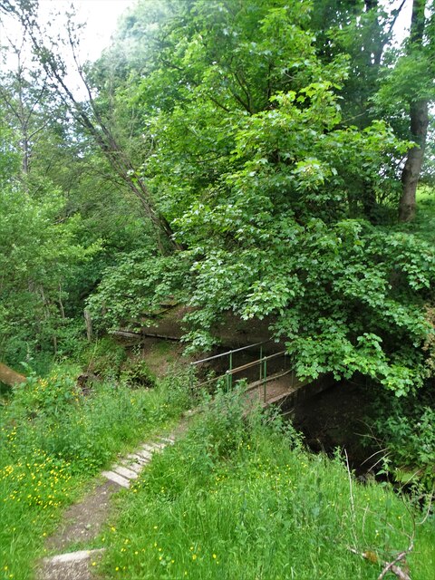
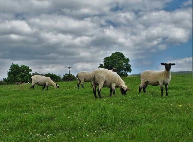
The woodlands in Abbey Wood are characterized by a diverse range of trees, including oak, birch, and beech, which create a lush and vibrant environment. The forest floor is carpeted with moss and wildflowers, adding to the enchanting atmosphere.

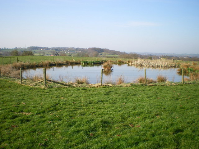
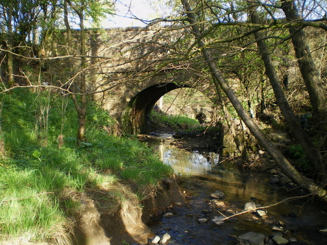
The woodlands are crisscrossed with a network of well-maintained trails, making it easy for visitors to explore the area on foot. These trails lead to various points of interest, such as a tranquil pond and a historic abbey ruins, which date back to the 12th century.

The wildlife in Abbey Wood is abundant, with sightings of deer, foxes, and various species of birds being a common occurrence. Nature enthusiasts can also spot a variety of plant species, including rare ferns and orchids that thrive in the woodlands.

Abbey Wood offers a peaceful and serene retreat from the hustle and bustle of nearby urban areas. Visitors can enjoy a leisurely walk, have a picnic amidst nature, or simply relax and immerse themselves in the tranquil surroundings.

Overall, Abbey Wood in Staffordshire is a haven for nature lovers, offering stunning woodlands, diverse wildlife, and a peaceful ambiance, making it a must-visit destination for those seeking a connection with nature.

If you have any feedback on the listing, please let us know in the comments section below.

Abbey Wood Images

Images are sourced within 2km of 53.121817/-2.0228065 or Grid Reference SJ9858. Thanks to Geograph Open Source API. All images are credited.

Newly layed hedge near Meerbrook The Derbyshire style of hedge laying where the brush (bushy growth) is placed to the livestock side of the hedge. Sawn timber stakes are used 24″ to 30″ apart. A strong, stock proof hedge is built by weaving the pleachers (layed stems) in front and behind the stakes – no binders are needed.
Newly layed hedge near Meerbrook
The Derbyshire style of hedge laying where the brush (bushy growth) is placed to the livestock side of the hedge. Sawn timber stakes are used 24″ to 30″ apart. A strong, stock proof hedge is built by weaving the pleachers (layed stems) in front and behind the stakes – no binders are needed.
Picnic tables at Tittesworth Visitor Centre
Solomon's Hollow Just outside Leek, a small valley with sides too steep for cultivation, now covered in scrub woodland with grazed clearings.
Solomon's Hollow
Just outside Leek, a small valley with sides too steep for cultivation, now covered in scrub woodland with grazed clearings.
Roaches View across the fields towards The Roaches and the Winking Man.  See <a href="https://www.geograph.org.uk/gridref/SK0062">SK0062</a> for closeup of these rocks.
Roaches
View across the fields towards The Roaches and the Winking Man. See SK0062 for closeup of these rocks.
Edge End milepost detail One of a small number of cast iron mileposts along the Leek to Buxton road, most of which are in much the same parlous state as this one.
Edge End milepost detail
One of a small number of cast iron mileposts along the Leek to Buxton road, most of which are in much the same parlous state as this one.
The Edge End milepost in its setting Beside the A53, and more or less opposite the entrance to the Leek water treatment works.
The Edge End milepost in its setting
Beside the A53, and more or less opposite the entrance to the Leek water treatment works.
Solomon's Hollow trig point Perched right on the edge of the valley of Solomon's Hollow, this sits at a spot height of 237m, which is slightly lower than the nearby spot of 239m.
Solomon's Hollow trig point
Perched right on the edge of the valley of Solomon's Hollow, this sits at a spot height of 237m, which is slightly lower than the nearby spot of 239m.
Benchmark plate on the trig point
A small pool in the field at Upper Tittesworth Farm
Narrow bridge beside the road to Thorncliffe This narrow path, and a bridge over the stream, lie beside the modern lane up from Haregate to Thorncliffe. It's well-used by horseriders, but not much else.
Narrow bridge beside the road to Thorncliffe
This narrow path, and a bridge over the stream, lie beside the modern lane up from Haregate to Thorncliffe. It's well-used by horseriders, but not much else.
Thorncliffe Lane bridge The bridge over the stream on the lane that leads up to Thorncliffe village.
Thorncliffe Lane bridge
The bridge over the stream on the lane that leads up to Thorncliffe village.
Track to Troutsdale Farm
A53 south of Blackshaw Grange A straight road (Roman alignment) looking towards a slight bend where the road crosses a small river
A53 south of Blackshaw Grange
A straight road (Roman alignment) looking towards a slight bend where the road crosses a small river
A53 approaching the valley of Solomon's Hollow
Old Milepost by the A53, Buxton Road, Leek Parish The milestone is located north west of Haregate, on the verge in front of drystone wall and hedge, on the south east side of road. Parish of Leek (Staffordshire Moorlands District). Cast iron post, green iron bobbin design, erected by the Leek & Hassop, Middlehills & Buxton turnpike trust in the 19th century. The milestone appears to have been relocated from the farm junction further North.

Inscription reads:- : LEEK / 1 / MILE : : BUXTON / 11 / MILES : : WM GREEN. MACCLESFIELD :

Grade II Listed. List Entry Number: 1268634
<span class="nowrap"><a title="https://historicengland.org.uk/listing/the-list/list-entry/1268634" rel="nofollow ugc noopener" href="https://historicengland.org.uk/listing/the-list/list-entry/1268634">Link</a><img style="margin-left:2px;" alt="External link" title="External link - shift click to open in new window" src="https://s1.geograph.org.uk/img/external.png" width="10" height="10"/></span>

Milestone Society National ID: ST_LKBX01
Old Milepost by the A53, Buxton Road, Leek Parish
The milestone is located north west of Haregate, on the verge in front of drystone wall and hedge, on the south east side of road. Parish of Leek (Staffordshire Moorlands District). Cast iron post, green iron bobbin design, erected by the Leek & Hassop, Middlehills & Buxton turnpike trust in the 19th century. The milestone appears to have been relocated from the farm junction further North. Inscription reads:- : LEEK / 1 / MILE : : BUXTON / 11 / MILES : : WM GREEN. MACCLESFIELD : Grade II Listed. List Entry Number: 1268634 LinkExternal link Milestone Society National ID: ST_LKBX01
A53 Buxton Road leaving Leek
Footbridge in Slack Wood It crosses one of the streams that feeds Tittesworth Reservoir.
Footbridge in Slack Wood
It crosses one of the streams that feeds Tittesworth Reservoir.
Lambs near Troutsdale Farm
Show me another place!

Abbey Wood is located at Grid Ref: SJ9858 (Lat: 53.121817, Lng: -2.0228065)

Administrative County: Staffordshire

District: Staffordshire Moorlands

Police Authority: Staffordshire

What 3 Words

///dunes.firewall.composed. Near Leek, Staffordshire

Related Wikis

Dieulacres Abbey

Dieulacres Abbey was a Cistercian monastery established by Ranulf, Earl of Chester at Poulton in Cheshire. It moved to the present site at Abbey Green...

Abbey Green, Staffordshire Moorlands

Abbey Green is a village near Leek in the English county of Staffordshire. The village is close to the site of Dieulacres Abbey. The abbey was founded...

Ball Haye Green

Ball Haye Green is an area of Leek in Staffordshire, England. The area was historically an estate in the township of Tittesworth. It was developed as...

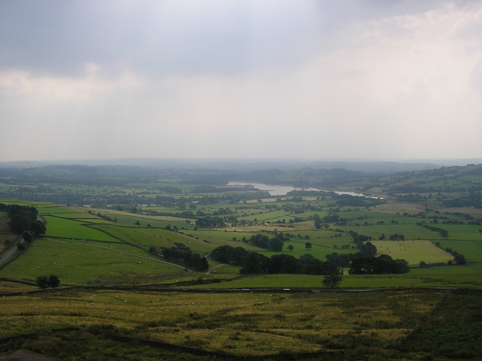
Tittesworth reservoir

Tittesworth Reservoir is a water storage reservoir near Leek, Staffordshire, England, fed by the River Churnet. The reservoir and associated water treatment...

Leek, Staffordshire

Leek is a market town and civil parish in the county of Staffordshire, England, on the River Churnet. It is situated about 10 miles (16 km) north east...

Tittesworth

Tittesworth is a civil parish in the Staffordshire Moorlands, in Staffordshire, England. It extends from the edge of the town of Leek in the south-west...

Buxton & Leek College

Buxton & Leek College is a college of Further and Higher Education operating at their campuses and facilities in Buxton, Derbyshire, Leek, Staffordshire...

Brindley Water Mill

The Brindley Water Mill is a water mill in the town of Leek, Staffordshire, England, built in 1752 by James Brindley. It was restored to working order...

Nearby Amenities

Located within 500m of 53.121817,-2.0228065
Barrier: stile
Lat/Long: 53.1224469/-2.015701
Barrier: kissing_gate
Lat/Long: 53.1223877/-2.02805
Barrier: kissing_gate
Lat/Long: 53.121265/-2.028995
Bench
Backrest: yes
Check Date: 2021-05-12
Lat/Long: 53.1212229/-2.0290618
The data included in this document is from www.openstreetmap.org. The data is made available under ODbL.

Have you been to Abbey Wood?

Leave your review of Abbey Wood below (or comments, questions and feedback).