Crowhurst Lane End

Settlement in Surrey Tandridge

England

Crowhurst Lane End

Posterngate Farm, South Godstone, Surrey Part of the extensive grounds of Posterngate Farm, where the many activities include the maintenance of a herd of pedigree Charollais, and a lake for trout fishing.  There is even a small business park.  
And this photograph 'wraps up' the TQ34 hectad, of which I have claimed 48 first geographs.
Posterngate Farm, South Godstone, Surrey Credit: Dr Neil Clifton

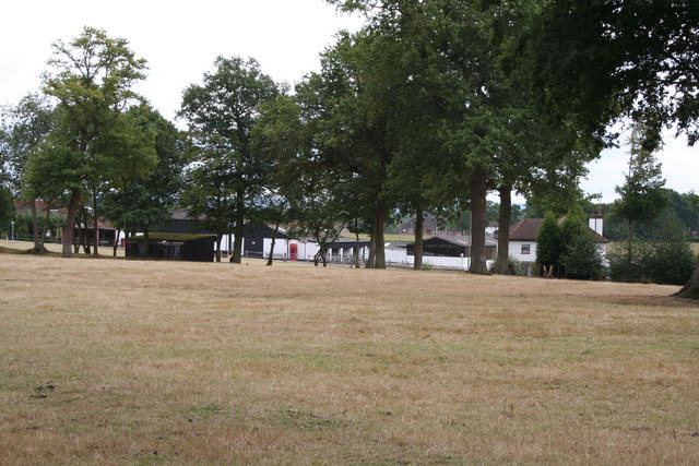
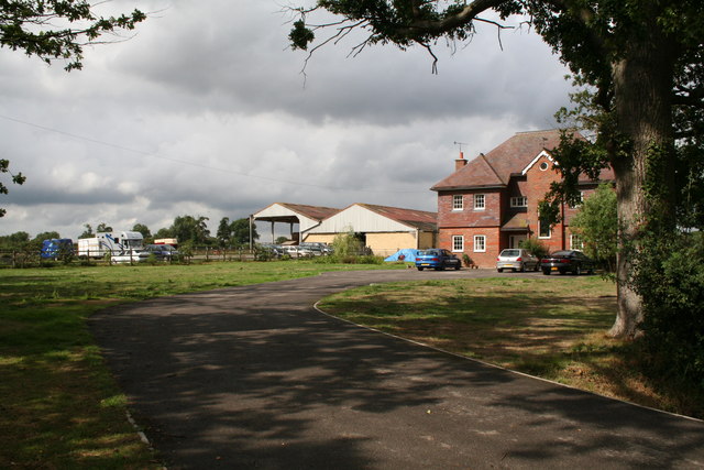
Crowhurst Lane End is a small village located in the county of Surrey, England. Nestled in the southeastern part of the county, it is situated within the Tandridge District, approximately 22 miles south of London. The village is surrounded by picturesque countryside, offering residents and visitors a tranquil and scenic environment.

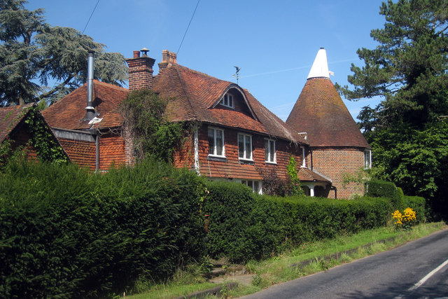
With a population of around 800, Crowhurst Lane End maintains a close-knit community atmosphere. The village predominantly consists of residential properties, ranging from historic cottages to modern houses. The architecture reflects the traditional English countryside style, adding to the village's charm.

Despite its small size, Crowhurst Lane End offers a range of amenities to cater to the needs of its residents. These include a village hall, a primary school, a small convenience store, and a pub. The village hall serves as a hub for various community activities and events, fostering a sense of togetherness among its inhabitants.

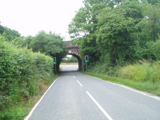
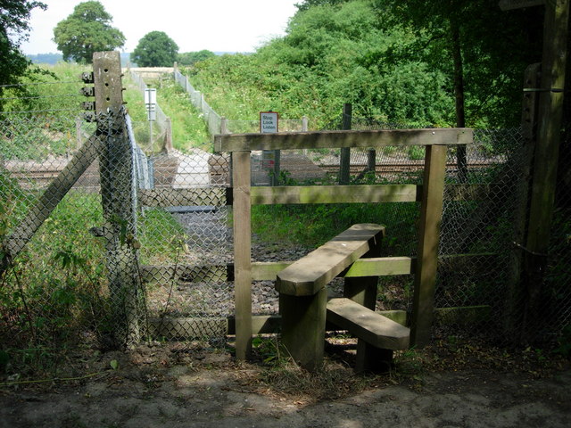
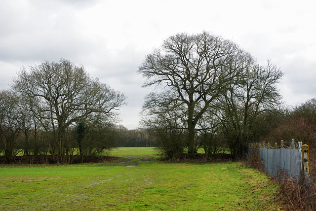
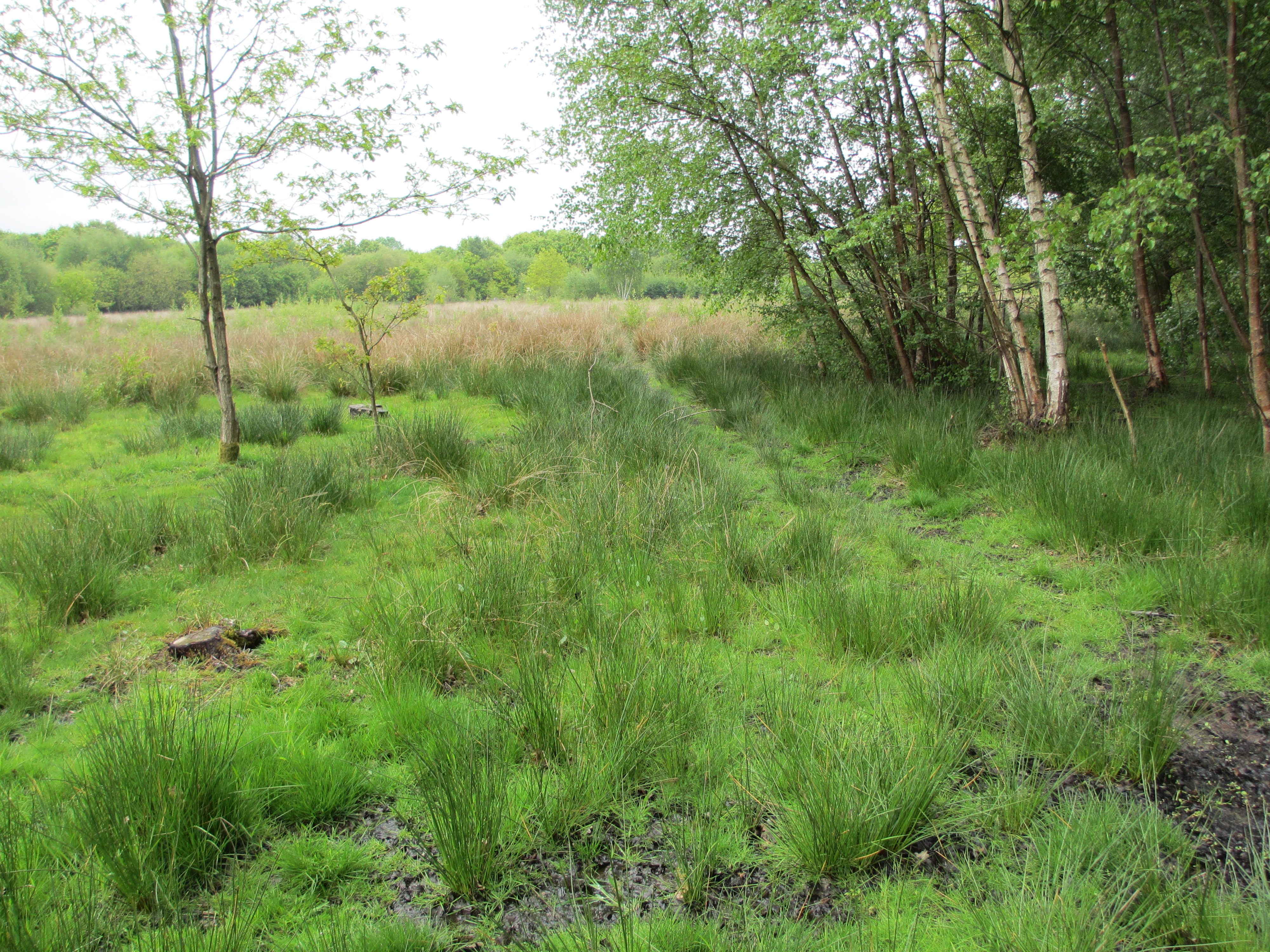
The village is surrounded by lush green fields and woodlands, making it an ideal location for outdoor enthusiasts. Residents can enjoy scenic walks and cycling routes along the nearby footpaths and bridleways. Additionally, Crowhurst Lane End benefits from its proximity to larger towns and cities, with easy access to amenities, shopping centers, and transportation links.

Overall, Crowhurst Lane End offers a peaceful and idyllic setting for those seeking a rural lifestyle within close proximity to urban conveniences. Its beautiful surroundings, community spirit, and range of amenities make it an attractive place to live or visit in the picturesque county of Surrey.

If you have any feedback on the listing, please let us know in the comments section below.

Crowhurst Lane End Images

Images are sourced within 2km of 51.215362/-0.030234 or Grid Reference TQ3748. Thanks to Geograph Open Source API. All images are credited.

Posterngate Farm, South Godstone, Surrey Part of the extensive grounds of Posterngate Farm, where the many activities include the maintenance of a herd of pedigree Charollais, and a lake for trout fishing.  There is even a small business park.  
And this photograph 'wraps up' the TQ34 hectad, of which I have claimed 48 first geographs.
Posterngate Farm, South Godstone, Surrey
Part of the extensive grounds of Posterngate Farm, where the many activities include the maintenance of a herd of pedigree Charollais, and a lake for trout fishing. There is even a small business park. And this photograph 'wraps up' the TQ34 hectad, of which I have claimed 48 first geographs.
South Godstone South Godstone is 3 miles south of Godstone village and developed when the Tonbridge railway line was built in the 19th century.
South Godstone
South Godstone is 3 miles south of Godstone village and developed when the Tonbridge railway line was built in the 19th century.
Railway Bridge Crowhurst Lane End railway bridge has a narrow width hence the traffic lights. The Brickmakers Arms Pub is just past the bridge.
Railway Bridge
Crowhurst Lane End railway bridge has a narrow width hence the traffic lights. The Brickmakers Arms Pub is just past the bridge.
Piper's Wood  and Oilseed Rape Field A field of ripe oilseed rape can be seen in the foreground with Piper's wood behind.
Piper's Wood and Oilseed Rape Field
A field of ripe oilseed rape can be seen in the foreground with Piper's wood behind.
Footpath across railway line Footpath crossing the Tonbridge to Redhill railway line.
Footpath across railway line
Footpath crossing the Tonbridge to Redhill railway line.
Little Chef restaurant, South Godstone, Surrey On the west side of the A22.
I suppose some people must actually eat in these establishments, otherwise they would not be there.
Little Chef restaurant, South Godstone, Surrey
On the west side of the A22. I suppose some people must actually eat in these establishments, otherwise they would not be there.
Ancient barn, Blackgrove Farm, Surrey. On the east side of Tandridge Lane.  Parts of this barn, which is still in use, date from around 1490.
Ancient barn, Blackgrove Farm, Surrey.
On the east side of Tandridge Lane. Parts of this barn, which is still in use, date from around 1490.
Buttons Mead Farm,  Tandridge Lane, Surrey All is in apple-pie order at Buttons Mead, where horse rearing is an important activity.
Buttons Mead Farm, Tandridge Lane, Surrey
All is in apple-pie order at Buttons Mead, where horse rearing is an important activity.
Ponies near Crowhurst Lane, Surrey A sharp shower of rain had just begun as we reached these friendly ponies being groomed in a field not far south of Crowhurst Lane.
Ponies near Crowhurst Lane, Surrey
A sharp shower of rain had just begun as we reached these friendly ponies being groomed in a field not far south of Crowhurst Lane.
Meadow and woodland, near Crowhurst, Surrey No metalled road enters this gridsquare, which is thus a haven of peaceful English countryside.  The infant River Eden meanders just beyond the trees, and a large herd of Channel Islands cattle can also just be discerned.
Meadow and woodland, near Crowhurst, Surrey
No metalled road enters this gridsquare, which is thus a haven of peaceful English countryside. The infant River Eden meanders just beyond the trees, and a large herd of Channel Islands cattle can also just be discerned.
The Crowhurst Yew This ancient tree is estimated to be around 4,000 years old; maybe twice the age of the church in whose graveyard it now stands. The location of a church here may suggest an effort to put an obvious Christian stamp on a site that was already of religious or spiritual significance to a pre-Christian population, thus easing the transition of religion.
The Crowhurst Yew
This ancient tree is estimated to be around 4,000 years old; maybe twice the age of the church in whose graveyard it now stands. The location of a church here may suggest an effort to put an obvious Christian stamp on a site that was already of religious or spiritual significance to a pre-Christian population, thus easing the transition of religion.
St. George's Church at Crowhurst The small disperesed village of Crowhurst lies about two miles north of Lingfield and is centred in the west of this grid-square around the small mediaeval church of St. George, seen here from the village street. 
<a href="https://www.geograph.org.uk/photo/691472">TQ3947 : The Crowhurst Yew</a> stands in the churchyard and its foliage can be seen to the right of the picture.
St. George's Church at Crowhurst
The small disperesed village of Crowhurst lies about two miles north of Lingfield and is centred in the west of this grid-square around the small mediaeval church of St. George, seen here from the village street. TQ3947 : The Crowhurst Yew stands in the churchyard and its foliage can be seen to the right of the picture.
Godstone Station, Surrey
The Lagham Public House, Eastbourne Road, South Godstone, Surrey
Eastbourne Road, South Godstone
Oast House at Newhouse Farm, Tandridge Lane, Tandridge, Surrey Twin round kiln oast house, converted to home. The majority of the conical roofs are missing along with cowls.
Oast House at Newhouse Farm, Tandridge Lane, Tandridge, Surrey
Twin round kiln oast house, converted to home. The majority of the conical roofs are missing along with cowls.
Way between fields The railway is behind the fence on the right.
Way between fields
The railway is behind the fence on the right.
Old excavations In the belt of woodland by Gibbs Brook Lane.
Old excavations
In the belt of woodland by Gibbs Brook Lane.
Show me another place!

Crowhurst Lane End is located at Grid Ref: TQ3748 (Lat: 51.215362, Lng: -0.030234)

Administrative County: Surrey

District: Tandridge

Police Authority: Surrey

What 3 Words

///smooth.paths.drop. Near Blindley Heath, Surrey

Nearby Locations

Crowhurst Lane End

Related Wikis

Godstone railway station

Godstone railway station is on the Redhill to Tonbridge Line and serves Godstone in Surrey, England. It is 28 miles 13 chains (28.16 miles, 45.32 km) measured...
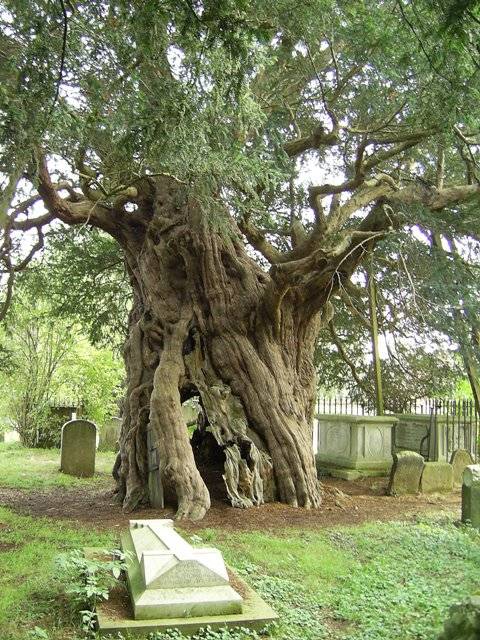
Crowhurst Yew

The Crowhurst Yew is a yew tree in the churchyard of St George's Church in Crowhurst, Surrey, England. It is thought to be about 4,000 years old. Its girth...
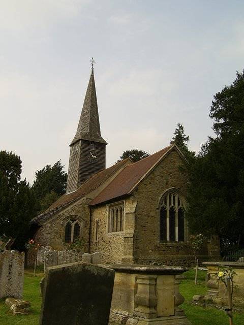
Crowhurst, Surrey

Crowhurst is a village and civil parish in the Tandridge district of Surrey, England. The nearest town is Oxted, 3 miles (5 km) to the north. Rated two...

Crowhurst Place

Crowhurst Place, Crowhurst, Surrey, England is a medieval hall house dating from the early 15th century. In the 20th century, the house was reconstructed...

Tandridge

Tandridge is a village and civil parish in the Tandridge District, in the county of Surrey, England. Its nucleus is on a rise of the Greensand Ridge between...

Godstone Ponds

Godstone Ponds is a 13.6-hectare (34-acre) biological Site of Special Scientific Interest in Godstone in Surrey. Bay Pond is an educational nature reserve...

Tilburstow Hill

Tilburstow Hill is a 9-hectare (22-acre) nature reserve south-east of Godstone in Surrey. It is managed by the Surrey Wildlife Trust.This is a semi-natural...

Blindley Heath SSSI

Blindley Heath SSSI is a 26.3-hectare (65-acre) biological Site of Special Scientific Interest in the hamlet Blindley Heath, on the southern outskirts...

Nearby Amenities

Located within 500m of 51.215362,-0.030234
Traffic Signals
Traffic Signals: bridge
Traffic Signals Direction: forward
Lat/Long: 51.2160084/-0.0280428
Man Made: survey_point
Source: npe
Lat/Long: 51.2171349/-0.0245348
Crowhurst Lane End
Place: hamlet
Source: npe
Lat/Long: 51.2142471/-0.0271303
Post Box
Ref: RH8 40
Lat/Long: 51.214985/-0.0233901
Barrier: stile
Lat/Long: 51.2133821/-0.0250914
Barrier: stile
Lat/Long: 51.2166508/-0.0358054
Barrier: stile
Lat/Long: 51.2189873/-0.0330572
Barrier: kissing_gate
Lat/Long: 51.2156904/-0.0283053
Traffic Signals
Traffic Signals: bridge
Traffic Signals Direction: backward
Lat/Long: 51.2156841/-0.0279637
Barrier: kissing_gate
Lat/Long: 51.2160337/-0.0317883
Barrier: stile
Lat/Long: 51.21831/-0.0268526
Barrier: stile
Lat/Long: 51.2183716/-0.0277953
Barrier: stile
Lat/Long: 51.2184141/-0.0283985
Pub
Brickmaker's Arms
Lat/Long: 51.215529/-0.0280986
Barrier: kissing_gate
Lat/Long: 51.215899/-0.0309491
Power: pole
Lat/Long: 51.2155443/-0.0300414
Power: pole
Lat/Long: 51.2153646/-0.0283617
Power: pole
Lat/Long: 51.2157233/-0.0317144
Power: pole
Lat/Long: 51.2158779/-0.0332728
Power: pole
Lat/Long: 51.216014/-0.0347185
Barrier: stile
Lat/Long: 51.2179604/-0.0337391
Bench
Backrest: yes
Seats: 2
Lat/Long: 51.2184908/-0.0330763
The data included in this document is from www.openstreetmap.org. The data is made available under ODbL.

Have you been to Crowhurst Lane End?

Leave your review of Crowhurst Lane End below (or comments, questions and feedback).