Cooper's Wood

Wood, Forest in Worcestershire

England

Cooper's Wood

Frankley Green Lane View The lane passes under the M5 motorway just south of the Frankley Services.
Frankley Green Lane View Credit: Gordon Griffiths

Cooper's Wood is a pristine forest located in Worcestershire, England. Spanning over a vast area, this wood is renowned for its natural beauty and diverse ecosystem. It is nestled within the heart of the county, making it easily accessible to both locals and visitors.

The wood boasts a rich history, dating back several centuries. It was historically used as a source of timber for cooperage, hence the name "Cooper's Wood." The remnants of old oak trees, once harvested for their wood, can still be seen throughout the forest, adding a touch of nostalgia and character to the landscape.

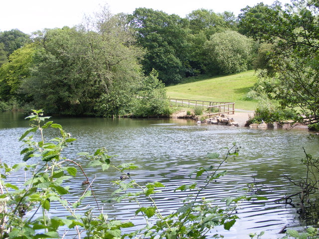
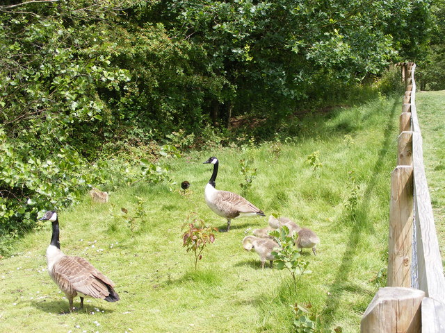
The woodland is home to an array of flora and fauna, making it a haven for nature enthusiasts. Ancient trees such as oak, beech, and birch dominate the canopy, providing a lush and vibrant habitat for numerous woodland creatures. Visitors can spot an abundance of wildlife, including deer, badgers, foxes, and a variety of bird species.

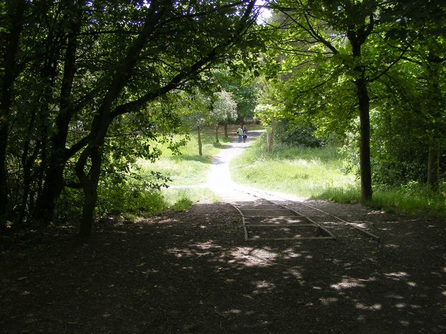
Cooper's Wood offers a range of recreational activities for outdoor enthusiasts. It features well-maintained walking trails that wind through the forest, offering breathtaking views of the surrounding countryside. These trails cater to all levels of fitness, making it an ideal location for casual strolls or more challenging hikes.

The wood is also a popular spot for picnicking, with designated areas equipped with benches and tables. Families and friends can enjoy a peaceful meal surrounded by the serene beauty of nature.

Cooper's Wood is a true gem in Worcestershire, providing a sanctuary for both wildlife and visitors seeking solace in the great outdoors. Its natural splendor and rich history make it a must-visit destination for all those who appreciate the beauty and tranquility of a pristine woodland setting.

If you have any feedback on the listing, please let us know in the comments section below.

Cooper's Wood Images

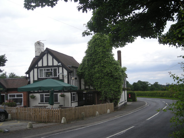
Images are sourced within 2km of 52.437014/-2.0247567 or Grid Reference SO9882. Thanks to Geograph Open Source API. All images are credited.

Frankley Green Lane View The lane passes under the M5 motorway just south of the Frankley Services.
Frankley Green Lane View
The lane passes under the M5 motorway just south of the Frankley Services.
Brookhouse Farm Track A footpath crosses the track near the M5 motorway.
Brookhouse Farm Track
A footpath crosses the track near the M5 motorway.
Services View The view from near Brookhouse Farm towards Frankley Services on the M5 motorway.
Services View
The view from near Brookhouse Farm towards Frankley Services on the M5 motorway.
Kettles Wood Edge
Kettles Wood Edge
Kettles Wood Stile
Kettles Wood Stile
Kettles Wood The view of a wood near Frankley motorway services.
Kettles Wood
The view of a wood near Frankley motorway services.
Lapal - Lye Close Lane Crossing M5 Motorway Near Junction 3
Slow Down - Spray. M5 Motorway Looking South From Lye Close Lane Bridge
Leasowes Path The view down the path to Breaches Pool in Leasowes Park, Halesowen.
Leasowes Path
The view down the path to Breaches Pool in Leasowes Park, Halesowen.
Breaches Pool The view in Leasowes Park, Halesowen.
Breaches Pool
The view in Leasowes Park, Halesowen.
Leasowes Goslings The view by Breaches Pool in Leasowes Park, Halesowen.
Leasowes Goslings
The view by Breaches Pool in Leasowes Park, Halesowen.
Manor Way School The view of the Halesowen Primary School.
Manor Way School
The view of the Halesowen Primary School.
Halesowen Abbey The view from the Monarch's Way of St Mary's Abbey ruins.
Halesowen Abbey
The view from the Monarch's Way of St Mary's Abbey ruins.
Monarchs Stile The view of the Monarch's Way near to St Mary's Abbey ruins.
Monarchs Stile
The view of the Monarch's Way near to St Mary's Abbey ruins.
Abbey View The view from the Monarch's Way of St Mary's Abbey ruins and Manor Abbey Farm.
Abbey View
The view from the Monarch's Way of St Mary's Abbey ruins and Manor Abbey Farm.
Frankley Services Northbound
Frankley motorway services area On the southbound carriageway.
Frankley motorway services area
On the southbound carriageway.
Car park at Frankley services (northbound)
Show me another place!

Cooper's Wood is located at Grid Ref: SO9882 (Lat: 52.437014, Lng: -2.0247567)

Unitary Authority: Dudley

Police Authority: West Midlands

What 3 Words

///alone.wide.shiny. Near Bartley Green, West Midlands

Nearby Locations

Cooper's Wood

Related Wikis

Illey

Illey is a hamlet south of Halesowen in the Dudley district, in the county of the West Midlands, England. == History == Illey was historically a township...
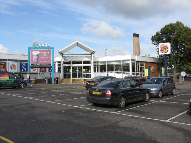
Frankley services

Frankley services is a motorway service station on the M5 motorway between Junctions 3 (A456, Quinton Interchange) and 4 (A38, Lydiate Ash), near Birmingham...

Illey Pastures

Illey Pastures is a 3.5-hectare (8.6-acre) biological site of Special Scientific Interest in the West Midlands. The site was notified in 1989 under the...

Woodgate, Birmingham

Woodgate is part of Birmingham, between Bartley Green and Harborne. It is split up into 3 parts, Woodgate Valley South (also known as South Woodgate),...

Nearby Amenities

Located within 500m of 52.437014,-2.0247567
Post Box
Ref: B62 24
Lat/Long: 52.4339518/-2.0275991
Pub
The Black Horse
Lat/Long: 52.4337878/-2.0272794
Illey
Place: hamlet
Wikidata: Q5999110
Lat/Long: 52.4335321/-2.0278111
Barrier: stile
Foot: yes
Lat/Long: 52.4373299/-2.0219656
Barrier: stile
Foot: yes
Lat/Long: 52.4370315/-2.0232643
Barrier: stile
Foot: yes
Lat/Long: 52.4405145/-2.0276454
Barrier: stile
Foot: yes
Lat/Long: 52.4405526/-2.0277196
Barrier: stile
Foot: yes
Material: wood
Stile: stepover
Lat/Long: 52.4389703/-2.0229169
Barrier: stile
Foot: yes
Lat/Long: 52.4388889/-2.0257801
Barrier: stile
Foot: yes
Lat/Long: 52.4348354/-2.0246955
Barrier: kissing_gate
Foot: yes
Lat/Long: 52.4337259/-2.0267422
Barrier: stile
Foot: yes
Material: wood
Stile: stepover
Lat/Long: 52.4371945/-2.0226471
Barrier: horse_barrier
Foot: yes
Lat/Long: 52.4389621/-2.022875
Power: tower
Source: survey
Lat/Long: 52.4399856/-2.022883
Power: tower
Source: bing
Lat/Long: 52.4354625/-2.0197903
Power: tower
Source: bing
Lat/Long: 52.4384379/-2.0218615
Barrier: stile
Source: survey
Lat/Long: 52.4383598/-2.0310187
Power: pole
Ref: 734707
Source: wpd_open_data
Transformer: distribution
Lat/Long: 52.4332866/-2.0272102
Power: pole
Source: bing
Lat/Long: 52.4330213/-2.0278868
Barrier: stile
Lat/Long: 52.434203/-2.0259716
Barrier: stile
Lat/Long: 52.4344499/-2.0261094
Ford: yes
Lat/Long: 52.4364661/-2.0258292
Barrier: stile
Material: wood
Stile: stepover
Lat/Long: 52.4357518/-2.0179548
The data included in this document is from www.openstreetmap.org. The data is made available under ODbL.

Have you been to Cooper's Wood?

Leave your review of Cooper's Wood below (or comments, questions and feedback).