Ailes Grove

Wood, Forest in Worcestershire Wychavon

England

Ailes Grove

Bredon Hill crest path, 13 Gradual descent south-east towards Ashton.
The distinctive outline of Dumbleton/Alderton Hill can be seen clearly as well as the Cotswold crest beyond.
This picture represents the completion of Hectad SO93 by the photographer, ie. a Geograph in every one of the 100 squares.
Bredon Hill crest path, 13 Credit: Jonathan Billinger

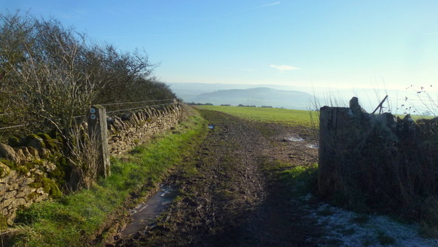
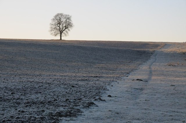
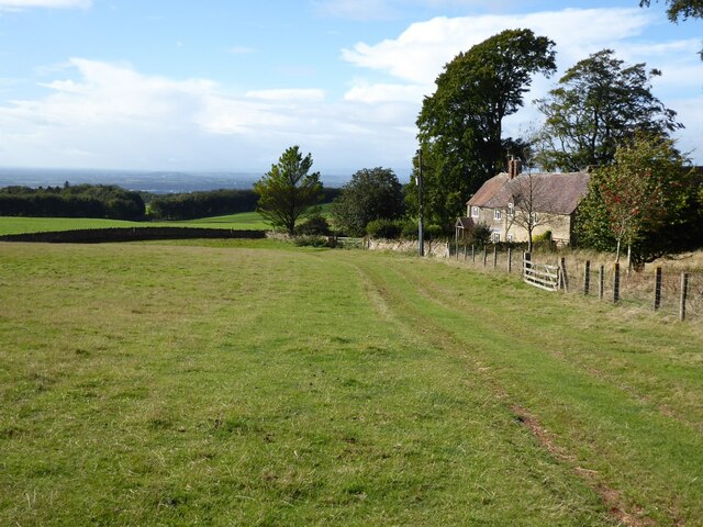
Ailes Grove, located in Worcestershire, is a picturesque woodland area known for its natural beauty and serene atmosphere. Situated in close proximity to the village of Ailesbury, this grove is a haven for nature enthusiasts and those seeking tranquility amidst a lush forest setting.

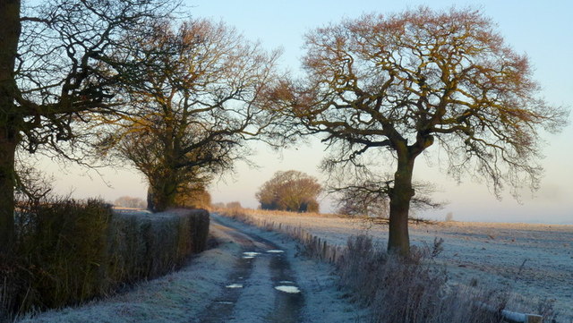
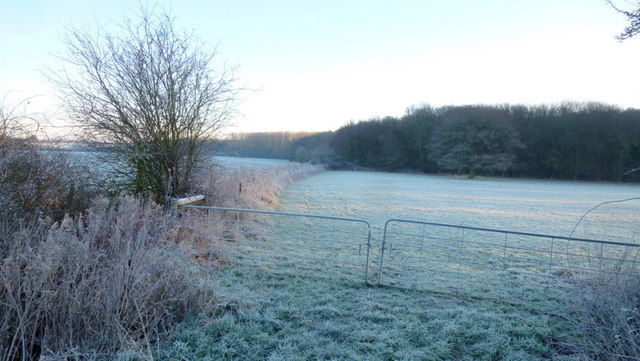
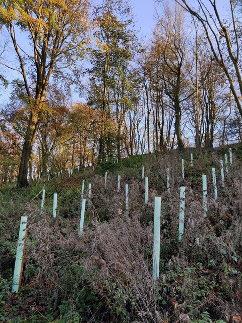
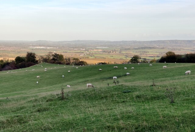
Covering an area of approximately 100 acres, Ailes Grove is primarily composed of various species of trees, including oak, beech, and birch. The dense foliage creates a vibrant green canopy, providing shelter and a nurturing environment for a diverse range of flora and fauna. The forest floor is adorned with an array of wildflowers, adding splashes of color to the landscape throughout the seasons.

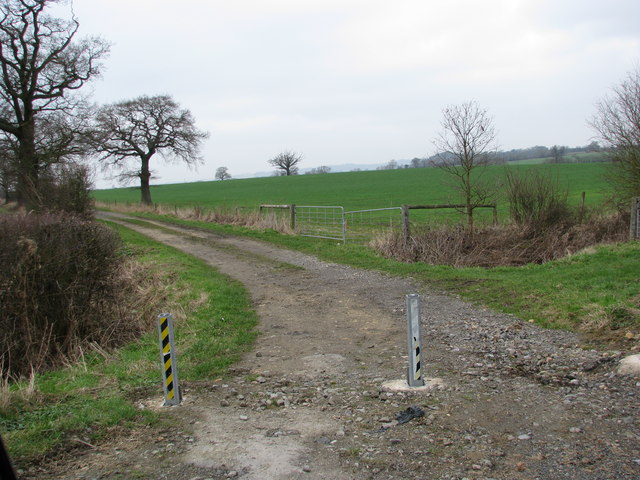
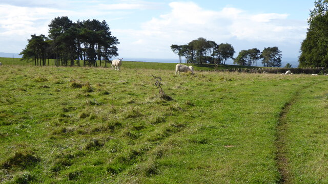
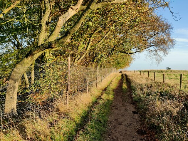
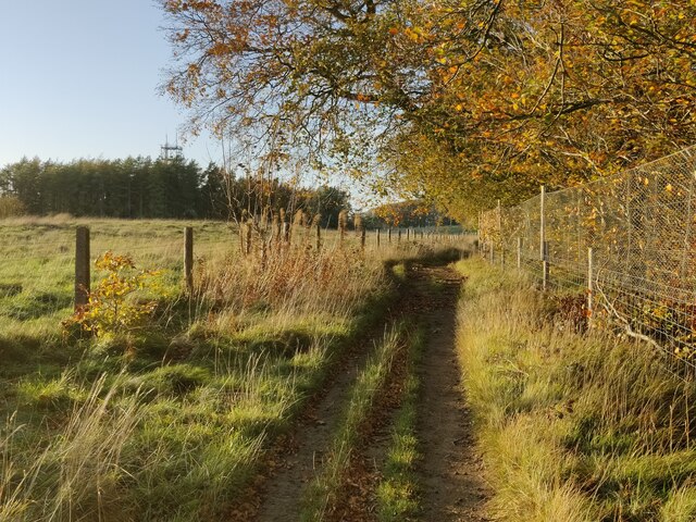
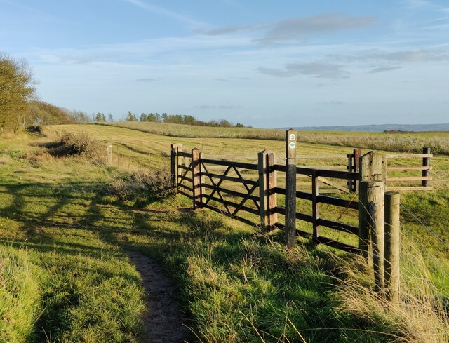
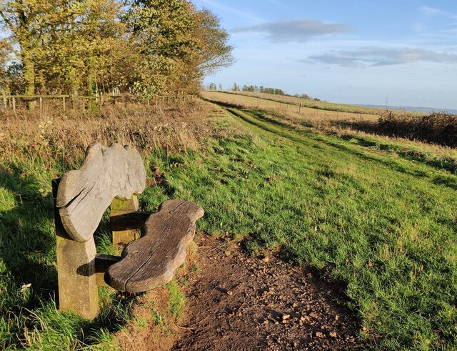
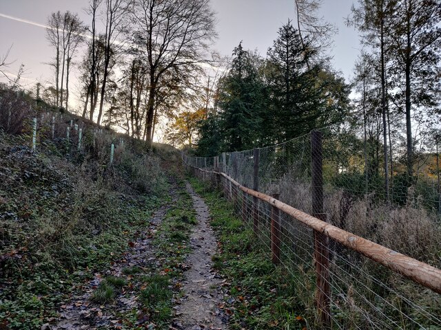
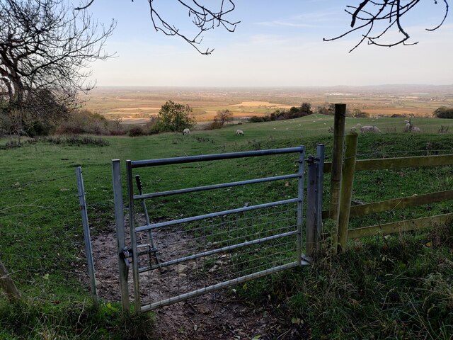
A network of well-maintained walking trails meanders through the grove, allowing visitors to explore its natural wonders at their own pace. These trails, often shaded by the overarching branches of the trees, offer a peaceful respite from the outside world. Along the way, one may encounter an abundance of wildlife, including squirrels, deer, and a variety of bird species.

Ailes Grove is also home to a small, secluded pond, which further enhances its allure. The tranquil waters reflect the surrounding trees, creating a serene and picturesque scene. It is not uncommon to find visitors enjoying a picnic or simply sitting on the banks, appreciating the serenity of this idyllic spot.

Overall, Ailes Grove in Worcestershire offers a captivating natural experience, combining the beauty of a dense woodland with the tranquility of a secluded forest setting. It is a place where one can immerse oneself in nature, unwind, and reconnect with the natural world.

If you have any feedback on the listing, please let us know in the comments section below.

Ailes Grove Images

Images are sourced within 2km of 52.059116/-2.0248804 or Grid Reference SO9840. Thanks to Geograph Open Source API. All images are credited.

Bredon Hill crest path, 13 Gradual descent south-east towards Ashton.
The distinctive outline of Dumbleton/Alderton Hill can be seen clearly as well as the Cotswold crest beyond.
This picture represents the completion of Hectad SO93 by the photographer, ie. a Geograph in every one of the 100 squares.
Bredon Hill crest path, 13
Gradual descent south-east towards Ashton. The distinctive outline of Dumbleton/Alderton Hill can be seen clearly as well as the Cotswold crest beyond. This picture represents the completion of Hectad SO93 by the photographer, ie. a Geograph in every one of the 100 squares.
Track to Furzehill Farm
The Salt Way A bridleway section north from the winding lane between Elmley Castle and Ashton.
These ancient routes centred upon Droitwich and radiate out to ports and centres of population, in this case to Lechlade where it could be transported to London on the Thames.
The Salt Way
A bridleway section north from the winding lane between Elmley Castle and Ashton. These ancient routes centred upon Droitwich and radiate out to ports and centres of population, in this case to Lechlade where it could be transported to London on the Thames.
Edge of Furzehill Brake Looking across frosty fields from the Elmley to Ashton road.
Edge of Furzehill Brake
Looking across frosty fields from the Elmley to Ashton road.
Tree in a frozen landscape A tree on the horizon in a frosted landscape near the hamlet of Kersoe.
Tree in a frozen landscape
A tree on the horizon in a frosted landscape near the hamlet of Kersoe.
Holcomb Nap Trig Point Flush Bracket S3790
View from Holcomb Nap Trig Point Flush Bracket S3790
Sheep and trees on Bredon Hill The trees in the background are in clump giving the impression it has been planted as an estate parkland.
Sheep and trees on Bredon Hill
The trees in the background are in clump giving the impression it has been planted as an estate parkland.
Bridleway passing Lalu Farm Bridleway passing Lalu Farm on Bredon Hill with Gloucestershire and the Severn vale in the distance.
Bridleway passing Lalu Farm
Bridleway passing Lalu Farm on Bredon Hill with Gloucestershire and the Severn vale in the distance.
Telecommunications mast on Bredon Hill Bredon Hill, 299 m (981 ft), is in South Worcestershire, it is geologically part of the Cotswolds but stands isolated in the Vale of Evesham.
There is a small stone tower on the summit called Parsons Folly, along with the remains of an Iron Age hill fort known as Kemerton Camp, abandoned in the 1st century AD.
Telecommunications mast on Bredon Hill
Bredon Hill, 299 m (981 ft), is in South Worcestershire, it is geologically part of the Cotswolds but stands isolated in the Vale of Evesham. There is a small stone tower on the summit called Parsons Folly, along with the remains of an Iron Age hill fort known as Kemerton Camp, abandoned in the 1st century AD.
Wychavon Way at Long Plantation on Bredon Hill The Wychavon Way begins in the Worcestershire town of Droitwich Spa and ends in the Cotswold village of Broadway. The trail is about 40 miles (64 km) in length and was created in 1977 to celebrate the Queen's Silver Jubilee.
Wychavon Way at Long Plantation on Bredon Hill
The Wychavon Way begins in the Worcestershire town of Droitwich Spa and ends in the Cotswold village of Broadway. The trail is about 40 miles (64 km) in length and was created in 1977 to celebrate the Queen's Silver Jubilee.
Wychavon Way on Bredon Hill The Wychavon Way begins in the Worcestershire town of Droitwich Spa and ends in the Cotswold village of Broadway. The trail is about 40 miles (64 km) in length and was created in 1977 to celebrate the Queen's Silver Jubilee.
Wychavon Way on Bredon Hill
The Wychavon Way begins in the Worcestershire town of Droitwich Spa and ends in the Cotswold village of Broadway. The trail is about 40 miles (64 km) in length and was created in 1977 to celebrate the Queen's Silver Jubilee.
Seat along the Wychavon Way on Bredon Hill Bredon Hill, 299 m (981 ft), is in South Worcestershire, it is geologically part of the Cotswolds but stands isolated in the Vale of Evesham.
There is a small stone tower on the summit called Parsons Folly, along with the remains of an Iron Age hill fort known as Kemerton Camp, abandoned in the 1st century AD.
Seat along the Wychavon Way on Bredon Hill
Bredon Hill, 299 m (981 ft), is in South Worcestershire, it is geologically part of the Cotswolds but stands isolated in the Vale of Evesham. There is a small stone tower on the summit called Parsons Folly, along with the remains of an Iron Age hill fort known as Kemerton Camp, abandoned in the 1st century AD.
Long Plantation on Bredon Hill Bredon Hill, 299 m (981 ft), is in South Worcestershire, it is geologically part of the Cotswolds but stands isolated in the Vale of Evesham.
There is a small stone tower on the summit called Parsons Folly, along with the remains of an Iron Age hill fort known as Kemerton Camp, abandoned in the 1st century AD.
Long Plantation on Bredon Hill
Bredon Hill, 299 m (981 ft), is in South Worcestershire, it is geologically part of the Cotswolds but stands isolated in the Vale of Evesham. There is a small stone tower on the summit called Parsons Folly, along with the remains of an Iron Age hill fort known as Kemerton Camp, abandoned in the 1st century AD.
Bridleway in Long Plantation on Bredon Hill Bredon Hill, 299 m (981 ft), is in South Worcestershire, it is geologically part of the Cotswolds but stands isolated in the Vale of Evesham.
There is a small stone tower on the summit called Parsons Folly, along with the remains of an Iron Age hill fort known as Kemerton Camp, abandoned in the 1st century AD.
Bridleway in Long Plantation on Bredon Hill
Bredon Hill, 299 m (981 ft), is in South Worcestershire, it is geologically part of the Cotswolds but stands isolated in the Vale of Evesham. There is a small stone tower on the summit called Parsons Folly, along with the remains of an Iron Age hill fort known as Kemerton Camp, abandoned in the 1st century AD.
Gate along a bridleway on Bredon Hill Bredon Hill, 299 m (981 ft), is in South Worcestershire, it is geologically part of the Cotswolds but stands isolated in the Vale of Evesham.
There is a small stone tower on the summit called Parsons Folly, along with the remains of an Iron Age hill fort known as Kemerton Camp, abandoned in the 1st century AD.
Gate along a bridleway on Bredon Hill
Bredon Hill, 299 m (981 ft), is in South Worcestershire, it is geologically part of the Cotswolds but stands isolated in the Vale of Evesham. There is a small stone tower on the summit called Parsons Folly, along with the remains of an Iron Age hill fort known as Kemerton Camp, abandoned in the 1st century AD.
Sheep at Fiddler's Knap on Bredon Hill Bredon Hill, 299 m (981 ft), is in South Worcestershire, it is geologically part of the Cotswolds but stands isolated in the Vale of Evesham.
There is a small stone tower on the summit called Parsons Folly, along with the remains of an Iron Age hill fort known as Kemerton Camp, abandoned in the 1st century AD.
Sheep at Fiddler's Knap on Bredon Hill
Bredon Hill, 299 m (981 ft), is in South Worcestershire, it is geologically part of the Cotswolds but stands isolated in the Vale of Evesham. There is a small stone tower on the summit called Parsons Folly, along with the remains of an Iron Age hill fort known as Kemerton Camp, abandoned in the 1st century AD.
Show me another place!

Ailes Grove is located at Grid Ref: SO9840 (Lat: 52.059116, Lng: -2.0248804)

Administrative County: Worcestershire

District: Wychavon

Police Authority: West Mercia

What 3 Words

///pounces.wharfs.vague. Near Eckington, Worcestershire

Nearby Locations

Ailes Grove

Related Wikis

Elmley Castle (castle)

Elmley Castle was a late 11th-century earthwork and timber castle which received stone additions in the 12th and possibly 13th centuries, located 0.5 miles...

Kersoe

Kersoe is a hamlet in Worcestershire, England. It is at the foot of Bredon Hill an area of outstanding natural beauty.

Elmley Castle

Elmley Castle is a village and civil parish in Worcestershire, in England, United Kingdom. It is located on the north side of Bredon Hill 3 miles south...

Netherton, Worcestershire

Netherton is a hamlet with population of 50 living in 20 households. It is part of the civil parish of Elmley Castle, Bricklehampton & Netherton in...

Bricklehampton

Bricklehampton is a village and civil parish in Worcestershire, England. In the 2021 census the population of the parish was recorded as 236. Its area...

Ashton under Hill

Ashton under Hill is a village and civil parish in the Wychavon district of Worcestershire in England. It is situated at the foot of Bredon Hill. According...

Bredon Hill

Bredon Hill is a hill in Worcestershire, England, south-west of Evesham in the Vale of Evesham. The summit of the hill is in the parish of Kemerton, and...

Bredon Hill Hoard

The Bredon Hill Hoard (also known as the Bredon Hill Roman Coin Hoard) is a hoard of 3,784 debased silver Roman coins discovered in June 2011 by two metal...

Nearby Amenities

Located within 500m of 52.059116,-2.0248804
Barrier: stile
Lat/Long: 52.0624418/-2.0214646
Barrier: stile
Lat/Long: 52.0630993/-2.0235927
Fiddler's Knap
Tourism: viewpoint
Lat/Long: 52.057364/-2.0265004
Castle Hill
Access: private
Ele: 193
Natural: peak
Source: OS OpenData StreetView
Lat/Long: 52.0603141/-2.0312436
The data included in this document is from www.openstreetmap.org. The data is made available under ODbL.

Have you been to Ailes Grove?

Leave your review of Ailes Grove below (or comments, questions and feedback).