Big Wood
Wood, Forest in Wiltshire
England
Big Wood
![A walk around Beacon Hill [5] The hillfort of Oliver&#039;s Castle, seen from the edge of Beacon Hill. The hillfort is a scheduled ancient monument see <span class="nowrap"><a title="https://historicengland.org.uk/listing/the-list/list-entry/1005709" rel="nofollow ugc noopener" href="https://historicengland.org.uk/listing/the-list/list-entry/1005709">Link</a><img style="margin-left:2px;" alt="External link" title="External link - shift click to open in new window" src="https://s1.geograph.org.uk/img/external.png" width="10" height="10"/></span> and the down is on the register of historic battlefields see <span class="nowrap"><a title="https://historicengland.org.uk/listing/the-list/list-entry/1000030" rel="nofollow ugc noopener" href="https://historicengland.org.uk/listing/the-list/list-entry/1000030">Link</a><img style="margin-left:2px;" alt="External link" title="External link - shift click to open in new window" src="https://s1.geograph.org.uk/img/external.png" width="10" height="10"/></span>
This short walk takes in Oliver’s Castle, an Iron Age hill fort, the former road to Bath, and the lower slopes of Beacon Hill which became known as Bloody Ditch when, after the battle of Roundway Down, the Parliamentary cavalry, in full retreat, rode over the edge to their death.](https://s2.geograph.org.uk/geophotos/07/04/90/7049066_6248f1c1.jpg)
Big Wood is a large forest located in the county of Wiltshire, England. It stretches across an area of approximately 500 acres, making it one of the largest woodlands in the region. The woodland is situated on the outskirts of a small village, surrounded by picturesque countryside.
The forest is predominantly composed of deciduous trees, such as oak, beech, and ash, which create a dense canopy that provides shelter for a wide variety of flora and fauna. The forest floor is covered in a thick layer of leaf litter, creating a natural habitat for many small mammals, including voles, shrews, and rabbits.
The wood is crisscrossed with a network of footpaths, allowing visitors to explore its beauty and tranquility. These paths lead through ancient woodlands, revealing stunning vistas and hidden glades. Big Wood is a popular destination for nature lovers, hikers, and birdwatchers, offering a peaceful retreat from the hustle and bustle of nearby towns and cities.
The forest is also home to a diverse range of bird species, including woodpeckers, owls, and various migratory birds. Birdwatchers are often drawn to the woodland to observe and listen to the melodious songs of these feathered inhabitants.
Big Wood has a rich history, with evidence of human activity dating back centuries. Archaeological discoveries have uncovered remnants of ancient settlements and burial mounds within the woodland, providing a glimpse into the lives of those who once inhabited the area.
In conclusion, Big Wood in Wiltshire is a vast forest that offers a haven for nature enthusiasts, boasting diverse flora and fauna, scenic landscapes, and a rich historical background.
If you have any feedback on the listing, please let us know in the comments section below.
Big Wood Images
Images are sourced within 2km of 51.372679/-2.0253933 or Grid Reference ST9863. Thanks to Geograph Open Source API. All images are credited.

![A walk around Bromham [4] Seen from near the village of Bromham is the Iron Age hillfort of Oliver&#039;s Castle on Roundway Down. Roundway Down was the site of a major battle in 1643 during the civil war. The down is a prominent feature and is visible over a large area. The hillfort is a scheduled ancient monument see <span class="nowrap"><a title="https://historicengland.org.uk/listing/the-list/list-entry/1005709" rel="nofollow ugc noopener" href="https://historicengland.org.uk/listing/the-list/list-entry/1005709">Link</a><img style="margin-left:2px;" alt="External link" title="External link - shift click to open in new window" src="https://s1.geograph.org.uk/img/external.png" width="10" height="10"/></span> and the down is on the register of historic battlefields see <span class="nowrap"><a title="https://historicengland.org.uk/listing/the-list/list-entry/1000030" rel="nofollow ugc noopener" href="https://historicengland.org.uk/listing/the-list/list-entry/1000030">Link</a><img style="margin-left:2px;" alt="External link" title="External link - shift click to open in new window" src="https://s1.geograph.org.uk/img/external.png" width="10" height="10"/></span>](https://s0.geograph.org.uk/geophotos/07/44/06/7440676_eea940a2.jpg)
![A walk around Bromham [17] Seen from near Bromham House Farm, the Iron Age hillfort of Oliver&#039;s Castle on Roundway Down. Roundway Down was the site of a major battle in 1643 during the civil war. The down is a prominent feature and is visible over a large area. The hillfort is a scheduled ancient monument see <span class="nowrap"><a title="https://historicengland.org.uk/listing/the-list/list-entry/1005709" rel="nofollow ugc noopener" href="https://historicengland.org.uk/listing/the-list/list-entry/1005709">Link</a><img style="margin-left:2px;" alt="External link" title="External link - shift click to open in new window" src="https://s1.geograph.org.uk/img/external.png" width="10" height="10"/></span> and the down is on the register of historic battlefields see <span class="nowrap"><a title="https://historicengland.org.uk/listing/the-list/list-entry/1000030" rel="nofollow ugc noopener" href="https://historicengland.org.uk/listing/the-list/list-entry/1000030">Link</a><img style="margin-left:2px;" alt="External link" title="External link - shift click to open in new window" src="https://s1.geograph.org.uk/img/external.png" width="10" height="10"/></span>
From the car park in front of the Greyhound public house, the route leads through fields and along Highfield to cross the A342 road. The next path leads past Bromham House Farm to Turnpike Farm and on to Wick Farm. Then paths through fields to Chittoe Heath and along minor roads to Nonsuch Nurseries. Another path through fields leads to a surfaced path at the edge of Wyatt’s Wood, this leads to the High Street and back to the starting point. Almost exactly 4 miles.](https://s1.geograph.org.uk/geophotos/07/44/15/7441549_af37f87a.jpg)
![A walk around Bromham [45] Seen from near Bromham, is the Iron Age hillfort of Oliver&#039;s Castle on Roundway Down. Roundway Down was the site of a major battle in 1643 during the civil war. The down is a prominent feature and is visible over a large area. The hillfort is a scheduled ancient monument see <span class="nowrap"><a title="https://historicengland.org.uk/listing/the-list/list-entry/1005709" rel="nofollow ugc noopener" href="https://historicengland.org.uk/listing/the-list/list-entry/1005709">Link</a><img style="margin-left:2px;" alt="External link" title="External link - shift click to open in new window" src="https://s1.geograph.org.uk/img/external.png" width="10" height="10"/></span> and the down is on the register of historic battlefields see <span class="nowrap"><a title="https://historicengland.org.uk/listing/the-list/list-entry/1000030" rel="nofollow ugc noopener" href="https://historicengland.org.uk/listing/the-list/list-entry/1000030">Link</a><img style="margin-left:2px;" alt="External link" title="External link - shift click to open in new window" src="https://s1.geograph.org.uk/img/external.png" width="10" height="10"/></span>](https://s1.geograph.org.uk/geophotos/07/44/38/7443869_033de145.jpg)


![A walk around Beacon Hill [7] Gates at the junction of the bridleway and footpath on the lower slopes of Beacon Hill.
This short walk takes in Oliver’s Castle, an Iron Age hill fort, the former road to Bath, and the lower slopes of Beacon Hill which became known as Bloody Ditch when, after the battle of Roundway Down, the Parliamentary cavalry, in full retreat, rode over the edge to their death.](https://s0.geograph.org.uk/geophotos/07/04/90/7049068_8baba51a.jpg)
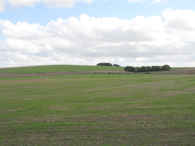
![A walk around Beacon Hill [8] From the lower slopes of Beacon Hill is this view over farmland, looking in the direction of Devizes.
This short walk takes in Oliver’s Castle, an Iron Age hill fort, the former road to Bath, and the lower slopes of Beacon Hill which became known as Bloody Ditch when, after the battle of Roundway Down, the Parliamentary cavalry, in full retreat, rode over the edge to their death.](https://s3.geograph.org.uk/geophotos/07/04/90/7049071_a849261c.jpg)


Big Wood is located at Grid Ref: ST9863 (Lat: 51.372679, Lng: -2.0253933)
Unitary Authority: Wiltshire
Police Authority: Wiltshire
What 3 Words
///ashes.yesterday.skinning. Near Rowde, Wiltshire
Nearby Locations
Related Wikis

Silverwood School
Silverwood School (formerly Rowdeford School and briefly North Wiltshire School) is a special needs community school, near Rowde, Wiltshire, England, for...
Rowde
Rowde () is a village and civil parish in the English county of Wiltshire, on the A342 about 1.7 miles (2.7 km) northwest of Devizes. The parish includes...
Roundway Down and Covert
Roundway Down and Covert (grid reference SU000646) is an 86 hectare biological Site of Special Scientific Interest near Devizes in Wiltshire, England....

Caen Hill Locks
Caen Hill Locks () are a flight of 29 locks on the Kennet and Avon Canal, between Rowde and Devizes in Wiltshire, England. == Description == The 29 locks...

St Peter's Church, Devizes
St Peter's Church is an Anglican parish church in Devizes, Wiltshire. It is a Victorian building and is on the Bath Road, on the western outskirts of the...

Bromham, Wiltshire
Bromham is a village and civil parish in Wiltshire, England. The village is 3+1⁄2 miles (6 km) northwest of Devizes and the same distance east of Melksham...
Devizes County House of Corrections
The Devizes County House of Corrections or Devizes Prison was a correctional facility in Devizes, Wiltshire, England. It opened in 1817, replacing the...
Roundway Park
Roundway Park (or New Park) was a 750-hectare (1,584-acre) estate in the former parish of Roundway in the centre of the English county of Wiltshire. The...
Nearby Amenities
Located within 500m of 51.372679,-2.0253933Have you been to Big Wood?
Leave your review of Big Wood below (or comments, questions and feedback).