Raikes Plantation

Wood, Forest in Yorkshire Craven

England

Raikes Plantation

Swinden Quarry [1] The quarry sign.
The quarry is 2 miles south of Grassington and supplies limestone. The quarry is served by the former Skipton to Grassington railway, which now terminates here.
Swinden Quarry [1] Credit: Michael Dibb

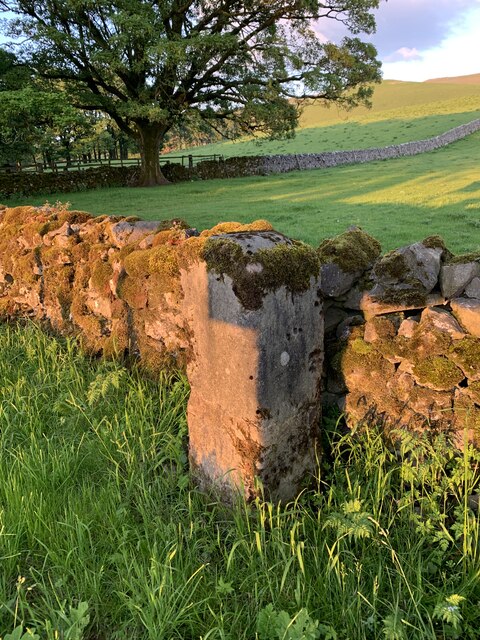
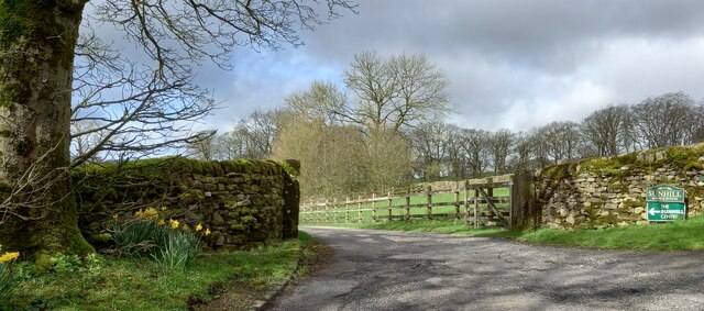
Raikes Plantation is a picturesque woodland located in the county of Yorkshire, England. Covering an area of approximately 50 acres, this forested area is renowned for its natural beauty and diverse range of flora and fauna. Situated near the village of Raikes, the plantation is easily accessible and attracts visitors from both local and international locations.

The woodland is predominantly composed of mixed broadleaf trees, including oak, beech, ash, and birch, creating a stunning tapestry of colors during the autumn months. The dense canopy provided by these trees creates a tranquil and shaded environment, ideal for leisurely walks and nature enthusiasts.

Raikes Plantation is home to a rich biodiversity, with various species of birds, mammals, and insects residing within its borders. Birdwatchers can spot woodland birds like woodpeckers, owls, and finches, while squirrel and deer sightings are also common. The forest floor boasts an array of wildflowers, ferns, and mosses, adding to the enchanting atmosphere.

The plantation offers several well-maintained walking trails, which cater to different fitness levels and interests. These paths wind through the woodland, providing opportunities to explore the area's natural wonders, ancient trees, and peaceful glades. Additionally, there are designated picnic areas and benches where visitors can relax and enjoy the tranquil surroundings.

Raikes Plantation is managed by the local authorities, who ensure the preservation of its natural beauty and the provision of appropriate facilities for visitors. With its stunning landscape, diverse wildlife, and accessible location, Raikes Plantation is a beloved natural treasure in the heart of Yorkshire.

If you have any feedback on the listing, please let us know in the comments section below.

Raikes Plantation Images

Images are sourced within 2km of 54.040427/-2.0288399 or Grid Reference SD9860. Thanks to Geograph Open Source API. All images are credited.

Swinden Quarry [1] The quarry sign.
The quarry is 2 miles south of Grassington and supplies limestone. The quarry is served by the former Skipton to Grassington railway, which now terminates here.
Swinden Quarry [1]
The quarry sign. The quarry is 2 miles south of Grassington and supplies limestone. The quarry is served by the former Skipton to Grassington railway, which now terminates here.
Swinden Quarry [2] The roadway into the quarry.
The quarry is 2 miles south of Grassington and supplies limestone. The quarry is served by the former Skipton to Grassington railway, which now terminates here.
Swinden Quarry [2]
The roadway into the quarry. The quarry is 2 miles south of Grassington and supplies limestone. The quarry is served by the former Skipton to Grassington railway, which now terminates here.
Swinden Quarry [3] Railway wagons at the end of  the line.
The quarry is 2 miles south of Grassington and supplies limestone. The quarry is served by the former Skipton to Grassington railway, which now terminates here.
Swinden Quarry [3]
Railway wagons at the end of the line. The quarry is 2 miles south of Grassington and supplies limestone. The quarry is served by the former Skipton to Grassington railway, which now terminates here.
Swinden Quarry [4] This fine view of Elbolton Hill is seen by those departing the quarry.
The quarry is 2 miles south of Grassington and supplies limestone. The quarry is served by the former Skipton to Grassington railway, which now terminates here.
Swinden Quarry [4]
This fine view of Elbolton Hill is seen by those departing the quarry. The quarry is 2 miles south of Grassington and supplies limestone. The quarry is served by the former Skipton to Grassington railway, which now terminates here.
The Devonshire Arms - Cracoe
Fields at Cracoe Green
House at Catch-all Farm
Ordnance Survey Cut Mark This mark can be found on a gatepost near Sunhill beside Fleets/Boss Moor Lane.
The recorded details give a height of 252.6396 metres above sea level.
For more detail see : <span class="nowrap"><a title="https://www.bench-marks.org.uk/bm42978" rel="nofollow ugc noopener" href="https://www.bench-marks.org.uk/bm42978">Link</a><img style="margin-left:2px;" alt="External link" title="External link - shift click to open in new window" src="https://s1.geograph.org.uk/img/external.png" width="10" height="10"/></span>
Ordnance Survey Cut Mark
This mark can be found on a gatepost near Sunhill beside Fleets/Boss Moor Lane. The recorded details give a height of 252.6396 metres above sea level. For more detail see : LinkExternal link
Old Milestone by B6265, North of Cracoe at Junction with Thorpe Lane The milestone is located on the verge behind the chevron sign on the south east side of the road.  Parish of Cracoe (Craven District). Carved stone post, erected in the 18th Century. Broken across 50cm from base, now cemented together; was to north of lane, demolished, repaired twice, so resited on south east side. An earlier photograph can be found here: <a title="https://www.geograph.org.uk/photo/6738011" href="https://www.geograph.org.uk/photo/6738011">Link</a> 

Inscription reads:-  
To / Grassingt(on) / (3) / K(ettle)well / To / Skipton / 6 miles 

Milestone Society National ID: YN_SKKT06
Old Milestone by B6265, North of Cracoe at Junction with Thorpe Lane
The milestone is located on the verge behind the chevron sign on the south east side of the road.  Parish of Cracoe (Craven District). Carved stone post, erected in the 18th Century. Broken across 50cm from base, now cemented together; was to north of lane, demolished, repaired twice, so resited on south east side. An earlier photograph can be found here: Link  Inscription reads:- To / Grassingt(on) / (3) / K(ettle)well / To / Skipton / 6 miles Milestone Society National ID: YN_SKKT06
Fleets, Fleets Cottage The benchmark is cut into the east facing wall of the cottage, which is on the west side of the lane.
Fleets, Fleets Cottage
The benchmark is cut into the east facing wall of the cottage, which is on the west side of the lane.
Fleets, Fleets Cottage There is a benchmark cut into the east facing wall of the cottage, which is on the west side of the lane.
Fleets, Fleets Cottage
There is a benchmark cut into the east facing wall of the cottage, which is on the west side of the lane.
Fleets, Fleets Lane According to the OS benchmark database there is a pivot benchmark at this location cut into the roadside wall on the east side of the lane. Nothing was found.
Fleets, Fleets Lane
According to the OS benchmark database there is a pivot benchmark at this location cut into the roadside wall on the east side of the lane. Nothing was found.
Sunhill Centre, Fleets Lane According to the OS benchmark database there is a benchmark cut into a gatepost at the drive entrance. Nothing was found.
Sunhill Centre, Fleets Lane
According to the OS benchmark database there is a benchmark cut into a gatepost at the drive entrance. Nothing was found.
Fleets, Boss Moor Lane The benchmark is cut into a right hand gatepost at a field entrance on the east side of the lane.
Fleets, Boss Moor Lane
The benchmark is cut into a right hand gatepost at a field entrance on the east side of the lane.
Fleets, Boss Moor Lane There is a benchmark cut into the right hand gatepost at the field entrance on the east side of the lane.
Fleets, Boss Moor Lane
There is a benchmark cut into the right hand gatepost at the field entrance on the east side of the lane.
Walls rising towards hill dome The location is along Swinden Lane, out of Cracoe. Ground rises to an attractively grassed hill dome off to the right of the bridleway, but the view from the hill would be quite different. To the north at the limit of the horizon lies the large, active Swinden Quarry which has taken away much of the far side right up to what was its summit area. (And much ground beyond.)
Walls rising towards hill dome
The location is along Swinden Lane, out of Cracoe. Ground rises to an attractively grassed hill dome off to the right of the bridleway, but the view from the hill would be quite different. To the north at the limit of the horizon lies the large, active Swinden Quarry which has taken away much of the far side right up to what was its summit area. (And much ground beyond.)
Grassy hill dome north of Cracoe The dome is now actually a half-dome! Out of view is the large void of the Swinden Quarry which has taken away the north-eastern part of the hill. The result can be seen in Adrian Smith's image - <a title="https://www.geograph.org.uk/photo/4948089" href="https://www.geograph.org.uk/photo/4948089">Link</a> .
Grassy hill dome north of Cracoe
The dome is now actually a half-dome! Out of view is the large void of the Swinden Quarry which has taken away the north-eastern part of the hill. The result can be seen in Adrian Smith's image - Link .
Walkers crossing Linton Moor Dull conditions for walkers heading north along the path close to the stream,  Hamerton Hill Syke which runs through the gap ahead. The path runs slightly to the east of the mapped line of a bridleway.
Walkers crossing Linton Moor
Dull conditions for walkers heading north along the path close to the stream, Hamerton Hill Syke which runs through the gap ahead. The path runs slightly to the east of the mapped line of a bridleway.
Show me another place!

Raikes Plantation is located at Grid Ref: SD9860 (Lat: 54.040427, Lng: -2.0288399)

Division: West Riding

Administrative County: North Yorkshire

District: Craven

Police Authority: North Yorkshire

What 3 Words

///weaned.paces.informed. Near Grassington, North Yorkshire

Related Wikis

Swinden Quarry

Swinden Quarry is 0.62 miles (1 km) north of the village of Cracoe, and 1.9 miles (3 km) south-west of Grassington in North Yorkshire, England. It is owned...

Rylstone railway station

Rylstone railway station was a railway station that served the small village of Rylstone in North Yorkshire, England. It was built by the Yorkshire Dales...

St Peter's Church, Rylstone

St Peter's Church is in the village of Rylstone, North Yorkshire, England. It is an active Anglican parish church in the deanery of Skipton, the archdeaconry...

Rylstone

Rylstone is a village and civil parish in the Craven district of North Yorkshire, England. It is situated very near to Cracoe and about 6 miles south west...

Linton, North Yorkshire

Linton is a village and civil parish in the Craven district of North Yorkshire, England. The population as of the 2011 census was 176. It lies not far...

Thorpe Fell Top

Thorpe Fell Top is the top of the hill of Burnsall and Thorpe Fell in the Yorkshire Dales, itself forming part of a larger wedge of ground between Wharfedale...

Hetton, North Yorkshire

Hetton is a small Dales village in the civil parish of Hetton-cum-Bordley, in the North Yorkshire district of North Yorkshire, England, situated 5.75 miles...

Cracoe

Cracoe is a small village and civil parish in the Craven district of North Yorkshire, England. It is situated near to Rylstone and about 6 miles south...

Nearby Amenities

Located within 500m of 54.040427,-2.0288399
Cafe
Farm Shop Ice Cream Parlour Cafe
Lat/Long: 54.0379193/-2.0346116
Power: pole
Source: EsriWorldImageryClarity
Lat/Long: 54.0387287/-2.0228068
Power: pole
Source: EsriWorldImageryClarity
Lat/Long: 54.0401904/-2.0219109
Power: pole
Source: EsriWorldImageryClarity
Lat/Long: 54.0375821/-2.0239709
Power: pole
Source: EsriWorldImageryClarity
Lat/Long: 54.036533/-2.0255856
Power: pole
Source: EsriWorldImageryClarity
Lat/Long: 54.0380672/-2.0232145
Source: Bing
Lat/Long: 54.0414848/-2.0338861
Power: pole
Lat/Long: 54.0419172/-2.024239
Power: pole
Lat/Long: 54.0422338/-2.0249659
Power: pole
Lat/Long: 54.0425708/-2.0259208
Material: wood
Power: pole
Lat/Long: 54.0428417/-2.0275033
Power: pole
Lat/Long: 54.0408887/-2.0316365
Power: pole
Lat/Long: 54.0415502/-2.0309418
Power: pole
Lat/Long: 54.0421976/-2.0302901
Material: wood
Power: pole
Lat/Long: 54.0427173/-2.0294479
Material: wood
Power: pole
Lat/Long: 54.043048/-2.0288739
Power: pole
Lat/Long: 54.043615/-2.0279458
Power: pole
Lat/Long: 54.0443395/-2.0277581
Power: pole
Lat/Long: 54.0423236/-2.0353514
Power: pole
Lat/Long: 54.0429866/-2.0343241
Power: pole
Lat/Long: 54.0436575/-2.0333102
Power: pole
Lat/Long: 54.0443442/-2.0322669
Power: pole
Lat/Long: 54.0396193/-2.0329723
Power: pole
Lat/Long: 54.0388601/-2.0337528
Power: pole
Lat/Long: 54.0384632/-2.0347345
The data included in this document is from www.openstreetmap.org. The data is made available under ODbL.

Have you been to Raikes Plantation?

Leave your review of Raikes Plantation below (or comments, questions and feedback).