Tongue Sharp Wood

Wood, Forest in Cheshire

England

Tongue Sharp Wood

On Shutlingsloe - first rays of sunlight on trig point An early morning start to get to the summit of Shutlingsloe to get the sunrise.
On Shutlingsloe - first rays of sunlight on trig point Credit: Colin Park

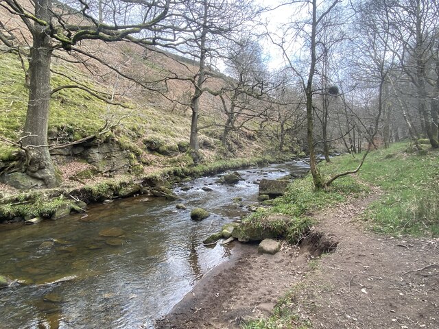
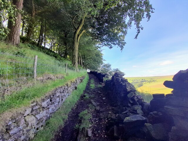
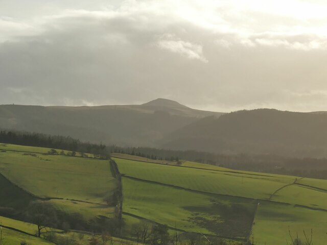
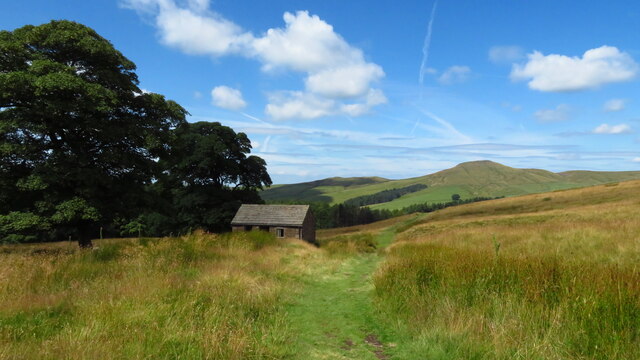
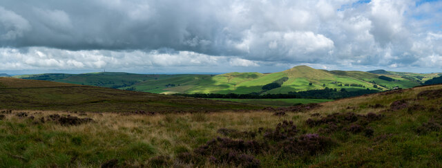
Tongue Sharp Wood is a picturesque forest located in the county of Cheshire, England. Covering an area of approximately 100 acres, this woodland is renowned for its natural beauty and diverse ecosystem. Situated near the charming village of Cholmondeley, it attracts nature enthusiasts, hikers, and photographers alike.

The wood is predominantly composed of deciduous trees, such as oak, beech, and birch, which create a dense canopy overhead. This lush vegetation provides a haven for various species of birds, including woodpeckers, owls, and thrushes, enhancing the overall enchanting atmosphere of the forest. The forest floor is adorned with an array of wildflowers, ferns, and mosses, adding to its ethereal charm.

Traversing through Tongue Sharp Wood is made easy by a network of well-maintained footpaths that wind their way through the forest. These paths allow visitors to explore the wood at their leisure, taking in the serene surroundings and enjoying the tranquil ambiance. Along the way, there are numerous benches and picnic spots, providing the perfect opportunity to rest and soak in the tranquil atmosphere.

Tongue Sharp Wood is also home to a diverse range of wildlife, including deer, foxes, and rabbits. The forest's secluded nature creates a safe haven for these creatures, making it an ideal location for wildlife enthusiasts and photographers to observe and capture these magnificent animals in their natural habitat.

Overall, Tongue Sharp Wood offers a peaceful retreat from the hustle and bustle of daily life, providing visitors with an opportunity to reconnect with nature and enjoy the beauty of Cheshire's countryside.

If you have any feedback on the listing, please let us know in the comments section below.

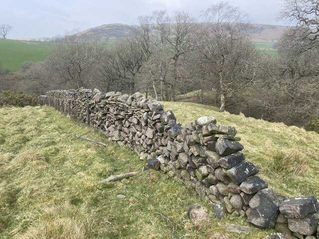
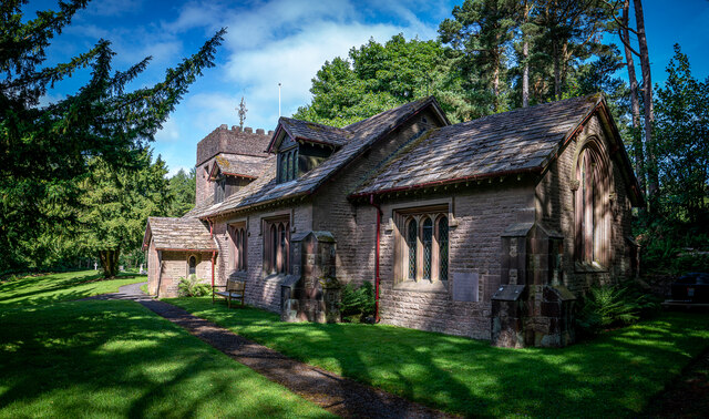
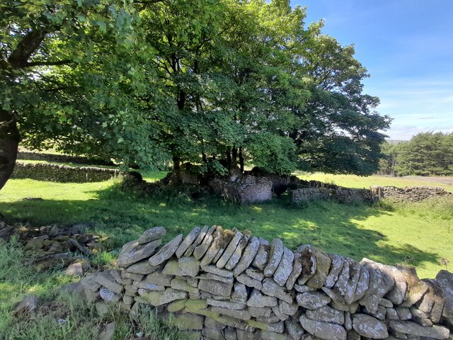
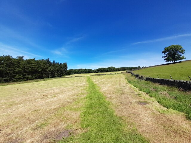
Tongue Sharp Wood Images

Images are sourced within 2km of 53.208433/-2.028348 or Grid Reference SJ9867. Thanks to Geograph Open Source API. All images are credited.

On Shutlingsloe - first rays of sunlight on trig point An early morning start to get to the summit of Shutlingsloe to get the sunrise.
On Shutlingsloe - first rays of sunlight on trig point
An early morning start to get to the summit of Shutlingsloe to get the sunrise.
Early morning - path north from Shutlingsloe
Shutlingsloe From Croker Hill
Shutlingsloe
From Croker Hill
Helmesley, Peak District The A54 is a short distance ahead. The Sutton Common BT Tower is also visible in the distance.
Helmesley, Peak District
The A54 is a short distance ahead. The Sutton Common BT Tower is also visible in the distance.
Shutlingsloe, Peak District Viewed from the A54, on the edge of the Peak District in Cheshire.
Shutlingsloe, Peak District
Viewed from the A54, on the edge of the Peak District in Cheshire.
Shutlingsloe & Croker Hill from Whetstone Ridge A clear sunny morning with a cold air inversion over the Cheshire Plain. The hills beyond are just into Wales.
Shutlingsloe & Croker Hill from Whetstone Ridge
A clear sunny morning with a cold air inversion over the Cheshire Plain. The hills beyond are just into Wales.
River Dane From the Staffordshire bank.
River Dane
From the Staffordshire bank.
In need of repair Drystone wall above the River Dane.
In need of repair
Drystone wall above the River Dane.
St. Saviours Church, Wildboarclough The church was built between 1901 and 1909 for the 16th Earl of Derby to celebrate the safe return of his sons from the Boer War. The building was carried out by workers from the Crag estate. The foundation stone was laid by the Countess of Derby on 14 September 1901, and the church was consecrated in 1909.


<span class="nowrap"><a title="https://en.wikipedia.org/wiki/St_Saviour%27s_Church,_Wildboarclough" rel="nofollow ugc noopener" href="https://en.wikipedia.org/wiki/St_Saviour%27s_Church,_Wildboarclough">Link</a><img style="margin-left:2px;" alt="External link" title="External link - shift click to open in new window" src="https://s1.geograph.org.uk/img/external.png" width="10" height="10"/></span>
St. Saviours Church, Wildboarclough
The church was built between 1901 and 1909 for the 16th Earl of Derby to celebrate the safe return of his sons from the Boer War. The building was carried out by workers from the Crag estate. The foundation stone was laid by the Countess of Derby on 14 September 1901, and the church was consecrated in 1909. LinkExternal link
Ruined sheepfold at Goosetree Farm
Ruins at Tagscloughhole
Footpath across a mown field
Walled footpath by Berrybank Wood
View towards Shutlingsloe from Tegg's Nose visitor centre The distance between the two is 4.5km as the crow flies.
View towards Shutlingsloe from Tegg's Nose visitor centre
The distance between the two is 4.5km as the crow flies.
Shutlingsloe from near Crag Hall, Wildboarclough
Moorland path west of A54 near Wildboarclough & view towards Shutlingsloe
Shuttlingsloe Summit Panno Class: Ethel, Hump, Dodd (500-599m), Dewey  ( <span class="nowrap"><a title="https://www.hill-bagging.co.uk/mountaindetails.php?qu=S&rf=3644" rel="nofollow ugc noopener" href="https://www.hill-bagging.co.uk/mountaindetails.php?qu=S&rf=3644">Link</a><img style="margin-left:2px;" alt="External link" title="External link - shift click to open in new window" src="https://s1.geograph.org.uk/img/external.png" width="10" height="10"/></span> )

Trigpoint ( <span class="nowrap"><a title="http://www.trigpointinguk.com/trigs/trig-details.php?t=5970" rel="nofollow ugc noopener" href="http://www.trigpointinguk.com/trigs/trig-details.php?t=5970">Link</a><img style="margin-left:2px;" alt="External link" title="External link - shift click to open in new window" src="https://s1.geograph.org.uk/img/external.png" width="10" height="10"/></span> )
Shuttlingsloe Summit Panno
Class: Ethel, Hump, Dodd (500-599m), Dewey ( LinkExternal link ) Trigpoint ( LinkExternal link )
Birchenough Hill 459m / 1506ft Pano Summit TuMP summit 

<span class="nowrap"><a title="https://www.hill-bagging.co.uk/mountaindetails.php?qu=S&rf=16500" rel="nofollow ugc noopener" href="https://www.hill-bagging.co.uk/mountaindetails.php?qu=S&rf=16500">Link</a><img style="margin-left:2px;" alt="External link" title="External link - shift click to open in new window" src="https://s1.geograph.org.uk/img/external.png" width="10" height="10"/></span>
Birchenough Hill 459m / 1506ft Pano Summit
TuMP summit LinkExternal link
Show me another place!

Tongue Sharp Wood is located at Grid Ref: SJ9867 (Lat: 53.208433, Lng: -2.028348)

Unitary Authority: Cheshire East

Police Authority: Cheshire

What 3 Words

///cooked.giggle.flips. Near Macclesfield, Cheshire

Related Wikis

Wildboarclough

Wildboarclough ( WIL-bÉ™-kluf) is a village in the civil parish of Macclesfield Forest and Wildboarclough, in the Cheshire East district, in the ceremonial...

St Saviour's Church, Wildboarclough

St Saviour's Church is in the village of Wildboarclough, Cheshire, England. It is an active Anglican parish church in the deanery of Macclesfield, the...

Crag Hall

Crag Hall is a country house east of the village of Wildboarclough, Cheshire, England and owned by the Earl of Derby. == Description == It was built in...

Allgreave

Allgreave is a village in Cheshire, England. It lies on the A54 (Buxton to Congleton) road, near to the border with Staffordshire. Allgreave Methodist...
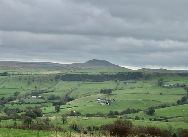
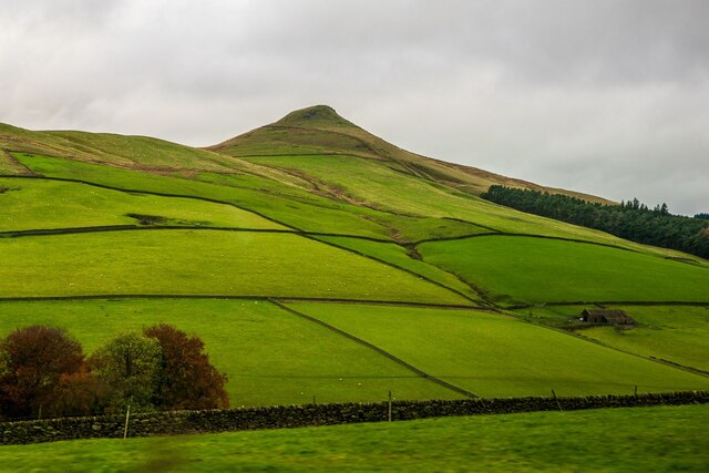
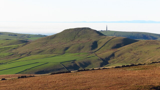
Shutlingsloe

Shutlingsloe is a hill near the village of Wildboarclough, in the east of the county of Cheshire. It stands to the south of Macclesfield Forest, on the...

Lud's Church

Lud's Church (sometimes written as Ludchurch) is a deep chasm penetrating the Millstone Grit bedrock created by a massive landslip on the hillside above...

Macclesfield Forest and Wildboarclough

Macclesfield Forest and Wildboarclough is a civil parish in the unitary authority of Cheshire East and the ceremonial county of Cheshire, England. It...

Three Shire Heads

Three Shire Heads (also known as Three Shires Head) is the point on Axe Edge Moor where Cheshire, Derbyshire and Staffordshire meet, at UK grid reference...

Nearby Amenities

Located within 500m of 53.208433,-2.028348
Barrier: stile
Lat/Long: 53.2095317/-2.0320327
Barrier: stile
Lat/Long: 53.20837/-2.0239592
Barrier: stile
Steps: 2
Stile: stepover
Lat/Long: 53.2066328/-2.0238888
Ele: 366.87
Lat/Long: 53.206182/-2.0241965
Barrier: stile
Steps: 2
Stile: stepover
Lat/Long: 53.2065372/-2.0240316
Ele: 323.0000000
Lat/Long: 53.2097458/-2.0266358
Ele: 322.0000000
Lat/Long: 53.2099265/-2.0267032
Ele: 328.0000000
Lat/Long: 53.2094977/-2.0262008
Ele: 329.0000000
Lat/Long: 53.2093265/-2.0256224
Post Box
Collection Times: Mo-Fr 09:00; Sa 07:00
Ref: SK11 64
Lat/Long: 53.2100577/-2.031187
The data included in this document is from www.openstreetmap.org. The data is made available under ODbL.

Have you been to Tongue Sharp Wood?

Leave your review of Tongue Sharp Wood below (or comments, questions and feedback).