Flashet Plantation

Wood, Forest in Dorset

England

Flashet Plantation

National Cycle Track This is where the track to Studland leaves the minor road that runs between Corfe and Arne.
National Cycle Track Credit: Nigel Mykura

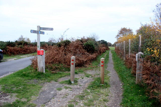
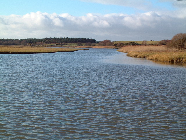
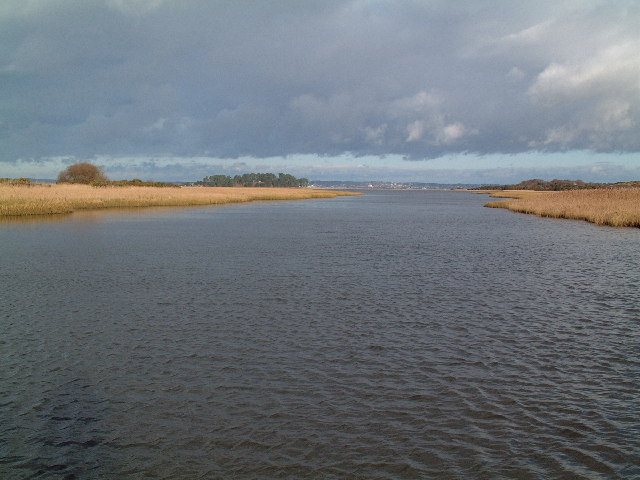
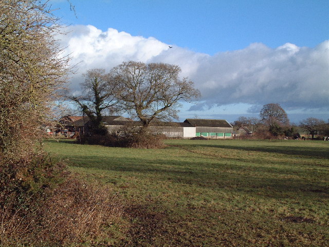
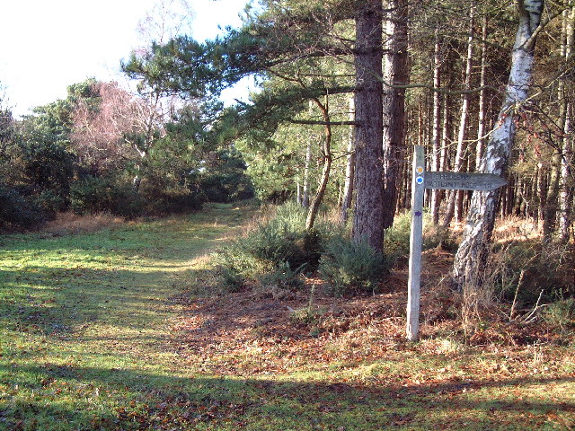
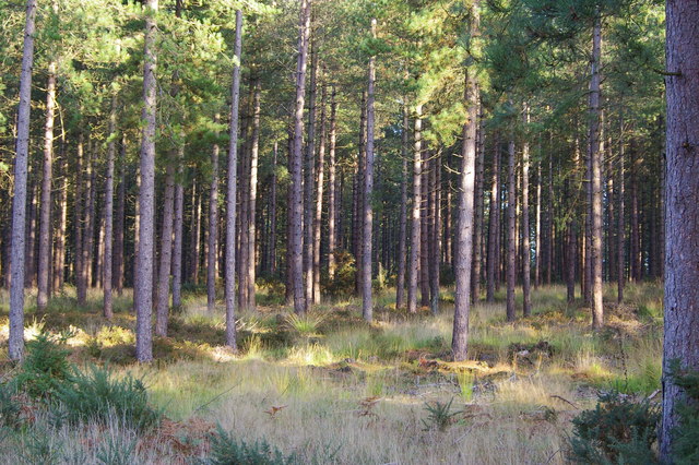
Flashet Plantation is a picturesque woodland area located in Dorset, England. Covering an extensive area, the plantation is known for its natural beauty and diverse ecosystem. The woodland is predominantly made up of a mixture of broadleaf and conifer trees, creating a rich and varied landscape.

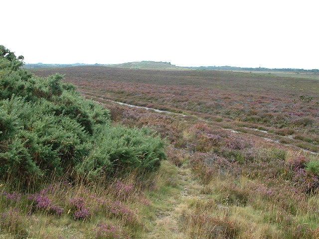
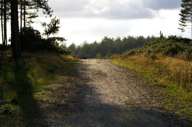
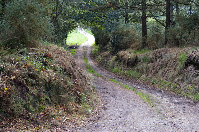
The plantation offers a tranquil escape from the hustle and bustle of city life, making it a popular destination for nature enthusiasts and outdoor adventurers. The dense forest provides ample opportunities for hiking, walking, and wildlife spotting. Visitors can explore the numerous trails and pathways that wind through the plantation, offering stunning views of the surrounding countryside.

Flashet Plantation is home to a wide range of flora and fauna. Native species such as oak, beech, and birch trees dominate the landscape, providing a haven for woodland animals including deer, foxes, and various bird species. The plantation is also known for its vibrant wildflowers, which carpet the forest floor during the spring and summer months.

In addition to its natural beauty, Flashet Plantation has a rich history. Originally part of a larger estate, it has been managed for conservation purposes since the early 20th century. The woodland has been carefully maintained to preserve its ecological integrity and protect its unique biodiversity.

Overall, Flashet Plantation is a hidden gem in Dorset, offering visitors a chance to reconnect with nature and experience the beauty of the British countryside. Whether it's a leisurely stroll or an adventurous hike, the woodland provides a peaceful and enriching environment for all who visit.

If you have any feedback on the listing, please let us know in the comments section below.

Flashet Plantation Images

Images are sourced within 2km of 50.656645/-2.0306457 or Grid Reference SY9784. Thanks to Geograph Open Source API. All images are credited.

National Cycle Track This is where the track to Studland leaves the minor road that runs between Corfe and Arne.
National Cycle Track
This is where the track to Studland leaves the minor road that runs between Corfe and Arne.
Hartland Moor National Nature Reserve View looking east towards Middlebere Heath
Hartland Moor National Nature Reserve
View looking east towards Middlebere Heath
Brenscombe Outdoor Centre, Corfe Castle, Dorset The centre offers a wide range of outdoor activities and farmhouse accommodation.
<span class="nowrap"><a title="http://www.brenscombeoutdoor.co.uk/index.html" rel="nofollow ugc noopener" href="http://www.brenscombeoutdoor.co.uk/index.html">Link</a><img style="margin-left:2px;" alt="External link" title="External link - shift click to open in new window" src="https://s1.geograph.org.uk/img/external.png" width="10" height="10"/></span>
Brenscombe Outdoor Centre, Corfe Castle, Dorset
The centre offers a wide range of outdoor activities and farmhouse accommodation. LinkExternal link
Wytch Lake Jetty There are relatively few points of access to the southern (quiet) half of Poole Harbour. This is mainly because the harbour on this side is fractured into a series of inlets which have marshy banks. One access point however is just north of Wytch Farm, this jetty being reached across a reed bed at the end of a track. This arm of the sea, which is fed by the Corfe River, is known as Wytch Lake.
Wytch Lake Jetty
There are relatively few points of access to the southern (quiet) half of Poole Harbour. This is mainly because the harbour on this side is fractured into a series of inlets which have marshy banks. One access point however is just north of Wytch Farm, this jetty being reached across a reed bed at the end of a track. This arm of the sea, which is fed by the Corfe River, is known as Wytch Lake.
Wytch Lake Looking west (ie upstream) at high tide. After about 500 metres this arm of Poole Harbour narrows considerably to the point where it is fed by the Corfe River.
Wytch Lake
Looking west (ie upstream) at high tide. After about 500 metres this arm of Poole Harbour narrows considerably to the point where it is fed by the Corfe River.
Wytch Lake Looking north west towards Poole which can just be made out in the distance.
Wytch Lake
Looking north west towards Poole which can just be made out in the distance.
Wytch Farm This typically rural view belies the fact that this is the farm that has given its name to the largest onshore oilfield in Europe.
Wytch Farm
This typically rural view belies the fact that this is the farm that has given its name to the largest onshore oilfield in Europe.
Wytch Heath The path straight ahead is signed "Scotland" - not the northern part of Britain but a farm where old horse drawn carts and waggons are restored. To the right is Hartland Moor National Nature Reserve.
Wytch Heath
The path straight ahead is signed "Scotland" - not the northern part of Britain but a farm where old horse drawn carts and waggons are restored. To the right is Hartland Moor National Nature Reserve.
Sharford Bridge This ancient two arch stone packhorse bridge is the lowest crossing point of the Corfe River. Note the gates at each end.
Sharford Bridge
This ancient two arch stone packhorse bridge is the lowest crossing point of the Corfe River. Note the gates at each end.
South Middlebere This stretch of National Trust owned open space is on the south eastern flank of Hartland Moor National Nature Reserve.
South Middlebere
This stretch of National Trust owned open space is on the south eastern flank of Hartland Moor National Nature Reserve.
Scotland Farm The Purbeck centre for the restoration of horse drawn carts and waggons.
Scotland Farm
The Purbeck centre for the restoration of horse drawn carts and waggons.
Corfe River Valley A view looking south westwards across the Corfe River valley to the Purbeck Hills beyond.
Corfe River Valley
A view looking south westwards across the Corfe River valley to the Purbeck Hills beyond.
Old shepherd's mobile hut Now used as a small hide overlooking the heath.
Old shepherd's mobile hut
Now used as a small hide overlooking the heath.
Forestry plantation, Rempstone Forest Photo taken from the adjacent bridleway
Forestry plantation, Rempstone Forest
Photo taken from the adjacent bridleway
Bridleway over forest road, Rempstone Forest
Bridleway, Rempstone Forest This route crosses the north west corner of the square, from a track through forestry plantations to a road between enclosed fields, near a farm to the north of Bushey.
Bridleway, Rempstone Forest
This route crosses the north west corner of the square, from a track through forestry plantations to a road between enclosed fields, near a farm to the north of Bushey.
Lane and farm north of Bushey
Lane and field sw of Lower Bushy Farm Location is to the south of the grid square.
Lane and field sw of Lower Bushy Farm
Location is to the south of the grid square.
Show me another place!

Flashet Plantation is located at Grid Ref: SY9784 (Lat: 50.656645, Lng: -2.0306457)

Unitary Authority: Dorset

Police Authority: Dorset

What 3 Words

///foods.crouching.sweetener. Near Corfe Castle, Dorset

Related Wikis

Wytch Farm

Wytch Farm is an oil field and processing facility in the Purbeck district of Dorset, England. It is the largest onshore oil field in western Europe. The...

Brenscombe Heath

Brenscombe Heath (grid reference SY985829) is a 34.7 hectare biological Site of Special Scientific Interest in Corfe Castle, Dorset, notified in 1985....

Wessex Basin

The Wessex Basin is a petroleum-bearing geological area located along the southern coast of England and extending into the English Channel. The onshore...

Purbeck Mineral and Mining Museum

The Purbeck Mining Museum exists to preserve and interpret the historic extractive industries in ball clay mining in the Isle of Purbeck. The museum is...

Rempstone Stone Circle

Rempstone Stone Circle (grid reference SY994820) is a stone circle located near to Corfe Castle on the Isle of Purbeck in the south-western English county...

Norden railway station (England)

Norden railway station is a railway station located one mile to the north of the village of Corfe Castle, on the Isle of Purbeck in the English county...

Corfe Castle railway station

Corfe Castle railway station is a railway station located in the village of Corfe Castle, in the English county of Dorset. Originally an intermediate...

Corfe Castle Hundred

Corfe Castle Hundred was a hundred in the county of Dorset, England, containing only the parish of Corfe Castle. It was sometimes also referred to as Corfe...

Nearby Amenities

Located within 500m of 50.656645,-2.0306457
Material: wood
Power: pole
Source: bing
Lat/Long: 50.6538144/-2.0283885
Material: wood
Power: pole
Source: bing
Transformer: distribution
Lat/Long: 50.654508/-2.0280718
Material: wood
Power: pole
Source: bing
Lat/Long: 50.6559364/-2.028565
Material: wood
Power: pole
Source: bing
Lat/Long: 50.6573229/-2.0281993
Material: wood
Power: pole
Source: bing
Lat/Long: 50.6580995/-2.0279903
Material: wood
Power: pole
Source: bing
Lat/Long: 50.658835/-2.0277976
Material: wood
Power: pole
Source: bing
Lat/Long: 50.6596767/-2.0270229
Meadus Lane Cottage
Addr Housename: Meadus Lane Cottage
Building: house
Source: Mapbox
Source Name: OS-OpenData_StreetView
Lat/Long: 50.6545398/-2.0289286
Homestead
Addr Housename: Homestead
Building: house
Source: Mapbox
Source Name: OS-OpenData_StreetView
Wikidata: Q26413482
Lat/Long: 50.654499/-2.0261307
Power: pole
Source: bing
Lat/Long: 50.6536576/-2.0284769
Power: pole
Source: bing
Lat/Long: 50.6527861/-2.0284729
The data included in this document is from www.openstreetmap.org. The data is made available under ODbL.

Have you been to Flashet Plantation?

Leave your review of Flashet Plantation below (or comments, questions and feedback).