Scabbate Gate Wood

Wood, Forest in Yorkshire Craven

England

Scabbate Gate Wood

Lovers Lane in midsummer This public footpath leads via Hawkswick Head Lane to stepping stones over the river and to the start of a riverbank footpath to Kettlewell.
Lovers Lane in midsummer Credit: Stephen Craven

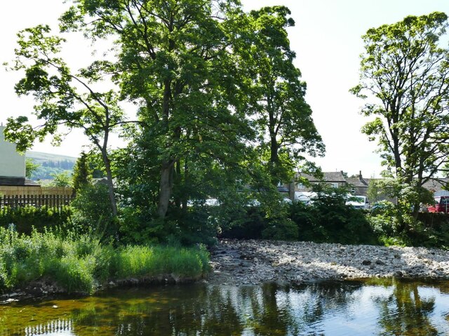
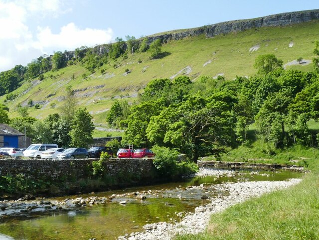
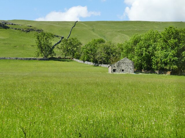
Scabbate Gate Wood is a picturesque woodland located in Yorkshire, England. This enchanting forest covers an area of approximately 200 acres and is known for its natural beauty and diverse wildlife.

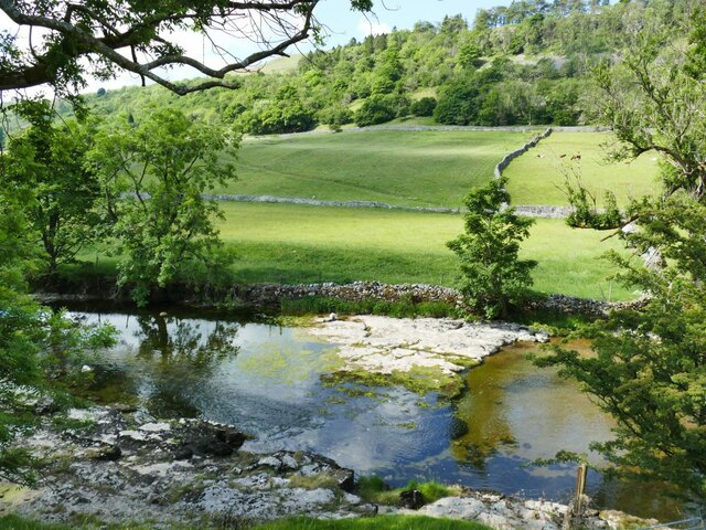
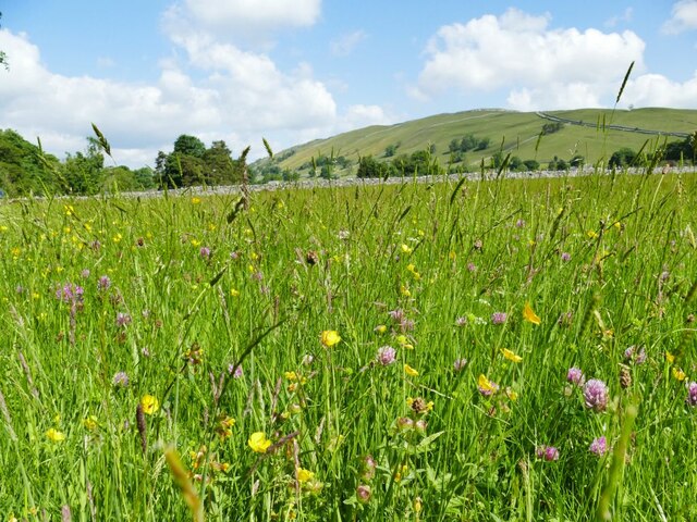
The wood is predominantly composed of native broadleaf trees such as oak, beech, and ash, which create a dense canopy that provides a haven for numerous species of flora and fauna. The forest floor is adorned with a rich carpet of wildflowers during the spring and summer months, adding vibrant colors to the landscape.

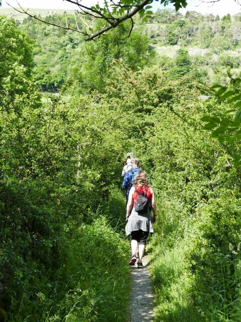
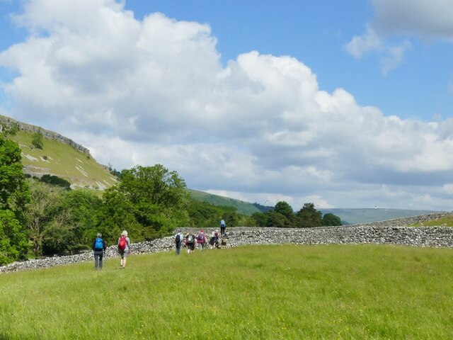
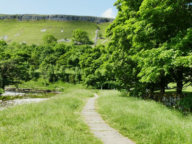
Scabbate Gate Wood is renowned for its tranquility and offers a peaceful retreat away from the bustling city life. Visitors can immerse themselves in the natural surroundings, taking leisurely strolls along the well-marked footpaths that wind through the woods. The gentle rustling of leaves and the melodious songs of birds create a soothing ambiance, providing a perfect escape for nature enthusiasts, hikers, and photographers.

The wood is home to a variety of wildlife, including deer, foxes, badgers, and a plethora of bird species. Birdwatchers can spot woodpeckers, owls, and various migratory birds during different seasons.

Scabbate Gate Wood is well-preserved and managed, with efforts made to maintain its ecological integrity. The wood plays an important role in the local ecosystem, acting as a habitat corridor and supporting biodiversity in the area.

Overall, Scabbate Gate Wood is a captivating destination that showcases the natural beauty of Yorkshire. Whether it's a peaceful walk, birdwatching, or simply appreciating the wonders of nature, this woodland offers an immersive experience for all who visit.

If you have any feedback on the listing, please let us know in the comments section below.

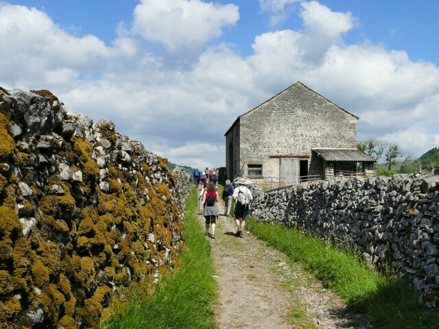
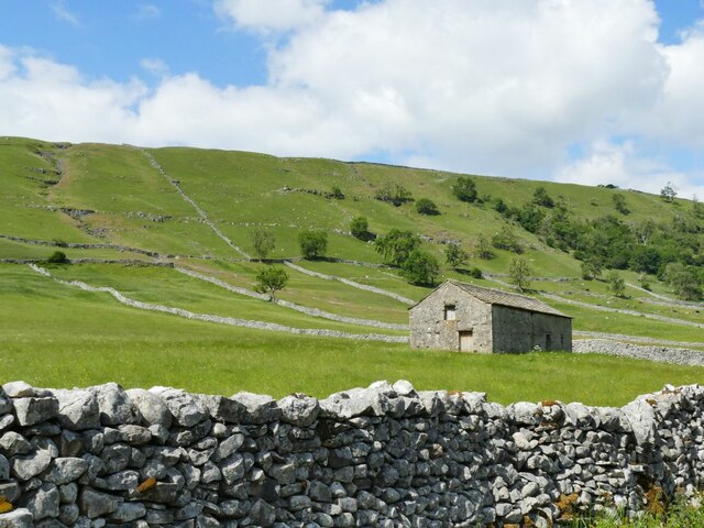
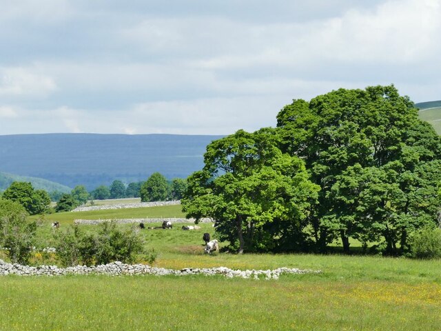
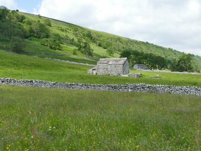
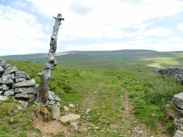
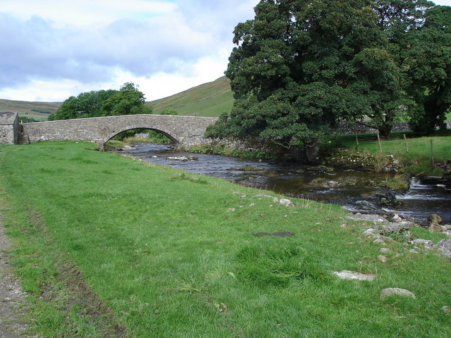
Scabbate Gate Wood Images

Images are sourced within 2km of 54.158476/-2.0368244 or Grid Reference SD9773. Thanks to Geograph Open Source API. All images are credited.

Lovers Lane in midsummer This public footpath leads via Hawkswick Head Lane to stepping stones over the river and to the start of a riverbank footpath to Kettlewell.
Lovers Lane in midsummer
This public footpath leads via Hawkswick Head Lane to stepping stones over the river and to the start of a riverbank footpath to Kettlewell.
Walking towards Kettlewell Ramblers on a footpath alongside the Wharfe.
Walking towards Kettlewell
Ramblers on a footpath alongside the Wharfe.
Shallows in the river Wharfe The river flows over a shallow step in the limestone bed at this point, and at low summer flow levels leaves some of the bedrock exposed. Roughly the same location as <a href="https://www.geograph.org.uk/photo/5416111">SD9771 : River Wharfe</a>.
Shallows in the river Wharfe
The river flows over a shallow step in the limestone bed at this point, and at low summer flow levels leaves some of the bedrock exposed. Roughly the same location as SD9771 : River Wharfe.
Meadow flowers near Kettlewell These limestone pastures are rich in spring and summer flowers.
Meadow flowers near Kettlewell
These limestone pastures are rich in spring and summer flowers.
Confluence of Dowber Gill and the river Wharfe There was little flow in the gill in a dry summer, but it can run in spate after a downpour on the slopes of Great Whernside.
Confluence of Dowber Gill and the river Wharfe
There was little flow in the gill in a dry summer, but it can run in spate after a downpour on the slopes of Great Whernside.
Bend in the river Wharfe at Kettlewell On the hillside behind is Gate Cote Scar.
Bend in the river Wharfe at Kettlewell
On the hillside behind is Gate Cote Scar.
Riverside path at Kettlewell This section of the path, forming part of the Dales Way, is paved.
Riverside path at Kettlewell
This section of the path, forming part of the Dales Way, is paved.
Stone laithe above Kettlewell One of many such structures in Upper Wharfedale, where there is still a network of small fields.  This laithe looks in better condition than most others.
Stone laithe above Kettlewell
One of many such structures in Upper Wharfedale, where there is still a network of small fields. This laithe looks in better condition than most others.
Stone laithe by the Dales Way One of many such structures in Upper Wharfedale, where there is still a network of small fields.  This laithe appears still to be in active use.
Stone laithe by the Dales Way
One of many such structures in Upper Wharfedale, where there is still a network of small fields. This laithe appears still to be in active use.
Haw Fields Laithe  One of many such structures in Upper Wharfedale, where there is still a network of small fields.  This laithe is one of the few to be shown on maps with a name.
Haw Fields Laithe
One of many such structures in Upper Wharfedale, where there is still a network of small fields. This laithe is one of the few to be shown on maps with a name.
Cows by the river Wharfe The cows are on the far side of the river from the photographer, the nearest one being at a point where they come down to the river to drink.
Cows by the river Wharfe
The cows are on the far side of the river from the photographer, the nearest one being at a point where they come down to the river to drink.
Stone laithe below Moor End One of many such structures in Upper Wharfedale, where there is still a network of small fields.
Stone laithe below Moor End
One of many such structures in Upper Wharfedale, where there is still a network of small fields.
Lambs at Cam Head
Lambs at Cam Head
Hay Tonge Farm Viewed from Top Mere Road.
Hay Tonge Farm
Viewed from Top Mere Road.
Top Mere Road The 'road' is unsurfaced, only accessible by 'off-road' vehicles, and only classed as a public bridleway. It gives a great view down Wharfedale.
Top Mere Road
The 'road' is unsurfaced, only accessible by 'off-road' vehicles, and only classed as a public bridleway. It gives a great view down Wharfedale.
A natural gatepost I'm not the only person to have noticed the pair of old gate hinges on this tree stump <a href="https://www.geograph.org.uk/photo/5628997">SD9773 : Gateway with gatepost</a>.
A natural gatepost
I'm not the only person to have noticed the pair of old gate hinges on this tree stump SD9773 : Gateway with gatepost.
Kettlewell village from Top Mere Road
Kettlewell old school See also <a href="https://www.geograph.org.uk/photo/3760245">SD9772 : The Old School House, Kettlewell</a>.  The present village school is on the road to Starbotton <a href="https://www.geograph.org.uk/photo/6792273">SD9672 : Kettlewell Primary School</a>.
Kettlewell old school
See also SD9772 : The Old School House, Kettlewell. The present village school is on the road to Starbotton SD9672 : Kettlewell Primary School.
Show me another place!

Scabbate Gate Wood is located at Grid Ref: SD9773 (Lat: 54.158476, Lng: -2.0368244)

Division: West Riding

Administrative County: North Yorkshire

District: Craven

Police Authority: North Yorkshire

What 3 Words

///amending.dust.callers. Near Grassington, North Yorkshire

Related Wikis

Kettlewell

Kettlewell is a village in Upper Wharfedale, North Yorkshire, England. Historically part of the West Riding of Yorkshire, it lies 6 miles (10 km) north...

Kettlewell with Starbotton

Kettlewell with Starbotton is a civil parish in the Craven district of North Yorkshire, England. Kettlewell is a village in Upper Wharfedale, North Yorkshire...

Starbotton

Starbotton is a village of around 60 houses in Upper Wharfedale in the Craven district of North Yorkshire, England. It is situated in the Yorkshire Dales...

Great Whernside

Great Whernside is a fell in the Yorkshire Dales, England, not to be confused with Whernside, some 17 miles (27 km) to the west. Its summit is the highest...

Scargill House

Scargill House is a Christian conference Centre run by the Scargill Movement and located in Wharfedale, in the county of North Yorkshire, England. Scargill...

Langcliffe Pot

Langcliffe Pot is a cave system on the slopes of Great Whernside in Upper Wharfedale, about 3 kilometres (1.9 mi) SSE of Kettlewell in North Yorkshire...

Hawkswick

Hawkswick is a hamlet and civil parish in the Craven district of North Yorkshire, England. Situated in the Yorkshire Dales, it lies in Littondale on the...

River Skirfare

River Skirfare is a small river in North Yorkshire, England, that flows through Littondale and ends where it joins the larger River Wharfe. The source...

Nearby Amenities

Located within 500m of 54.158476,-2.0368244
Historic: mine_shaft
Source: OS 1:25k
Lat/Long: 54.1599917/-2.0420593
Historic: mine_shaft
Source: Bing
Lat/Long: 54.1578983/-2.02938
Historic: mine_shaft
Source: Bing
Lat/Long: 54.1576656/-2.0303456
Historic: mine_shaft
Source: Bing
Lat/Long: 54.1558538/-2.0310589
Historic: mine_shaft
Source: Bing
Lat/Long: 54.1549078/-2.0331029
Historic: mine_shaft
Mineral: lead
Source: Bing
Source Mineral: OS 1853 sheet 98
Lat/Long: 54.1607356/-2.0431978
Historic: mine_shaft
Source: Bing
Lat/Long: 54.1584041/-2.0437762
Historic: mine_shaft
Source: Bing
Lat/Long: 54.1593134/-2.0442456
Historic: mine_shaft
Source: Bing
Lat/Long: 54.1614036/-2.0409894
Historic: mine_shaft
Source: Bing
Lat/Long: 54.1614445/-2.040984
Historic: mine_shaft
Source: Bing
Lat/Long: 54.1601568/-2.043524
Historic: mine_shaft
Source: Bing
Lat/Long: 54.1594469/-2.0424512
Historic: mine_shaft
Source: Bing
Lat/Long: 54.1598851/-2.0425933
Historic: mine_shaft
Source: Bing
Lat/Long: 54.1613739/-2.0417055
Historic: mine_shaft
Source: Bing
Lat/Long: 54.1598851/-2.0430037
Historic: mine_shaft
Source: Bing
Lat/Long: 54.1615528/-2.0413702
Historic: mine_shaft
Source: Bing
Lat/Long: 54.1584779/-2.0433068
Historic: mine_shaft
Source: Bing
Lat/Long: 54.1617507/-2.0413461
Historic: mine_shaft
Source: Bing
Lat/Long: 54.1592946/-2.0440793
Historic: mine_shaft
Source: Bing
Lat/Long: 54.1583679/-2.0441758
Historic: mine_shaft
Source: Bing
Lat/Long: 54.1592066/-2.0434865
Historic: mine_shaft
Source: Bing
Lat/Long: 54.1591374/-2.0428347
Historic: mine_shaft
Source: Bing
Lat/Long: 54.1591972/-2.0420971
Historic: mine_shaft
Source: Bing
Lat/Long: 54.1608886/-2.0413702
Historic: mine_shaft
Source: Bing
Lat/Long: 54.1607614/-2.0420193
Historic: mine_shaft
Source: Bing
Lat/Long: 54.1591218/-2.0427113
Historic: mine_shaft
Source: Bing
Lat/Long: 54.1606687/-2.042022
Historic: mine_shaft
Source: Bing
Lat/Long: 54.1580177/-2.0408901
Historic: mine_shaft
Source: Bing
Lat/Long: 54.1585705/-2.0426335
Historic: mine_shaft
Source: Bing
Lat/Long: 54.1597751/-2.0419657
Historic: mine_shaft
Source: Bing
Lat/Long: 54.1605588/-2.0409706
Historic: mine_shaft
Source: Bing
Lat/Long: 54.1596887/-2.0419147
Historic: mine_shaft
Source: Bing
Lat/Long: 54.1584418/-2.0426201
Historic: mine_shaft
Source: Bing
Lat/Long: 54.1603389/-2.0416143
Historic: mine_shaft
Source: Bing
Lat/Long: 54.1609279/-2.0427274
Historic: mine_shaft
Source: Bing
Lat/Long: 54.1609146/-2.0423715
Historic: mine_shaft
Source: Bing
Lat/Long: 54.1586019/-2.0424699
Historic: mine_shaft
Source: Bing
Lat/Long: 54.1591281/-2.04225
Historic: mine_shaft
Source: Bing
Lat/Long: 54.1584606/-2.0433953
Historic: mine_shaft
Source: Bing
Lat/Long: 54.1578841/-2.0422929
Historic: mine_shaft
Source: Bing
Lat/Long: 54.1601128/-2.041727
Historic: mine_shaft
Source: Bing
Lat/Long: 54.1606483/-2.0411637
Historic: mine_shaft
Source: Bing
Lat/Long: 54.1608524/-2.042714
Historic: mine_shaft
Source: Bing
Lat/Long: 54.1585266/-2.0430305
Historic: mine_shaft
Source: Bing
Lat/Long: 54.1584558/-2.0437413
Historic: mine_shaft
Source: Bing
Lat/Long: 54.1619219/-2.0412951
Historic: mine_shaft
Source: Bing
Lat/Long: 54.158539/-2.0433685
Historic: mine_shaft
Source: Bing
Lat/Long: 54.1598725/-2.0415499
Historic: mine_shaft
Source: Bing
Lat/Long: 54.1619078/-2.0397582
Historic: mine_shaft
Source: Bing
Lat/Long: 54.1616236/-2.0397502
Historic: mine_shaft
Mineral: lead
Source: Bing
Source Mineral: OS 1853 sheet 98
Lat/Long: 54.1612969/-2.0405629
Historic: mine_shaft
Source: Bing
Lat/Long: 54.1615827/-2.0399245
Historic: mine_shaft
Source: Bing
Lat/Long: 54.1605117/-2.0421373
Historic: mine_shaft
Source: Bing
Lat/Long: 54.1584527/-2.0435965
Historic: mine_shaft
Source: Bing
Lat/Long: 54.158349/-2.0443126
Historic: mine_shaft
Source: Bing
Lat/Long: 54.1578795/-2.0424941
Historic: mine_shaft
Source: Bing
Lat/Long: 54.1591123/-2.0430815
Historic: mine_shaft
Source: Bing
Lat/Long: 54.159092/-2.0433068
Historic: mine_shaft
Source: Bing
Lat/Long: 54.159117/-2.0435267
Historic: mine_shaft
Source: Bing
Lat/Long: 54.1621166/-2.0412307
Historic: mine_shaft
Source: Bing
Lat/Long: 54.159062/-2.0434355
Historic: mine_shaft
Mineral: lead
Source: Bing
Source Mineral: OS 1853 sheet 98
Lat/Long: 54.1610245/-2.0418029
Historic: mine_shaft
Source: Bing
Lat/Long: 54.1610204/-2.0421963
Historic: mine_shaft
Source: Bing
Lat/Long: 54.1595254/-2.0434382
Historic: mine_shaft
Source: Bing
Lat/Long: 54.1594076/-2.0439934
Historic: mine_shaft
Source: Bing
Lat/Long: 54.1593856/-2.0435804
Historic: mine_shaft
Mineral: lead
Source: Bing
Source Mineral: OS 1853 sheet 98
Lat/Long: 54.161011/-2.042773
Historic: mine_shaft
Source: Bing
Lat/Long: 54.1593966/-2.0438754
Historic: mine_shaft
Source: Bing
Lat/Long: 54.158932/-2.0387079
Historic: mine_shaft
Mineral: lead
Source: Bing;OS 1853 sheet 98
Source Mineral: OS 1853 sheet 98
Lat/Long: 54.1582315/-2.0403065
Historic: mine_shaft
Source: Bing
Lat/Long: 54.158995/-2.0385953
Historic: mine_shaft
Source: Bing
Lat/Long: 54.1559944/-2.0430388
Historic: mine_shaft
Source: Bing
Lat/Long: 54.1562616/-2.0431675
Historic: mine_shaft
Source: Bing
Lat/Long: 54.1577254/-2.0443638
Historic: mine_shaft
Source: Bing
Lat/Long: 54.1563148/-2.042336
Historic: mine_shaft
Source: Bing
Lat/Long: 54.1568647/-2.0437522
Historic: mine_shaft
Source: Bing
Lat/Long: 54.1577662/-2.0441277
Historic: mine_shaft
Source: Bing
Lat/Long: 54.1563464/-2.0418425
Historic: mine_shaft
Source: Bing
Lat/Long: 54.1563871/-2.0435328
Historic: mine_shaft
Source: Bing
Lat/Long: 54.1578102/-2.043543
Historic: mine_shaft
Source: Bing
Lat/Long: 54.158944/-2.04313
Historic: mine_shaft
Source: Bing
Lat/Long: 54.1567736/-2.0437844
Historic: mine_shaft
Source: OS 1851;'Bing
Lat/Long: 54.1556027/-2.0409453
Stile: stepover
Lat/Long: 54.1626473/-2.0347967
Historic: mine_shaft
Source: DigitalGlobe-Standard
Lat/Long: 54.1596708/-2.0437989
Historic: mine_shaft
Source: DigitalGlobe-Standard
Lat/Long: 54.1578836/-2.0440993
Natural: spring
Source: OS 1853 sheet 98
Lat/Long: 54.1613511/-2.0380801
Historic: mine_shaft
Source: DigitalGlobe-Standard
Lat/Long: 54.1600006/-2.0434556
Historic: mine_shaft
Source: DigitalGlobe-Standard
Lat/Long: 54.1599472/-2.0432678
Historic: mine_shaft
Source: DigitalGlobe-Standard
Lat/Long: 54.1602579/-2.042608
Natural: spring
Source: OS 1853 sheet 98
Lat/Long: 54.1612506/-2.0380962
Historic: mine_shaft
Source: DigitalGlobe-Standard
Lat/Long: 54.157786/-2.0439866
Historic: mine_shaft
Source: DigitalGlobe-Standard
Lat/Long: 54.160635/-2.040768
Historic: mine_shaft
Mineral: lead
Source: Bing
Source Mineral: OS 1853 sheet 98
Lat/Long: 54.1611689/-2.0409718
Historic: mine_shaft
Source: DigitalGlobe-Standard
Lat/Long: 54.160261/-2.043182
Historic: mine_shaft
Source: DigitalGlobe-Standard
Lat/Long: 54.1603992/-2.0431069
Historic: mine_shaft
Source: DigitalGlobe-Standard
Lat/Long: 54.1602046/-2.0438794
Historic: mine_shaft
Source: DigitalGlobe-Standard
Lat/Long: 54.1600352/-2.0438847
Historic: mine_shaft
Source: DigitalGlobe-Standard
Lat/Long: 54.1600163/-2.0436219
Historic: mine_shaft
Source: DigitalGlobe-Standard
Lat/Long: 54.1578897/-2.0435789
Historic: mine_shaft
Source: Bing
Lat/Long: 54.1587725/-2.0434019
Historic: mine_shaft
Source: Bing
Lat/Long: 54.1588416/-2.0427957
Historic: mine_shaft
Source: Bing
Lat/Long: 54.1587034/-2.0424041
Historic: mine_shaft
Source: Bing
Lat/Long: 54.1587975/-2.0441261
old level
Historic: mine_level
Source: OS 1894 Yorkshire XCVIII.16
Lat/Long: 54.158364/-2.0406284
Power: pole
Lat/Long: 54.1566184/-2.0355633
Power: pole
Lat/Long: 54.1559807/-2.0357725
Power: pole
Lat/Long: 54.1552817/-2.03603
Power: pole
Lat/Long: 54.1546268/-2.0362392
The data included in this document is from www.openstreetmap.org. The data is made available under ODbL.

Have you been to Scabbate Gate Wood?

Leave your review of Scabbate Gate Wood below (or comments, questions and feedback).