Knott Wood

Wood, Forest in Yorkshire

England

Knott Wood

Mourner statue in the churchyard, Heptonstall This is a memorial for Simpson Bowes, who died in 1909 aged only 39, and his wife Minnie Dutton, who lived until 1940, aged 67. He was landlord of the White Horse Hotel in Hebden Bridge, and she carried on running the pub after his death. The White Horse closed in 1960 and was demolished in 1962. The site is now a car park and market place; I think it was in St George's Square.  There is a photograph from behind the mourner under the Simpson Bowes entry in Malcolm Bull's Calderdale Companion website.
Mourner statue in the churchyard, Heptonstall Credit: Humphrey Bolton

Knott Wood, located in the beautiful county of Yorkshire, is a serene and picturesque forest that captivates the senses with its natural beauty and tranquility. Covering an area of approximately 50 acres, this woodland is a haven for nature enthusiasts and those seeking a peaceful escape from the hustle and bustle of urban life.

The wood's name, "Knott," is derived from the Old English word "cnotta," meaning a small hill or knoll, which accurately describes the gentle undulations of the terrain within the forest. It boasts a diverse range of trees, including oak, beech, birch, and pine, creating a rich tapestry of colors throughout the seasons.

Visitors to Knott Wood can enjoy a variety of activities, such as walking along the well-maintained trails that wind their way through the forest, providing ample opportunities for exploration. The dense foliage provides a cool and shaded environment during the summer months, making it a popular spot for picnics and outdoor gatherings.

Wildlife enthusiasts will be delighted to discover the abundance of animal and bird species that call Knott Wood their home. From deer and rabbits to woodpeckers and owls, there is always something fascinating to observe and appreciate.

Knott Wood is easily accessible, with a designated car park and nearby public transport options. It is also conveniently located near several charming villages, allowing visitors to combine their woodland adventure with a visit to a cozy country pub or a stroll through a traditional English village.

Overall, Knott Wood offers an enchanting retreat for anyone seeking a slice of nature's paradise in the heart of Yorkshire.

If you have any feedback on the listing, please let us know in the comments section below.

Knott Wood Images

Images are sourced within 2km of 53.738568/-2.0410624 or Grid Reference SD9726. Thanks to Geograph Open Source API. All images are credited.

Mourner statue in the churchyard, Heptonstall This is a memorial for Simpson Bowes, who died in 1909 aged only 39, and his wife Minnie Dutton, who lived until 1940, aged 67. He was landlord of the White Horse Hotel in Hebden Bridge, and she carried on running the pub after his death. The White Horse closed in 1960 and was demolished in 1962. The site is now a car park and market place; I think it was in St George's Square.  There is a photograph from behind the mourner under the Simpson Bowes entry in Malcolm Bull's Calderdale Companion website.
Mourner statue in the churchyard, Heptonstall
This is a memorial for Simpson Bowes, who died in 1909 aged only 39, and his wife Minnie Dutton, who lived until 1940, aged 67. He was landlord of the White Horse Hotel in Hebden Bridge, and she carried on running the pub after his death. The White Horse closed in 1960 and was demolished in 1962. The site is now a car park and market place; I think it was in St George's Square. There is a photograph from behind the mourner under the Simpson Bowes entry in Malcolm Bull's Calderdale Companion website.
Refurbished prefab, Townfield Lane, Heptonstall The prefabs were built soon after the second World War, and there are several small sites in Calderdale. The most prominent one is alongside the A58 climbing up from Sowerby Bridge.
Refurbished prefab, Townfield Lane, Heptonstall
The prefabs were built soon after the second World War, and there are several small sites in Calderdale. The most prominent one is alongside the A58 climbing up from Sowerby Bridge.
Northfield, Heptonstall This is a block of early 19C back-to-back cottages, listed, Grade II. There are clothes lines across the street, a traditional feature not often seen nowadays. For the clothes lines in use see <a href="https://www.geograph.org.uk/photo/1861939">SD9828 : Northfield - Townfield Lane</a>.
Northfield, Heptonstall
This is a block of early 19C back-to-back cottages, listed, Grade II. There are clothes lines across the street, a traditional feature not often seen nowadays. For the clothes lines in use see SD9828 : Northfield - Townfield Lane.
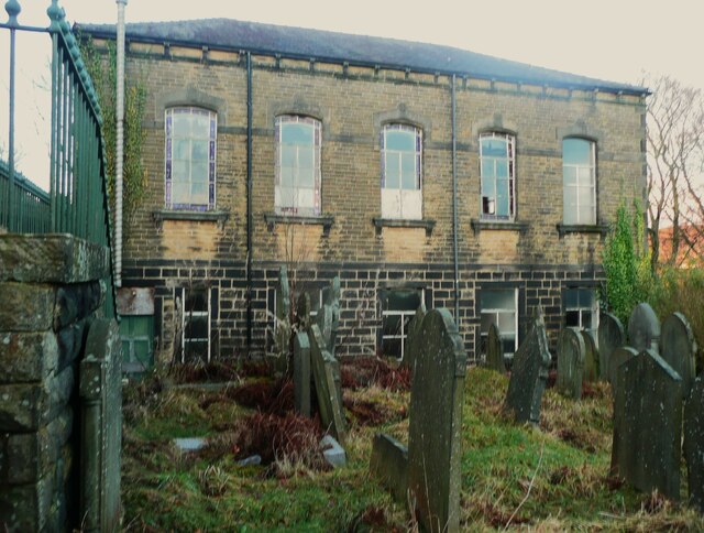
Methodist Sunday School, Heptonstall This view was last photographed in 2019 and the building looks to be gradually deteriorating.  There is now a missing widow pane, and the window frames look overdue for repainting.
Methodist Sunday School, Heptonstall
This view was last photographed in 2019 and the building looks to be gradually deteriorating. There is now a missing widow pane, and the window frames look overdue for repainting.
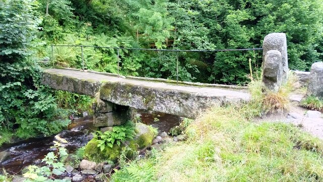
Clapper Bridge Bridge now repaired after collapse some time ago.
Clapper Bridge
Bridge now repaired after collapse some time ago.
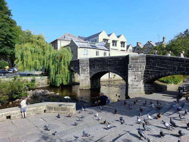
Bridgegate
Bridgegate
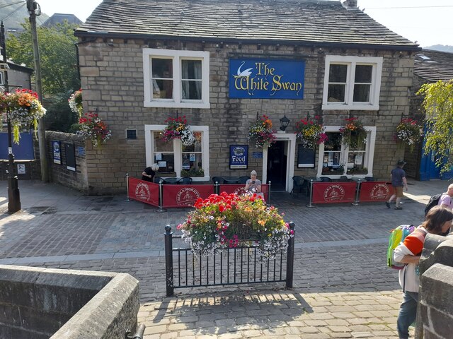
The White Swan
The White Swan
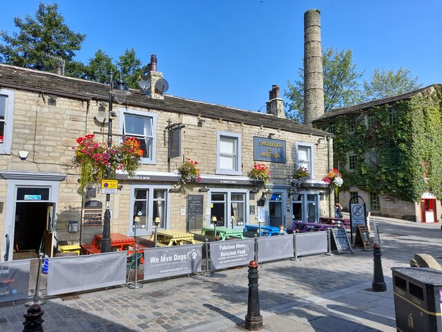
Shoulder Of Mutton
Shoulder Of Mutton
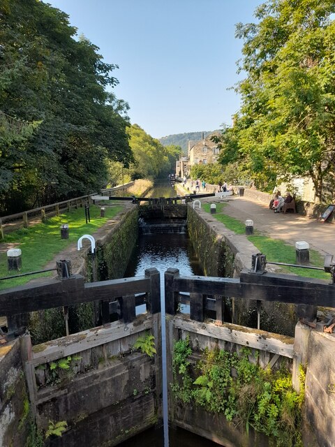
Canal lock
Canal lock
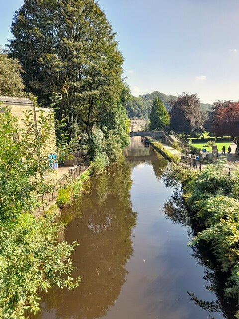
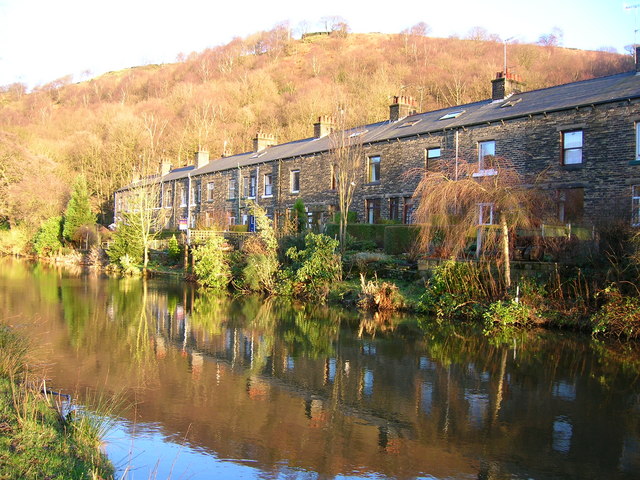
Canal view
Canal view
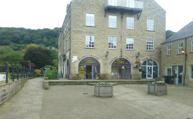
The Flying Saucer at Hebden Bridge Cafe and studio in old canal warehouse
The Flying Saucer at Hebden Bridge
Cafe and studio in old canal warehouse
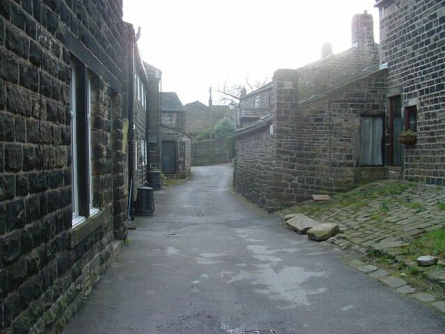
Northgate View along Northgate towards the main village
Northgate
View along Northgate towards the main village
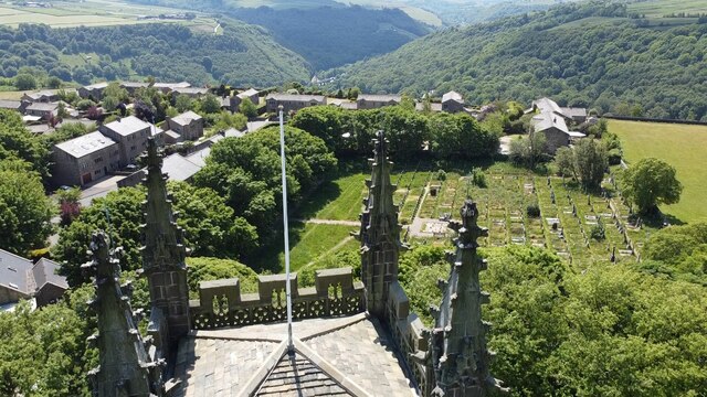
From above the church tower Picture taken from my DJi Mini drone of the top of the church tower, the new graveyard just beyond, and in the far distance Whiteley Arches rail bridge in the green Calder Valley.
From above the church tower
Picture taken from my DJi Mini drone of the top of the church tower, the new graveyard just beyond, and in the far distance Whiteley Arches rail bridge in the green Calder Valley.
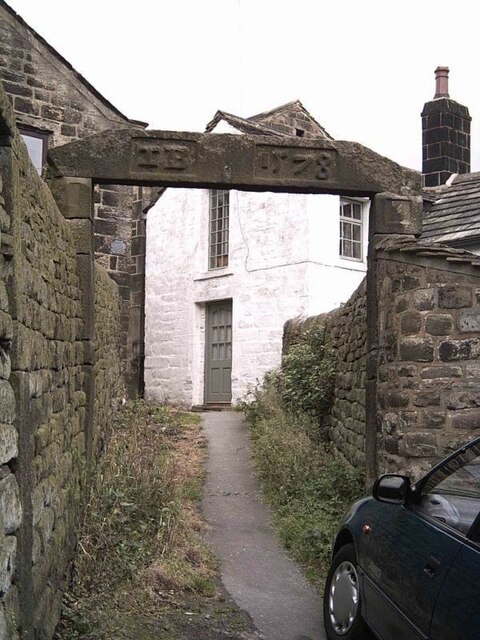
Whitehall Farm archway Archway marking the entrance to Whitehall Farm, inscribed on the lintel are the initials JB standing for John Bentley, once owner of the farm and the date of 1578..
Whitehall Farm archway
Archway marking the entrance to Whitehall Farm, inscribed on the lintel are the initials JB standing for John Bentley, once owner of the farm and the date of 1578..
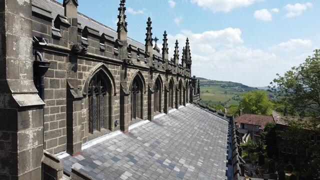
View along the church roof A view along the roof of the church of St Thomas the Apostle, looking towards the village of Old town in the distance.
View along the church roof
A view along the roof of the church of St Thomas the Apostle, looking towards the village of Old town in the distance.
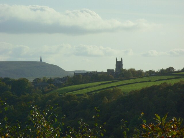
Heptonstall from Smeekin Hill Taken from the Smeekin Hill/Wadsworth war memorial looking across Hebden Dale towards Heptonstall and in the far distance the peace monument of Stoodley Pike Monument.
Heptonstall from Smeekin Hill
Taken from the Smeekin Hill/Wadsworth war memorial looking across Hebden Dale towards Heptonstall and in the far distance the peace monument of Stoodley Pike Monument.
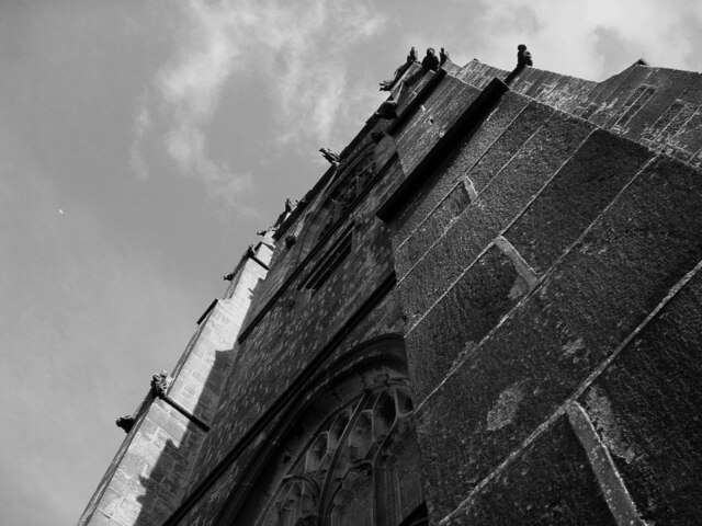
Looking up the church tower Looking up the tower of the church of St Thomas the Apostle.
Looking up the church tower
Looking up the tower of the church of St Thomas the Apostle.
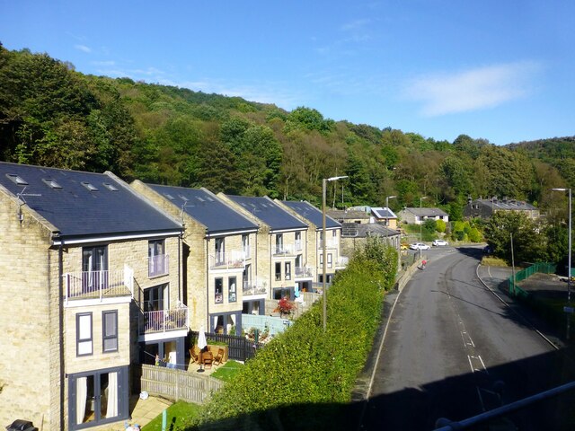
Halifax Road at Calderside View from rail line on Whiteley Arches
Halifax Road at Calderside
View from rail line on Whiteley Arches
Show me another place!

Knott Wood is located at Grid Ref: SD9726 (Lat: 53.738568, Lng: -2.0410624)

Division: West Riding

Unitary Authority: Calderdale

Police Authority: West Yorkshire

What 3 Words

///coverings.endings.dictation. Near Hebden Bridge, West Yorkshire

Related Wikis

Eastwood (L&Y) railway station

Eastwood Railway Station served the village of Eastwood in the civil parish of Todmorden, West Yorkshire, England. The station opened with the line on...

South Pennines Regional Park

The South Pennines Regional Park (or South Pennines Park) is a proposed national park that would cover the South Pennines area in Northern England, encompassing...

Eastwood, West Yorkshire

Eastwood is a place within the civil parish of Todmorden and Metropolitan Borough of Calderdale, in West Yorkshire, England. It lies 8 miles (12.9 km)...

Heptonstall

Heptonstall is a small village and civil parish within the Calderdale borough of West Yorkshire, England, historically part of the West Riding of Yorkshire...

Hepton Rural District

Hepton was a rural district in the West Riding of Yorkshire, England, from 1894 to 1974. The district included four civil parishes: Heptonstall, Blackshaw...

Battle of Heptonstall

The Battle of Heptonstall occurred in November 1643 during the First English Civil War at Hebden Bridge and Heptonstall, Yorkshire. During the battle,...

Hebden Bridge Town Hall

Hebden Bridge Town Hall, formerly Hebden Bridge Council Offices, is a municipal building in St George's Street, Hebden Bridge, West Yorkshire, England...

Hebden Bridge Picture House

Hebden Bridge Picture House in Hebden Bridge, West Yorkshire, is one of the last remaining council-owned cinemas in Britain. Together with the adjacent...

Nearby Amenities

Located within 500m of 53.738568,-2.0410624
Waterway: turning_point
Lat/Long: 53.7360295/-2.039738
Seamark Type: gate
Waterway: lock_gate
Lat/Long: 53.7352949/-2.0409384
Seamark Type: gate
Waterway: lock_gate
Lat/Long: 53.7353964/-2.040659
Barrier: stile
Steps: 2
Stile: stepover
Lat/Long: 53.7350364/-2.0401973
Barrier: stile
Steps: 1
Stile: stepover
Lat/Long: 53.7344275/-2.0419528
Description: Council Information Board
Ele: 110.44
Tourism: information
Lat/Long: 53.7349004/-2.0441276
Post Box
Brand: Royal Mail
Brand Wikidata: Q638098
Brand Wikipedia: en:Royal Mail
Collection Times: Mo-Fr 16:45; Sa 10:30
Ele: 108.75
Operator: Royal Mail
Operator Wikidata: Q638098
Post Box Type: lamp
Ref: HX7 162
Royal Cypher: EIIR
Royal Cypher Wikidata: Q33102113
Source: survey
Survey Date: 2015-05-19
Lat/Long: 53.7348001/-2.0442192
Barrier: stile
Steps: 2
Stile: stepover
Lat/Long: 53.7417722/-2.0381016
Note: FIXME - check gates stils and tracks here
Lat/Long: 53.7419024/-2.0377343
Waterway: waterfall
Lat/Long: 53.7382707/-2.0450341
Bus Stop
Halifax Road Beaumont View
Local Ref: 45019819
Naptan AtcoCode: 450019819
Naptan Bearing: NE
Naptan CommonName: Halifax Road Beaumont View
Naptan Crossing: Beaumont View
Naptan Indicator: Stop 45019819
Naptan PlusbusZoneRef: LEEDS
Naptan ShortCommonName: Beaumont View
Naptan Street: Halifax Road
Naptan Verified: no
Source: naptan_import
Lat/Long: 53.7373313/-2.0342169
Bus Stop
Halifax Road Groudle Glen
Local Ref: 45019820
Naptan AtcoCode: 450019820
Naptan Bearing: SW
Naptan CommonName: Halifax Road Groudle Glen
Naptan Crossing: Woodland Dell
Naptan Indicator: Stop 45019820
Naptan PlusbusZoneRef: LEEDS
Naptan ShortCommonName: Groudle Glen
Naptan Street: Halifax Road
Naptan Verified: no
Source: naptan_import
Lat/Long: 53.7371335/-2.0342925
Bus Stop
Halifax Road Stoney Lane
Bus: yes
Local Ref: 45019821
Naptan AtcoCode: 450019821
Naptan Bearing: NE
Naptan CommonName: Halifax Road Stoney Lane
Naptan Crossing: Stoney Lane
Naptan Indicator: Stop 45019821
Naptan PlusbusZoneRef: LEEDS
Naptan ShortCommonName: Stoney Lane
Naptan Street: Halifax Road
Naptan Verified: no
Public Transport: platform
Source: naptan_import
Lat/Long: 53.7362417/-2.040568
Bus Stop
Halifax Road
Bus: yes
Local Ref: 45019822
Naptan AtcoCode: 450019822
Naptan Bearing: SW
Naptan CommonName: Halifax Road
Naptan Crossing: Stoney Lane
Naptan Indicator: Stop 45019822
Naptan Landmark: Callis Mill
Naptan PlusbusZoneRef: LEEDS
Naptan ShortCommonName: Callis Mill
Naptan Street: Halifax Road
Naptan Verified: no
Public Transport: platform
Source: naptan_import
Lat/Long: 53.7360079/-2.0409771
Waterway: waterfall
Lat/Long: 53.7378257/-2.0450311
Power: pole
Lat/Long: 53.7371865/-2.0418692
Power: pole
Lat/Long: 53.7376283/-2.0423895
Power: pole
Lat/Long: 53.7381495/-2.0429648
Power: pole
Lat/Long: 53.7385913/-2.0435093
Power: pole
Lat/Long: 53.7415729/-2.0466489
Power: pole
Lat/Long: 53.7410209/-2.0460856
Power: pole
Lat/Long: 53.7404815/-2.0454928
Power: pole
Lat/Long: 53.739858/-2.0448357
Power: pole
Lat/Long: 53.7392489/-2.0441759
Power: pole
Lat/Long: 53.7387174/-2.0436555
Power: pole
Lat/Long: 53.7400183/-2.047703
Power: pole
Lat/Long: 53.7403974/-2.0463914
Power: pole
Lat/Long: 53.740729/-2.0452943
Power: pole
Lat/Long: 53.740986/-2.044495
Power: pole
Lat/Long: 53.7413921/-2.0430815
Power: pole
Lat/Long: 53.741676/-2.0417176
Power: pole
Lat/Long: 53.741887/-2.0406622
Power: pole
Lat/Long: 53.7421313/-2.0395075
Power: pole
Lat/Long: 53.742378/-2.0383152
Barrier: cattle_grid
Lat/Long: 53.7353082/-2.038317
Barrier: stile
Material: wood
Stile: stepover
Lat/Long: 53.735336/-2.0386566
Rest Area
Informal: yes
Lat/Long: 53.7342695/-2.0421857
Power: pole
Lat/Long: 53.7419049/-2.0367682
The data included in this document is from www.openstreetmap.org. The data is made available under ODbL.

Have you been to Knott Wood?

Leave your review of Knott Wood below (or comments, questions and feedback).