Hullasey Grove

Wood, Forest in Gloucestershire Cotswold

England

Hullasey Grove

Trewsbury Road towards Coates The gates to the very grand Trewsbury Farm are to the left.
Trewsbury Road towards Coates Credit: Robin Webster

Hullasey Grove is a charming woodland located in the county of Gloucestershire, England. Known for its natural beauty and serene atmosphere, this picturesque forest is a haven for nature enthusiasts and those seeking a peaceful retreat.

Covering an area of approximately 200 acres, Hullasey Grove is predominantly composed of deciduous trees, including oak, beech, and ash. The forest is home to a diverse range of wildlife, providing a habitat for various species such as deer, birds, and small mammals. Birdwatchers in particular will delight in the opportunity to spot a variety of avian species, including woodpeckers, owls, and songbirds.

Visitors to Hullasey Grove can explore the forest through a network of well-maintained trails, allowing for leisurely walks or invigorating hikes. The paths wind through the woodland, offering glimpses of tranquil ponds, babbling brooks, and carpets of wildflowers during the spring and summer months. The forest also boasts several picnic areas, providing the perfect spot to enjoy a packed lunch amidst the natural surroundings.

Hullasey Grove is not only a place of natural beauty but also cultural significance. The forest has a rich history, with evidence of human activity dating back centuries. Archaeological remains, such as ancient settlements and burial mounds, can be found scattered throughout the woodland, offering a glimpse into the area's past.

Overall, Hullasey Grove is a true gem in Gloucestershire, offering visitors a chance to connect with nature, discover local wildlife, and immerse themselves in the tranquility of this stunning woodland.

If you have any feedback on the listing, please let us know in the comments section below.

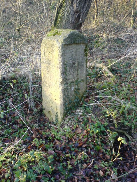
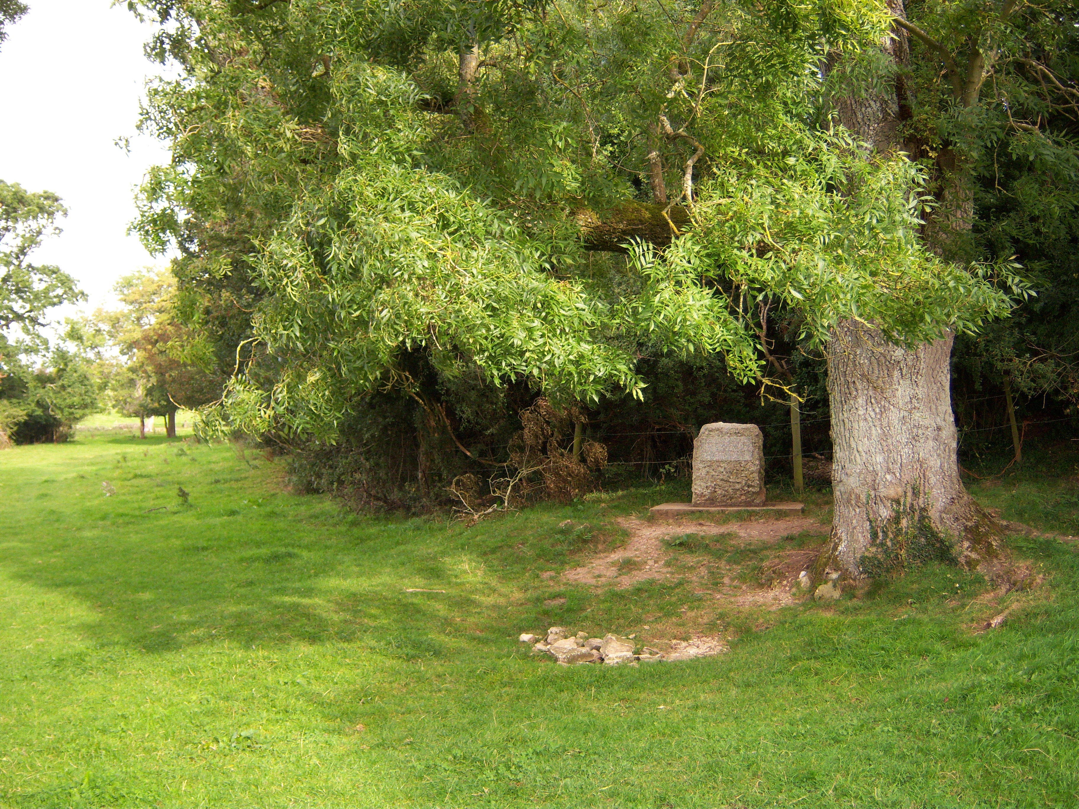
Hullasey Grove Images

Images are sourced within 2km of 51.691717/-2.0398522 or Grid Reference ST9799. Thanks to Geograph Open Source API. All images are credited.

Trewsbury Road towards Coates The gates to the very grand Trewsbury Farm are to the left.
Trewsbury Road towards Coates
The gates to the very grand Trewsbury Farm are to the left.
Road from Kemble towards Tarlton
Lane towards Tarlton Looking across the A433. The lane is lined with trees all the way to Tarlton.
Lane towards Tarlton
Looking across the A433. The lane is lined with trees all the way to Tarlton.
Lane towards Tarlton
Ploughed field west of Tarlton
Lane from Tarlton towards Coates
Sheep grazing north of Kemble
Stone Stile, Tarlton Close to the manor house and church on Gloucestershire footpaths BRO5 & BRO7 looking North. The view South is <a href="https://www.geograph.org.uk/photo/7074515">ST9599 : Stone Stile, Tarlton</a>.
Stone Stile, Tarlton
Close to the manor house and church on Gloucestershire footpaths BRO5 & BRO7 looking North. The view South is ST9599 : Stone Stile, Tarlton.
Stone Stile, Tarlton Close to the manor house and church on Gloucestershire footpaths BRO5 & BRO7 looking South. The view North is <a href="https://www.geograph.org.uk/photo/7074513">ST9599 : Stone Stile, Tarlton</a>.
Stone Stile, Tarlton
Close to the manor house and church on Gloucestershire footpaths BRO5 & BRO7 looking South. The view North is ST9599 : Stone Stile, Tarlton.
Stone Stile, Tarlton A "fallen idle", the remains of a slab stile. Looking South on Gloucestershire footpaths BRO6 & BRO8 to a horse field. The view looking NE is <a href="https://www.geograph.org.uk/photo/7074533">ST9599 : Stone Stile, Tarlton</a>.
Stone Stile, Tarlton
A "fallen idle", the remains of a slab stile. Looking South on Gloucestershire footpaths BRO6 & BRO8 to a horse field. The view looking NE is ST9599 : Stone Stile, Tarlton.
Stone Stile, Tarlton A "fallen idle", the remains of a slab stile. Looking NE on Gloucestershire footpaths BRO6 & BRO8 to a horse field. The view looking South is <a href="https://www.geograph.org.uk/photo/7074531">ST9599 : Stone Stile, Tarlton</a>.
Stone Stile, Tarlton
A "fallen idle", the remains of a slab stile. Looking NE on Gloucestershire footpaths BRO6 & BRO8 to a horse field. The view looking South is ST9599 : Stone Stile, Tarlton.
The Thames Head Inn The Thames Head Inn stands on the Fosse Way; it is named after the nearby source of the River Thames.
The Thames Head Inn
The Thames Head Inn stands on the Fosse Way; it is named after the nearby source of the River Thames.
Stone Stile, Kemble Actually at Thames Head, or opposite the nearest access to the source of the Thames from the A433. On Gloucestershire footpath BKE7 (part of the Thames & Severn Way) Looking NE to the road, the view down is <a href="https://www.geograph.org.uk/photo/7300122">ST9898 : Stone Stile, Kemble</a>.
Stone Stile, Kemble
Actually at Thames Head, or opposite the nearest access to the source of the Thames from the A433. On Gloucestershire footpath BKE7 (part of the Thames & Severn Way) Looking NE to the road, the view down is ST9898 : Stone Stile, Kemble.
Stone Stile, Kemble Actually at Thames Head, or opposite the nearest access to the source of the Thames from the A433. On Gloucestershire footpath BKE7 (part of the Thames & Severn Way) Looking NE to the road, the view down is <a href="https://www.geograph.org.uk/photo/7300121">ST9898 : Stone Stile, Kemble</a>.
Stone Stile, Kemble
Actually at Thames Head, or opposite the nearest access to the source of the Thames from the A433. On Gloucestershire footpath BKE7 (part of the Thames & Severn Way) Looking NE to the road, the view down is ST9898 : Stone Stile, Kemble.
Milestone Jackaments Bottom near Kemble 2006 Plate would have read Cirencester 4 1/2, Malmesbury 7
Milestone Jackaments Bottom near Kemble 2006
Plate would have read Cirencester 4 1/2, Malmesbury 7
Water Tower, Kemble Station A water tower is an elevated structure supporting a water tank constructed at a height sufficient to pressurize a water supply system for the distribution of drinkable water, and to provide emergency storage for fire protection.
Wikipedia: <span class="nowrap"><a title="http://en.wikipedia.org/wiki/Water_tower" rel="nofollow ugc noopener" href="http://en.wikipedia.org/wiki/Water_tower">Link</a><img style="margin-left:2px;" alt="External link" title="External link - shift click to open in new window" src="https://s1.geograph.org.uk/img/external.png" width="10" height="10"/></span>
Water Tower, Kemble Station
A water tower is an elevated structure supporting a water tank constructed at a height sufficient to pressurize a water supply system for the distribution of drinkable water, and to provide emergency storage for fire protection. Wikipedia: LinkExternal link
Water Tank, Kemble Station Listed buildings and structures are officially designated as being of special architectural, historical or cultural significance. There are over half a million listed structures in the United Kingdom, covered by around 375,000 listings.
Listed status is more commonly associated with buildings or groups of buildings, however it can cover many other structures, including bridges, headstones, steps, ponds, monuments, walls, phone boxes, wrecks, parks, and heritage sites, and in more recent times a road crossing (Abbey Road) and graffiti art (Banksy 'Spy-booth') have been included.

In England and Wales there are three main listing designations;
Grade I (2.5%) - exceptional interest, sometimes considered to be internationally important.
Grade II* (5.5%) - particularly important buildings of more than special interest. 
Grade II (92%) - nationally important and of special interest. 

There are also locally listed structures (at the discretion of local authorities) using A, B and C designations.

In Scotland three classifications are also used but the criteria are different. There are around 47,500 Listed buildings.
Category A (8%)- generally equivalent to Grade I and II* in England and Wales
Category B (51%)- this appears generally to cover the ground of Grade II, recognising national importance.
Category C (41%)- buildings of local importance, probably with some overlap with English Grade II.

In Northern Ireland the criteria are similar to Scotland, but the classifications are:
Grade A (2.3%)
Grade B+ (4.7%)
Grade B (93%)

Read more at Wikipedia <span class="nowrap"><a title="http://en.wikipedia.org/wiki/Listed_building" rel="nofollow ugc noopener" href="http://en.wikipedia.org/wiki/Listed_building">Link</a><img style="margin-left:2px;" alt="External link" title="External link - shift click to open in new window" src="https://s1.geograph.org.uk/img/external.png" width="10" height="10"/></span>
Water Tank, Kemble Station
Listed buildings and structures are officially designated as being of special architectural, historical or cultural significance. There are over half a million listed structures in the United Kingdom, covered by around 375,000 listings. Listed status is more commonly associated with buildings or groups of buildings, however it can cover many other structures, including bridges, headstones, steps, ponds, monuments, walls, phone boxes, wrecks, parks, and heritage sites, and in more recent times a road crossing (Abbey Road) and graffiti art (Banksy 'Spy-booth') have been included. In England and Wales there are three main listing designations; Grade I (2.5%) - exceptional interest, sometimes considered to be internationally important. Grade II* (5.5%) - particularly important buildings of more than special interest. Grade II (92%) - nationally important and of special interest. There are also locally listed structures (at the discretion of local authorities) using A, B and C designations. In Scotland three classifications are also used but the criteria are different. There are around 47,500 Listed buildings. Category A (8%)- generally equivalent to Grade I and II* in England and Wales Category B (51%)- this appears generally to cover the ground of Grade II, recognising national importance. Category C (41%)- buildings of local importance, probably with some overlap with English Grade II. In Northern Ireland the criteria are similar to Scotland, but the classifications are: Grade A (2.3%) Grade B+ (4.7%) Grade B (93%) Read more at Wikipedia LinkExternal link
Swindon to Cheltenham Line Written by Brian Robert Marshall
The line, also known as the Golden Valley Line, dates back to the early days of railway development in the 19th century. The first section, from Cheltenham to Gloucester, opened in 1840. In 1841 a line was opened from Swindon Junction to Cirencester via Kemble. Then in 1845 a line from Kemble to Gloucester was opened (Kemble became a junction in its own right with branches to Cirencester to the east, and Tetbury to the west both of which closed on the 1960s). At one time there were twenty stations or halts between Cheltenham, at the northern end of the line, and its terminus at Swindon. Now only six remain open (Cheltenham, Gloucester, Stonehouse, Stroud, Kemble and Swindon). In 1968, the hitherto twin track line was butchered by the then British Rail (under a Labour government) and the stretch between Swindon and Kemble was singled (the plan had been to single the entire section between Swindon and Stonehouse but protests led to the abandonment of the project once it had reached Kemble leaving the section from Kemble north to Stonehouse still a twin track). Proposals to restore the twin track between Kemble and Swindon were made in 2008 but were kicked into the long grass by the Office of Rail Regulation (again under a Labour government). Thankfully the Coalition government that took office in 2010 revived the moribund proposal and announced in 2011 that the project could go ahead. Work on the £45m project started in July 2013 and was expected to be completed by Easter 2014. However, on 07 February 2014 Network Rail announced that completion of the project would be put back until August 2014 because "The very high volume of works during Easter nationally, coupled with ongoing remedial work from flooding earlier this year, means our engineering resources will now be operating at full capacity during one of the busiest phases of the Swindon to Kemble redoubling scheme.
"To minimise risk to the work, and avoid the possibility of unnecessary inconvenience to customers, we are now working towards completing the scheme between Swindon and Kemble by August 2014 rather than Easter as originally planned." Anecdotal evidence suggests that the local residents are looking forward to a considerable hike in property values as the increased rail traffic that will be enabled by the doubling of the line will make the all-important London Paddington destination even more accessible.
Sources: <span class="nowrap"><a title="http://en.wikipedia.org/wiki/Golden_Valley_Line" rel="nofollow ugc noopener" href="http://en.wikipedia.org/wiki/Golden_Valley_Line">Link</a><img style="margin-left:2px;" alt="External link" title="External link - shift click to open in new window" src="https://s1.geograph.org.uk/img/external.png" width="10" height="10"/></span>
<span class="nowrap"><a title="http://en.wikipedia.org/wiki/Cheltenham_and_Great_Western_Union_Railway" rel="nofollow ugc noopener" href="http://en.wikipedia.org/wiki/Cheltenham_and_Great_Western_Union_Railway">Link</a><img style="margin-left:2px;" alt="External link" title="External link - shift click to open in new window" src="https://s1.geograph.org.uk/img/external.png" width="10" height="10"/></span>
<span class="nowrap"><a title="http://www.bbc.co.uk/news/uk-england-wiltshire-23784244" rel="nofollow ugc noopener" href="http://www.bbc.co.uk/news/uk-england-wiltshire-23784244">Link</a><img style="margin-left:2px;" alt="External link" title="External link - shift click to open in new window" src="https://s1.geograph.org.uk/img/external.png" width="10" height="10"/></span>
<span class="nowrap"><a title="http://www.swindonadvertiser.co.uk/news/10632952.Train_line_work_is_on_track/" rel="nofollow ugc noopener" href="http://www.swindonadvertiser.co.uk/news/10632952.Train_line_work_is_on_track/">Link</a><img style="margin-left:2px;" alt="External link" title="External link - shift click to open in new window" src="https://s1.geograph.org.uk/img/external.png" width="10" height="10"/></span>
<span class="nowrap"><a title="http://www.bbc.co.uk/news/uk-england-23920961" rel="nofollow ugc noopener" href="http://www.bbc.co.uk/news/uk-england-23920961">Link</a><img style="margin-left:2px;" alt="External link" title="External link - shift click to open in new window" src="https://s1.geograph.org.uk/img/external.png" width="10" height="10"/></span>
<span class="nowrap"><a title="http://www.systemed.plus.com/New_Adlestrop_Railway_Atlas.pdf" rel="nofollow ugc noopener" href="http://www.systemed.plus.com/New_Adlestrop_Railway_Atlas.pdf">Link</a><img style="margin-left:2px;" alt="External link" title="External link - shift click to open in new window" src="https://s1.geograph.org.uk/img/external.png" width="10" height="10"/></span> (pdf)
<span class="nowrap"><a title="http://www.bbc.co.uk/news/uk-england-26067520" rel="nofollow ugc noopener" href="http://www.bbc.co.uk/news/uk-england-26067520">Link</a><img style="margin-left:2px;" alt="External link" title="External link - shift click to open in new window" src="https://s1.geograph.org.uk/img/external.png" width="10" height="10"/></span>
Swindon to Cheltenham Line
Written by Brian Robert Marshall The line, also known as the Golden Valley Line, dates back to the early days of railway development in the 19th century. The first section, from Cheltenham to Gloucester, opened in 1840. In 1841 a line was opened from Swindon Junction to Cirencester via Kemble. Then in 1845 a line from Kemble to Gloucester was opened (Kemble became a junction in its own right with branches to Cirencester to the east, and Tetbury to the west both of which closed on the 1960s). At one time there were twenty stations or halts between Cheltenham, at the northern end of the line, and its terminus at Swindon. Now only six remain open (Cheltenham, Gloucester, Stonehouse, Stroud, Kemble and Swindon). In 1968, the hitherto twin track line was butchered by the then British Rail (under a Labour government) and the stretch between Swindon and Kemble was singled (the plan had been to single the entire section between Swindon and Stonehouse but protests led to the abandonment of the project once it had reached Kemble leaving the section from Kemble north to Stonehouse still a twin track). Proposals to restore the twin track between Kemble and Swindon were made in 2008 but were kicked into the long grass by the Office of Rail Regulation (again under a Labour government). Thankfully the Coalition government that took office in 2010 revived the moribund proposal and announced in 2011 that the project could go ahead. Work on the £45m project started in July 2013 and was expected to be completed by Easter 2014. However, on 07 February 2014 Network Rail announced that completion of the project would be put back until August 2014 because "The very high volume of works during Easter nationally, coupled with ongoing remedial work from flooding earlier this year, means our engineering resources will now be operating at full capacity during one of the busiest phases of the Swindon to Kemble redoubling scheme. "To minimise risk to the work, and avoid the possibility of unnecessary inconvenience to customers, we are now working towards completing the scheme between Swindon and Kemble by August 2014 rather than Easter as originally planned." Anecdotal evidence suggests that the local residents are looking forward to a considerable hike in property values as the increased rail traffic that will be enabled by the doubling of the line will make the all-important London Paddington destination even more accessible. Sources: LinkExternal link LinkExternal link LinkExternal link LinkExternal link LinkExternal link LinkExternal link (pdf) LinkExternal link
Show me another place!

Hullasey Grove is located at Grid Ref: ST9799 (Lat: 51.691717, Lng: -2.0398522)

Administrative County: Gloucestershire

District: Cotswold

Police Authority: Gloucestershire

What 3 Words

///troll.arrival.hamster. Near Coates, Gloucestershire

Related Wikis

Thames Head

Thames Head is a group of seasonal springs that arise near the village of Coates in the Cotswolds, about three miles south-west of the town of Cirencester...

Tetbury Road railway station

Tetbury Road railway station was built by the Cheltenham & Great Western Union Railway to serve the Gloucestershire villages of Kemble and Coates, and...

Coates, Gloucestershire

Coates is a village and civil parish situated in Cotswold District, Gloucestershire, England. It is around 3 miles (4.8 km) west of Cirencester and close...

Kemble, Gloucestershire

Kemble is a village in the civil parish of Kemble and Ewen, in the Cotswold district of Gloucestershire, England. Historically part of Wiltshire, it lies...

Kemble railway station

Kemble railway station is a railway station that serves the village of Kemble in Gloucestershire, England. The station is on the Swindon to Gloucester...

Jackament's Bridge Halt railway station

Jackament's Bridge Halt railway station served RAF Kemble, on the boundary of Gloucestershire and Wiltshire, England. It was open between 1939 and 1948...

Kemble Railway Cuttings

Kemble Railway Cuttings (ST975976 & ST985973 & ST982989) is a 2.72-hectare (6.7-acre) geological Site of Special Scientific Interest in Gloucestershire...

Cotswold Airport

Cotswold Airport (IATA: GBA, ICAO: EGBP) (formerly Kemble Airfield) is a private general aviation airport, near the village of Kemble in Gloucestershire...

Nearby Amenities

Located within 500m of 51.691717,-2.0398522
Power: pole
Source: bing
Lat/Long: 51.6900248/-2.0431378
Power: pole
Source: bing
Lat/Long: 51.6883504/-2.0440136
Power: pole
Source: bing
Lat/Long: 51.6892167/-2.0435777
The data included in this document is from www.openstreetmap.org. The data is made available under ODbL.

Have you been to Hullasey Grove?

Leave your review of Hullasey Grove below (or comments, questions and feedback).