Threestoneburn Wood

Wood, Forest in Northumberland

England

Threestoneburn Wood

Cunyan Crags Prominent granite outcrops on the south-eastern flank of Dunmoor Hill.

This photograph was taken during the Coronavirus (COVID-19) pandemic of 2020/21/22.
Cunyan Crags Credit: James T M Towill

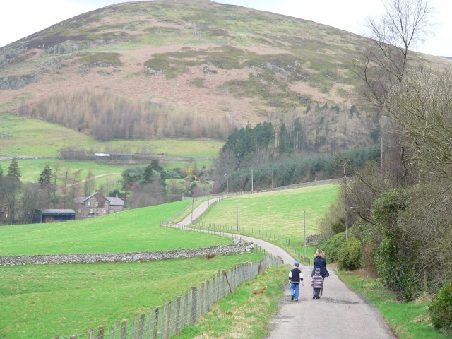
Threestoneburn Wood is a picturesque forest located in Northumberland, England. Covering an area of approximately 100 hectares, the wood is a mix of broadleaf and coniferous trees, creating a diverse and vibrant ecosystem. The wood is known for its tranquil atmosphere, making it a popular destination for nature lovers and outdoor enthusiasts.

The wood is home to a variety of wildlife, including deer, squirrels, and a wide array of bird species. Visitors to Threestoneburn Wood can enjoy walking along the well-maintained trails that wind through the forest, providing opportunities to observe the flora and fauna up close. The wood is also a popular spot for birdwatching, with many rare and migratory species making their home in the area.

Threestoneburn Wood is managed by the Northumberland Wildlife Trust, who work to maintain the natural beauty and biodiversity of the forest. The wood is open to the public year-round, offering visitors the chance to escape the hustle and bustle of everyday life and immerse themselves in the peaceful surroundings of this beautiful woodland.

If you have any feedback on the listing, please let us know in the comments section below.

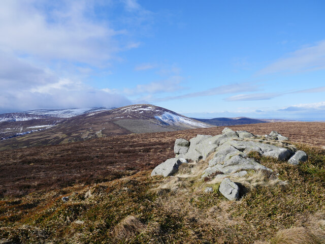
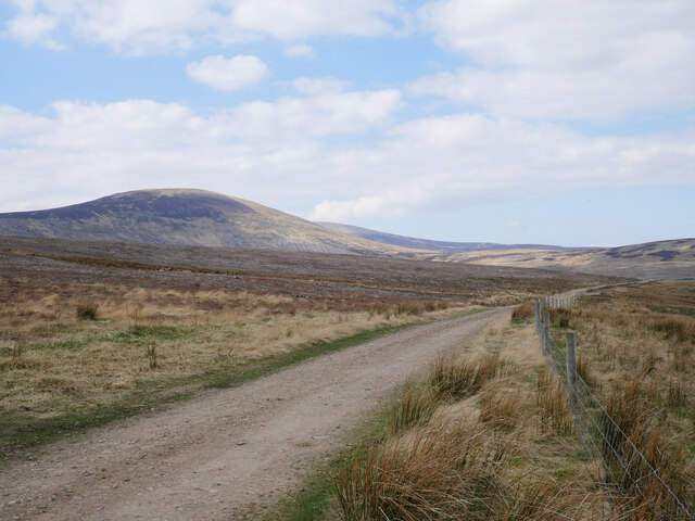
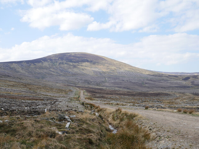
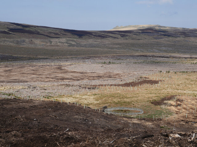
Threestoneburn Wood Images

Images are sourced within 2km of 55.46931/-2.0565196 or Grid Reference NT9619. Thanks to Geograph Open Source API. All images are credited.

Cunyan Crags Prominent granite outcrops on the south-eastern flank of Dunmoor Hill.

This photograph was taken during the Coronavirus (COVID-19) pandemic of 2020/21/22.
Cunyan Crags
Prominent granite outcrops on the south-eastern flank of Dunmoor Hill. This photograph was taken during the Coronavirus (COVID-19) pandemic of 2020/21/22.
Cunyan Crags and the former Threestoneburn Wood Threestoneburn Wood has been nearly completely harvested in recent years.  This view is from the north of Cunyan Crags across part of the former forest towards Kitty Crags.

This photograph was taken during the Coronavirus (COVID-19) pandemic of 2020/21/22.
Cunyan Crags and the former Threestoneburn Wood
Threestoneburn Wood has been nearly completely harvested in recent years. This view is from the north of Cunyan Crags across part of the former forest towards Kitty Crags. This photograph was taken during the Coronavirus (COVID-19) pandemic of 2020/21/22.
Atop Cunyan Crags The remains of Threestoneburn Wood, Dunmoor Hill - and if you look very closely above the hillside in the centre of shot - Hedgehope Hill all feature in this view from the crags.

This photograph was taken during the Coronavirus (COVID-19) pandemic of 2020/21/22.
Atop Cunyan Crags
The remains of Threestoneburn Wood, Dunmoor Hill - and if you look very closely above the hillside in the centre of shot - Hedgehope Hill all feature in this view from the crags. This photograph was taken during the Coronavirus (COVID-19) pandemic of 2020/21/22.
Looking back to Cunyan Crags Bound for the summit of Dunmoor Hill and Hedgehope Hill beyond, time to look back to Cunyan Crags with meltwater running down the rutted quadbike track.

This photograph was taken during the Coronavirus (COVID-19) pandemic of 2020/21/22.
Looking back to Cunyan Crags
Bound for the summit of Dunmoor Hill and Hedgehope Hill beyond, time to look back to Cunyan Crags with meltwater running down the rutted quadbike track. This photograph was taken during the Coronavirus (COVID-19) pandemic of 2020/21/22.
The summit of Dunmoor Hill The summit of Dunmoor Hill surrounded by managed grouse moorland.  Hedgehope Hill and a cloud-capped The Cheviot are in the distance.

This photograph was taken during the Coronavirus (COVID-19) pandemic of 2020/21/22.
The summit of Dunmoor Hill
The summit of Dunmoor Hill surrounded by managed grouse moorland. Hedgehope Hill and a cloud-capped The Cheviot are in the distance. This photograph was taken during the Coronavirus (COVID-19) pandemic of 2020/21/22.
Self-seeded spruce trees from the former Threestoneburn Wood Some self-seeded spruce trees can be found on the northern slope of Dunmoor Hill in managed grouse moorland.  The clearfelled Threestoneburn Wood remains can be noted in the background whilst Hedgehope Hill looms over the scene in the background.

This photograph was taken during the Coronavirus (COVID-19) pandemic of 2020/21/22.
Self-seeded spruce trees from the former Threestoneburn Wood
Some self-seeded spruce trees can be found on the northern slope of Dunmoor Hill in managed grouse moorland. The clearfelled Threestoneburn Wood remains can be noted in the background whilst Hedgehope Hill looms over the scene in the background. This photograph was taken during the Coronavirus (COVID-19) pandemic of 2020/21/22.
Clearfell below Hedgehope Hill The south-west corner of the former Threestoneburn Wood.

This photograph was taken during the Coronavirus (COVID-19) pandemic of 2020/21/22.
Clearfell below Hedgehope Hill
The south-west corner of the former Threestoneburn Wood. This photograph was taken during the Coronavirus (COVID-19) pandemic of 2020/21/22.
Looking back to Dunmoor Hill On a boggy quadbike-rutted track bound for Hedgehope Hill.

This photograph was taken during the Coronavirus (COVID-19) pandemic of 2020/21/22.
Looking back to Dunmoor Hill
On a boggy quadbike-rutted track bound for Hedgehope Hill. This photograph was taken during the Coronavirus (COVID-19) pandemic of 2020/21/22.
Heading up Hedgehope Hill The route up Hedgehope Hill has been badly rutted by quadbikes and provides a gutter for meltwater as seen in this shot.  The former Threestoneburn Wood is out of shot to the right.

This photograph was taken during the Coronavirus (COVID-19) pandemic of 2020/21/22.
Heading up Hedgehope Hill
The route up Hedgehope Hill has been badly rutted by quadbikes and provides a gutter for meltwater as seen in this shot. The former Threestoneburn Wood is out of shot to the right. This photograph was taken during the Coronavirus (COVID-19) pandemic of 2020/21/22.
A meeting of fences on the south east side of Hedgehope Hill The clearfelled Threestoneburn Wood can be noted to the far left of shot, with the muirburn mosaic on Dunmoor Hill evident left of centre in the distance.

This photograph was taken during the Coronavirus (COVID-19) pandemic of 2020/21/22.
A meeting of fences on the south east side of Hedgehope Hill
The clearfelled Threestoneburn Wood can be noted to the far left of shot, with the muirburn mosaic on Dunmoor Hill evident left of centre in the distance. This photograph was taken during the Coronavirus (COVID-19) pandemic of 2020/21/22.
An old sheepfold An old sheepfold and attendant corrugated iron structure now once again in the open following the clearfelling of Threestoneburn Wood in the past decade.

This photograph was taken during the Coronavirus (COVID-19) pandemic of 2020/21/22.
An old sheepfold
An old sheepfold and attendant corrugated iron structure now once again in the open following the clearfelling of Threestoneburn Wood in the past decade. This photograph was taken during the Coronavirus (COVID-19) pandemic of 2020/21/22.
Spearhead by the trackside A Spearhead 460 rotary mower which appears to have been used in the past in rough grazing (formerly the clearfelled Threestoneburn Wood) in the background of this shot.  Kitty Crags on the north-east side of Dunmoor Hill can be noted above the scene in the distance.

This photograph was taken during the Coronavirus (COVID-19) pandemic of 2020/21/22.
Spearhead by the trackside
A Spearhead 460 rotary mower which appears to have been used in the past in rough grazing (formerly the clearfelled Threestoneburn Wood) in the background of this shot. Kitty Crags on the north-east side of Dunmoor Hill can be noted above the scene in the distance. This photograph was taken during the Coronavirus (COVID-19) pandemic of 2020/21/22.
Open country once again The site of the former Threestoneburn Wood with Hedgehope Hill in the distance.

This photograph was taken during the Coronavirus (COVID-19) pandemic of 2020/21/22.
Open country once again
The site of the former Threestoneburn Wood with Hedgehope Hill in the distance. This photograph was taken during the Coronavirus (COVID-19) pandemic of 2020/21/22.
A bleak landscape at the former Threestoneburn Wood The site of the former Threestoneburn Wood with Hedgehope Hill looming large in the distance.  Moorland and upland bog restoration works are in progress in the area.

This photograph was taken during the Coronavirus (COVID-19) pandemic of 2020/21/22.
A bleak landscape at the former Threestoneburn Wood
The site of the former Threestoneburn Wood with Hedgehope Hill looming large in the distance. Moorland and upland bog restoration works are in progress in the area. This photograph was taken during the Coronavirus (COVID-19) pandemic of 2020/21/22.
An old sheepfold by Threestone Burn With the removal of Threestoneburn Wood over the past decade, old features of former open moorland are once again evident such as this sheepfold.  Plantings of native tree species shrouded by tree protectors are evident beside the Threestone Burn.

This photograph was taken during the Coronavirus (COVID-19) pandemic of 2020/21/22.
An old sheepfold by Threestone Burn
With the removal of Threestoneburn Wood over the past decade, old features of former open moorland are once again evident such as this sheepfold. Plantings of native tree species shrouded by tree protectors are evident beside the Threestone Burn. This photograph was taken during the Coronavirus (COVID-19) pandemic of 2020/21/22.
From the end of the track The western end of a timber extraction track in the former Threestoneburn Wood offers a bleak view across tree debris to Hedgehope Hill.

This photograph was taken during the Coronavirus (COVID-19) pandemic of 2020/21/22.
From the end of the track
The western end of a timber extraction track in the former Threestoneburn Wood offers a bleak view across tree debris to Hedgehope Hill. This photograph was taken during the Coronavirus (COVID-19) pandemic of 2020/21/22.
Southern edge of Threestoneburn Wood The boundary fence leads downhill to the watershed of the Dunmoor Burn. The hill in the background is Dunmoor Hill. For a free selection of walking routes in the Cheviot Hills visit <span class="nowrap"><a title="www.cheviotwalks.co.uk" rel="nofollow ugc noopener" href="http://www.cheviotwalks.co.uk">Link</a><img style="margin-left:2px;" alt="External link" title="External link - shift click to open in new window" src="https://s1.geograph.org.uk/img/external.png" width="10" height="10"/></span>
Southern edge of Threestoneburn Wood
The boundary fence leads downhill to the watershed of the Dunmoor Burn. The hill in the background is Dunmoor Hill. For a free selection of walking routes in the Cheviot Hills visit LinkExternal link
Boundary fence of Threestoneburn Wood Looking downhill across the south western corner of Threestoneburn Wood with Hedgehope Hill in the background. For a selection of free walking routes in the Cheviot Hills visit <span class="nowrap"><a title="www.cheviotwalks.co.uk" rel="nofollow ugc noopener" href="http://www.cheviotwalks.co.uk">Link</a><img style="margin-left:2px;" alt="External link" title="External link - shift click to open in new window" src="https://s1.geograph.org.uk/img/external.png" width="10" height="10"/></span>
Boundary fence of Threestoneburn Wood
Looking downhill across the south western corner of Threestoneburn Wood with Hedgehope Hill in the background. For a selection of free walking routes in the Cheviot Hills visit LinkExternal link
Show me another place!

Threestoneburn Wood is located at Grid Ref: NT9619 (Lat: 55.46931, Lng: -2.0565196)

Unitary Authority: Northumberland

Police Authority: Northumbria

What 3 Words

///pops.variances.sprayed. Near Wooler, Northumberland

Nearby Locations

Threestoneburn Wood

Related Wikis

Threestoneburn Stone Circle

Threestoneburn Stone Circle is an archaeological site, a stone circle near the village of Ilderton and about 5 miles (8 km) south of Wooler, in Northumberland...

Hedgehope Hill

Hedgehope Hill is a mountain in the Cheviot Hills of north Northumberland in northeast England, and categorised as a Hewitt. At a height of 714 metres...

Linhope

Linhope is a small village in Northumberland, England. It is located in the Cheviots on the River Breamish, and within Northumberland National Park. Linhope...

Ilderton, Northumberland

Ilderton is a small village in Northumberland, England. It is located on the edge of the Northumberland National Park, between Lilburn, Northumberland...

Have you been to Threestoneburn Wood?

Leave your review of Threestoneburn Wood below (or comments, questions and feedback).