Badbury Clump

Wood, Forest in Dorset

England

Badbury Clump

Farmland view from Badbury Rings NT car park With the point to point course receding into the distance.
Farmland view from Badbury Rings NT car park Credit: David Martin

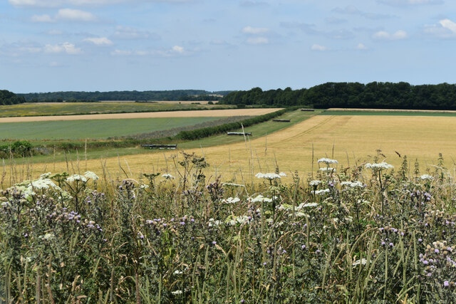
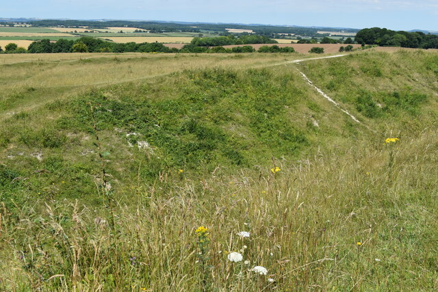
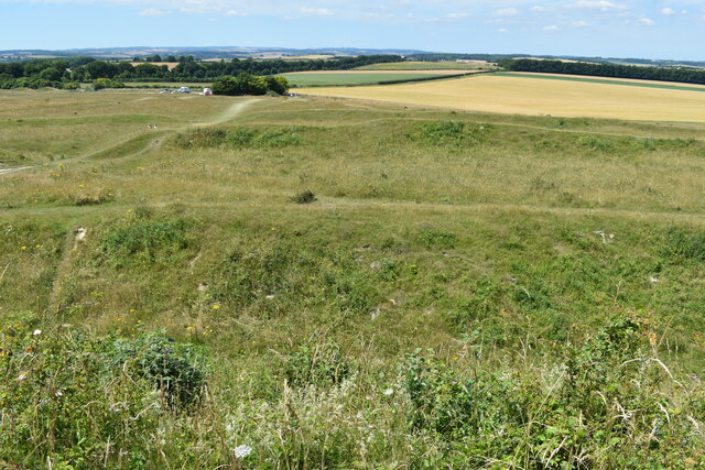
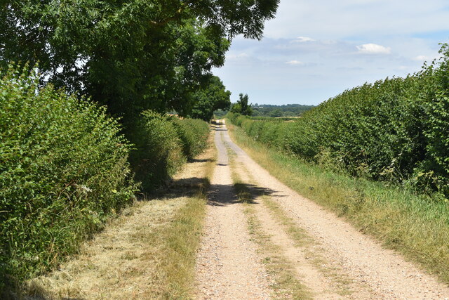
Badbury Clump is a dense woodland located in Dorset, England. Covering an area of approximately 90 acres, it is situated near the village of Badbury in the north of the county. The woodland is known for its scenic beauty and is a popular destination for nature enthusiasts and hikers alike.

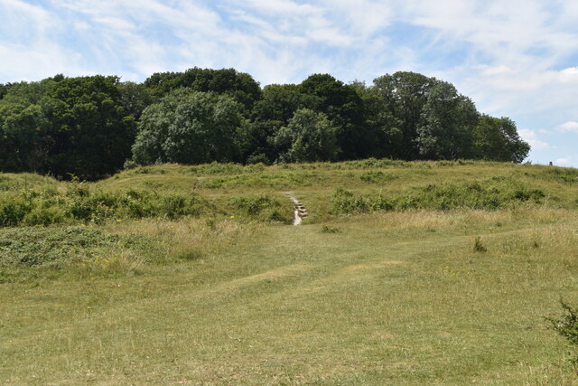
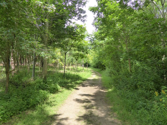
Comprising mainly of ancient beech trees, Badbury Clump is a part of the National Trust and is protected for its ecological importance. The forest floor is adorned with a rich carpet of bluebells during spring, adding to its allure. The tall, majestic trees provide a haven for various bird species, including woodpeckers, thrushes, and owls. The woodland is also home to a diverse range of flora and fauna, with sightings of deer and squirrels being common.

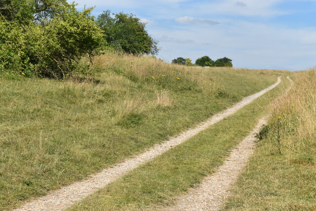
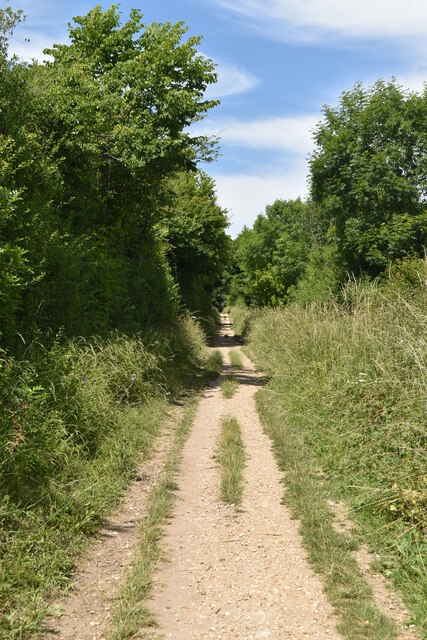
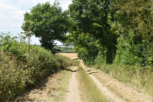
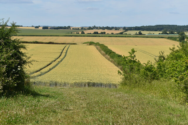
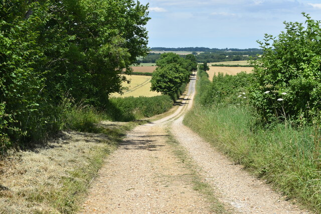
Badbury Clump offers several well-marked walking trails, allowing visitors to explore the forest at their own pace. The most popular route is the circular walk that takes visitors around the perimeter of the woodland, offering breathtaking views of the surrounding countryside. The trails are suitable for all ages and abilities, with options for shorter or longer walks depending on one's preference.

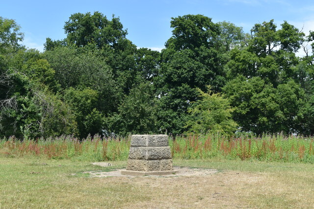
The woodland has a rich history, with evidence of human habitation dating back to the Iron Age. Ruins of an ancient hill fort can still be seen within the forest, adding an element of intrigue to the area. Badbury Clump provides a peaceful and tranquil setting for those seeking solace in nature, with its stunning vistas and abundant wildlife.

If you have any feedback on the listing, please let us know in the comments section below.

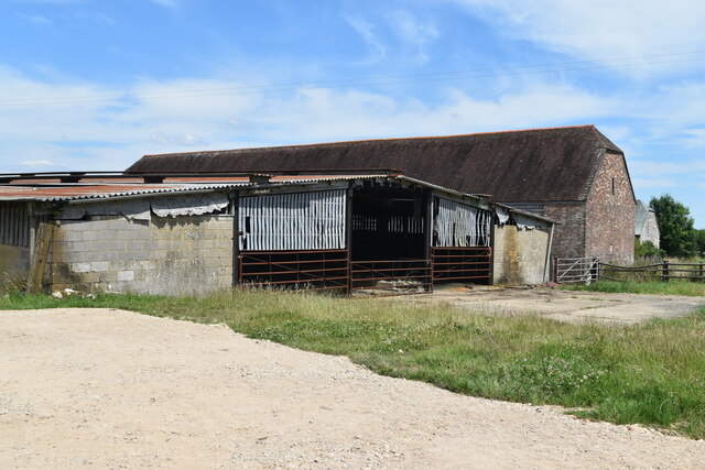
Badbury Clump Images

Images are sourced within 2km of 50.826293/-2.0521821 or Grid Reference ST9602. Thanks to Geograph Open Source API. All images are credited.

Farmland view from Badbury Rings NT car park With the point to point course receding into the distance.
Farmland view from Badbury Rings NT car park
With the point to point course receding into the distance.
Bridleway on course of Roman Road at Badbury Rings
Topograph stone at Badbury Rings The woodland appears to have grown up and obscured views of local landmarks presumably visible when this was installed.
Topograph stone at Badbury Rings
The woodland appears to have grown up and obscured views of local landmarks presumably visible when this was installed.
B3082 Blandford Road through avenue of trees near Badbury Rings
On the Iron Age earthworks at Badbury Rings
View to the summit of Badbury Rings The trig point is just visible on the horizon to the right.
View to the summit of Badbury Rings
The trig point is just visible on the horizon to the right.
View over the earthworks at Badbury Rings The National Trust car park is just visible to the left of the small copse.
View over the earthworks at Badbury Rings
The National Trust car park is just visible to the left of the small copse.
Bridleway east of Badbury Rings
Buildings at King Down Farm
Track west of The Oaks A private farm track, off the marked National Trust estate walk.
Track west of The Oaks
A private farm track, off the marked National Trust estate walk.
Farmland view northwest towards Abbeycroft Down In the left distance is the former Tarrant Rushton Airfield site, with a hangar just visible between the trees.
Farmland view northwest towards Abbeycroft Down
In the left distance is the former Tarrant Rushton Airfield site, with a hangar just visible between the trees.
Hardy Way on farm track north of King Down Farm
Fallen tree in Coneygar Copse, Kingston Lacy The tree was beside the walk that has been provided for dog walking through the woods, away from the formal gardens.  The house, stables and car park are in the distance
Fallen tree in Coneygar Copse, Kingston Lacy
The tree was beside the walk that has been provided for dog walking through the woods, away from the formal gardens. The house, stables and car park are in the distance
Sculpted log, Coneygar Copse, Kingston Lacy The house at Kingston Lacy, its stables and National Trust car park are in the distance
Sculpted log, Coneygar Copse, Kingston Lacy
The house at Kingston Lacy, its stables and National Trust car park are in the distance
Path through Coneygar Copse, Kingston Lacy A woodland walk that is welcoming to dogs on the Kingston Lacy estate
Path through Coneygar Copse, Kingston Lacy
A woodland walk that is welcoming to dogs on the Kingston Lacy estate
Turn for Sturminster Marshall Blandford Road, amongst the avenue of beech trees, near Badbury Rings.
Turn for Sturminster Marshall
Blandford Road, amongst the avenue of beech trees, near Badbury Rings.
The B3082 near Badbury Rings Approaching the turn for Shapwick (left) or Badbury Rings car park (right) on the B3082 between Wimborne and Blandford.
The B3082 near Badbury Rings
Approaching the turn for Shapwick (left) or Badbury Rings car park (right) on the B3082 between Wimborne and Blandford.
Show me another place!

Badbury Clump is located at Grid Ref: ST9602 (Lat: 50.826293, Lng: -2.0521821)

Unitary Authority: Dorset

Police Authority: Dorset

What 3 Words

///graph.event.link. Near Sturminster Marshall, Dorset

Related Wikis

Badbury Rings

Badbury Rings is an Iron Age hill fort and Scheduled Monument in east Dorset, England. It was in the territory of the Durotriges. In the Roman era a temple...

Kingston Lacy

Kingston Lacy is a country house and estate near Wimborne Minster, Dorset, England. It was for many years the family seat of the Bankes family who lived...

Philae obelisk

The Philae obelisk is one of a pair of twin obelisks erected at Philae in Upper Egypt in the second century BC. It was discovered by William John Bankes...

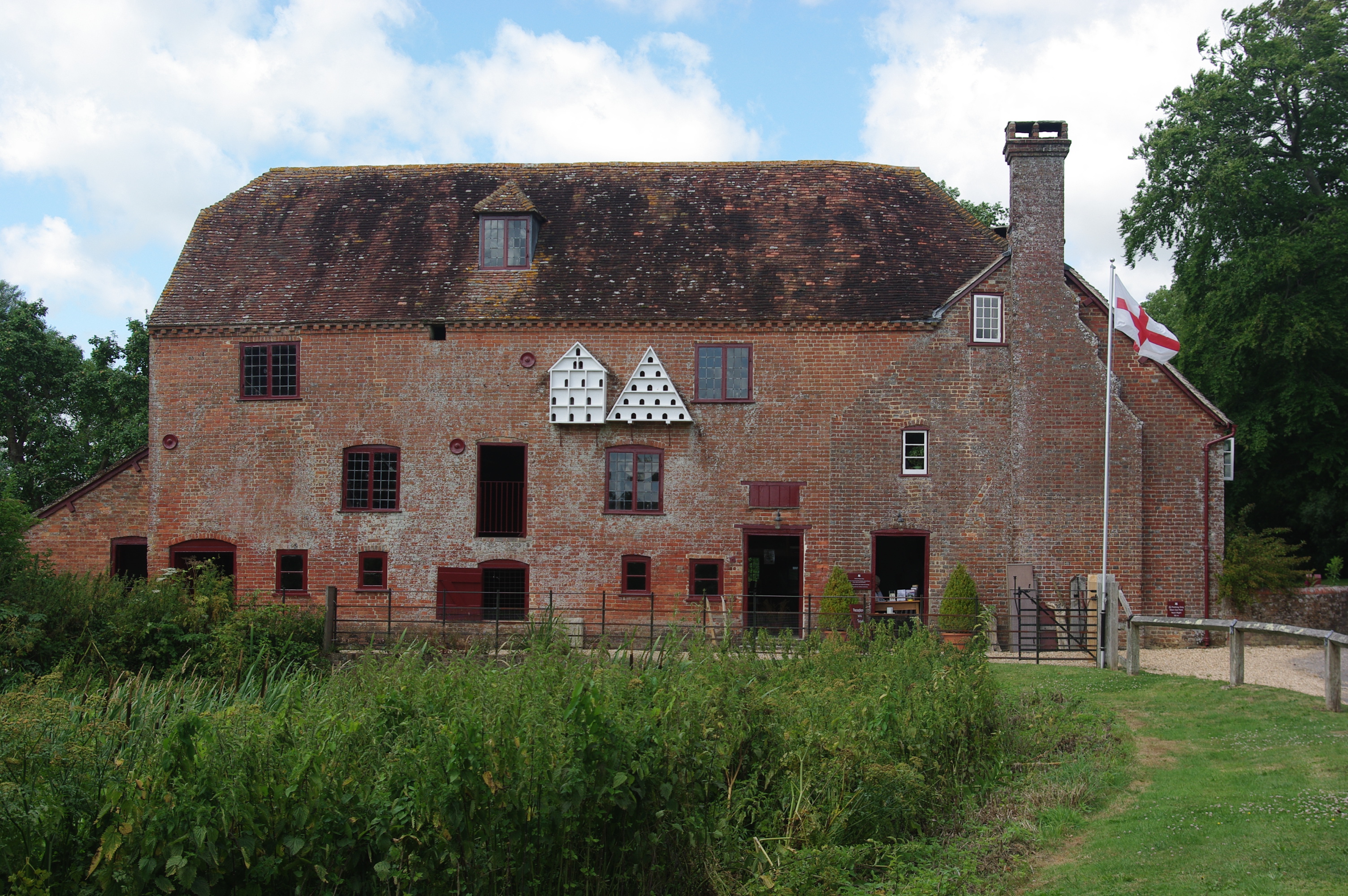
White Mill, Sturminster Marshall

White Mill is an 18th-century water powered corn mill near Sturminster Marshall in Dorset on the River Stour which is in the care of the National Trust...

Shapwick, Dorset

Shapwick is a village and civil parish in east Dorset, England, situated on the River Stour five miles south-east of Blandford Forum and eight miles north...

RAF Tarrant Rushton

Royal Air Force Tarrant Rushton or more simply RAF Tarrant Rushton is a former Royal Air Force station near the village of Tarrant Rushton east of Blandford...

St Stephen's Church, Pamphill

St Stephen's is the parish church of Pamphill in Dorset, England.The current church lies on the site of a former church dating from 1229. The current church...

River Winterborne

There are two River Winterbornes in Dorset, England.The rivers only flow overground during the winter, hence the name. They both flow through a number...

Related Videos

Kingston Lacy Dorset ~ June Holiday 2019 Day # 13

kingstonlacy #nationaltrust #placestovisitindorset #holidaysindorset #dorset We visit Kingston Lacy owned by the National trust, ...

Kingston Lacy | National Trust | Walkthrough

One of our favourite National Trust properties, join us for a walk around in the lovely British weather #NationalTrust #Hiking ...

Kingston Lacy | National Trust | Snowdrops | Full Walkthrough

Join us for another National Trust adventure, time time at the beautiful Kingston Lacy. We find over 70 varieties of Snowdrops here ...

Once Upon A Time....A Kingston Lacy Christmas

Aimee & I visited Kingston Lacy to see the Christmas Decorations Music:- Solstice Spirit by Foxxy Mulderr.

Nearby Amenities

Located within 500m of 50.826293,-2.0521821
Bench
Lat/Long: 50.8269154/-2.0476752
Barrier: stile
Lat/Long: 50.8270921/-2.0477768
Barrier: stile
Lat/Long: 50.8294178/-2.0535613
Badbury Rings
Email: kingstonlacy@nationaltrust.org.uk
Historic: archaeological_site
Historic Civilization: celtic;roman
Name La: Vindocladia
Note: Part of Kingston Lacey
Phone: +44 1202 883402
Website: http://www.hiddendorset.org/index.php/hd/gem/hd1141.html
Wikidata: Q798831
Wikipedia: en:Badbury Rings
Lat/Long: 50.8262617/-2.0525425
Man Made: survey_point
Source: GPS; Survey
Lat/Long: 50.8273957/-2.0503017
Information: board
Tourism: information
Lat/Long: 50.8274625/-2.0581648
Leisure: picnic_table
Lat/Long: 50.8275485/-2.0580505
Leisure: picnic_table
Lat/Long: 50.8274524/-2.0580977
Tourism: viewpoint
Lat/Long: 50.8264289/-2.0524797
Badbury Rings
Ele: 100
Natural: peak
Lat/Long: 50.8265265/-2.0524775
The data included in this document is from www.openstreetmap.org. The data is made available under ODbL.

Have you been to Badbury Clump?

Leave your review of Badbury Clump below (or comments, questions and feedback).