Crossmyloof

Settlement in Renfrewshire

Scotland

Crossmyloof

Blairhall Avenue Part of a terrace of 20 houses. Photographed after a light snowfall.

Scanned from an AGFA colour transparency.
Blairhall Avenue Credit: Richard Sutcliffe

Crossmyloof is a small residential area located in Renfrewshire, Scotland. Situated south of Glasgow, it is bordered by Shawlands to the east, Pollokshields to the west, and Pollok Country Park to the south. The name "Crossmyloof" is believed to have originated from an old Scottish phrase meaning "cross my love," with various speculations surrounding its historical significance.

Primarily a residential neighborhood, Crossmyloof comprises mainly of traditional sandstone tenement buildings, interspersed with some modern developments. The area offers a mix of housing options, including flats, terraced houses, and semi-detached properties, catering to a diverse range of residents.

Crossmyloof benefits from its close proximity to Glasgow city center, which is easily accessible via public transport, with Crossmyloof railway station providing regular train services. The area also enjoys excellent connectivity to other parts of Renfrewshire and beyond, thanks to its well-developed road network.

Residents of Crossmyloof can avail themselves of a variety of amenities nearby. The area is home to several local shops, cafes, and restaurants, providing convenient options for daily needs. Additionally, nearby recreational facilities, such as Pollok Country Park, offer ample opportunities for outdoor activities and leisurely strolls.

Overall, Crossmyloof offers a peaceful residential environment while being within easy reach of the bustling city of Glasgow. With its range of housing options, good transport links, and nearby amenities, it presents an attractive choice for those seeking a well-connected and comfortable place to live in Renfrewshire.

If you have any feedback on the listing, please let us know in the comments section below.
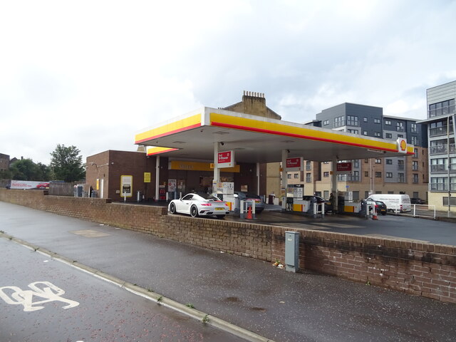
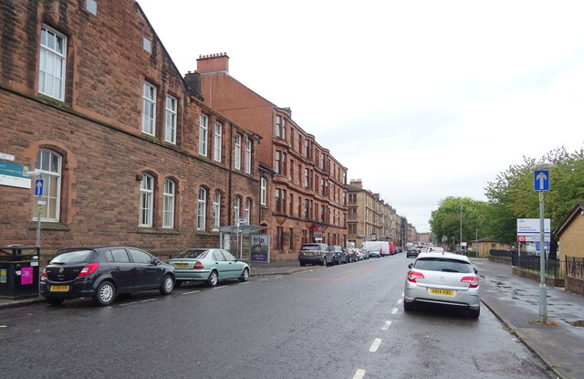
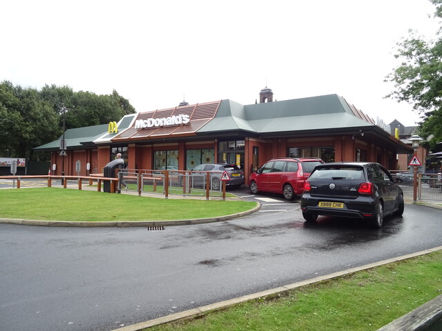
Crossmyloof Images

Images are sourced within 2km of 55.834369/-4.2837194 or Grid Reference NS5762. Thanks to Geograph Open Source API. All images are credited.

Blairhall Avenue Part of a terrace of 20 houses. Photographed after a light snowfall.

Scanned from an AGFA colour transparency.
Blairhall Avenue
Part of a terrace of 20 houses. Photographed after a light snowfall. Scanned from an AGFA colour transparency.
M74 Motorway bridge over Eglinton Street (A77), Glasgow
Shops on Eglinton Street (A77), Glasgow
Service station on Victoria Road
Shops on Cathcart Road, Glasgow
Calder Street (B763), Glasgow
Govanhill Library On Calder Street.
Govanhill Library
On Calder Street.
Lidl Supermarket on Victoria Road, Glasgow
Pollokshaws Road (A77), Glasgow
Mc Donald's Restaurant on Pollokshaws Road
Calder Street (B763), Glasgow
Nithsdale Drive (B763), Glasgow
Railway towards Pollokshields East Station Looking north from the bridge on Nithsdale Drive (B763).
ScotRail Class 380, No. 380011.
Railway towards Pollokshields East Station
Looking north from the bridge on Nithsdale Drive (B763). ScotRail Class 380, No. 380011.
Railway towards Pollokshields East Station Looking north from the bridge on Nithsdale Drive (B763).
Railway towards Pollokshields East Station
Looking north from the bridge on Nithsdale Drive (B763).
Railway towards Queen's Park Station Looking south from the bridge on Nithsdale Drive (B763).
Railway towards Queen's Park Station
Looking south from the bridge on Nithsdale Drive (B763).
Nithsdale Drive (B763), Glasgow
Car dealership on Nithsdale Drive (B763), Glasgow
Shop on Nithsdale Road (B763), Glasgow On a railway bridge.
Shop on Nithsdale Road (B763), Glasgow
On a railway bridge.
Show me another place!

Crossmyloof is located at Grid Ref: NS5762 (Lat: 55.834369, Lng: -4.2837194)

Unitary Authority: City of Glasgow

Police Authority: Greater Glasgow

What 3 Words

///pest.open.cakes. Near Giffnock, East Renfrewshire

Related Wikis

Crossmyloof railway station

Crossmyloof railway station is a railway station serving the areas of Crossmyloof and Shawlands in Glasgow, Scotland, located 1 mile 60 chains (2.8 km...

Titwood

Titwood is a cricket ground in the Pollokshields area of Glasgow, Scotland. It is the home of the Clydesdale Cricket Club and is one of four international...

Hutchesons' Grammar School

Hutchesons' Grammar School is an independent day school for boys and girls aged 3–18 in Glasgow, Scotland. It was founded as Hutchesons' Boys' Grammar...

Crossmyloof

Crossmyloof (, Scottish Gaelic: Crois Mo Liubha, Scots: Crossmaluif) is an area on the south side of Glasgow situated between the districts of Pollokshields...

Shawlands Academy

Shawlands Academy is a state secondary school in the Shawlands area of Glasgow, Scotland. == Admissions == Shawlands Academy was Glasgow's designated International...

Maxwell Park railway station

Maxwell Park railway station is a railway station in Pollokshields area of Glasgow, Scotland, adjacent to the park of the same name. The station is managed...

Pollokshields Burgh Hall

The Pollokshields Burgh Hall is a municipal building at the edge of Maxwell Park, Glasgow, Scotland. The burgh hall, which was briefly the headquarters...

Pollokshields West railway station

Pollokshields West railway station is one of three railway stations in Pollokshields, a district of Glasgow, Scotland. The station is managed by ScotRail...

Nearby Amenities

Located within 500m of 55.834369,-4.2837194
Traffic Signals
Lat/Long: 55.8315573/-4.2788596
Traffic Signals
Lat/Long: 55.8342808/-4.2875348
Traffic Signals
Lat/Long: 55.8343803/-4.2836791
Crossmyloof
Naptan AtcoCode: 9100CRSMYLF
Network: National Rail
Network Website: https://www.nationalrail.co.uk/stations/cmy/
Network Wikidata: Q26334
Operator: ScotRail
Operator Website: https://www.scotrail.co.uk/plan-your-journey/stations-and-facilities/cmy
Operator Wikidata: Q18356161
Public Transport: station
Railway: station
Ref Crs: CMY
Train: yes
Wheelchair: yes
Wikidata: Q3044898
Wikipedia: en:Crossmyloof railway station
Lat/Long: 55.8339652/-4.2841408
Maxwell Park
Naptan AtcoCode: 9100MAXWLPK
Network: National Rail
Network Website: https://www.nationalrail.co.uk/stations/max/
Network Wikidata: Q26334
Operator: ScotRail
Operator Website: https://www.scotrail.co.uk/plan-your-journey/stations-and-facilities/max
Operator Wikidata: Q18356161
Public Transport: stop_position
Railway: station
Ref Crs: MAX
Source: npe/landsat
Train: yes
Wikidata: Q2482069
Wikipedia: en:Maxwell Park railway station
Lat/Long: 55.8376818/-4.2885458
Bus Stop
Dinmont Road / Norham Street
Bus: yes
Naptan AtcoCode: 60902917
Naptan Bearing: NE
Naptan CommonName: Norham Street
Naptan Indicator: Opp
Naptan Landmark: Norham Street
Naptan NaptanCode: 45235235
Naptan Street: Dinmont Road
Nat Ref: 60902917
Public Transport: platform
Ref: 60902917
Lat/Long: 55.8332836/-4.2841925
Bus Stop
Durward Avenue / Quentin Street
Bus: yes
Naptan AtcoCode: 60902919
Naptan Bearing: NE
Naptan CommonName: Quentin Street
Naptan Indicator: Opp
Naptan Landmark: Quentin Street
Naptan NaptanCode: 45237382
Naptan Street: Durward Avenue
Nat Ref: 60902919
Public Transport: platform
Ref: 60902919
Lat/Long: 55.8328447/-4.2850126
Telephone
Booth: KX100
Covered: booth
Source: survey
Lat/Long: 55.8329646/-4.2765491
Post Box
Collection Times: Mo-Fr 18:00; Sa 12:00
Operator: Royal Mail
Operator Wikidata: Q638098
Ref: G41 476
Source: survey
Lat/Long: 55.8325482/-4.277219
Bus Stop
Minard Road / Frankfort Street
Bus: yes
Naptan AtcoCode: 60902911
Naptan Bearing: NW
Naptan CommonName: Frankfort Street
Naptan Indicator: before
Naptan Landmark: Frankfort Street
Naptan NaptanCode: 45242627
Naptan Street: Minard Road
Nat Ref: 60902911
Public Transport: platform
Ref: 60902911
Lat/Long: 55.8317921/-4.2794269
Post Box
Postal Code: G41
Ref: G41 404
Lat/Long: 55.8309406/-4.2874018
Bar
The Linen Bar
Lat/Long: 55.8306927/-4.2808742
Bicycle Parking
Bicycle Parking: stands
Capacity: 4
Covered: no
Lat/Long: 55.8319694/-4.2779903
Fuel
BP
Addr Housenumber: 890
Addr Postcode: G41 2ET
Addr Street: Pollokshaws Road
Brand: BP
Brand Wikidata: Q152057
Brand Wikipedia: en:BP
Fhrs Id: 125752
Source Addr: FHRS Open Data
Website: https://map.bp.com/en-GB/GB/petrol-station/glasgow/pollokshaws-sf-connect/4407
Lat/Long: 55.8334878/-4.2760269
Pub
Sweeney's On The Park
Addr City: Glasgow
Addr Housenumber: 964
Addr Postcode: G41 2ET
Addr Street: Pollokshaws Road
Fhrs Id: 696550
Lat/Long: 55.8325858/-4.2772888
Cafe
Buongiorno
Addr Housenumber: 1012
Addr Postcode: G41 2HG
Addr Street: Pollokshaws Road
Fhrs Id: 125754
Source Addr: FHRS Open Data
Lat/Long: 55.8319486/-4.2784261
The Co-operative Food
Addr City: Glasgow
Addr Housenumber: 1060-1078
Addr Postcode: G41 3EA
Addr Street: Pollokshaws Road
Brand: The Co-operative Food
Brand Wikidata: Q3277439
Brand Wikipedia: en:Co-op Food
Operator: The Co-operative Group
Operator Wikidata: Q117202
Shop: supermarket
Website: https://www.coop.co.uk/store-finder/G41-3EA/1060-1078-pollokshaws-road
Lat/Long: 55.8311751/-4.2799509
Bar
Waverley Tea Rooms
Lat/Long: 55.8310139/-4.2818378
Bar
Tusk
Lat/Long: 55.831014/-4.2816256
Pub
The Granary
Addr Housenumber: 10
Addr Postcode: G41 3NH
Addr Street: Kilmarnock Road
Fhrs Id: 112537
Source Addr: FHRS Open Data
Lat/Long: 55.8301981/-4.2815956
Cycleway: asl
Lat/Long: 55.8306506/-4.2812989
Post Office
Shawlands Post Office
Addr Country: GB
Addr Postcode: G41 3EA
Brand: Post Office
Brand Wikidata: Q1783168
Contact Website: https://www.postoffice.co.uk/branch-finder/1538322/shawlands
Ref Pol Id: 22670
Lat/Long: 55.831387/-4.2797562
Bus Stop
Pollokshaws Road / Minard Road
Bench: no
Bus: yes
Naptan AtcoCode: 60902647
Naptan Bearing: NE
Naptan CommonName: Queens Park
Naptan Indicator: Opp
Naptan Landmark: Minard Road
Naptan NaptanCode: 45242857
Naptan Street: Pollokshaws Road
Public Transport: platform
Ref: 60902647
Shelter: yes
Source: survey;bing
Lat/Long: 55.8320941/-4.2780358
Bus Stop
Pollokshaws Road / Minard Road
Bench: yes
Bus: yes
Lit: yes
Naptan AtcoCode: 60902649
Naptan Bearing: SW
Naptan CommonName: Queens Park
Naptan Indicator: At
Naptan Landmark: Minnard Road
Naptan NaptanCode: 45237362
Naptan Street: Pollokshaws Road
Public Transport: platform
Ref: 60902649
Shelter: yes
Tactile Paving: no
Lat/Long: 55.83208/-4.27775
Restaurant
Di Maggios
Addr Housenumber: 1040
Addr Postcode: G41 3EB
Addr Street: Pollokshaws Road
Fhrs Id: 511175
Source Addr: FHRS Open Data
Lat/Long: 55.8315469/-4.2791495
Post Box
Collection Times: Mo-Fr 17:30; Sa 12:00
Operator: Royal Mail
Operator Wikidata: Q638098
Ref: G41 1388
Lat/Long: 55.831226/-4.2795733
Fast Food
BABA Tandoori
Lat/Long: 55.8311654/-4.2792944
Pub
Georgic
Addr Housenumber: 1097
Addr Postcode: G41 3YG
Addr Street: Pollokshaws Road
Brand: Belhaven Pubs
Brand Wikidata: Q105516156
Fhrs Id: 49122
Source Addr: FHRS Open Data
Website: https://www.belhaven.co.uk/pubs/lanarkshire/georgic
Lat/Long: 55.8308102/-4.2799005
Fast Food
Subway
Addr City: Glasgow
Addr Housenumber: 1103
Addr Postcode: G41 3YG
Addr Street: Pollokshaws Road
Brand: Subway
Brand Wikidata: Q244457
Brand Wikipedia: en:Subway (restaurant)
Contact Website: https://restaurants.subway.com/united-kingdom/sc/glasgow/1103-pollokshaws-road
Cuisine: sandwich
Fhrs Id: 10662
Source Addr: FHRS Open Data
Takeaway: yes
Lat/Long: 55.8307425/-4.2800373
Cafe
Kavir
Addr Street: Pollokshaws Road
Lat/Long: 55.8306905/-4.2802051
Fast Food
Haddock's Fish Bar & Spicy Hut
Addr Street: Pollokshaws Road
Lat/Long: 55.8306075/-4.2803479
Pharmacy
J.P. Mackie
Healthcare: pharmacy
Lat/Long: 55.8310863/-4.2794336
Fast Food
Hong Kong
Addr Street: Pollokshaws Road
Lat/Long: 55.8303756/-4.2807787
Bicycle Parking
Capacity: 6
Covered: no
Lat/Long: 55.8309786/-4.280197
Bus Stop
Pollokshaws Road / Kilmarnock Road
Bus: yes
Naptan AtcoCode: 60902668
Naptan Bearing: SW
Naptan CommonName: Shawlands Cross
Naptan Indicator: at
Naptan Landmark: Kilmarnock Road
Naptan NaptanCode: 45242732
Naptan Street: Pollokshaws Road
Public Transport: platform
Ref: 60902668
Lat/Long: 55.83012/-4.2821414
Recycling
Source: Local_Knowledge
Lat/Long: 55.832735/-4.2846097
Bicycle Parking
Bicycle Parking: stands
Capacity: 10
Covered: no
Lat/Long: 55.8341268/-4.2840324
Recycling
Recycling Type: container
Source: survey
Lat/Long: 55.833442/-4.286421
Recycling
Lat/Long: 55.831001/-4.280157
Bus Stop
Darnley Road / Boleyn Road
Bus: yes
Naptan AtcoCode: 60903842
Naptan Bearing: SW
Naptan CommonName: Boleyn Road
Naptan Indicator: opp
Naptan Landmark: Boleyn Road
Naptan NaptanCode: 45292587
Naptan Street: Darnley Road
Public Transport: platform
Ref: 60903842
Lat/Long: 55.83527/-4.2808
Bus Stop
Darnley Road / Boleyn Road
Bus: yes
Naptan AtcoCode: 60903591
Naptan Bearing: NE
Naptan CommonName: Boleyn Road
Naptan Indicator: at
Naptan Landmark: Boleyn Road
Naptan NaptanCode: 45242984
Naptan Street: Darnley Road
Public Transport: platform
Ref: 60903591
Lat/Long: 55.83555/-4.28043
Bus Stop
Titwood Road / Dolphin Road
Bus: yes
Naptan AtcoCode: 60903576
Naptan Bearing: E
Naptan CommonName: Dolphin Road
Naptan Indicator: before
Naptan Landmark: Dolphin Road
Naptan NaptanCode: 45242945
Naptan Street: Titwood Road
Public Transport: platform
Ref: 60903576
Lat/Long: 55.83437/-4.28876
Bus Stop
Titwood Road / Morrisons Superstore
Bus: yes
Naptan AtcoCode: 60902914
Naptan Bearing: W
Naptan CommonName: Shawmoss Road
Naptan Indicator: before
Naptan Landmark: Morrisons Superstore
Naptan NaptanCode: 45238286
Naptan Street: Titwood Road
Public Transport: platform
Ref: 60902914
Shelter: yes
Lat/Long: 55.83414/-4.28605
Bus Stop
Titwood Road / Springkell Avenue
Bus: yes
Naptan AtcoCode: 60903592
Naptan Bearing: W
Naptan CommonName: Springkell Avenue
Naptan Indicator: after
Naptan Landmark: Springkell Avenue
Naptan NaptanCode: 45232463
Naptan Street: Titwood Road
Public Transport: platform
Ref: 60903592
Lat/Long: 55.83431/-4.29098
Bus Stop
Dinmont Road / Norham Street
Bus: yes
Naptan AtcoCode: 60902918
Naptan Bearing: SW
Naptan CommonName: Norham Street
Naptan Indicator: after
Naptan Landmark: Norham Street
Naptan NaptanCode: 45239386
Naptan Street: Dinmont Road
Public Transport: platform
Ref: 60902918
Lat/Long: 55.83315/-4.28406
Bus Stop
Minard Road / Frankfort Street
Bus: yes
Naptan AtcoCode: 60902910
Naptan Bearing: SE
Naptan CommonName: Frankfort Street
Naptan Indicator: Opp
Naptan Landmark: Frankfort Street
Naptan NaptanCode: 45235628
Naptan Street: Minard Road
Public Transport: platform
Ref: 60902910
Lat/Long: 55.83206/-4.2796
Bus Stop
Minard Road / Waverley Gardens
Bench: yes
Bus: yes
Naptan AtcoCode: 60902912
Naptan Bearing: SE
Naptan CommonName: Waverley Gardens
Naptan Indicator: At
Naptan Landmark: Waverley Gardens
Naptan NaptanCode: 45232692
Naptan Street: Minard Road
Public Transport: platform
Ref: 60902912
Shelter: yes
Lat/Long: 55.83341/-4.28203
Bus Stop
Minard Road / Waverley Gardens
Bus: yes
Naptan AtcoCode: 60902913
Naptan Bearing: NW
Naptan CommonName: Waverley Gardens
Naptan Indicator: Opp
Naptan Landmark: Waverley Gardens
Naptan NaptanCode: 45232458
Naptan Street: Minard Road
Public Transport: platform
Ref: 60902913
Shelter: yes
Lat/Long: 55.83363/-4.28274
Bus Stop
Pollokshaws Road / Kilmarnock Road
Bus: yes
Naptan AtcoCode: 60902669
Naptan Bearing: SW
Naptan CommonName: Old Parish Church
Naptan Indicator: opp
Naptan Landmark: Kilmarnock Road
Naptan NaptanCode: 45239793
Naptan Street: Pollokshaws Road
Public Transport: platform
Ref: 60902669
Lat/Long: 55.8300472/-4.2823526
Bus Stop
Pollokshaws Road / Moss-side road
Bus: yes
Naptan AtcoCode: 60902670
Naptan Bearing: NE
Naptan CommonName: Old Parish Church
Naptan Indicator: at
Naptan Landmark: Moss-side road
Naptan NaptanCode: 45234948
Naptan Street: Pollokshaws Road
Public Transport: platform
Ref: 60902670
Lat/Long: 55.83018/-4.28224
Noexit: yes
Lat/Long: 55.8333684/-4.2847661
Addr City: Glasgow
Addr Housenumber: 21
Addr Street: Titwood Road
Lat/Long: 55.8339669/-4.2758169
Addr City: Glasgow
Addr Housenumber: 23
Addr Street: Titwood Road
Lat/Long: 55.8339696/-4.2759189
Addr City: Glasgow
Addr Housenumber: 25
Addr Street: Titwood Road
Lat/Long: 55.8339722/-4.276021
Addr City: Glasgow
Addr Housenumber: 27
Addr Street: Titwood Road
Lat/Long: 55.8339801/-4.2762638
Addr City: Glasgow
Addr Housenumber: 29
Addr Street: Titwood Road
Lat/Long: 55.8339831/-4.2763613
Addr City: Glasgow
Addr Housenumber: 31
Addr Street: Titwood Road
Lat/Long: 55.8339876/-4.2764641
Addr City: Glasgow
Addr Housenumber: 33
Addr Street: Titwood Road
Lat/Long: 55.8339891/-4.2765564
Addr City: Glasgow
Addr Housenumber: 35
Addr Street: Titwood Road
Lat/Long: 55.8339921/-4.2766539
Addr City: Glasgow
Addr Housenumber: 37
Addr Street: Titwood Road
Lat/Long: 55.8339951/-4.2767514
Addr City: Glasgow
Addr Housenumber: 39
Addr Street: Titwood Road
Lat/Long: 55.8339982/-4.2768489
Addr City: Glasgow
Addr Housenumber: 45
Addr Street: Titwood Road
Lat/Long: 55.8340165/-4.277572
Addr City: Glasgow
Addr Housenumber: 47
Addr Street: Titwood Road
Lat/Long: 55.8340194/-4.2776851
Addr City: Glasgow
Addr Housenumber: 49
Addr Street: Titwood Road
Lat/Long: 55.834022/-4.2777913
Addr City: Glasgow
Addr Housenumber: 51
Addr Street: Titwood Road
Lat/Long: 55.8340247/-4.2778943
Addr City: Glasgow
Addr Housenumber: 53
Addr Street: Titwood Road
Lat/Long: 55.8340271/-4.2779923
Addr City: Glasgow
Addr Housenumber: 55
Addr Street: Titwood Road
Lat/Long: 55.8340294/-4.2780825
Addr City: Glasgow
Addr Housenumber: 57
Addr Street: Titwood Road
Lat/Long: 55.8340316/-4.27817
Addr City: Glasgow
Addr Housenumber: 59
Addr Street: Titwood Road
Lat/Long: 55.8340346/-4.2782889
Addr City: Glasgow
Addr Housenumber: 61
Addr Street: Titwood Road
Lat/Long: 55.834037/-4.2783815
Addr City: Glasgow
Addr Housenumber: 63
Addr Street: Titwood Road
Lat/Long: 55.8340396/-4.2784849
Addr City: Glasgow
Addr Housenumber: 65
Addr Street: Titwood Road
Lat/Long: 55.8340489/-4.2786706
Addr City: Glasgow
Addr Housenumber: 67
Addr Street: Titwood Road
Lat/Long: 55.8340505/-4.2787693
Addr City: Glasgow
Addr Housenumber: 69
Addr Street: Titwood Road
Lat/Long: 55.8340514/-4.278977
Addr City: Glasgow
Addr Housenumber: 71
Addr Street: Titwood Road
Lat/Long: 55.8340536/-4.2791082
Addr City: Glasgow
Addr Housenumber: 73
Addr Street: Titwood Road
Lat/Long: 55.8340571/-4.2793864
Addr City: Glasgow
Addr Housenumber: 75
Addr Street: Titwood Road
Lat/Long: 55.8340611/-4.2796287
Addr City: Glasgow
Addr Housenumber: 77
Addr Street: Titwood Road
Lat/Long: 55.8340656/-4.279902
Addr City: Glasgow
Addr Housenumber: 79
Addr Street: Titwood Road
Lat/Long: 55.8340699/-4.2801676
Addr City: Glasgow
Addr Housenumber: 83
Addr Street: Titwood Road
Lat/Long: 55.8340767/-4.2805777
Addr City: Glasgow
Addr Housenumber: 85
Addr Street: Titwood Road
Lat/Long: 55.8340813/-4.2808561
Addr City: Glasgow
Addr Housenumber: 87
Addr Street: Titwood Road
Lat/Long: 55.8340855/-4.2811138
Addr City: Glasgow
Addr Housenumber: 89
Addr Street: Titwood Road
Lat/Long: 55.8341132/-4.2814515
Man Made: surveillance
Lat/Long: 55.8317817/-4.2790618
Vending Machine
Vending: public_transport_tickets
Lat/Long: 55.8339789/-4.2843479
Addr City: Glasgow
Addr Housenumber: 38
Addr Street: Durward Avenue
Lat/Long: 55.832424/-4.2871302
Addr City: Glasgow
Addr Housenumber: 40
Addr Street: Durward Avenue
Lat/Long: 55.832401/-4.2872045
Addr City: Glasgow
Addr Housenumber: 42
Addr Street: Durward Avenue
Lat/Long: 55.8323386/-4.2874667
Addr City: Glasgow
Addr Housenumber: 44
Addr Street: Durward Avenue
Lat/Long: 55.8323189/-4.2875303
Addr City: Glasgow
Addr Housenumber: 46
Addr Street: Durward Avenue
Lat/Long: 55.8322476/-4.2877233
Addr City: Glasgow
Addr Housenumber: 48
Addr Street: Durward Avenue
Lat/Long: 55.8322288/-4.2877843
Addr City: Glasgow
Addr Housenumber: 50
Addr Street: Durward Avenue
Lat/Long: 55.8321396/-4.2879966
Addr City: Glasgow
Addr Housenumber: 52
Addr Street: Durward Avenue
Lat/Long: 55.8321227/-4.2880513
Addr City: Glasgow
Addr Housenumber: 54
Addr Street: Durward Avenue
Lat/Long: 55.8320848/-4.288174
Addr City: Glasgow
Addr Housenumber: 56
Addr Street: Durward Avenue
Lat/Long: 55.8320696/-4.2882231
Addr City: Glasgow
Addr Housenumber: 58
Addr Street: Durward Avenue
Lat/Long: 55.8320266/-4.2883625
Addr City: Glasgow
Addr Housenumber: 60
Addr Street: Durward Avenue
Lat/Long: 55.8320091/-4.2884191
Addr City: Glasgow
Addr Housenumber: 62
Addr Street: Durward Avenue
Lat/Long: 55.8319727/-4.2885369
Addr City: Glasgow
Addr Housenumber: 64
Addr Street: Durward Avenue
Lat/Long: 55.8319545/-4.2885957
Addr City: Glasgow
Addr Housenumber: 66
Addr Street: Durward Avenue
Lat/Long: 55.8319202/-4.288707
Addr City: Glasgow
Addr Housenumber: 68
Addr Street: Durward Avenue
Lat/Long: 55.8319077/-4.2887473
Addr City: Glasgow
Addr Housenumber: 70
Addr Street: Durward Avenue
Lat/Long: 55.8318256/-4.2890144
Addr City: Glasgow
Addr Housenumber: 72
Addr Street: Durward Avenue
Lat/Long: 55.8318123/-4.2890574
Addr City: Glasgow
Addr Housenumber: 74
Addr Street: Durward Avenue
Lat/Long: 55.831771/-4.2891913
Addr City: Glasgow
Addr Housenumber: 76
Addr Street: Durward Avenue
Lat/Long: 55.831752/-4.2892526
Addr City: Glasgow
Addr Housenumber: 78
Addr Street: Durward Avenue
Lat/Long: 55.8317207/-4.2893448
Addr City: Glasgow
Addr Housenumber: 80
Addr Street: Durward Avenue
Lat/Long: 55.8316854/-4.2894406
Addr City: Glasgow
Addr Housenumber: 82
Addr Street: Durward Avenue
Lat/Long: 55.8316668/-4.2894912
Addr City: Glasgow
Addr Housenumber: 84
Addr Street: Durward Avenue
Lat/Long: 55.8316169/-4.2896213
Addr City: Glasgow
Addr Housenumber: 86
Addr Street: Durward Avenue
Lat/Long: 55.8315996/-4.2896647
Addr City: Glasgow
Addr Housenumber: 88
Addr Street: Durward Avenue
Lat/Long: 55.8315538/-4.2897793
Addr City: Glasgow
Addr Housenumber: 90
Addr Street: Durward Avenue
Lat/Long: 55.8315369/-4.2898214
Crossmyloof
Naptan AtcoCode: 9100CRSMYLF
Network: National Rail
Public Transport: stop_position
Railway: stop
Train: yes
Lat/Long: 55.8339512/-4.2841389
Cafe
Glad Cafe
Addr City: Glasgow
Addr Housenumber: 1006A
Addr Postcode: G41 2HG
Addr Street: Pollokshaws Road
Diet Vegan: yes
Diet Vegetarian: yes
Fhrs Id: 433001
Opening Hours: Mo-Th 17:00-23:00; Fr 17:00-24:00; Sa 10:00-24:00; Su 10:00-23:00
Phone: +44 141 636 6119
Website: https://www.thegladcafe.co.uk/
Lat/Long: 55.8320417/-4.2782944
Bicycle Parking
Bicycle Parking: stands
Capacity: 12
Covered: no
Lat/Long: 55.8317252/-4.2783109
Crossmyloof
Name Gd: Crois MoLiubha
Place: suburb
Wikidata: Q5188735
Wikipedia: en:Crossmyloof
Lat/Long: 55.8342784/-4.2834792
Cycleway: asl
Lat/Long: 55.8344859/-4.2833645
Crossing
Crossing: traffic_signals
Crossing Island: no
Tactile Paving: yes
Lat/Long: 55.8343015/-4.2839217
Shawmoss
Place: quarter
Lat/Long: 55.8335813/-4.2903976
Man Made: surveillance
Lat/Long: 55.8317991/-4.2790913
Shawlands Cross
Junction: yes
Lat/Long: 55.8305024/-4.2809292
Access: yes
Leisure: playground
Lat/Long: 55.8383543/-4.2801808
Cafe
Strange Brew
Addr City: Glasgow
Addr Housenumber: 1109
Addr Postcode: G41 3YG
Addr Street: Pollokshaws Road
Cuisine: brunch
Internet Access: wlan
Opening Hours: Mo-Sa 09:00-16:30; Su 09:30-15:30
Lat/Long: 55.8309098/-4.2802727
Traffic Calming: cushion
Lat/Long: 55.8374725/-4.2874189
Traffic Signals
Traffic Signals: signal
Lat/Long: 55.8304819/-4.280878
Traffic Signals
Traffic Signals: signal
Lat/Long: 55.8305204/-4.2809742
Bench
Backrest: no
Material: stone
Seats: 1
Lat/Long: 55.8312635/-4.2780997
Bench
Backrest: no
Material: stone
Seats: 1
Lat/Long: 55.8312762/-4.2780086
Bench
Backrest: no
Material: stone
Seats: 1
Lat/Long: 55.8312677/-4.2780693
Bench
Backrest: no
Material: stone
Seats: 1
Lat/Long: 55.831272/-4.2780391
Bench
Backrest: no
Material: stone
Seats: 1
Lat/Long: 55.8316342/-4.2784944
Bench
Backrest: no
Material: stone
Seats: 1
Lat/Long: 55.8316046/-4.2785517
Bench
Backrest: no
Material: stone
Seats: 1
Lat/Long: 55.8316638/-4.2784384
Bench
Backrest: no
Material: stone
Seats: 1
Lat/Long: 55.8316946/-4.2783807
Shop: beauty
Lat/Long: 55.8332132/-4.2761941
Post Box
Collection Times: Mo-Fr 09:00; Sa 07:00
Operator: Royal Mail
Operator Wikidata: Q638098
Post Box Type: pillar
Ref: G41 331D
Royal Cypher: GR
Royal Cypher Wikidata: Q33102273
Lat/Long: 55.8341902/-4.2765006
Post Box
Collection Times: Mo-Fr 09:00; Sa 07:00
Operator: Royal Mail
Operator Wikidata: Q638098
Post Box Design: type_g
Post Box Type: pillar
Ref: G41 182D
Royal Cypher: scottish_crown
Lat/Long: 55.833393/-4.2820059
Post Box
Collection Times: Mo-Fr 09:00; Sa 07:00
Operator: Royal Mail
Post Box Type: pillar
Ref: G41 330D
Royal Cypher: GR
Royal Cypher Wikidata: Q33102273
Lat/Long: 55.8345231/-4.290424
Post Box
Operator: Royal Mail
Lat/Long: 55.8367366/-4.2793758
Waste Basket
Lat/Long: 55.8381386/-4.2802869
Bench
Backrest: yes
Lat/Long: 55.8381547/-4.2801185
Waste Basket
Lat/Long: 55.8381313/-4.2800454
Waste Basket
Lat/Long: 55.8381947/-4.2803536
Bench
Backrest: yes
Lat/Long: 55.8381584/-4.2802243
Cycleway: asl
Lat/Long: 55.8302309/-4.2813247
Cycleway: asl
Lat/Long: 55.8303814/-4.2814073
Crossing
Crossing: traffic_signals
Lat/Long: 55.8306311/-4.2812503
Cycleway: asl
Lat/Long: 55.8305712/-4.2807005
Crossing
Crossing: traffic_signals
Lat/Long: 55.8305456/-4.2807517
Crossing
Crossing: traffic_signals
Lat/Long: 55.8314684/-4.2790311
Crossing
Crossing: traffic_signals
Lat/Long: 55.8316311/-4.278991
Ladbrokes
Brand: Ladbrokes
Brand Wikidata: Q1799875
Brand Wikipedia: en:Ladbrokes Coral
Shop: bookmaker
Lat/Long: 55.8313755/-4.279447
Mika
Shop: hairdresser
Lat/Long: 55.8314824/-4.2792633
Generator Method: photovoltaic
Generator Output Electricity: yes
Generator Source: solar
Generator Type: solar_photovoltaic_panel
Power: generator
Lat/Long: 55.8334065/-4.291502
Generator Method: photovoltaic
Generator Output Electricity: yes
Generator Source: solar
Generator Type: solar_photovoltaic_panel
Power: generator
Lat/Long: 55.8334174/-4.2913268
Generator Method: photovoltaic
Generator Output Electricity: yes
Generator Source: solar
Generator Type: solar_photovoltaic_panel
Power: generator
Lat/Long: 55.8334224/-4.2911764
Crossing
Crossing: traffic_signals
Crossing Island: no
Tactile Paving: yes
Lat/Long: 55.8343001/-4.2835915
Crossing
Crossing: traffic_signals
Crossing Island: no
Tactile Paving: yes
Lat/Long: 55.8344734/-4.2834019
Cycleway: asl
Lat/Long: 55.8342793/-4.2840072
Crossing
Crossing: traffic_signals
Crossing Island: no
Tactile Paving: yes
Lat/Long: 55.8342863/-4.2877071
Crossing
Crossing: traffic_signals
Crossing Island: no
Tactile Paving: yes
Lat/Long: 55.8342736/-4.2873406
Crossing
Crossing: traffic_signals
Crossing Island: no
Tactile Paving: yes
Lat/Long: 55.8342113/-4.2875324
Crossing
Crossing: traffic_signals
Crossing Island: no
Tactile Paving: yes
Lat/Long: 55.8343731/-4.287526
Crossing
Crossing: traffic_signals
Crossing Island: no
Tactile Paving: yes
Lat/Long: 55.8339339/-4.2878852
Street Lamp
Lat/Long: 55.8333319/-4.2760517
Street Lamp
Lat/Long: 55.8330308/-4.276117
Street Lamp
Lat/Long: 55.8328076/-4.2764908
Street Lamp
Lat/Long: 55.8326109/-4.2768429
Street Lamp
Lat/Long: 55.8323816/-4.2772403
Street Lamp
Lat/Long: 55.8320661/-4.2778328
Street Lamp
Lat/Long: 55.8318368/-4.2781966
Street Lamp
Lat/Long: 55.8315683/-4.2786562
Street Lamp
Lat/Long: 55.8317963/-4.279498
Man Made: surveillance
Lat/Long: 55.8318617/-4.2796557
Street Lamp
Lat/Long: 55.8318204/-4.279848
Waste Basket
Lat/Long: 55.8319853/-4.2794853
Man Made: surveillance
Lat/Long: 55.8317929/-4.2790739
Shop: butcher
Lat/Long: 55.8318185/-4.2791084
Shop: electronics
Lat/Long: 55.8318626/-4.2791929
Pharmacy
Lat/Long: 55.8318012/-4.2790689
Cafe
Tapa
Lat/Long: 55.8319014/-4.2792372
eagles dare
Shop: tattoo
Lat/Long: 55.8319386/-4.2793042
Restaurant
Lat/Long: 55.8319635/-4.2793438
Fast Food
Wing Rush
Lat/Long: 55.8320343/-4.2794873
Shawlands Laundry
Shop: laundry
Lat/Long: 55.831994/-4.2794115
Street Lamp
Lat/Long: 55.8328684/-4.2794135
Street Lamp
Lat/Long: 55.8326233/-4.2795382
Street Lamp
Lat/Long: 55.8330793/-4.2813906
Street Lamp
Lat/Long: 55.8324683/-4.2801297
Street Lamp
Lat/Long: 55.8323957/-4.2805788
Street Lamp
Lat/Long: 55.8323137/-4.2800318
Street Lamp
Lat/Long: 55.8320403/-4.2799335
Street Lamp
Lat/Long: 55.8340705/-4.2764188
Street Lamp
Lat/Long: 55.8341805/-4.2759669
Crossing
Crossing: traffic_signals
Crossing Island: yes
Lat/Long: 55.8314829/-4.2787408
Traffic Calming: cushion
Lat/Long: 55.8372407/-4.2788024
Traffic Calming: cushion
Lat/Long: 55.8372982/-4.2804093
Traffic Calming: cushion
Lat/Long: 55.8373331/-4.2815384
Traffic Calming: cushion
Lat/Long: 55.8374181/-4.2844906
Traffic Calming: cushion
Lat/Long: 55.8374257/-4.2848695
Traffic Calming: cushion
Lat/Long: 55.8374461/-4.2858753
Traffic Calming: cushion
Lat/Long: 55.8372932/-4.2872107
Traffic Calming: cushion
Lat/Long: 55.8367209/-4.2872748
Traffic Calming: cushion
Lat/Long: 55.8358518/-4.2873611
Traffic Calming: cushion
Lat/Long: 55.8351647/-4.2874297
Traffic Calming: cushion
Lat/Long: 55.8346381/-4.2874929
Covered: no
Leisure: picnic_table
Lat/Long: 55.8312938/-4.2781958
Covered: no
Leisure: picnic_table
Lat/Long: 55.8313231/-4.2782298
Covered: no
Leisure: picnic_table
Lat/Long: 55.831345/-4.2782703
Covered: no
Leisure: picnic_table
Lat/Long: 55.8313627/-4.2783059
Covered: no
Leisure: picnic_table
Lat/Long: 55.8313841/-4.2783365
Bicycle Parking
Capacity: 12
Covered: no
Lat/Long: 55.8325129/-4.2770197
Leisure: picnic_table
Lat/Long: 55.8322973/-4.2771368
Traffic Calming: cushion
Lat/Long: 55.8367782/-4.290154
Traffic Calming: cushion
Lat/Long: 55.8360386/-4.2901664
Traffic Calming: cushion
Lat/Long: 55.835234/-4.290254
Traffic Calming: cushion
Lat/Long: 55.8346224/-4.2903203
Advertising: sign
Lit: no
Luminous: no
Message: commercial
Operator: Morrisons
Lat/Long: 55.833854/-4.2876824
Advertising: totem
Animated: no
Lit: no
Luminous: yes
Operator: Morrisons
Lat/Long: 55.8341262/-4.2868097
The data included in this document is from www.openstreetmap.org. The data is made available under ODbL.

Have you been to Crossmyloof?

Leave your review of Crossmyloof below (or comments, questions and feedback).