Broughton Wood

Wood, Forest in Worcestershire Wychavon

England

Broughton Wood

Ford at Shell The ford close to the hamlet of Shell
Ford at Shell Credit: Rob Newman

Broughton Wood is a picturesque woodland located in the county of Worcestershire, England. Situated near the village of Broughton Hackett, the wood covers an area of approximately 40 acres and is known for its abundant natural beauty and diverse wildlife.

The woodland is primarily composed of broadleaf trees, including oak, ash, and beech, which create a dense canopy that provides shelter and habitat for a variety of species. The forest floor is adorned with an array of wildflowers, such as bluebells and primroses, bringing vibrant colors to the woodland during springtime.

Broughton Wood is a popular destination for nature enthusiasts and walkers, who can explore the numerous trails that wind through the forest. The paths offer a peaceful and tranquil environment, allowing visitors to immerse themselves in the serenity of nature.

Wildlife thrives in Broughton Wood, with sightings of various bird species, including woodpeckers, owls, and thrushes. The wood is also home to small mammals like squirrels, rabbits, and badgers. Additionally, the presence of deer adds to the charm and allure of the woodland.

The management of Broughton Wood is overseen by local conservation organizations, ensuring the protection and preservation of its natural habitat. Regular conservation efforts are carried out, including tree planting and the maintenance of footpaths to enhance visitors' experience while minimizing the impact on the environment.

Overall, Broughton Wood offers a peaceful retreat amidst nature, where visitors can enjoy the tranquil surroundings, observe diverse wildlife, and appreciate the beauty of Worcestershire's woodlands.

If you have any feedback on the listing, please let us know in the comments section below.

Broughton Wood Images

Images are sourced within 2km of 52.248496/-2.0587495 or Grid Reference SO9661. Thanks to Geograph Open Source API. All images are credited.
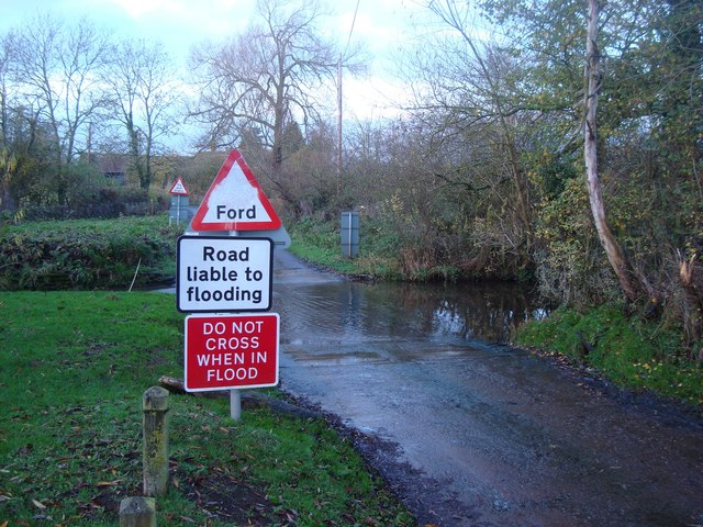
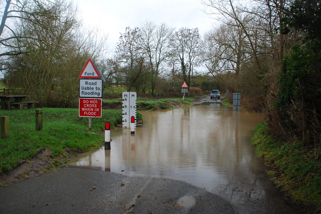
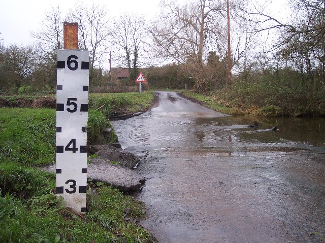
Ford at Shell The ford close to the hamlet of Shell
Ford at Shell
The ford close to the hamlet of Shell
Picnic Site at Shell The small [1 table!] picnic site and footbridge at Shell beside the ford
Picnic Site at Shell
The small [1 table!] picnic site and footbridge at Shell beside the ford
Shell Ford This ford on the Shell Brook was two and a half foot deep at the time of my visit as can be seen in the video:
<span class="nowrap"><a title="http://www.youtube.com/watch?v=p7t1kvldoZU" rel="nofollow ugc noopener" href="http://www.youtube.com/watch?v=p7t1kvldoZU">Link</a><img style="margin-left:2px;" alt="External link" title="External link - shift click to open in new window" src="https://s1.geograph.org.uk/img/external.png" width="10" height="10"/></span>
Shell Ford
This ford on the Shell Brook was two and a half foot deep at the time of my visit as can be seen in the video: LinkExternal link
Shell Manor Farm. Shell Manor, a fine timbered house with work dating from the 14th to 16th century
Shell Manor Farm.
Shell Manor, a fine timbered house with work dating from the 14th to 16th century
Shell Brook Footbridge over the Shell Brook. - the good news is that the bull is a Hereford. This breed is making a comeback.
Shell Brook
Footbridge over the Shell Brook. - the good news is that the bull is a Hereford. This breed is making a comeback.
Pedestrian Bridge by Shell Ford A warning notice, in these days of blame culture, reads "No Safety Rails On Bridge", "Cyclists Dismount" and "Pedestrians Please Take Care".
Pedestrian Bridge by Shell Ford
A warning notice, in these days of blame culture, reads "No Safety Rails On Bridge", "Cyclists Dismount" and "Pedestrians Please Take Care".
Shell Ford The water indicator is in feet. Looking west. For more information see:
<span class="nowrap"><a title="http://vamp.idlers.org/~jaffa/worcestershire.htm#shellford" rel="nofollow ugc noopener" href="http://vamp.idlers.org/~jaffa/worcestershire.htm#shellford">Link</a><img style="margin-left:2px;" alt="External link" title="External link - shift click to open in new window" src="https://s1.geograph.org.uk/img/external.png" width="10" height="10"/></span> 
 or 
<span class="nowrap"><a title="http://worcestershire.whub.org.uk/home/wccindex/wcc-countryside/wcc-countryside-sites.htm" rel="nofollow ugc noopener" href="http://worcestershire.whub.org.uk/home/wccindex/wcc-countryside/wcc-countryside-sites.htm">Link</a><img style="margin-left:2px;" alt="External link" title="External link - shift click to open in new window" src="https://s1.geograph.org.uk/img/external.png" width="10" height="10"/></span>
Shell Ford
The water indicator is in feet. Looking west. For more information see: LinkExternal link or LinkExternal link
Shell Ford Shell Ford near Earl's Common viewed from the pedestrian footbridge.  This is one of a number of fords crossing Shell Brook.
Shell Ford
Shell Ford near Earl's Common viewed from the pedestrian footbridge. This is one of a number of fords crossing Shell Brook.
Shell Manor Shell Manor is one of a number of impressive half-timbered manor houses in this area of Worcestershire.
Shell Manor
Shell Manor is one of a number of impressive half-timbered manor houses in this area of Worcestershire.
Road junction, Shell The sign on the left warns of Shell Ford a couple of hundred metres down the road.
Road junction, Shell
The sign on the left warns of Shell Ford a couple of hundred metres down the road.
Road to Lower Hollowfields Farm
Country road near Shell A milepost can be seen in the hedge on the left.
Country road near Shell
A milepost can be seen in the hedge on the left.
Milepost near Shell 'To Worcester Cross 9 Miles'
Milepost near Shell
'To Worcester Cross 9 Miles'
Collapsed building, Shell Only the roof remains and that doesn't look too good.
Collapsed building, Shell
Only the roof remains and that doesn't look too good.
Part of Shell Manor Farm
Shell Ford and foot bridge I'm stood on the very edge of the ford looking towards the foot bridge. There is a picnic area on the extreme left.
Shell Ford and foot bridge
I'm stood on the very edge of the ford looking towards the foot bridge. There is a picnic area on the extreme left.
Mere Green Farmhouse Grade II Listed. Listed as in Hanbury ward. The view from the public road. There are two further listed buildings in the complex but there are no good trespass free views.
Mere Green Farmhouse
Grade II Listed. Listed as in Hanbury ward. The view from the public road. There are two further listed buildings in the complex but there are no good trespass free views.
Mere Green Farmhouse Grade II Listed. This was the best view I could manage from a public place. The complex includes two further listed buildings but I could not get a meaningful view of those from public places.
Mere Green Farmhouse
Grade II Listed. This was the best view I could manage from a public place. The complex includes two further listed buildings but I could not get a meaningful view of those from public places.
Show me another place!

Broughton Wood is located at Grid Ref: SO9661 (Lat: 52.248496, Lng: -2.0587495)

Administrative County: Worcestershire

District: Wychavon

Police Authority: West Mercia

What 3 Words

///whimpered.each.contain. Near Stoke Prior, Worcestershire

Nearby Locations

Broughton Wood

Related Wikis

Mere Green, Worcestershire

Mere Green is a hamlet in the English county of Worcestershire. It is located south of the village of Hanbury roughly midway between Worcester and Redditch...

Earls Common

Earls Common is a village in Worcestershire, England. Villages nearby include Himbleton and Stock Green.

Hanbury, Worcestershire

Hanbury is a rural village in Worcestershire, England near Droitwich Spa and the M5 motorway. The population of Hanbury has remained around 1,000 since...

Bradley Green, Worcestershire

Bradley Green is a village in the Wychavon district of Worcestershire, England. It is located just south of the town of Redditch and south of Feckenham...

Feckenham Forest

Feckenham Forest was a royal forest, centred on the village of Feckenham, covering large parts of Worcestershire and west Warwickshire. It was not entirely...

Himbleton

Himbleton is a village in Worcestershire, England. It lies about 5 miles (8.0 km) south-east of Droitwich and 7.5 miles (12.1 km) north-east of Worcester...

Hanbury Hall

Hanbury Hall is a large 18th-century stately home standing in parkland at Hanbury, Worcestershire. The main range has two storeys and is built of red brick...

St Mary the Virgin, Hanbury

The church of St Mary the Virgin is an Anglican parish church in the village of Hanbury, Worcestershire. Its earliest parts date from about 1210 and it...

Related Videos

Walking In The Countryside In Summer Near Hanbury, England - Country Trails & Canal Walk

Virtual walk in rural Worcestershire. 30 minute trail hiking video for relaxation and indoor treadmill workout scenery. Peaceful ...

Hanbury || Home of the Archers #Worcestershire #OSCircularWalk

Wow it's been a whole month since we last posted a video. We have a massive backlog of videos to edit so bear with us and thank ...

Jinney Ring Craft Centre Hanbury Bromsgrove

A great place to visit , i had a surprise lovely shops ,friendly staff , great gardens ,Hanbury Rd, Hanbury, Bromsgrove, ...

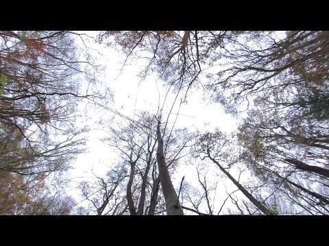
Hanbury Woods - Insta360 One X - no enhancements.

I uploaded an enhanced version this video a few days ago. It was a fairly dull day so I increased the brightness, contrast, ...

Nearby Amenities

Located within 500m of 52.248496,-2.0587495
Post Box
Collection Times: Mo-Fr 16:00; Sa 09:00
Post Box Type: lamp
Ref: WR9 339
Royal Cypher: EIIR
Royal Cypher Wikidata: Q33102113
Lat/Long: 52.2487372/-2.0657656
Power: pole
Lat/Long: 52.2446712/-2.060504
Power: pole
Lat/Long: 52.2482556/-2.0660754
Broughton Green East
Power: pole
Transformer: distribution
Voltage Primary: 11000
Lat/Long: 52.247873/-2.0658441
Power: pole
Lat/Long: 52.2474452/-2.0655558
Power: pole
Lat/Long: 52.2469016/-2.0652004
Power: pole
Lat/Long: 52.2464048/-2.0646049
Power: pole
Lat/Long: 52.246239/-2.0642763
Power: pole
Lat/Long: 52.2455771/-2.0628682
Duggards
Power: pole
Transformer: distribution
Voltage Primary: 11000
Lat/Long: 52.2451165/-2.0618972
Power: pole
Lat/Long: 52.2450155/-2.0611221
The data included in this document is from www.openstreetmap.org. The data is made available under ODbL.

Have you been to Broughton Wood?

Leave your review of Broughton Wood below (or comments, questions and feedback).