Garden Wood

Wood, Forest in Northumberland

England

Garden Wood

Trig point at Burradon Mains At 235m with a flush bracket number S7920.
With former tip used as a manure 'depot' in the background.
Looking over the Foxton Burn valley.
Storm Arwen took down adjacent trees.
Trig point at Burradon Mains Credit: Russel Wills

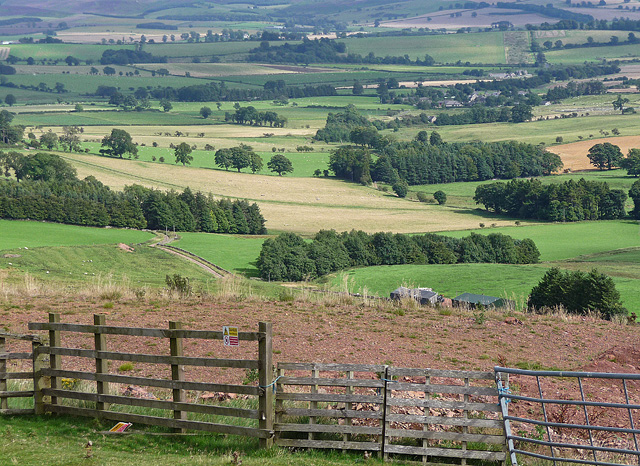
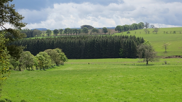
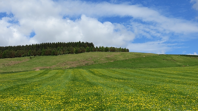
Garden Wood, located in Northumberland, is a picturesque forest that spans over a vast area and is renowned for its natural beauty. This woodland is situated in the northernmost county of England, within close proximity to the Scottish border. With its diverse flora and fauna, Garden Wood attracts nature enthusiasts and visitors seeking an escape into the wilderness.

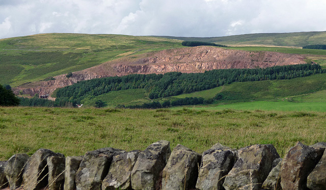
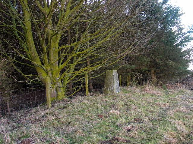
The wood is characterized by its dense foliage, comprised of a variety of tree species including oak, birch, beech, and pine. The towering trees create a canopy that filters sunlight, casting a serene and tranquil atmosphere throughout the forest. The forest floor is covered with a thick carpet of moss and wildflowers, adding a splash of color to the surroundings.

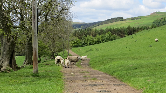
Garden Wood is teeming with wildlife, making it a haven for animal lovers. Visitors may be lucky enough to spot deer, foxes, badgers, and a range of bird species. The forest also provides a habitat for smaller creatures such as squirrels, rabbits, and numerous insects.

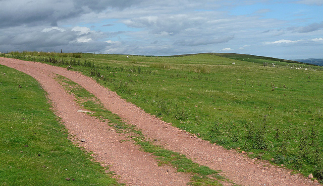
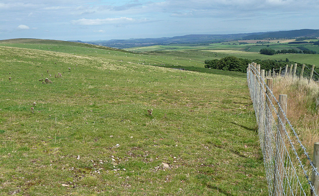
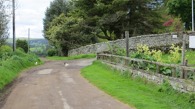
The wood offers several walking trails, providing visitors with the opportunity to explore the area at their own pace. These trails wind through the forest, leading to hidden groves, babbling brooks, and scenic viewpoints. The peaceful ambiance of Garden Wood makes it an ideal setting for walking, hiking, and picnicking.

Garden Wood is not only a natural haven but also plays an important ecological role in the region. Its preservation is crucial to maintaining the biodiversity of Northumberland and ensuring future generations can enjoy this enchanting forest.

If you have any feedback on the listing, please let us know in the comments section below.
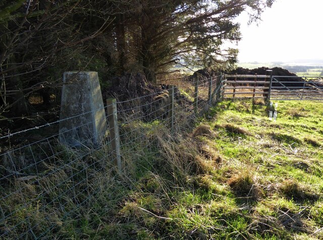
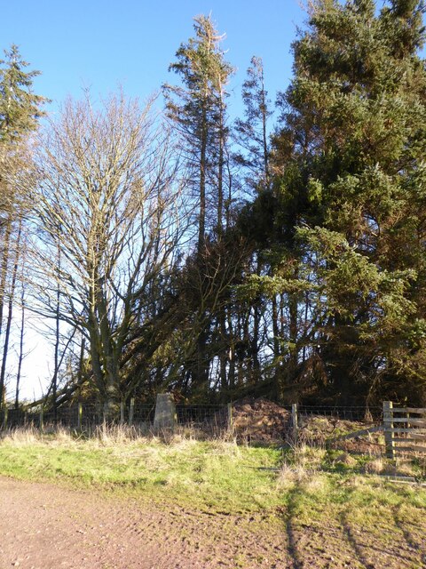
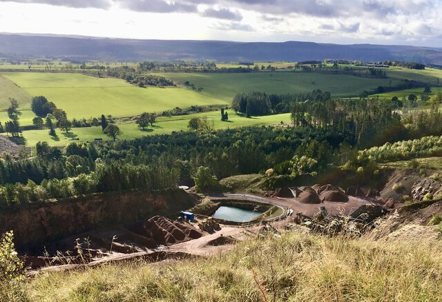
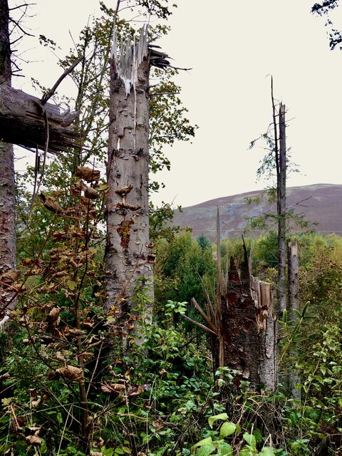
Garden Wood Images

Images are sourced within 2km of 55.36627/-2.0636922 or Grid Reference NT9608. Thanks to Geograph Open Source API. All images are credited.

Trig point at Burradon Mains At 235m with a flush bracket number S7920.
With former tip used as a manure 'depot' in the background.
Looking over the Foxton Burn valley.
Storm Arwen took down adjacent trees.
Trig point at Burradon Mains
At 235m with a flush bracket number S7920. With former tip used as a manure 'depot' in the background. Looking over the Foxton Burn valley. Storm Arwen took down adjacent trees.
Burradon Mains trig point Threatened by windfall from Storm Arwen.
Burradon Mains trig point
Threatened by windfall from Storm Arwen.
A peek into Harden Quarry The source of red roadstone.  'Harden Red' is a red volcanic felsite.  It is used for cycleways, bus lanes and, famously, for surfacing The Mall.
A peek into Harden Quarry
The source of red roadstone. 'Harden Red' is a red volcanic felsite. It is used for cycleways, bus lanes and, famously, for surfacing The Mall.
"Ill blows the wind that profits nobody" Massive piles of logs like these are scattered all over Northumberland.  Harvesting the forest has often been the only practical way of clearing up after Storm Arwen blew in from the north.  A year on and there are still many areas left to clear.
"Ill blows the wind that profits nobody"
Massive piles of logs like these are scattered all over Northumberland. Harvesting the forest has often been the only practical way of clearing up after Storm Arwen blew in from the north. A year on and there are still many areas left to clear.
The violence of Storm Arwen One can't help but be impressed by the ferocity of a wind that can snap mature tree trunks like a child snaps twigs.
The violence of Storm Arwen
One can't help but be impressed by the ferocity of a wind that can snap mature tree trunks like a child snaps twigs.
Bleakmore Hill near Biddlestone (1) The prevalent red stone of this area, extracted at the adjacent Harden quarry (<a href="https://www.geograph.org.uk/photo/2387346">NT9508 : Harden quarry, Biddlestone (1)</a>), is evident. Harden Hill is on the right.
Bleakmore Hill near Biddlestone (1)
The prevalent red stone of this area, extracted at the adjacent Harden quarry (NT9508 : Harden quarry, Biddlestone (1)), is evident. Harden Hill is on the right.
Bleakmore Hill near Biddlestone (2) Looking east. The top of the hill is grazed by sheep, but is open access land and the fence on the right stops accessees from falling into Harden quarry (<a href="https://www.geograph.org.uk/photo/2387346">NT9508 : Harden quarry, Biddlestone (1)</a>).
Bleakmore Hill near Biddlestone (2)
Looking east. The top of the hill is grazed by sheep, but is open access land and the fence on the right stops accessees from falling into Harden quarry (NT9508 : Harden quarry, Biddlestone (1)).
Harden quarry, Biddlestone (1) Extracting unusually red stone, recognisable from bus lanes and cycle paths everywhere.
The cordon of trees no doubt helps to keep the noise down.
Harden quarry, Biddlestone (1)
Extracting unusually red stone, recognisable from bus lanes and cycle paths everywhere. The cordon of trees no doubt helps to keep the noise down.
Harden quarry, Biddlestone (2) As seen from the road to Netherton, the quarry extracts unusually red stone, recognisable from bus lanes and cycle paths everywhere. For a closer view see here: <a href="https://www.geograph.org.uk/photo/2387346">NT9508 : Harden quarry, Biddlestone (1)</a>.
The cordon of trees no doubt helps to keep the noise down.
Harden quarry, Biddlestone (2)
As seen from the road to Netherton, the quarry extracts unusually red stone, recognisable from bus lanes and cycle paths everywhere. For a closer view see here: NT9508 : Harden quarry, Biddlestone (1). The cordon of trees no doubt helps to keep the noise down.
Stone wall, Biddlestone Showcasing the unusually red stone in this area, extracted at the nearby Harden quarry (<a href="https://www.geograph.org.uk/photo/2387346">NT9508 : Harden quarry, Biddlestone (1)</a>) for use primarily in bus lanes and cycle paths.
Stone wall, Biddlestone
Showcasing the unusually red stone in this area, extracted at the nearby Harden quarry (NT9508 : Harden quarry, Biddlestone (1)) for use primarily in bus lanes and cycle paths.
View from Bleakmore Hill Looking south-east, the village of Netherton vaguely visible in the distance, right of centre. The top of Bleakmore Hill is grazed by sheep, but is open access land and the rickety ragbag of a fence is a token gesture to stop accessees from falling into Harden quarry (<a href="https://www.geograph.org.uk/photo/2387346">NT9508 : Harden quarry, Biddlestone (1)</a>).
On second thoughts, it's more likely that the gesture is made towards sheep, against which it is probably considerably more effective. No flying sheep in these parts ...
View from Bleakmore Hill
Looking south-east, the village of Netherton vaguely visible in the distance, right of centre. The top of Bleakmore Hill is grazed by sheep, but is open access land and the rickety ragbag of a fence is a token gesture to stop accessees from falling into Harden quarry (NT9508 : Harden quarry, Biddlestone (1)). On second thoughts, it's more likely that the gesture is made towards sheep, against which it is probably considerably more effective. No flying sheep in these parts ...
Copse with trig point Although the woodland may look extensive in this image it has a fairly small extent and is not mapped at the common OS scales. The trig point is known to the OS as Burradon Mains.
Copse with trig point
Although the woodland may look extensive in this image it has a fairly small extent and is not mapped at the common OS scales. The trig point is known to the OS as Burradon Mains.
Elilaw A very quiet road for the hens. The yellow road is the rather rough and narrow track that goes straight on. It looks like a field access and is rather confusing. The bigger road is a drive.
Elilaw
A very quiet road for the hens. The yellow road is the rather rough and narrow track that goes straight on. It looks like a field access and is rather confusing. The bigger road is a drive.
Yellow road, Eli Law A very rough and loose surface for a yellow road. The road is gated.
Yellow road, Eli Law
A very rough and loose surface for a yellow road. The road is gated.
Field, Biddlestone A gently sloping field beneath the very rough yellow road that is used by the Pennine Cycleway.
Field, Biddlestone
A gently sloping field beneath the very rough yellow road that is used by the Pennine Cycleway.
Hay meadow, Biddlestone More likely it will now be cut for silage, the woods attempt to hide Harden Quarry. The keep out sign overkill tells you that there is a quarry there, they are almost legible from the road.
Hay meadow, Biddlestone
More likely it will now be cut for silage, the woods attempt to hide Harden Quarry. The keep out sign overkill tells you that there is a quarry there, they are almost legible from the road.
Garden Wood The 1:25,000 map shows a rectangular structure inside which was probably the walled garden for Biddlestone Hall. It will no doubt be revealed one day by clear felling.  The inevitable goml sign is well crafted for once, not as ugly as these foul things usually are. It  got the traditional Agincourt salute.
Garden Wood
The 1:25,000 map shows a rectangular structure inside which was probably the walled garden for Biddlestone Hall. It will no doubt be revealed one day by clear felling. The inevitable goml sign is well crafted for once, not as ugly as these foul things usually are. It got the traditional Agincourt salute.
Minor road, Biddlestone A much better surface than near Elilaw.
Minor road, Biddlestone
A much better surface than near Elilaw.
Show me another place!

Garden Wood is located at Grid Ref: NT9608 (Lat: 55.36627, Lng: -2.0636922)

Unitary Authority: Northumberland

Police Authority: Northumbria

What 3 Words

///pile.parked.probe. Near Whittingham, Northumberland

Nearby Locations

Garden Wood Biddlestone

Related Wikis

Biddlestone

Biddlestone is a village and civil parish in Northumberland, England. It is about 14 miles (23 km) to the west of Alnwick. In the early 21st Century several...

Biddlestone Chapel

Biddlestone Chapel is a redundant Roman Catholic chapel in Biddlestone, Northumberland, England. It is recorded in the National Heritage List for England...

Biddlestone Hall

Biddlestone Hall was a large country house at Biddlestone in Northumberland. == History == The Georgian style mansion was built for the Selby family about...

Netherton, Northumberland

Netherton is a village and civil parish in the English county of Northumberland. The population of the village at the 2011 census was 185.Located 6+1⁄2...

Nearby Amenities

Located within 500m of 55.36627,-2.0636922
Ford: yes
Lat/Long: 55.3659692/-2.058905
Telephone
Lat/Long: 55.3684556/-2.0638913
Post Box
Ref: NE65 164
Lat/Long: 55.3683993/-2.0638241
Biddlestone
Place: hamlet
Source: NLS-OS-1st_Series
Lat/Long: 55.3686909/-2.0661357
The data included in this document is from www.openstreetmap.org. The data is made available under ODbL.

Have you been to Garden Wood?

Leave your review of Garden Wood below (or comments, questions and feedback).