Edward's Wood

Wood, Forest in Staffordshire South Staffordshire

England

Edward's Wood

Timber stacks The results of recent tree cutting.
Timber stacks Credit: Ian Calderwood

Edward's Wood is a picturesque forest located in the county of Staffordshire, England. Spread over an area of approximately 300 acres, this magnificent woodland is renowned for its natural beauty and diverse flora and fauna. The wood is situated near the small village of Edward's Green, adding to its peaceful and secluded ambiance.

The wood is predominantly made up of deciduous trees, including oak, ash, beech, and birch, which create a vibrant and colorful landscape throughout the year. These trees provide a canopy that shelters a wide variety of wildlife, making it a popular spot for nature enthusiasts and birdwatchers. Visitors can often spot birds such as woodpeckers, jays, and thrushes, among others.

Edward's Wood offers an extensive network of well-maintained walking trails, allowing visitors to explore the area at their own pace. The paths wind through the forest, offering glimpses of babbling brooks, small ponds, and wildflower meadows. The tranquil atmosphere and the sound of rustling leaves make it an ideal location for a peaceful stroll or a picnic amidst nature.

The wood also holds historical significance, with remnants of an ancient Roman road passing through its boundaries. Archaeological excavations have revealed pottery fragments, indicating human habitation in the area during Roman times.

Edward's Wood, Staffordshire, is a haven for those seeking solace in nature and a perfect destination to immerse oneself in the beauty of the English countryside. Whether it's a leisurely walk, birdwatching, or simply enjoying the peaceful surroundings, this woodland offers a serene escape from the hustle and bustle of everyday life.

If you have any feedback on the listing, please let us know in the comments section below.

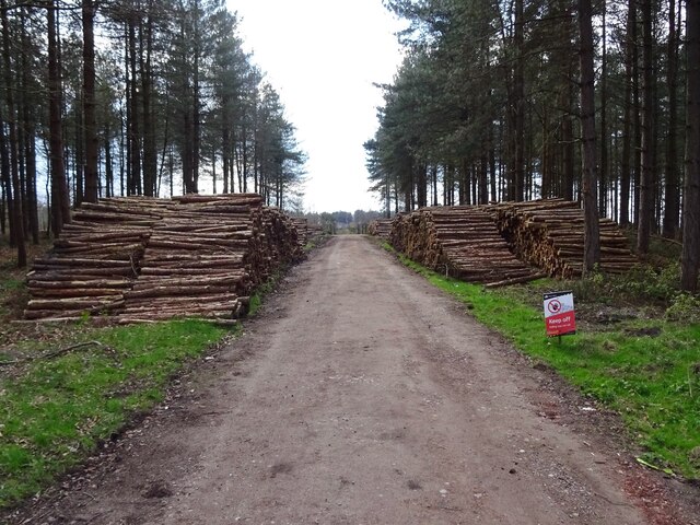
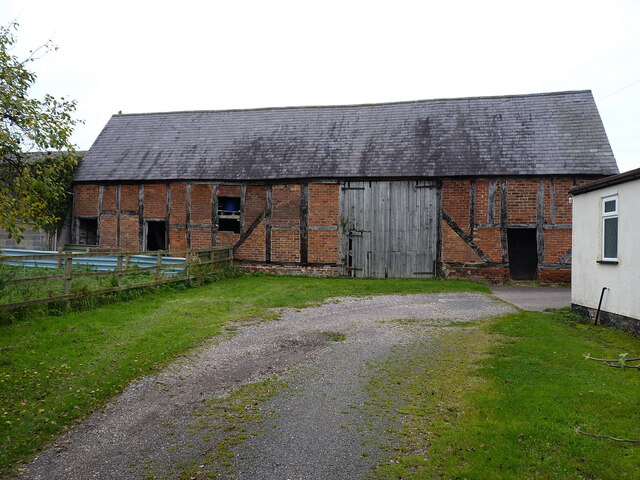
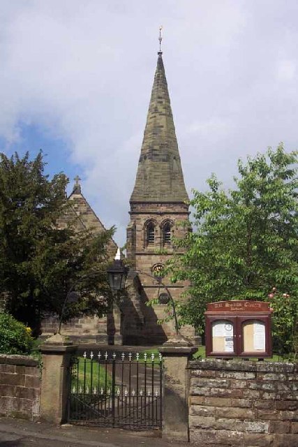
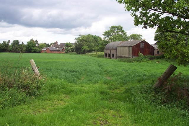
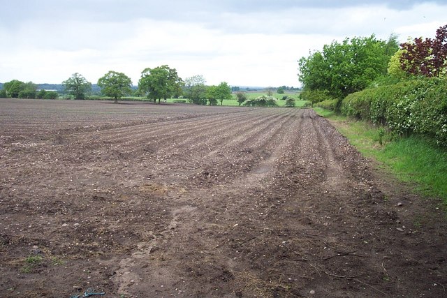
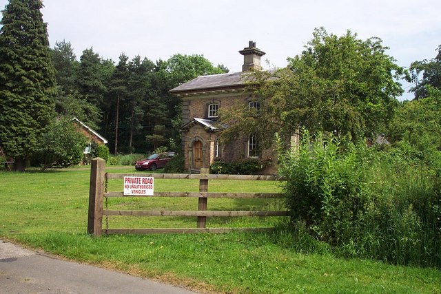
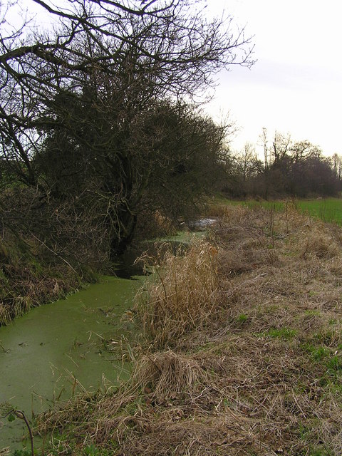
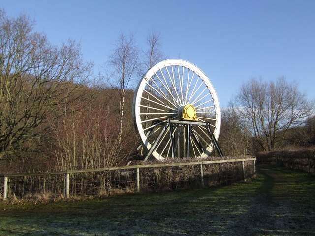
Edward's Wood Images

Images are sourced within 2km of 52.742879/-2.0604075 or Grid Reference SJ9616. Thanks to Geograph Open Source API. All images are credited.

Timber stacks The results of recent tree cutting.
Timber stacks
The results of recent tree cutting.
Timber-framed barn at Lower Farm Described in its 1986 Grade II listing <span class="nowrap"><a title="https://britishlistedbuildings.co.uk/101039249-barn-incorporating-cowhouse-approximately-5-yards-north-of-lower-farmhouse-acton-trussell-and-bednall#.Ymo90drMI2w" rel="nofollow ugc noopener" href="https://britishlistedbuildings.co.uk/101039249-barn-incorporating-cowhouse-approximately-5-yards-north-of-lower-farmhouse-acton-trussell-and-bednall#.Ymo90drMI2w">Link</a><img style="margin-left:2px;" alt="External link" title="External link - shift click to open in new window" src="https://s1.geograph.org.uk/img/external.png" width="10" height="10"/></span> & <span class="nowrap"><a title="https://historicengland.org.uk/listing/the-list/list-entry/1039249" rel="nofollow ugc noopener" href="https://historicengland.org.uk/listing/the-list/list-entry/1039249">Link</a><img style="margin-left:2px;" alt="External link" title="External link - shift click to open in new window" src="https://s1.geograph.org.uk/img/external.png" width="10" height="10"/></span> as "Early 18th century", this building is still in agricultural use. It has a cowhouse at the left end, and a threshing room to the right of the full-height doorway.
Timber-framed barn at Lower Farm
Described in its 1986 Grade II listing LinkExternal link & LinkExternal link as "Early 18th century", this building is still in agricultural use. It has a cowhouse at the left end, and a threshing room to the right of the full-height doorway.
Springslade Lodge Food is served here for hungry walkers on Cannock Chase. The smell of cooking bacon wafts over the road to tempt passers by.
Springslade Lodge
Food is served here for hungry walkers on Cannock Chase. The smell of cooking bacon wafts over the road to tempt passers by.
All Saints, Bednall <span class="nowrap"><a title="http://churches.lichfield.anglican.org/penkridge/actont/bednall.htm" rel="nofollow ugc noopener" href="http://churches.lichfield.anglican.org/penkridge/actont/bednall.htm">Link</a><img style="margin-left:2px;" alt="External link" title="External link - shift click to open in new window" src="https://s1.geograph.org.uk/img/external.png" width="10" height="10"/></span>
All Saints, Bednall
Near Bednall Looking north
Near Bednall
Looking north
Open Land Looking North West
Open Land
Looking North West
Keepers Lodge
Keepers Lodge
Gipsy Green
Gipsy Green
Footpath Near Teddesley
Coppice Farm & Buxtons A34 Buxtons Aborists Supplies at Coppice Farm
Bernard Buxton started Buxton’s over 40 years ago while still working as a farmer. He started out hiring and selling Dolmar chainsaws with Oregon chain, he soon became an agent for Stihl dealing with their first 3 models 08S, 07S and Lightning. He later became an agent for Husqvarna and Jonsered and the farmhouse became a shop and workshop with repairs carried out by Bernard and his father in law Frank Owen. 20 years later Bernard’s daughter, Lucy joined the firm.
Coppice Farm & Buxtons A34
Buxtons Aborists Supplies at Coppice Farm Bernard Buxton started Buxton’s over 40 years ago while still working as a farmer. He started out hiring and selling Dolmar chainsaws with Oregon chain, he soon became an agent for Stihl dealing with their first 3 models 08S, 07S and Lightning. He later became an agent for Husqvarna and Jonsered and the farmhouse became a shop and workshop with repairs carried out by Bernard and his father in law Frank Owen. 20 years later Bernard’s daughter, Lucy joined the firm.
Grenville's Wood View across the A34 down the valley to Springslade Pool.
Grenville's Wood
View across the A34 down the valley to Springslade Pool.
Staffordshire Way, Teddesley
Track Crossing The Staffordshire Way, Teddesley
Yew Tree Farm Yew Tree Farm ,Pottal Pool Road, Penkridge

View from the road across the gate
Yew Tree Farm
Yew Tree Farm ,Pottal Pool Road, Penkridge View from the road across the gate
Woodland at Teddesley Hay and Staffordshire Way
Drainage stream from Logeral pool at Teddeslay Hay The Staffordshire Way passes over this stream with two difficult stiles
Drainage stream from Logeral pool at Teddeslay Hay
The Staffordshire Way passes over this stream with two difficult stiles
Quarry extensions at Warren Hill, Cannock Chase The quarry has been entended beyond that which is shown on the current map
Quarry extensions at Warren Hill, Cannock Chase
The quarry has been entended beyond that which is shown on the current map
Fence and gate of Quarry extension New quarry extension is fenced off from rest of Cannock Chase
Fence and gate of Quarry extension
New quarry extension is fenced off from rest of Cannock Chase
Show me another place!

Edward's Wood is located at Grid Ref: SJ9616 (Lat: 52.742879, Lng: -2.0604075)

Administrative County: Staffordshire

District: South Staffordshire

Police Authority: Staffordshire

What 3 Words

///basics.lordship.only. Near Penkridge, Staffordshire

Related Wikis

Bednall

Bednall is a village in Staffordshire, England. == Location == Bednall lies somewhat remote from main roads, in dairy-farming countryside some 2.5 miles...

Teddesley Hall

Teddesley Hall was a large Georgian English country house located close to Penkridge in Staffordshire, now demolished. It was the main seat firstly of...

Acton Trussell and Bednall

Acton Trussell and Bednall is a civil parish in the South Staffordshire district of Staffordshire, England. As the name indicates, it contains the two...

Cannock Chase German Military Cemetery

The Cannock Chase German Military Cemetery (grid reference SJ984157) is on Cannock Chase, Staffordshire, England. The cemetery contains nearly 5,000 burials...

Pye Green BT Tower

Pye Green BT Tower is a 96.9-metre (318 ft) tall telecommunication tower built of reinforced concrete at Pye Green, Staffordshire, England (grid reference...

Pillaton, Staffordshire

Pillaton is a small village in Staffordshire, England, nearby to Penkridge and lying on the B5012 road between Cannock and Penkridge. It falls under the...

Acton Trussell

Acton Trussell is a village in the English county of Staffordshire. It is known as Actone in the Domesday Book. Located around 4 miles southeast of Stafford...

Huntington, Staffordshire

Huntington is a civil parish and former mining village in Staffordshire, on the outskirts of Cannock Chase. It lies on the A34 road just north of Cannock...

Nearby Amenities

Located within 500m of 52.742879,-2.0604075
Man Made: tower
Source: bing
Tower Type: communication
Lat/Long: 52.7432761/-2.0570022
The data included in this document is from www.openstreetmap.org. The data is made available under ODbL.

Have you been to Edward's Wood?

Leave your review of Edward's Wood below (or comments, questions and feedback).