Hartley Wood

Wood, Forest in Gloucestershire Cotswold

England

Hartley Wood

Path and fence line
Path and fence line Credit: don cload

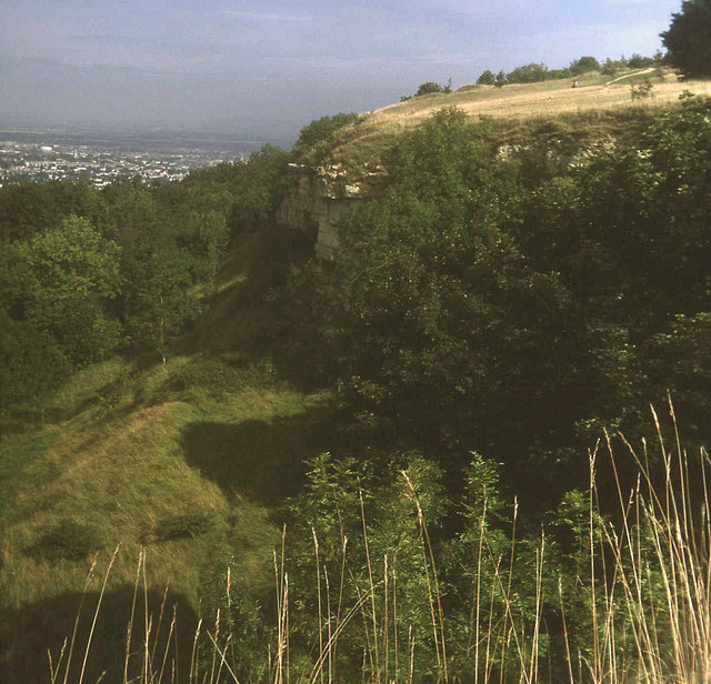
Hartley Wood is a charming woodland located in Gloucestershire, England. It is nestled in the heart of the Forest of Dean, a picturesque area known for its natural beauty and rich history. This enchanting woodland covers an area of approximately 200 acres and is teeming with diverse flora and fauna.

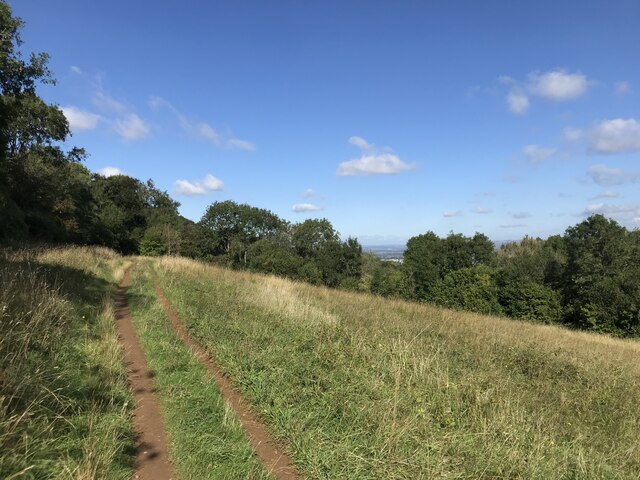
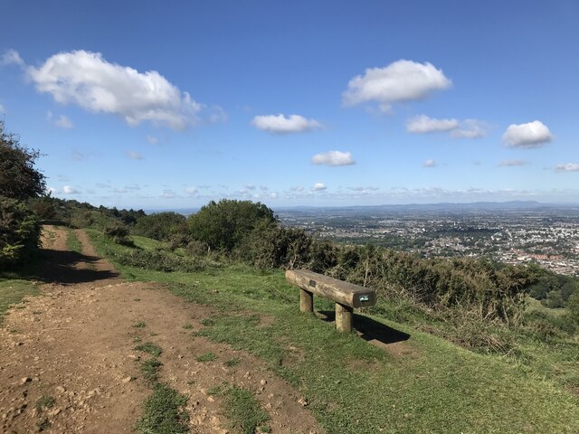
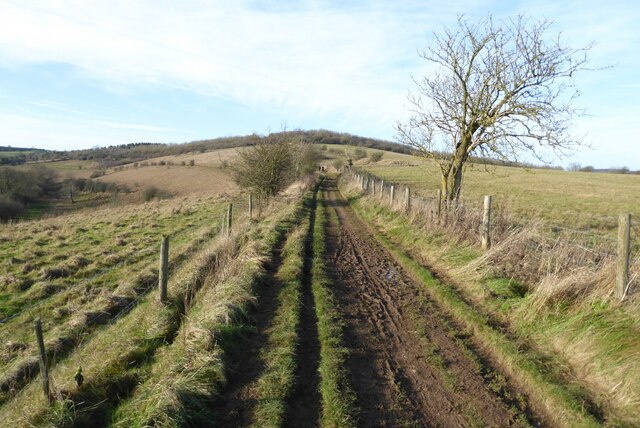
Hartley Wood offers a tranquil and serene environment, making it a popular destination for nature lovers and outdoor enthusiasts. The woodland is predominantly composed of oak and beech trees, which provide a dense canopy and create a peaceful atmosphere. Visitors can explore the winding trails that meander through the woods, allowing them to immerse themselves in the beauty of nature.

The woodland is home to a wide array of wildlife, including deer, badgers, foxes, and a variety of bird species. Nature enthusiasts will delight in the opportunity to observe these creatures in their natural habitat. Additionally, the woodland boasts a vibrant ecosystem of plants and wildflowers, adding bursts of color and fragrance to the landscape.

Hartley Wood is not only a haven for nature lovers but also a hub for outdoor activities. Visitors can enjoy walking, hiking, and cycling along the well-maintained trails, or take part in orienteering and geocaching adventures. There are also designated picnic areas where families and friends can relax and enjoy a meal amidst the tranquility of the woods.

Overall, Hartley Wood in Gloucestershire is a captivating woodland retreat that offers a perfect blend of natural beauty, wildlife, and outdoor recreational opportunities. Whether for a peaceful stroll or an adventure-filled day, this woodland is a hidden gem waiting to be discovered.

If you have any feedback on the listing, please let us know in the comments section below.

Hartley Wood Images

Images are sourced within 2km of 51.853403/-2.0597703 or Grid Reference SO9517. Thanks to Geograph Open Source API. All images are credited.

Path and fence line
Path and fence line
Stubble by the Cotswold Way
Open land
Open land
Seat with a view
Seat with a view
Leckhampton hill fort
Disused quarry
Disused quarry
Manx Loaghtan sheep Manx Loaghtan sheep in a field at Coberley.
Manx Loaghtan sheep
Manx Loaghtan sheep in a field at Coberley.
Manx Loaghtan sheep Manx Loaghtan sheep in a field at Coberley.
Manx Loaghtan sheep
Manx Loaghtan sheep in a field at Coberley.
Manx Loaghtan sheep Manx Loaghtan sheep in a field at Coberley.
Manx Loaghtan sheep
Manx Loaghtan sheep in a field at Coberley.
Coldwell Bottom The Gloucestershire Way long distance footpath follows this path above the valley on the right which is called Coldwell Bottom.
Coldwell Bottom
The Gloucestershire Way long distance footpath follows this path above the valley on the right which is called Coldwell Bottom.
Path and gate above Coldwell Bottom The Gloucestershire Way follows this right of way above Coldwell Bottom.
Path and gate above Coldwell Bottom
The Gloucestershire Way follows this right of way above Coldwell Bottom.
Coldwell Bottom View across Coldwell Bottom to the Churn valley beyond, from the Gloucestershire Way.
Coldwell Bottom
View across Coldwell Bottom to the Churn valley beyond, from the Gloucestershire Way.
Gloucestershire Way Gloucestershire Way with Coldwell Bottom below on the left.
Gloucestershire Way
Gloucestershire Way with Coldwell Bottom below on the left.
A junction of paths The right of way on the left passing through the gate is the route of the Gloucestershire Way, alternatively there is a right of way on the right which eventually rejoins the Gloucestershire Way.
A junction of paths
The right of way on the left passing through the gate is the route of the Gloucestershire Way, alternatively there is a right of way on the right which eventually rejoins the Gloucestershire Way.
A junction of rights of way Continuing along this right of way passes Cuckoopen Barn Farm.  The path on the left, out of view is the route of the Gloucestershire Way.  This is almost exactly the same view as when I was last here almost fourteen years ago to the day <a href="https://www.geograph.org.uk/photo/653006">SO9515 : Footpath junction near Coberley</a>.
A junction of rights of way
Continuing along this right of way passes Cuckoopen Barn Farm. The path on the left, out of view is the route of the Gloucestershire Way. This is almost exactly the same view as when I was last here almost fourteen years ago to the day SO9515 : Footpath junction near Coberley.
The Gloucestershire Way The Gloucestershire Way to the west of Coberley and above Coldwell Bottom which is out of view on the left.
The Gloucestershire Way
The Gloucestershire Way to the west of Coberley and above Coldwell Bottom which is out of view on the left.
Dowman's Farm Dowman's Farm in the village of Coberley.
Dowman's Farm
Dowman's Farm in the village of Coberley.
Footpath approaching Dowman's Farm Footpath crossing field approaching Dowman's Farm at Coberley.
Footpath approaching Dowman's Farm
Footpath crossing field approaching Dowman's Farm at Coberley.
Show me another place!

Hartley Wood is located at Grid Ref: SO9517 (Lat: 51.853403, Lng: -2.0597703)

Administrative County: Gloucestershire

District: Cotswold

Police Authority: Gloucestershire

What 3 Words

///viewer.divisions.glad. Near Charlton Kings, Gloucestershire

Related Wikis

Seven Springs, Gloucestershire

Seven Springs is a hamlet in the heavily wooded parish of Coberley in the Cotswold District of Gloucestershire in England, 4 miles (6.4 km) south of Cheltenham...

Coberley

Coberley is a village and civil parish in the Cotswold District of Gloucestershire in England, 4 miles (6.4 km) south of Cheltenham. It lies at the confluence...

National Star College

The National Star College (previously known as the Star Centre) is an independent specialist further education college for people with physical disabilities...

Leckhampton Hill and Charlton Kings Common

Leckhampton Hill and Charlton Kings Common (grid reference SO952187) is a 63.8-hectare (158-acre) biological and geological Site of Special Scientific...

Devil's Chimney (Gloucestershire)

The Devil's Chimney is a limestone rock formation that stands above a disused quarry in Leckhampton, near Cheltenham, Gloucestershire, England. It is named...

Ullenwood

Ullenwood is a village in the Coberley civil parish, near Cheltenham in Gloucestershire. It is the site of a formerly secret civil defence bunker intended...

DoubleTree by Hilton Cheltenham

DoubleTree by Hilton Cheltenham (earlier known as Cheltenham Park Hotel), Charlton Kings, is a Regency building of historical significance. It was previously...

Charlton Kings railway station

Charlton Kings railway station was a small station in Gloucestershire serving the village of Charlton Kings and the southern outskirts of Cheltenham Spa...

Nearby Amenities

Located within 500m of 51.853403,-2.0597703
Power: tower
Source: Bing
Lat/Long: 51.8552709/-2.0632037
Power: tower
Source: Bing
Lat/Long: 51.8538925/-2.054685
Power: tower
Source: Bing
Lat/Long: 51.8545287/-2.0586547
Hartley Bottom
Place: locality
Source Name: OS_OpenData_StreetView
Lat/Long: 51.8526664/-2.0603442
Barrier: stile
Lat/Long: 51.8547958/-2.063865
Barrier: stile
Lat/Long: 51.8509045/-2.057518
Power: pole
Lat/Long: 51.8531701/-2.0535126
Power: pole
Lat/Long: 51.8536803/-2.054607
Power: pole
Lat/Long: 51.8541757/-2.0556557
Power: pole
Lat/Long: 51.8570889/-2.0618409
Power: pole
Lat/Long: 51.8566835/-2.0609812
Power: pole
Lat/Long: 51.8561836/-2.0599084
Power: pole
Lat/Long: 51.855682/-2.0588462
Power: pole
Lat/Long: 51.8551863/-2.0577941
Power: pole
Lat/Long: 51.8546789/-2.0567286
Power: pole
Lat/Long: 51.8550856/-2.0558341
Power: pole
Lat/Long: 51.8555391/-2.0548276
The data included in this document is from www.openstreetmap.org. The data is made available under ODbL.

Have you been to Hartley Wood?

Leave your review of Hartley Wood below (or comments, questions and feedback).