Crossgates

Settlement in Fife

Scotland

Crossgates

Hill of Beath
Hill of Beath Credit: Robert Struthers

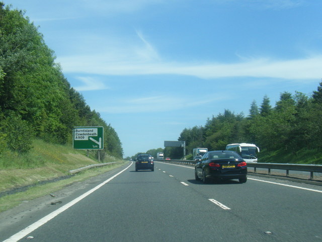
Crossgates is a small village located in the region of Fife, Scotland. Situated approximately 5 miles north of Dunfermline, it is nestled between the towns of Cowdenbeath and Halbeath. The village is easily accessible, being located just off the A92 road, which connects it to nearby towns and cities.

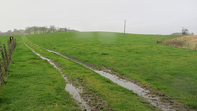
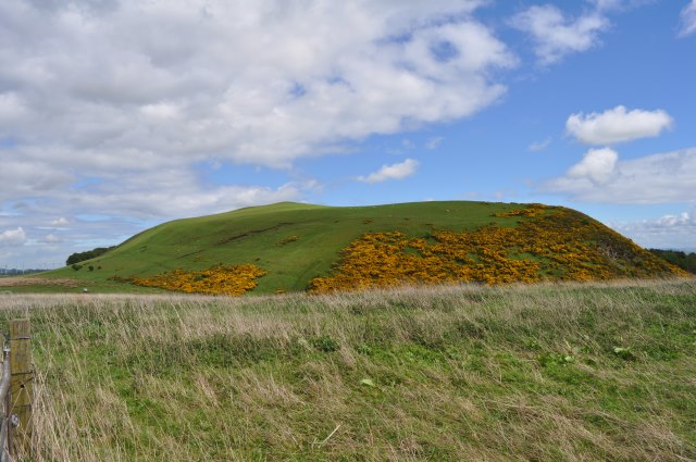
Crossgates is home to a population of around 2,000 residents. The village has a close-knit community feel and offers a peaceful and picturesque setting for its residents. The landscape of Crossgates is characterized by rolling hills, green fields, and a charming mix of traditional and modern architecture.

The village is well-equipped with amenities for its residents. It boasts various local shops, including convenience stores and small businesses, providing easy access to everyday essentials. Additionally, Crossgates is home to a primary school, providing education for the local children.

For outdoor enthusiasts, Crossgates offers plenty of recreational opportunities. The nearby Fife Coastal Path provides stunning walking routes along the coastline, allowing residents to enjoy the beauty of the surrounding area. The village is also in close proximity to Lochore Meadows Country Park, a popular destination for nature walks, cycling, and various water sports activities.

In terms of transportation, Crossgates benefits from excellent connectivity. The village has a well-served bus network, connecting it to surrounding towns and cities. For those commuting further afield, the nearby Halbeath Park and Ride offers easy access to major cities like Edinburgh and Glasgow via public transport.

Overall, Crossgates offers a quiet and scenic living environment while providing convenient access to essential amenities and recreational opportunities, making it an attractive place to reside in Fife, Scotland.

If you have any feedback on the listing, please let us know in the comments section below.

Crossgates Images

Images are sourced within 2km of 56.084151/-3.3752692 or Grid Reference NT1488. Thanks to Geograph Open Source API. All images are credited.

Hill of Beath
Hill of Beath
Hill of Beath Trig Point Flush Bracket S3169
Farm track, Hill of Beath A dark wet day during a gale.
Farm track, Hill of Beath
A dark wet day during a gale.
Torbeath Gardens, Hill of Beath Striking roofs on the houses here.
Torbeath Gardens, Hill of Beath
Striking roofs on the houses here.
Looking up the Main Street in Hill of Beath in Fife Though a village in its own right, it is now very much a part of Cowdenbeath.
Looking up the Main Street in Hill of Beath in Fife
Though a village in its own right, it is now very much a part of Cowdenbeath.
Hill of Beath from Keirsbeath Ridge Hill of Beath is a volcanic neck, or plug, rising above the surrounding coal-bearing carboniferous limestone.
Hill of Beath from Keirsbeath Ridge
Hill of Beath is a volcanic neck, or plug, rising above the surrounding coal-bearing carboniferous limestone.
Keirsbeath Access Road The former access road widens considerably here. At the far end it bends sharply and crosses the M90 motorway via a narrow bridge, so there was probably some sort of traffic management to control movement of the coal lorries.
Keirsbeath Access Road
The former access road widens considerably here. At the far end it bends sharply and crosses the M90 motorway via a narrow bridge, so there was probably some sort of traffic management to control movement of the coal lorries.
Motorway Flyover This bridge was built to carry farm traffic over the M90 and was later used to access the Keirsbeath open cast coal mine.
Motorway Flyover
This bridge was built to carry farm traffic over the M90 and was later used to access the Keirsbeath open cast coal mine.
Quarry at Hill of Beath The quarry is marked on the OS Six-Inch series as a 'Whinstone Quarry'.
Quarry at Hill of Beath
The quarry is marked on the OS Six-Inch series as a 'Whinstone Quarry'.
Statue of Jim Baxter, Hill of Beath This statue was erected in 2003 in memory of the footballer, Jim Baxter, who was born in this former mining village.
Statue of Jim Baxter, Hill of Beath
This statue was erected in 2003 in memory of the footballer, Jim Baxter, who was born in this former mining village.
A92 south of Cowdenbeath
Bridge over A92 at Crossgates
Park and Ride
Park and Ride
Crop spraying On a field on the fringes of Kingseat. The building in middle frame was once Halbeath Primary School but is now a small commercial unit.
Crop spraying
On a field on the fringes of Kingseat. The building in middle frame was once Halbeath Primary School but is now a small commercial unit.
Hill of Beath A landmark on the M90, this small hill rises steeply above the Fife coalfield.  Amongst the summit junk are the remains of old girders, possibly once a communications mast.
Hill of Beath
A landmark on the M90, this small hill rises steeply above the Fife coalfield. Amongst the summit junk are the remains of old girders, possibly once a communications mast.
Hawthorn Crescent Hawthorn Crescent, Hill of Beath. The 'Hill' of Beath in the background.
Hawthorn Crescent
Hawthorn Crescent, Hill of Beath. The 'Hill' of Beath in the background.
Keirs Park, Hill of Beath Keirs Park, home of Hill of Beath Hawthorn (Hawes) and HOB Swifts. Crossgates half mile away.
Keirs Park, Hill of Beath
Keirs Park, home of Hill of Beath Hawthorn (Hawes) and HOB Swifts. Crossgates half mile away.
Statue of Jim Baxter This statue which is situated outside Hill O'Beath Club is of Scottish international footballer Jim Baxter who was born in the village.
Statue of Jim Baxter
This statue which is situated outside Hill O'Beath Club is of Scottish international footballer Jim Baxter who was born in the village.
Show me another place!

Crossgates is located at Grid Ref: NT1488 (Lat: 56.084151, Lng: -3.3752692)

Unitary Authority: Fife

Police Authority: Fife

What 3 Words

///deleting.slips.papers. Near Crossgates, Fife

Nearby Locations

Crossgates

Related Wikis

Crossgates, Fife

Crossgates is a village in Fife, Scotland. It is located close to the junction of the M90 and A92, about two miles east of Dunfermline and a similar distance...

Humbug Park

Humbug Park also previously known as Crossgates Greyhound Stadium is a football ground and former greyhound racing track on Inverkeithing Road in Crossgates...

Crossgates railway station (Fife)

Crossgates Fife railway station co-served the village of Crossgates, Fife, Scotland, from 1848 to 1949 on the Edinburgh and Northern Railway. == History... ==

Hill of Beath Hawthorn F.C.

Hill of Beath Hawthorn Football Club are a Scottish football club from Hill of Beath, near Cowdenbeath, Fife. Formed in 1975, they play their home games...

Nearby Amenities

Located within 500m of 56.084151,-3.3752692
Traffic Signals
Source: survey
Traffic Signals Direction: both
Lat/Long: 56.0841464/-3.3752513
Crossgates
Place: village
Source: npe
Wikidata: Q5188613
Wikipedia: en:Crossgates, Fife
Lat/Long: 56.0849176/-3.3757208
Fuel
Brand: Thames
Source: survey
Lat/Long: 56.0866594/-3.3734468
Turning Circle
Lat/Long: 56.0832397/-3.3743108
Direction: both
Surface: asphalt
Traffic Calming: table
Lat/Long: 56.0830317/-3.3732432
Direction: both
Traffic Calming: table
Lat/Long: 56.0826732/-3.3737407
Post Office
Crossgates Post Office
Brand: Post Office
Brand Wikidata: Q1783168
Check Date: 2023-09-27
Operator: Costcutter
Ref Pol Id: 167752
Lat/Long: 56.0847124/-3.3752695
Crossing
Crossing: traffic_signals
Crossing Island: no
Kerb: lowered
Tactile Paving: yes
Lat/Long: 56.0840976/-3.379801
Direction: both
Traffic Calming: table
Lat/Long: 56.0819164/-3.3712047
Direction: both
Traffic Calming: table
Lat/Long: 56.0822381/-3.3710069
Post Box
Collection Times: Mo-Fr 09:00; Sa 07:00
Operator: Royal Mail
Post Box Type: lamp
Ref: KY4 66D
Royal Cypher: scottish_crown
Lat/Long: 56.0844806/-3.3679794
Post Box
Collection Times: Mo-Fr 09:00; Sa 07:00
Operator: Royal Mail
Post Box Type: lamp
Ref: KY4 177D
Royal Cypher: scottish_crown
Lat/Long: 56.0843942/-3.3816248
Direction: both
Surface: asphalt
Traffic Calming: table
Lat/Long: 56.0825717/-3.3722674
Direction: both
Surface: asphalt
Traffic Calming: table
Lat/Long: 56.0834192/-3.3707701
Barrier: kissing_gate
Foot: yes
Lat/Long: 56.0855209/-3.373649
Wicked Cheesecake
Addr City: Crossgates
Addr Housenumber: 2
Addr Postcode: KY4 8AJ
Addr Street: Main Street
Fhrs Id: 812882
Shop: pastry
Source Addr: FHRS Open Data
Website: http://www.wickedcheesecakes.co.uk
Lat/Long: 56.0838438/-3.3751397
Fast Food
Jaz's Takeaway
Addr City: Crossgates
Addr Housenumber: 26-28
Addr Postcode: KY4 8AJ
Addr Street: Main Street
Cuisine: fish;pizza;kebab;burger
Fhrs Id: 121794
Source Addr: FHRS Open Data
Lat/Long: 56.0842414/-3.37502
Target Shooting Supplies
Addr City: Crossgates
Addr Housenumber: 4
Addr Street: Main Street
Shop: weapons
Lat/Long: 56.0839212/-3.3751191
Direction: both
Surface: asphalt
Traffic Calming: cushion
Lat/Long: 56.0816826/-3.3761222
Mossgreen Convenience Store
Addr City: Crossgates
Addr Postcode: KY4 8BU
Brand: Premier
Brand Wikidata: Q7240340
Brand Wikipedia: en:Premier Stores
Fhrs Id: 126069
Opening Hours: 06:00-20:00
Shop: convenience
Source Addr: FHRS Open Data
Website: https://www.premier-stores.co.uk/our-stores/mossgreen-convenience-store
Lat/Long: 56.0846579/-3.367381
Bus Stop
Droverhall Avenue
Bench: yes
Bus: yes
Departures Board: timetable
Naptan AtcoCode: 6500D0137
Naptan NaptanCode: 34325394
Public Transport: platform
Shelter: yes
Tactile Paving: no
Lat/Long: 56.0845131/-3.3677776
Post Box
Brand: Royal Mail
Brand Wikidata: Q638098
Brand Wikipedia: en:Royal Mail
Collection Times: Mo-Fr 17:00; Sa 10:45
Operator: Royal Mail
Operator Wikidata: Q638098
Post Box Type: pillar
Ref: KY4 102
Royal Cypher: scottish_crown
Lat/Long: 56.08436/-3.3753148
Salon Sixteen
Shop: hairdresser
Lat/Long: 56.0861705/-3.3740714
Bus Stop
Hillview Crescent
Bench: yes
Bin: yes
Bus: yes
Naptan AtcoCode: 6500D0129
Naptan Bearing: NE
Naptan CommonName: Hillview Crescent
Naptan Indicator: adj
Naptan NaptanCode: 34325426
Naptan Street: Main Street
Public Transport: platform
Shelter: yes
Lat/Long: 56.0854424/-3.374715
Divito's
Addr City: Crossgates
Addr Housenumber: 59
Addr Postcode: KY4 8AJ
Addr Street: Main Street
Fhrs Id: 121796
Shop: confectionery
Source Addr: FHRS Open Data
Lat/Long: 56.0853021/-3.374921
Kutz for U
Shop: hairdresser
Lat/Long: 56.0849808/-3.3751644
Fast Food
The Munch Box
Addr City: Crossgates
Addr Housenumber: 27B
Addr Postcode: KY4 8AJ
Addr Street: Main Street
Fhrs Id: 121793
Phone: +44 1383 518282
Source Addr: FHRS Open Data
Lat/Long: 56.0844559/-3.3753345
Crossing
Crossing: traffic_signals
Tactile Paving: yes
Lat/Long: 56.0841477/-3.3754424
Crossing
Crossing: traffic_signals
Crossing Island: no
Tactile Paving: yes
Lat/Long: 56.0842646/-3.3752074
Hidden Beauty
Addr City: Crossgates
Addr Housenumber: 8
Addr Street: Main Street
Male: yes
Phone: +44 1383 695738
Shop: beauty
Website: https://www.hiddenbeauty.info/
Lat/Long: 56.0840622/-3.3750779
Mane
Addr City: Crossgates
Addr Housenumber: 6
Addr Street: Main Street
Phone: +44 1383 515 900
Shop: hairdresser
Lat/Long: 56.0839945/-3.3750947
Bus Stop
Manse Road
Bench: yes
Bin: yes
Bus: yes
Departures Board: timetable
Naptan AtcoCode: 6500D0128
Naptan Bearing: SW
Naptan CommonName: Manse Road
Naptan Indicator: opp
Naptan NaptanCode: 34325429
Naptan Street: Main Street
Public Transport: platform
Shelter: yes
Lat/Long: 56.0856564/-3.3741921
Bus Stop
Main Street
Bench: yes
Bin: yes
Bus: yes
Departures Board: timetable
Public Transport: platform
Shelter: yes
Lat/Long: 56.0881234/-3.3731876
Traffic Calming: choker
Lat/Long: 56.0873453/-3.3734038
Pharmacy
Well Pharmacy
Brand: Well Pharmacy
Brand Wikidata: Q7726524
Brand Wikipedia: en:Well Pharmacy
Dispensing: yes
Healthcare: pharmacy
Opening Hours: Mo-Fr 08:30-13:30,14:00-18:00; We 08:30-12:30; Sa 09:00-12:30
Website: https://finder.well.co.uk/store/crossgates-main-street
Lat/Long: 56.0877336/-3.3728363
Bus Stop
Lady Anne Court
Bench: no
Bin: no
Bus: yes
Departures Board: timetable
Naptan AtcoCode: 6500D0130
Naptan NaptanCode: 34325395
Public Transport: platform
Shelter: yes
Surface: tactile_paving
Tactile Paving: no
Lat/Long: 56.0843867/-3.382735
Bus Stop
Reid Avenue
Bus: yes
Departures Board: timetable
Public Transport: platform
Surface: tactile_paving
Lat/Long: 56.0842506/-3.382686
Bus Stop
Primary School
Bench: no
Bin: yes
Bus: yes
Departures Board: timetable
Public Transport: platform
Shelter: no
Surface: tactile_paving
Tactile Paving: no
Lat/Long: 56.0842243/-3.3785157
Bus Stop
Primary School
Bench: yes
Bus: yes
Departures Board: timetable
Naptan AtcoCode: 6500D0132
Naptan NaptanCode: 34325379
Public Transport: platform
Shelter: yes
Surface: tactile_paving
Lat/Long: 56.0840493/-3.3793296
Bus Stop
Fairy Fa Crescent
Bus: yes
Public Transport: platform
Lat/Long: 56.0837215/-3.3744887
Bus Stop
Fairy Fa Crescent
Bus: yes
Public Transport: platform
Lat/Long: 56.0836433/-3.3747326
Bus Stop
Springhill Brae
Bus: yes
Naptan AtcoCode: 6500D0134
Naptan NaptanCode: 34325376
Public Transport: platform
Lat/Long: 56.0838343/-3.3726218
Bus Stop
Springhill Brae
Bus: yes
Departures Board: timetable
Public Transport: platform
Shelter: yes
Lat/Long: 56.0837776/-3.3722291
Recycling
Recycling Type: container
Lat/Long: 56.0822853/-3.37887
Recycling
Recycling Type: container
Lat/Long: 56.0865264/-3.3805265
Recycling
Recycling Type: container
Lat/Long: 56.0830127/-3.3688814
Generator Method: photovoltaic
Generator Output Electricity: yes
Generator Source: solar
Generator Type: solar_photovoltaic_panel
Power: generator
Lat/Long: 56.0827729/-3.3764144
Generator Method: photovoltaic
Generator Output Electricity: yes
Generator Source: solar
Generator Type: solar_photovoltaic_panel
Power: generator
Lat/Long: 56.0830521/-3.3740175
Generator Method: photovoltaic
Generator Output Electricity: yes
Generator Source: solar
Generator Type: solar_photovoltaic_panel
Power: generator
Lat/Long: 56.0828816/-3.3738292
Generator Method: photovoltaic
Generator Output Electricity: yes
Generator Source: solar
Generator Type: solar_photovoltaic_panel
Power: generator
Lat/Long: 56.0819074/-3.3724467
Generator Method: photovoltaic
Generator Output Electricity: yes
Generator Source: solar
Generator Type: solar_photovoltaic_panel
Power: generator
Lat/Long: 56.0821425/-3.3722431
Generator Method: photovoltaic
Generator Output Electricity: yes
Generator Source: solar
Generator Type: solar_photovoltaic_panel
Power: generator
Lat/Long: 56.0827575/-3.3701798
Generator Method: photovoltaic
Generator Output Electricity: yes
Generator Source: solar
Generator Type: solar_photovoltaic_panel
Power: generator
Lat/Long: 56.0837599/-3.3711213
Generator Method: photovoltaic
Generator Output Electricity: yes
Generator Source: solar
Generator Type: solar_photovoltaic_panel
Power: generator
Lat/Long: 56.0837493/-3.3710299
Generator Method: photovoltaic
Generator Output Electricity: yes
Generator Source: solar
Generator Type: solar_photovoltaic_panel
Power: generator
Lat/Long: 56.0854238/-3.3820952
Generator Method: photovoltaic
Generator Output Electricity: yes
Generator Source: solar
Generator Type: solar_photovoltaic_panel
Power: generator
Lat/Long: 56.0846855/-3.3675125
Generator Method: photovoltaic
Generator Output Electricity: yes
Generator Source: solar
Generator Type: solar_photovoltaic_panel
Power: generator
Lat/Long: 56.0848596/-3.367759
Generator Method: photovoltaic
Generator Output Electricity: yes
Generator Source: solar
Generator Type: solar_photovoltaic_panel
Power: generator
Lat/Long: 56.0845333/-3.3687003
Generator Method: photovoltaic
Generator Output Electricity: yes
Generator Source: solar
Generator Type: solar_photovoltaic_panel
Power: generator
Lat/Long: 56.0803919/-3.3770449
Generator Method: photovoltaic
Generator Output Electricity: yes
Generator Source: solar
Generator Type: solar_photovoltaic_panel
Power: generator
Lat/Long: 56.0806055/-3.3776684
Generator Method: photovoltaic
Generator Output Electricity: yes
Generator Source: solar
Generator Type: solar_photovoltaic_panel
Power: generator
Lat/Long: 56.0806355/-3.3777361
Generator Method: photovoltaic
Generator Output Electricity: yes
Generator Source: solar
Generator Type: solar_photovoltaic_panel
Power: generator
Lat/Long: 56.0827392/-3.3778048
Generator Method: photovoltaic
Generator Output Electricity: yes
Generator Source: solar
Generator Type: solar_photovoltaic_panel
Power: generator
Lat/Long: 56.0827404/-3.3777194
Generator Method: photovoltaic
Generator Output Electricity: yes
Generator Source: solar
Generator Type: solar_photovoltaic_panel
Power: generator
Lat/Long: 56.0830383/-3.372122
Generator Method: photovoltaic
Generator Output Electricity: yes
Generator Source: solar
Generator Type: solar_photovoltaic_panel
Power: generator
Lat/Long: 56.0830314/-3.372028
Generator Method: photovoltaic
Generator Output Electricity: yes
Generator Source: solar
Generator Type: solar_photovoltaic_panel
Power: generator
Lat/Long: 56.0853231/-3.3829284
Generator Method: photovoltaic
Generator Output Electricity: yes
Generator Source: solar
Generator Type: solar_photovoltaic_panel
Power: generator
Lat/Long: 56.0827684/-3.3797767
Generator Method: photovoltaic
Generator Output Electricity: yes
Generator Source: solar
Generator Type: solar_photovoltaic_panel
Power: generator
Lat/Long: 56.0827582/-3.3787766
Generator Method: photovoltaic
Generator Output Electricity: yes
Generator Source: solar
Generator Type: solar_photovoltaic_panel
Power: generator
Lat/Long: 56.0827616/-3.3786953
Crossing
Crossing: traffic_signals
Crossing Island: no
Kerb: lowered
Tactile Paving: yes
Lat/Long: 56.0826629/-3.3758371
Generator Method: photovoltaic
Generator Output Electricity: yes
Generator Source: solar
Generator Type: solar_photovoltaic_panel
Power: generator
Lat/Long: 56.0825386/-3.3742579
Generator Method: photovoltaic
Generator Output Electricity: yes
Generator Source: solar
Generator Type: solar_photovoltaic_panel
Power: generator
Lat/Long: 56.0863938/-3.3769959
Generator Method: photovoltaic
Generator Output Electricity: yes
Generator Source: solar
Generator Type: solar_photovoltaic_panel
Power: generator
Lat/Long: 56.0850946/-3.3756064
Generator Method: photovoltaic
Generator Output Electricity: yes
Generator Source: solar
Generator Type: solar_photovoltaic_panel
Power: generator
Lat/Long: 56.0850522/-3.3756188
Generator Method: wind_turbine
Generator Source: wind
Power: generator
Lat/Long: 56.0863819/-3.3726706
Barrier: cycle_barrier
Lat/Long: 56.0840254/-3.3798653
Defibrillator
Defibrillator Location: On wall, roadside
Emergency: defibrillator
Indoor: no
Lat/Long: 56.0835846/-3.3756507
Crossgates Barber
Phone: +44 1383 511 275
Shop: hairdresser
Lat/Long: 56.0841979/-3.3750318
Costcutter
Addr City: Crossgates
Addr Housenumber: 41
Addr Postcode: KY4 8AJ
Addr Street: Main Street
Brand: Costcutter
Brand Wikidata: Q5175072
Brand Wikipedia: en:Costcutter
Fhrs Id: 121795
Opening Hours: Mo-Sa 06:00-22:00; Su 07:00-22:00
Shop: convenience
Source Addr: FHRS Open Data
Lat/Long: 56.0847519/-3.3752601
Atm
Lat/Long: 56.0847025/-3.3752054
Entrance: yes
Lat/Long: 56.0847733/-3.3751796
Fast Food
New Loon Wah
Addr City: Crossgates
Addr Housenumber: 40
Addr Postcode: KY4 8AJ
Addr Street: Main Street
Cuisine: chinese
Fhrs Id: 112869
Phone: +44 1383610368
Source Addr: FHRS Open Data
Lat/Long: 56.0848369/-3.374796
Crystal Corner
Shop: yes
Lat/Long: 56.0843825/-3.375379
Crossing
Crossing: traffic_signals
Tactile Paving: yes
Lat/Long: 56.084038/-3.3752935
Crossing
Crossing: unmarked
Tactile Paving: yes
Lat/Long: 56.0836614/-3.3752487
Crossing
Crossing: unmarked
Tactile Paving: yes
Lat/Long: 56.0837623/-3.3752032
Crossing
Crossing: unmarked
Crossing Island: yes
Tactile Paving: yes
Lat/Long: 56.0872848/-3.3734284
Traffic Calming: cushion
Lat/Long: 56.0844277/-3.3693854
Direction: both
Surface: asphalt
Traffic Calming: cushion
Lat/Long: 56.0846024/-3.3822655
Direction: both
Traffic Calming: table
Lat/Long: 56.0820424/-3.373835
Direction: both
Traffic Calming: table
Lat/Long: 56.0818444/-3.3707644
Direction: both
Traffic Calming: cushion
Lat/Long: 56.0824081/-3.3762617
Direction: both
Surface: asphalt
Traffic Calming: hump
Lat/Long: 56.0858851/-3.3760911
Direction: both
Surface: asphalt
Traffic Calming: cushion
Lat/Long: 56.0851148/-3.3752584
Direction: both
Surface: asphalt
Traffic Calming: cushion
Lat/Long: 56.0862728/-3.374202
Direction: both
Surface: asphalt
Traffic Calming: cushion
Lat/Long: 56.0805389/-3.3767571
Direction: both
Surface: asphalt
Traffic Calming: cushion
Lat/Long: 56.0799433/-3.3761558
Generator Method: photovoltaic
Generator Output Electricity: yes
Generator Source: solar
Generator Type: solar_photovoltaic_panel
Power: generator
Lat/Long: 56.0818769/-3.3706238
Generator Method: photovoltaic
Generator Output Electricity: yes
Generator Source: solar
Generator Type: solar_photovoltaic_panel
Power: generator
Lat/Long: 56.0818769/-3.3705648
Generator Method: photovoltaic
Generator Output Electricity: yes
Generator Source: solar
Generator Type: solar_photovoltaic_panel
Power: generator
Lat/Long: 56.082195/-3.3695707
Generator Method: photovoltaic
Generator Output Electricity: yes
Generator Source: solar
Generator Type: solar_photovoltaic_panel
Power: generator
Lat/Long: 56.0826413/-3.3708253
Generator Method: photovoltaic
Generator Output Electricity: yes
Generator Source: solar
Generator Type: solar_photovoltaic_panel
Power: generator
Lat/Long: 56.0815245/-3.371404
Generator Method: photovoltaic
Generator Output Electricity: yes
Generator Source: solar
Generator Type: solar_photovoltaic_panel
Power: generator
Lat/Long: 56.083664/-3.3687525
Generator Method: photovoltaic
Generator Output Electricity: yes
Generator Source: solar
Generator Type: solar_photovoltaic_panel
Power: generator
Lat/Long: 56.0831867/-3.3695001
Generator Method: photovoltaic
Generator Output Electricity: yes
Generator Source: solar
Generator Type: solar_photovoltaic_panel
Power: generator
Lat/Long: 56.0832008/-3.3694116
The data included in this document is from www.openstreetmap.org. The data is made available under ODbL.

Have you been to Crossgates?

Leave your review of Crossgates below (or comments, questions and feedback).