Crossford

Settlement in Fife

Scotland

Crossford

Junction of Hunt Place and Katrine Drive
Junction of Hunt Place and Katrine Drive Credit: Rod Allday

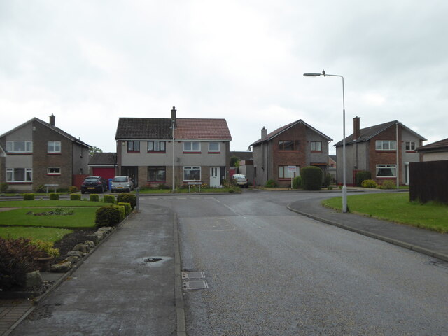
Crossford is a small village located in the Kingdom of Fife, Scotland. Situated on the eastern bank of the River Devon, it is nestled between the towns of Dunfermline and Kincardine. With a population of around 1,200 residents, Crossford offers a charming and peaceful setting for its inhabitants.

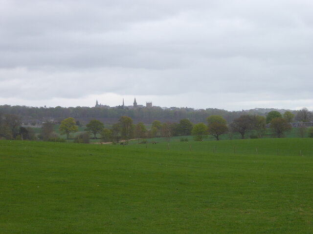
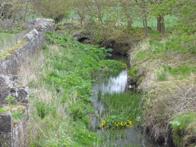
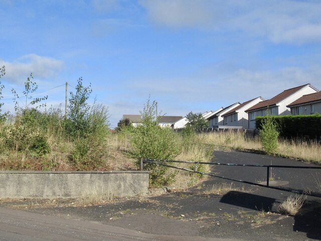
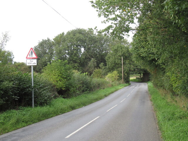
The village is known for its picturesque landscapes, surrounded by stunning countryside and rolling hills. It is a popular destination for outdoor enthusiasts, offering various walking and cycling routes along the river and through the nearby forests. The area is also rich in wildlife, with opportunities for birdwatching and spotting local fauna.

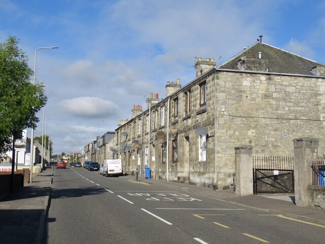
Crossford boasts a close-knit community with a strong sense of pride in local heritage. The village is home to the historic Crossford Bridge, a stone arch bridge that dates back to the 18th century and is a cherished local landmark. Other notable features include the Crossford Inn, a traditional pub that serves as a social hub for residents and visitors alike.

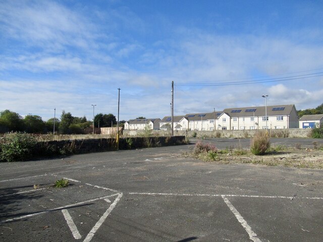
Residents in Crossford benefit from a range of amenities, including a village shop, a primary school, and a community hall that hosts various events and activities throughout the year. The village is well-connected, with good transportation links to nearby towns and cities, making it an ideal location for those seeking a quieter lifestyle while still having easy access to urban amenities.

In summary, Crossford offers a tranquil and idyllic setting, with a friendly community and an abundance of natural beauty, making it an attractive place to live or visit in the heart of Fife.

If you have any feedback on the listing, please let us know in the comments section below.

Crossford Images

Images are sourced within 2km of 56.063599/-3.497718 or Grid Reference NT0686. Thanks to Geograph Open Source API. All images are credited.

Junction of Hunt Place and Katrine Drive
Field on the east side of Waggon Road Looking towards Dunfermline.
Field on the east side of Waggon Road
Looking towards Dunfermline.
Crossford Burn east of Waggon Road
Thistle plant In the garden close to the Glen Pavilion in Pittencrieff Park, Dunfermline, this thistle plant is getting pretty big! There are several species of thistle and I'm not sure which one this is.
Thistle plant
In the garden close to the Glen Pavilion in Pittencrieff Park, Dunfermline, this thistle plant is getting pretty big! There are several species of thistle and I'm not sure which one this is.
Rumblingwell
Rumblingwell
Abbey Cars site, Rumblingwell The car showroom has been demolished and the plot is for sale.
Abbey Cars site, Rumblingwell
The car showroom has been demolished and the plot is for sale.
Former Fife Council Depot, Rumblingwell
Crossford Along the A994.
Crossford
Along the A994.
View towards Dunfermline
Waggon Road Approaching a bridge carrying the railway from Dunfermline to Alloa via Kincardine, criminally underused.
Waggon Road
Approaching a bridge carrying the railway from Dunfermline to Alloa via Kincardine, criminally underused.
Roadway in Pittencrieff Park Through quiet area of park
Roadway in Pittencrieff Park
Through quiet area of park
Trees and bushes in park Mainly green with a splash of lilac and yellow
Trees and bushes in park
Mainly green with a splash of lilac and yellow
Pittencrieff House Formerly a museum now used for weddings and events
Pittencrieff House
Formerly a museum now used for weddings and events
Dunfermline Children's Gala 2023 There was a good attendance at the gala day on Saturday, 24th June helped by excellent weather.
Dunfermline Children's Gala 2023
There was a good attendance at the gala day on Saturday, 24th June helped by excellent weather.
Dunfermline Children's Gala 2023 There was a good attendance at the gala day on Saturday, 24th June helped by excellent weather.
Dunfermline Children's Gala 2023
There was a good attendance at the gala day on Saturday, 24th June helped by excellent weather.
Dunfermline Children's Gala 2023 There was a good attendance at the gala day on Saturday, 24th June helped by excellent weather. The rings in the foreground mark the position to be occupied by one of the local primary schools which took part in the gala.
Dunfermline Children's Gala 2023
There was a good attendance at the gala day on Saturday, 24th June helped by excellent weather. The rings in the foreground mark the position to be occupied by one of the local primary schools which took part in the gala.
Dunfermline Children's Gala 2023 There was a good attendance at the gala day on Saturday, 24th June helped by excellent weather. Local primary schools paraded through the park before taking up their positions for an afternoon of activities.
Dunfermline Children's Gala 2023
There was a good attendance at the gala day on Saturday, 24th June helped by excellent weather. Local primary schools paraded through the park before taking up their positions for an afternoon of activities.
Show me another place!

Crossford is located at Grid Ref: NT0686 (Lat: 56.063599, Lng: -3.497718)

Unitary Authority: Fife

Police Authority: Fife

What 3 Words

///filer.number.debate. Near Crossford, Fife

Related Wikis

Crossford, Fife

Crossford is a splendid village in West Fife, Scotland (population in 2011 was 2358). It is 1 mile (1.5 kilometres) west of Dunfermline, east of Cairneyhill...
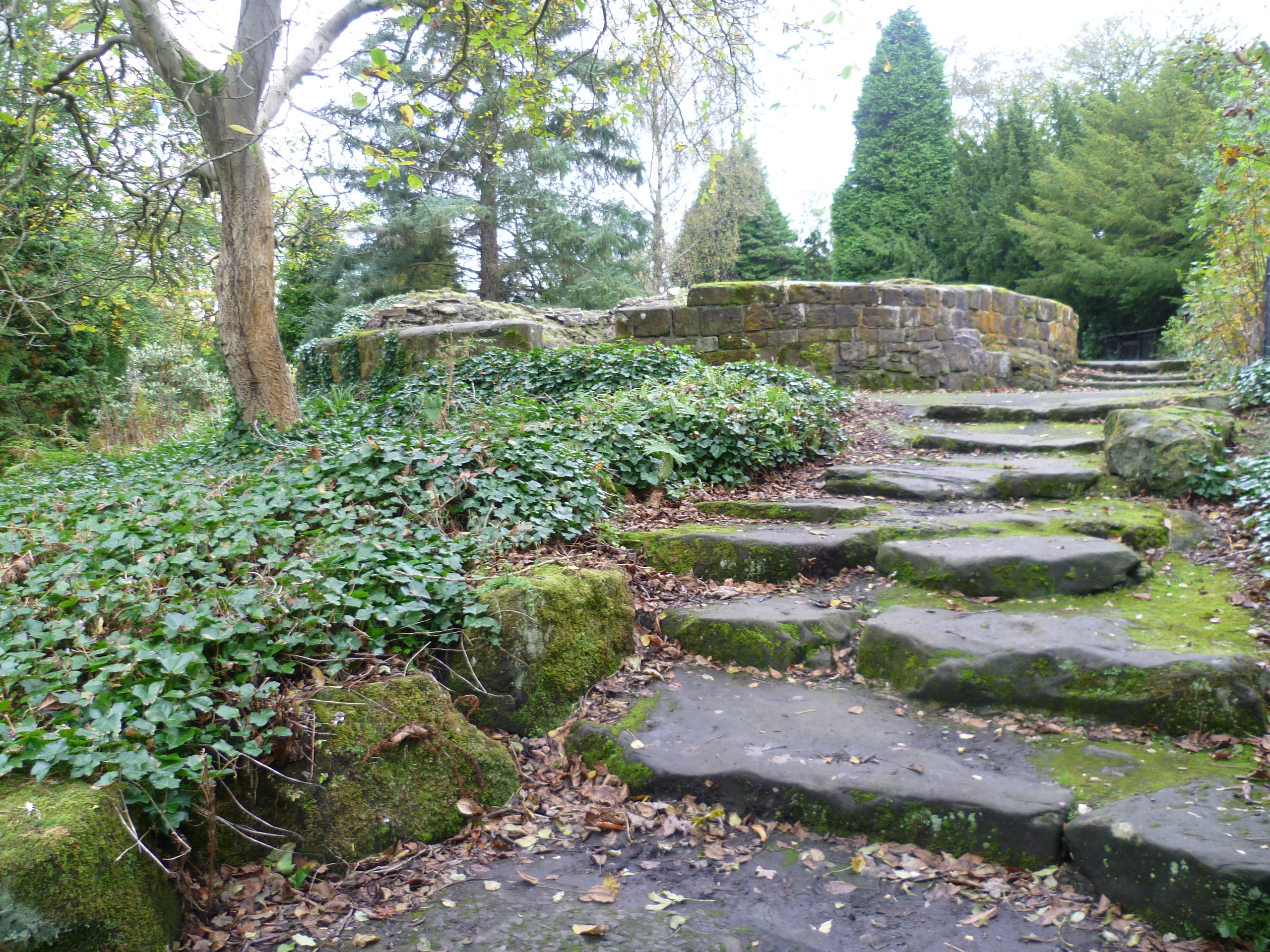
Pittencrieff Park

Pittencrieff Park (known locally as "The Glen") is a public park in Dunfermline, Fife, Scotland. It was purchased in 1902 by Andrew Carnegie, and given...

Malcolm's Tower

Malcolm's Tower, also known as Malcolm Canmore's Tower, is a historic site in the Scottish city of Dunfermline, Fife. It consists of the foundations of...

McLean Primary School

McLean Primary School is located in the centre of Dunfermline, Fife. The head teacher is Carol Newton. Pupils from the school progress onto Queen Anne...

Dunfermline Palace

Dunfermline Palace is a ruined former Scottish royal palace and important tourist attraction in Dunfermline, Fife, Scotland. It is currently, along with...
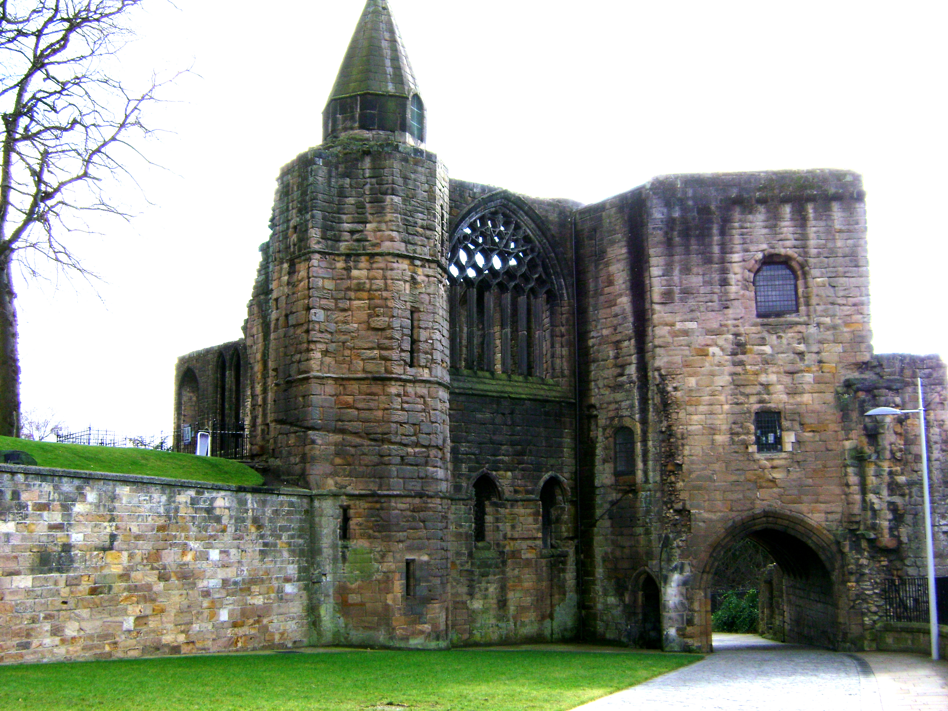
Dunfermline Abbey

Dunfermline Abbey is a Church of Scotland parish church in Dunfermline, Fife, Scotland. The church occupies the site of the ancient chancel and transepts...

Dunfermline City Chambers

Dunfermline City Chambers is a municipal facility at the corner of Bridge Street and Kirkgate in Dunfermline, Fife. The building, which serves as home...

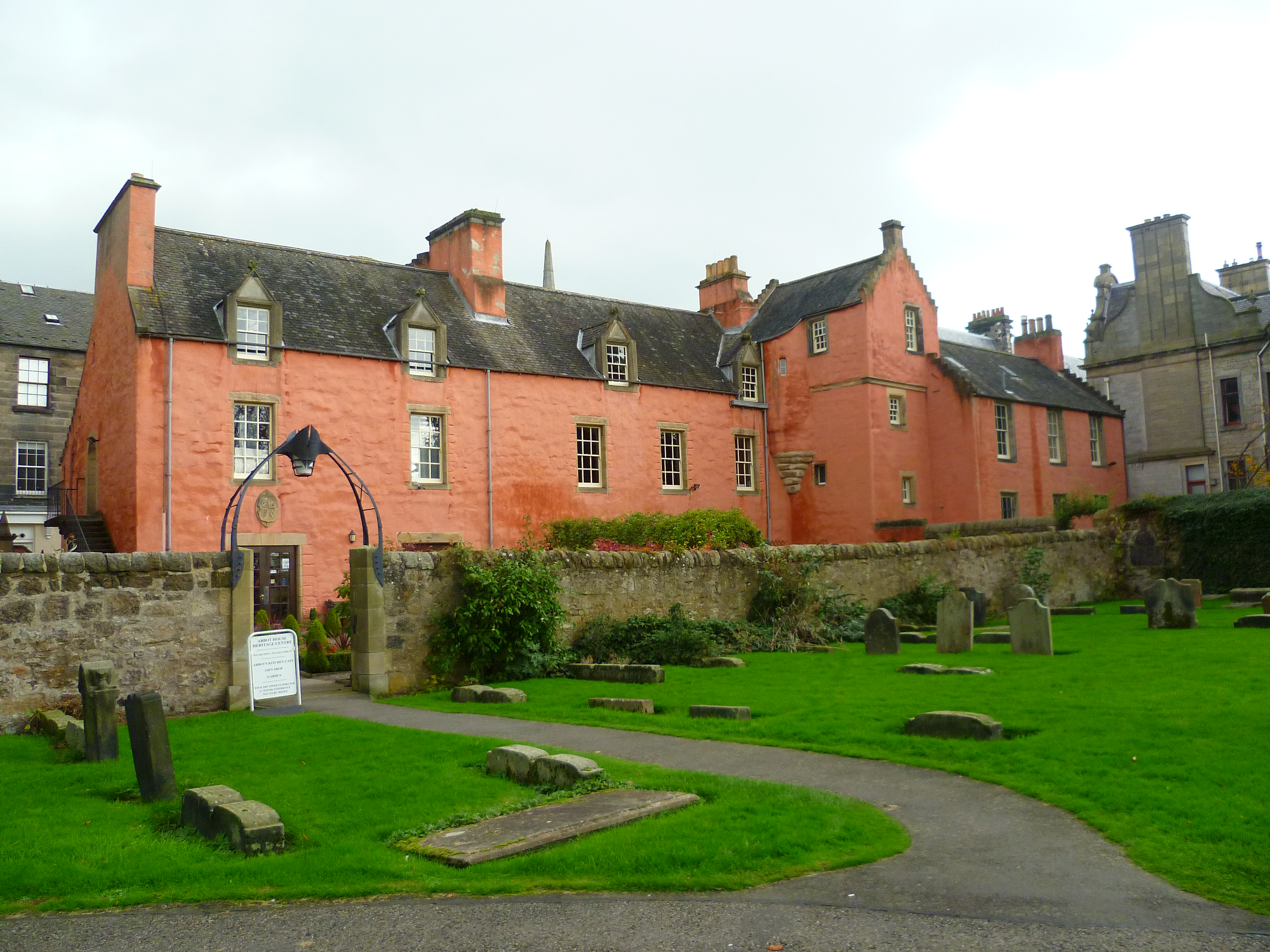
Abbot House, Dunfermline

Abbot House is the oldest secular building in Dunfermline, Scotland. Lying in the shadow of Dunfermline's great abbey church, the core of the building...

Nearby Amenities

Located within 500m of 56.063599,-3.497718
Traffic Signals
Traffic Signals: signal
Lat/Long: 56.0635585/-3.4976488
Scissors
Addr City: Crossford
Addr Housenumber: 84
Addr Postcode: KY12 8NJ
Addr Street: Main Street
Phone: +44 1383 721465
Shop: hairdresser
Lat/Long: 56.0638231/-3.4965662
Fast Food
The Original Master Chef
Addr City: Crossford
Addr Housenumber: 88
Addr Postcode: KY12 8NL
Addr Street: Main Street
Cuisine: fish_and_chips
Delivery: yes
Drive Through: no
Opening Hours: Mo-Su 16:30-23:30
Outdoor Seating: yes
Phone: +44 1383 739129
Takeaway: yes
Lat/Long: 56.063786/-3.49685
The Co-operative Food
Addr City: Crossford
Addr Housenumber: 88
Addr Postcode: KY12 8NL
Addr Street: Main Street
Brand: The Co-operative Food
Brand Wikidata: Q107617274
Opening Hours: Mo-Su 06:00-22:00
Operator: The Co-operative Group
Shop: convenience
Lat/Long: 56.0637648/-3.4970103
Adamson Hotel
Addr City: Crossford
Addr Housenumber: 27
Addr Postcode: KY12 8NJ
Addr Street: Main Street
Stars: 3
Tourism: hotel
Lat/Long: 56.0635203/-3.4955446
Pub
Adamson Hotel
Description: One of the few original Coaching Inns left in Scotland
Lat/Long: 56.0636581/-3.4954158
Pharmacy
Crossford Pharmacy
Addr City: Crossford
Addr Housenumber: 61
Addr Postcode: KY12 8NN
Addr Street: Main Street
Drive Through: no
Healthcare: pharmacy
Opening Hours: Mo-Fr 09:00-17:30; Sa 09:00-12:30
Phone: +44 1383 724725
Lat/Long: 56.0633973/-3.4981979
Post Box
Ref: KY12 47
Source: survey
Lat/Long: 56.0633296/-3.4973958
Crossford
Place: village
Wikidata: Q3698674
Wikipedia: en:Crossford, Fife
Lat/Long: 56.0638835/-3.4958221
Recycling
Recycling Cans: yes
Recycling Glass: yes
Recycling Glass Bottles: yes
Recycling Type: container
Lat/Long: 56.0627551/-3.49915
Post Box
Collection Times: Mo-Fr 09:00; Sa 07:00
Operator: Royal Mail
Post Box Type: lamp
Ref: KY12 162D
Royal Cypher: scottish_crown
Lat/Long: 56.0639618/-3.4952449
Aura Beauty
Addr City: Crossford
Addr Housenumber: 80
Addr Postcode: KY12 8NJ
Addr Street: Main Street
Phone: +44 1383 733988
Shop: beauty
Lat/Long: 56.0638428/-3.4964472
Bus Stop
Beechwood
Bench: yes
Bus: yes
Naptan AtcoCode: 6500D0582
Naptan NaptanCode: 34324597
Public Transport: platform
Shelter: yes
Lat/Long: 56.0638495/-3.4953629
Bus Stop
Beechwood
Bench: no
Bus: yes
Naptan AtcoCode: 6500D0583
Naptan NaptanCode: 34324596
Public Transport: platform
Shelter: no
Lat/Long: 56.063809/-3.4961877
Bus Stop
Lundin Road
Bench: no
Bus: yes
Description: Cairneyhill Road Opposite Lundin Road, Crossford
Operator: Traveline
Phone: +44 871 2002233
Public Transport: platform
Ref: 34324573
Shelter: no
Website: https://www.travelinescotland.com/
Lat/Long: 56.0631298/-3.5004033
Atm
Currency GBP: yes
Description: Inside Co-op
Drive Through: no
Lat/Long: 56.0638266/-3.4969881
Bench
Backrest: yes
Lat/Long: 56.0617662/-3.4983799
Bench
Backrest: no
Lat/Long: 56.0619107/-3.5009608
Bench
Backrest: yes
Lat/Long: 56.062294/-3.4987288
Crossing
Crossing: traffic_signals
Lat/Long: 56.0632949/-3.499858
Post Office
Crossford Post Office
Addr Country: GB
Addr Postcode: KY12 8NN
Brand: Post Office
Brand Wikidata: Q1783168
Contact Website: https://www.postoffice.co.uk/branch-finder/1888447/crossford
Ref Pol Id: 5986
Lat/Long: 56.0634226/-3.4981565
Bench
Backrest: yes
Lat/Long: 56.0618241/-3.4984231
Bus Stop
Douglas Drive
Bus: yes
Departures Board: timetable
Network: Fife
Operator: Stagecoach
Public Transport: platform
Surface: tactile_paving
Lat/Long: 56.0627451/-3.5045898
Bus Stop
Douglas Drive
Bus: yes
Departures Board: timetable
Network: Fife
Operator: Stagecoach
Public Transport: platform
Surface: tactile_paving
Lat/Long: 56.0626619/-3.504775
Bus Stop
Lyne Grove
Bus: yes
Departures Board: timetable
Naptan AtcoCode: 6500D0579
Naptan NaptanCode: 34324634
Network: Fife
Operator: Stagecoach
Public Transport: platform
Surface: tactile_paving
Lat/Long: 56.0645882/-3.4912573
Bus Stop
Lyne Grove
Bus: yes
Departures Board: timetable
Naptan AtcoCode: 6500D0581
Naptan NaptanCode: 34324593
Network: Fife
Operator: Stagecoach
Public Transport: platform
Surface: tactile_paving
Lat/Long: 56.0644899/-3.4913792
Bus Stop
Miller Avenue
Bus: yes
Naptan AtcoCode: 6500D9650
Naptan NaptanCode: 34324635
Public Transport: platform
Shelter: no
Lat/Long: 56.0645292/-3.4982623
Bus Stop
Miller Avenue
Bus: yes
Public Transport: platform
Shelter: no
Lat/Long: 56.0643469/-3.4982931
Bus Stop
Kirkwood Crescent
Bus: yes
Naptan AtcoCode: 6500D9651
Naptan NaptanCode: 34324676
Public Transport: platform
Shelter: no
Lat/Long: 56.0655251/-3.5005546
Bus Stop
Miller Avenue
Bus: yes
Public Transport: platform
Shelter: no
Lat/Long: 56.0654373/-3.5006778
Bus Stop
Anderson Avenue
Bus: yes
Public Transport: platform
Shelter: no
Lat/Long: 56.0644964/-3.5009596
Bus Stop
Miller Avenue
Bus: yes
Naptan AtcoCode: 6500D9675
Naptan NaptanCode: 34324643
Public Transport: platform
Lat/Long: 56.0645537/-3.500903
Bus Stop
Dean Drive
Bus: yes
Public Transport: platform
Shelter: no
Lat/Long: 56.0634058/-3.5057269
Bus Stop
Kilburn Road
Bus: yes
Naptan AtcoCode: 6500D9716
Naptan NaptanCode: 34324637
Public Transport: platform
Shelter: no
Lat/Long: 56.0644075/-3.5049129
Bus Stop
Abbey View
Bus: yes
Public Transport: platform
Shelter: no
Lat/Long: 56.0614578/-3.495993
Bus Stop
Abbey View
Bus: yes
Naptan AtcoCode: 6500D9757
Naptan NaptanCode: 34324329
Public Transport: platform
Shelter: no
Lat/Long: 56.0614033/-3.495745
Generator Method: photovoltaic
Generator Output Electricity: yes
Generator Source: solar
Generator Type: solar_photovoltaic_panel
Power: generator
Lat/Long: 56.0647185/-3.4918011
Generator Method: photovoltaic
Generator Output Electricity: yes
Generator Source: solar
Generator Type: solar_photovoltaic_panel
Power: generator
Lat/Long: 56.0646901/-3.4921766
Generator Method: photovoltaic
Generator Output Electricity: yes
Generator Source: solar
Generator Type: solar_photovoltaic_panel
Power: generator
Lat/Long: 56.0645332/-3.4924213
Bus Stop
Bus Stop (89)
Lat/Long: 56.0604304/-3.4950015
Power: pole
Lat/Long: 56.0611166/-3.4911478
Power: pole
Lat/Long: 56.0611917/-3.4922992
Power: pole
Lat/Long: 56.0612844/-3.4936206
Power: pole
Lat/Long: 56.0611972/-3.4944416
Power: pole
Lat/Long: 56.0611033/-3.4953734
Power: pole
Lat/Long: 56.0674823/-3.493676
Power: pole
Lat/Long: 56.0671444/-3.494503
Power: pole
Lat/Long: 56.0668186/-3.4956207
Power: pole
Lat/Long: 56.0664012/-3.4964377
Power: pole
Lat/Long: 56.0659594/-3.4973042
Power: pole
Lat/Long: 56.0672559/-3.5012726
Power: pole
Lat/Long: 56.0668518/-3.5001787
Power: pole
Lat/Long: 56.0664465/-3.499057
Power: pole
Lat/Long: 56.0660467/-3.4979828
Power: pole
Lat/Long: 56.0675675/-3.4978048
Power: pole
Lat/Long: 56.0669423/-3.4977679
Power: pole
Lat/Long: 56.0663342/-3.4977248
Crossing
Crossing: marked
Lat/Long: 56.0637064/-3.4981866
Charging Station
Lat/Long: 56.0636143/-3.4978662
Addr Housenumber: 2
Addr Street: Western Avenue
Lat/Long: 56.0591575/-3.4970558
Addr Housenumber: 12
Addr Street: Hunt Place
Lat/Long: 56.0593488/-3.495169
Addr Housenumber: 4
Addr Street: Hunt Place
Lat/Long: 56.0594414/-3.4946654
Addr Housenumber: 2
Addr Street: Hunt Place
Lat/Long: 56.0595073/-3.4945506
Addr Housenumber: 16
Addr Street: Katrine Drive
Lat/Long: 56.0596514/-3.4967173
Addr Housenumber: 14
Addr Street: Katrine Drive
Lat/Long: 56.0595717/-3.4966358
Addr Housenumber: 12
Addr Street: Katrine Drive
Lat/Long: 56.059494/-3.4965738
Addr Housenumber: 10
Addr Street: Katrine Drive
Lat/Long: 56.0594229/-3.4965105
Addr Housenumber: 8
Addr Street: Katrine Drive
Lat/Long: 56.0593441/-3.4963402
Addr Housenumber: 6
Addr Street: Katrine Drive
Lat/Long: 56.0593033/-3.4963084
The data included in this document is from www.openstreetmap.org. The data is made available under ODbL.

Have you been to Crossford?

Leave your review of Crossford below (or comments, questions and feedback).