Church Coppice

Wood, Forest in Worcestershire Wychavon

England

Church Coppice

NT Hanbury Hall View across the autumnal formal garden towards the South-west facade.
NT Hanbury Hall Credit: Jonathan Billinger

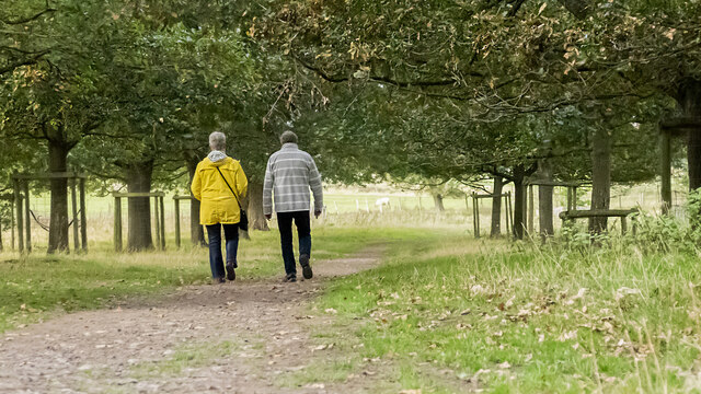
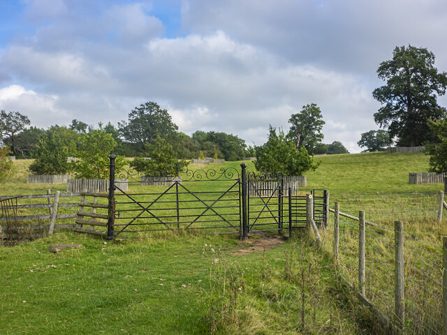
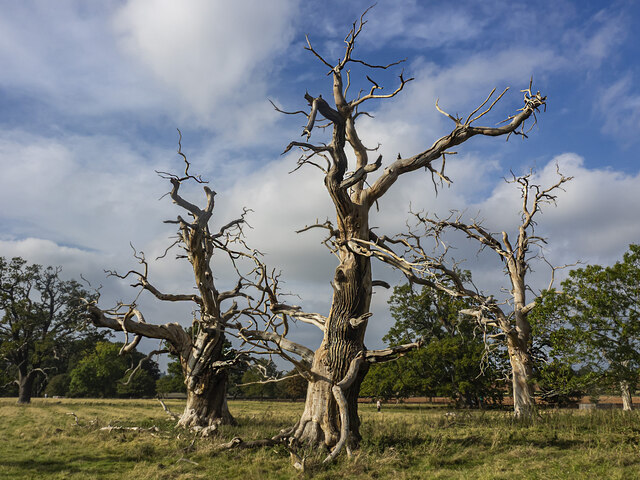
Church Coppice is a picturesque woodland area located in Worcestershire, England. It is known for its dense forestation and tranquil atmosphere, making it a popular destination for nature enthusiasts and hikers alike. The coppice, which is a term used to describe a managed woodland area, is predominantly composed of deciduous trees such as oak, beech, and birch.

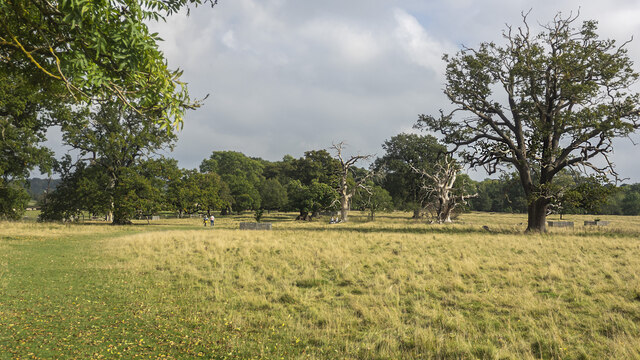
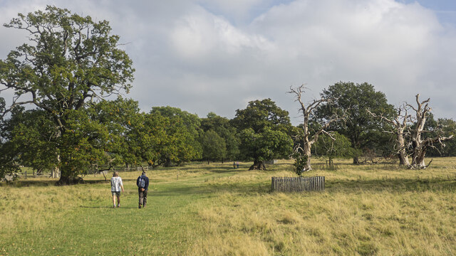
Covering an approximate area of 50 hectares, Church Coppice offers a diverse range of flora and fauna. The forest floor is adorned with a carpet of bluebells during the spring season, creating a breathtaking sight for visitors. The area is also home to various species of wildlife, including deer, foxes, and a variety of bird species, making it an ideal spot for birdwatching.

Visitors can explore the woodland through a network of well-maintained walking trails that wind through the trees, providing opportunities for leisurely strolls or more challenging hikes. Along these trails, one can discover ancient trees with twisted branches, adding to the mystical ambiance of the area.

Church Coppice holds historical significance as well, with the ruins of a medieval church nestled within its boundaries. The church was believed to have been built in the 12th century and provides a glimpse into the area's rich history.

Overall, Church Coppice offers a serene escape from the hustle and bustle of city life, providing visitors with the opportunity to immerse themselves in the beauty of nature while also experiencing a touch of history.

If you have any feedback on the listing, please let us know in the comments section below.

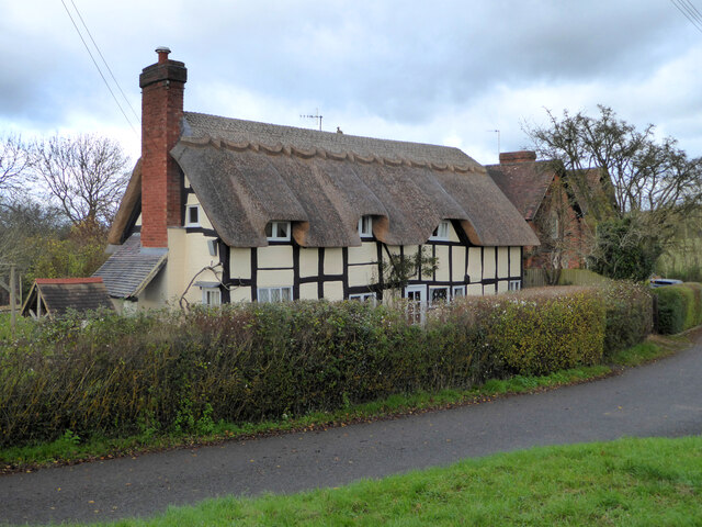
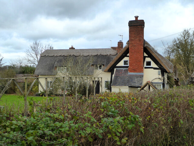
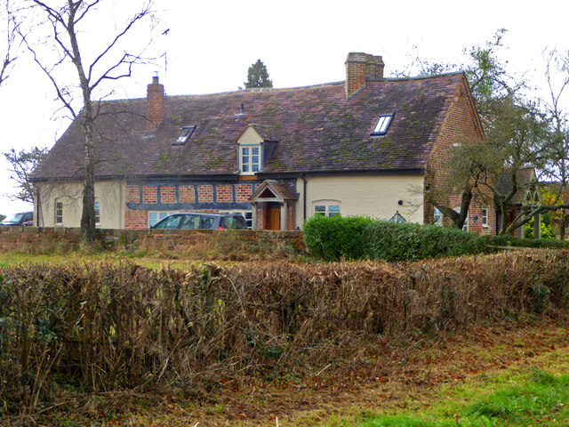
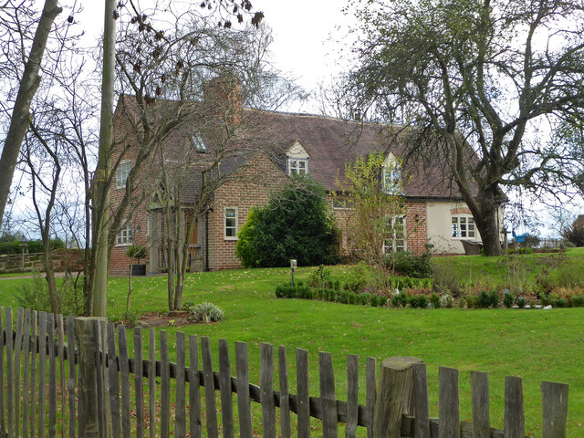
Church Coppice Images

Images are sourced within 2km of 52.278473/-2.0699288 or Grid Reference SO9564. Thanks to Geograph Open Source API. All images are credited.

NT Hanbury Hall View across the autumnal formal garden towards the South-west facade.
NT Hanbury Hall
View across the autumnal formal garden towards the South-west facade.
Still Life at Hanbury An autumnal display near the entrance to Hanbury Hall.
Still Life at Hanbury
An autumnal display near the entrance to Hanbury Hall.
Dahlia display Within the walled garden at Hanbury Hall.
Dahlia display
Within the walled garden at Hanbury Hall.
A walk in the park A fine autumn afternoon at NT Hanbury Hall.
A walk in the park
A fine autumn afternoon at NT Hanbury Hall.
Hanbury Hall parkland A fine walk around the park at NT Hanbury Hall.
Hanbury Hall parkland
A fine walk around the park at NT Hanbury Hall.
Hanbury Hall parkland There are several dead skeletal oaks within the estate.
Hanbury Hall parkland
There are several dead skeletal oaks within the estate.
Gate on the estate A fine piece of ironwork on a public path through the NT Hanbury Hall estate.
Gate on the estate
A fine piece of ironwork on a public path through the NT Hanbury Hall estate.
Skeletal oaks at Hanbury There are several dead skeletal oaks within the estate.
Skeletal oaks at Hanbury
There are several dead skeletal oaks within the estate.
The parterre garden at Hanbury Hall A recreation of the garden designed by George London in 1705.
The parterre garden at Hanbury Hall
A recreation of the garden designed by George London in 1705.
Hanbury Hall National Trust property in Worcestershire built in 1701.
Hanbury Hall
National Trust property in Worcestershire built in 1701.
Well Cottage, Hanbury A 17th century house with a thatched roof, Listed Grade II.
Well Cottage, Hanbury
A 17th century house with a thatched roof, Listed Grade II.
Well Cottage, Hanbury A 17th century thatched dwelling, Listed Grade II.
Well Cottage, Hanbury
A 17th century thatched dwelling, Listed Grade II.
Dovecote by Pumphouse Farm Early 17th century dovecote, Listed Grade II. Difficult to get a clear view over the hedge from the public road. There is no convenient public footpath here.
Dovecote by Pumphouse Farm
Early 17th century dovecote, Listed Grade II. Difficult to get a clear view over the hedge from the public road. There is no convenient public footpath here.
Barn at Pumphouse Farm, Hanbury Grade II Listed.
Barn at Pumphouse Farm, Hanbury
Grade II Listed.
Pumphouse Farmhouse, Hanbury Grade II Listed.
Pumphouse Farmhouse, Hanbury
Grade II Listed.
White House Cottage, Hanbury Early 18th century with late 19th and early 20th century alterations. Grade II Listed.
White House Cottage, Hanbury
Early 18th century with late 19th and early 20th century alterations. Grade II Listed.
Appleby, Hanbury An early 17th century house with late 19th and mid-20th century alterations and additions. Listed Grade II.
Appleby, Hanbury
An early 17th century house with late 19th and mid-20th century alterations and additions. Listed Grade II.
Appleby, Hanbury An early 17th century house with late 19th and mid-20th century alterations and additions. Listed Grade II.
Appleby, Hanbury
An early 17th century house with late 19th and mid-20th century alterations and additions. Listed Grade II.
Show me another place!

Church Coppice is located at Grid Ref: SO9564 (Lat: 52.278473, Lng: -2.0699288)

Administrative County: Worcestershire

District: Wychavon

Police Authority: West Mercia

What 3 Words

///solar.shifters.tunnel. Near Stoke Prior, Worcestershire

Related Wikis

St Mary the Virgin, Hanbury

The church of St Mary the Virgin is an Anglican parish church in the village of Hanbury, Worcestershire. Its earliest parts date from about 1210 and it...
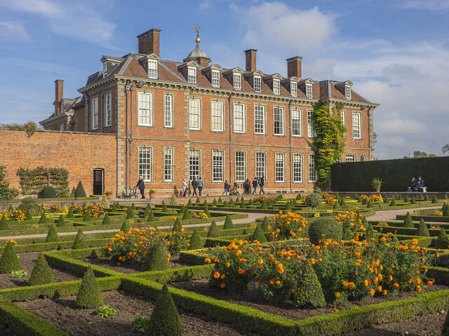
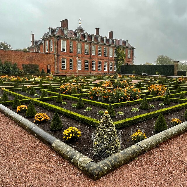
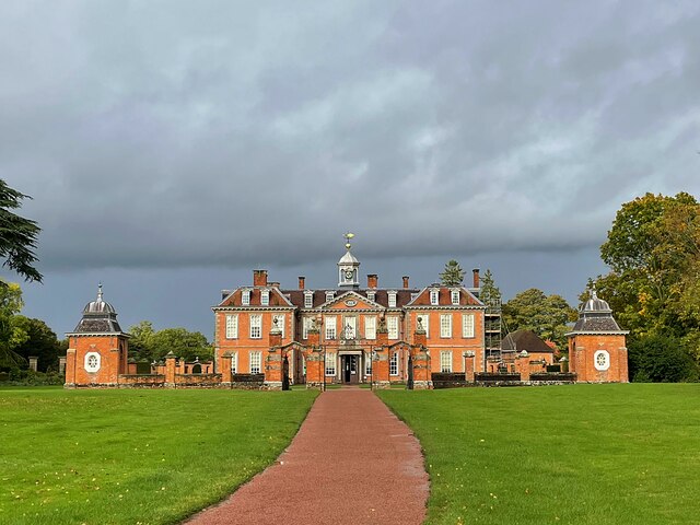
Hanbury Hall

Hanbury Hall is a large 18th-century stately home standing in parkland at Hanbury, Worcestershire. The main range has two storeys and is built of red brick...

Hanbury, Worcestershire

Hanbury is a rural village in Worcestershire, England near Droitwich Spa and the M5 motorway. The population of Hanbury has remained around 1,000 since...

Mere Green, Worcestershire

Mere Green is a hamlet in the English county of Worcestershire. It is located south of the village of Hanbury roughly midway between Worcester and Redditch...

Stoke Works railway station

Stoke Works railway station was a station in the hamlet of Stoke Prior in the English county of Worcestershire, near Bromsgrove. It was located on the...

Droitwich Road railway station

Droitwich Road railway station served the town of Droitwich Spa, Worcestershire, England, from 1840 to 1855 on the Birmingham and Gloucester Railway....

Stoke Prior, Worcestershire

Stoke Prior is a village in the civil parish of Stoke in the Bromsgrove district of Worcestershire. The parish includes the settlement of Stoke Wharf and...

Droitwich Transmitting Station

The Droitwich transmitting station is a large broadcasting facility for long-wave and medium-wave transmissions, established in 1934 in the civil parish...

Nearby Amenities

Located within 500m of 52.278473,-2.0699288
Barrier: kissing_gate
Foot: yes
Lat/Long: 52.2795658/-2.0670817
Information: map
Man Made: obelisk
Map Type: topo
Source: survey
Tourism: viewpoint
Lat/Long: 52.2770282/-2.0680789
Bench
Source: survey
Lat/Long: 52.2770423/-2.0681621
Bench
Source: survey
Lat/Long: 52.2770492/-2.0682741
Bench
Source: survey
Lat/Long: 52.2770688/-2.0683541
Barrier: stile
Source: survey
Lat/Long: 52.2781239/-2.0680457
Barrier: kissing_gate
Foot: yes
Lat/Long: 52.2755875/-2.0746608
Barrier: kissing_gate
Foot: yes
Lat/Long: 52.2771963/-2.0701219
Barrier: kissing_gate
Foot: yes
Lat/Long: 52.2805624/-2.0662114
Barrier: kissing_gate
Lat/Long: 52.277076/-2.0684516
Hanbury Church Hill
Natural: peak
Lat/Long: 52.2781358/-2.0688196
Barrier: lift_gate
Lat/Long: 52.2758563/-2.0666379
Dodderhill Common South
Power: pole
Transformer: distribution
Voltage Primary: 11000
Lat/Long: 52.2788598/-2.062836
Power: pole
Lat/Long: 52.2794707/-2.0628903
Power: pole
Lat/Long: 52.2812097/-2.0752493
Power: pole
Lat/Long: 52.2810357/-2.0742917
Power: pole
Lat/Long: 52.2808675/-2.0733583
Power: pole
Lat/Long: 52.2806985/-2.0724276
Power: pole
Lat/Long: 52.2805221/-2.0714714
Power: pole
Lat/Long: 52.2803252/-2.0703784
Power: pole
Lat/Long: 52.2801234/-2.0693082
Power: pole
Lat/Long: 52.2800495/-2.0688602
Location Transition: yes
Power: pole
Lat/Long: 52.2799265/-2.0681199
Hanbury Church
Power: pole
Transformer: distribution
Voltage Primary: 11000
Lat/Long: 52.276568/-2.0690212
Location Transition: yes
Power: pole
Lat/Long: 52.2757902/-2.067963
Hanbury School
Location Transition: yes
Power: pole
Transformer: distribution
Voltage Primary: 11000
Lat/Long: 52.2753749/-2.0669653
Power: pole
Lat/Long: 52.2754586/-2.065427
The data included in this document is from www.openstreetmap.org. The data is made available under ODbL.

Have you been to Church Coppice?

Leave your review of Church Coppice below (or comments, questions and feedback).