Gardenhouse Plantation

Wood, Forest in Durham

England

Gardenhouse Plantation

Presser Pumping Station near the top of Bale Hill Consett Water Company established in 1859 merged and became the Weardale and Consett Water Company in 1902. Some time late in the 19th or early 20th century one of the two former companies had taken over the engine house of closed Derwent Lead Mines and developed this Grade II Listed pumping house to supply water to Consett. It is reported that they started paying rent to the estate in 1902 and the rent in 1911 was £360.
Presser Pumping Station near the top of Bale Hill Credit: Jo and Steve Turner

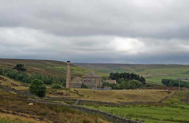
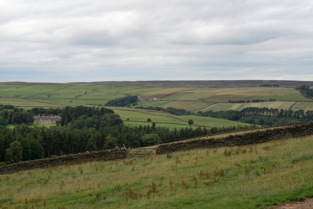
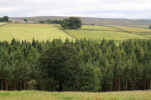
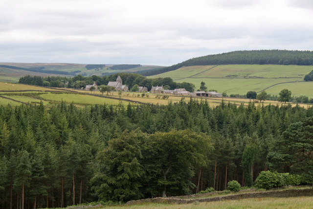
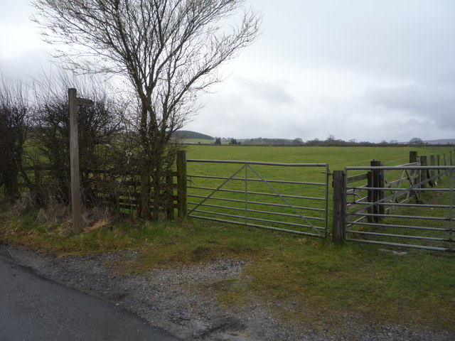
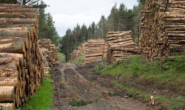
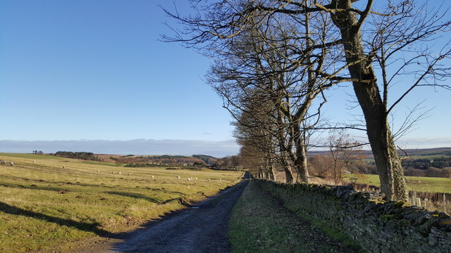
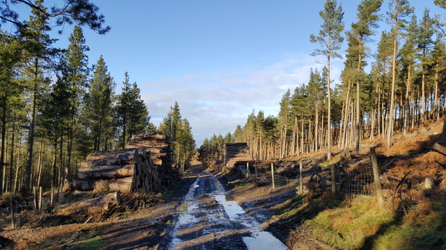
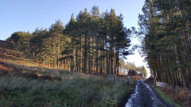
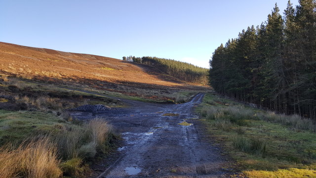
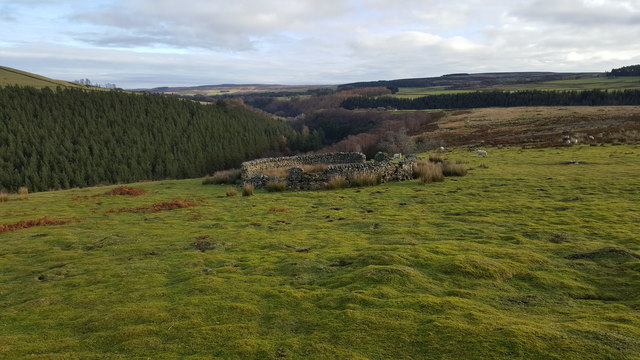
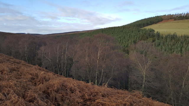
Gardenhouse Plantation, located in Durham, is a picturesque woodland area known for its lush greenery and diverse plant life. Spread over a vast expanse, the plantation encompasses a variety of tree species, creating a serene and tranquil environment. The predominant trees in this woodland are oak, beech, and birch, which contribute to the overall beauty of the area.

The plantation is home to numerous plant species, both native and introduced. The forest floor is adorned with a carpet of ferns, mosses, and wildflowers, adding to the charm of the surroundings. The undergrowth provides a habitat for various animals, including rabbits, squirrels, and a plethora of bird species. Birdwatchers can often be found in the area, captivated by the diverse birdlife that thrives within the woodland.

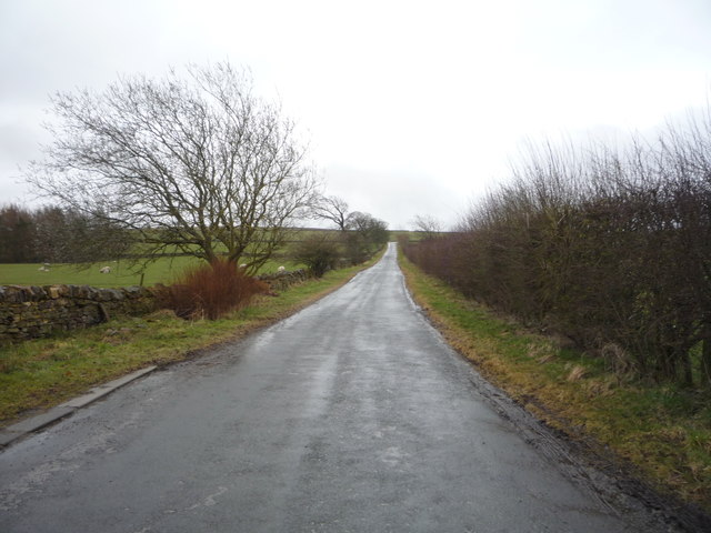
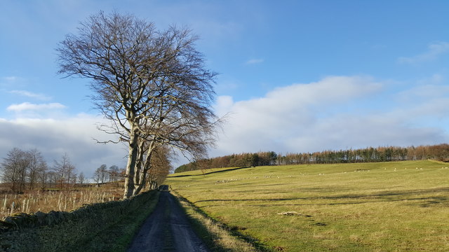
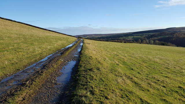
Gardenhouse Plantation offers visitors the opportunity to explore nature at its finest. There are well-maintained walking trails that meander through the plantation, providing visitors with an immersive experience in the natural beauty of the forest. The trails are ideal for hiking, jogging, or simply enjoying a leisurely stroll amidst the calming ambiance of the woodland.

The plantation also serves as an educational resource, with guided tours and informational boards available to provide insights into the various plant and animal species found within the area. These resources help visitors learn about the importance of preserving and protecting the delicate ecosystem that exists within Gardenhouse Plantation.

Overall, Gardenhouse Plantation is a haven for nature lovers and those seeking solace in the embrace of a serene woodland. Its diverse plant and animal life, coupled with well-maintained trails and educational resources, make it a must-visit destination for anyone looking to immerse themselves in the beauty of Durham's natural landscape.

If you have any feedback on the listing, please let us know in the comments section below.

Gardenhouse Plantation Images

Images are sourced within 2km of 54.839782/-2.0759516 or Grid Reference NY9549. Thanks to Geograph Open Source API. All images are credited.

Presser Pumping Station near the top of Bale Hill Consett Water Company established in 1859 merged and became the Weardale and Consett Water Company in 1902. Some time late in the 19th or early 20th century one of the two former companies had taken over the engine house of closed Derwent Lead Mines and developed this Grade II Listed pumping house to supply water to Consett. It is reported that they started paying rent to the estate in 1902 and the rent in 1911 was £360.
Presser Pumping Station near the top of Bale Hill
Consett Water Company established in 1859 merged and became the Weardale and Consett Water Company in 1902. Some time late in the 19th or early 20th century one of the two former companies had taken over the engine house of closed Derwent Lead Mines and developed this Grade II Listed pumping house to supply water to Consett. It is reported that they started paying rent to the estate in 1902 and the rent in 1911 was £360.
Newbiggin Hall and Birkside Farm from Bale Hill The Reverend Daniel Capper sold up Newbiggin and Hunstanworth estate by auction in London on 1st August 1865. The sales brochure describes the mansion house of Newbiggin as the jewel in the estate crown. Rev Capper had recently spent £30,000 on new farm buildings, the latest water power machinery and rebuilding the estate cottages "with four rooms each". Kelly's Directory 1894 tells us it is owned by Edward Joicey esq. J.P. Pevsner documents that the house was rebuilt in Neo-classical style in 1906 after a fire of 1904 from a Latin inscription on the west wall. Reports indicate it has been a First World War sanatorium, a turkey farm and hotel and was more recently owned by a member of the Arabian royal family who stays a couple of times a year for the grouse shooting.
Newbiggin Hall and Birkside Farm from Bale Hill
The Reverend Daniel Capper sold up Newbiggin and Hunstanworth estate by auction in London on 1st August 1865. The sales brochure describes the mansion house of Newbiggin as the jewel in the estate crown. Rev Capper had recently spent £30,000 on new farm buildings, the latest water power machinery and rebuilding the estate cottages "with four rooms each". Kelly's Directory 1894 tells us it is owned by Edward Joicey esq. J.P. Pevsner documents that the house was rebuilt in Neo-classical style in 1906 after a fire of 1904 from a Latin inscription on the west wall. Reports indicate it has been a First World War sanatorium, a turkey farm and hotel and was more recently owned by a member of the Arabian royal family who stays a couple of times a year for the grouse shooting.
View to East High House Farm from Bale Hill
Hunstanworth from Bale Hill Hunstanworth is one of the 'Thankful Villages' (a term popularised by the writer Arthur Mee in the 1930s) that suffered no fatalities during the Great War of 1914-1918. The unusual patterns in the roof tiles was a creation of architect Samuel Sanders Teulon who had been commissioned by Reverend Daniel Capper, landowner who would stay in Newbiggin Hall during the grouse shooting season, to build a new church, school, reading room, shop and workers' terraced cottages in 1863. The distinctive diamond-patterned, steep-pitched roofs and Victorian Gothic detail make Hunstanworth unique among the villages of the North Pennines. Closure of the local lead mines in the 1880s diminished the 800 strong population (778 in 1861) to just 200 by 1901. The population of the village in 2011 was 116. John Marius Wilson's Imperial Gazetteer of England and Wales of 1870-72 informs us that "the church was rebuilt in 1865, at a cost of £2,500".
Hunstanworth from Bale Hill
Hunstanworth is one of the 'Thankful Villages' (a term popularised by the writer Arthur Mee in the 1930s) that suffered no fatalities during the Great War of 1914-1918. The unusual patterns in the roof tiles was a creation of architect Samuel Sanders Teulon who had been commissioned by Reverend Daniel Capper, landowner who would stay in Newbiggin Hall during the grouse shooting season, to build a new church, school, reading room, shop and workers' terraced cottages in 1863. The distinctive diamond-patterned, steep-pitched roofs and Victorian Gothic detail make Hunstanworth unique among the villages of the North Pennines. Closure of the local lead mines in the 1880s diminished the 800 strong population (778 in 1861) to just 200 by 1901. The population of the village in 2011 was 116. John Marius Wilson's Imperial Gazetteer of England and Wales of 1870-72 informs us that "the church was rebuilt in 1865, at a cost of £2,500".
Field entrance and footpath near the Rope Barn
Minor road towards Allenshields Looking south near the Rope Barn.
Minor road towards Allenshields
Looking south near the Rope Barn.
Grazing near the Rope Barn
Timber stacks alongside estate road The road passes between Beldon High and Beldon Low Plantations on the north side of the valley of the Beldon Burn.
Timber stacks alongside estate road
The road passes between Beldon High and Beldon Low Plantations on the north side of the valley of the Beldon Burn.
Road between Baybridge and Newbiggin House and Hall This is a private road to the homes on this lane, however it carries a footpath up  the valley to the fells.
Road between Baybridge and Newbiggin House and Hall
This is a private road to the homes on this lane, however it carries a footpath up the valley to the fells.
Track by Long Plantation
Track in grazing field between High and Low Beldon Plantations
Timber stacks either side of track in Low Beldon Plantation
Low Beldon Plantation
Sheepfold at Nookton East Park
Footpath between Nookton East Park and Gibraltar Banks
Natural Birch woodland and Low Beldon Pine Plantation beyond
Show me another place!

Gardenhouse Plantation is located at Grid Ref: NY9549 (Lat: 54.839782, Lng: -2.0759516)

Unitary Authority: County Durham

Police Authority: Durham

What 3 Words

///contour.states.greyhound. Near Slaley, Northumberland

Related Wikis

Beldon Burn

Beldon Burn is a headwater stream of the River Derwent in Northumberland and County Durham, England.It rises at Quickcleugh Moss as the Quickcleugh Burn...

Hunstanworth

Hunstanworth is a village in County Durham, England. It is situated approximately 10 miles to the west of Consett, south-west of the village of Blanchland...

Baybridge, Northumberland

Baybridge is a small village in Northumberland, England, just to the west of Blanchland and on the border with County Durham. It is situated to the west...

Townfield

Townfield is a village in County Durham, in England. It is situated just to the south of Hunstanworth and part of that parish, about 10 miles (16 km) west...

Blanchland

Blanchland is a village in Northumberland, England, on the County Durham boundary. The population of the civil parish at the 2011 census was 135.Set beside...

Blanchland Abbey

Blanchland Abbey at Blanchland, in the English county of Northumberland, was founded as a premonstratensian priory in 1165 by Walter de Bolbec II, and...

Ramshaw, Consett

Ramshaw is a small village in County Durham, in England. It is situated to the south of Hunstanworth, a few miles west of Consett. Lead mining was an important...

Muggleswick, Stanhope and Edmundbyers Commons and Blanchland Moor

Muggleswick, Stanhope and Edmundbyers Commons and Blanchland Moor is a Site of Special Scientific Interest in County Durham and Northumberland, England...

Nearby Amenities

Located within 500m of 54.839782,-2.0759516
Hunstanworth
Place: hamlet
Wikidata: Q743220
Wikipedia: en:Hunstanworth
Lat/Long: 54.8360878/-2.0793158
Post Box
Post Box Type: lamp
Royal Cypher: EIIR
Lat/Long: 54.8359481/-2.0797302
Bus Stop
Hunstanworth
Naptan AtcoCode: 13001083A
Naptan Bearing: N
Naptan CommonName: Hunstanworth
Naptan Indicator: north bound
Naptan Landmark: Landmark not known
Naptan NaptanCode: duradaja
Naptan Notes: In front of South View opposite Hunstanworth Farm- on main road- at corner of road with St Ja
Naptan Street: Unclassified Road
Naptan Verified: no
Source: naptan_import
Lat/Long: 54.8360292/-2.0796522
Bus Stop
Hunstanworth
Naptan AtcoCode: 13001083E
Naptan Bearing: S
Naptan CommonName: Hunstanworth
Naptan Indicator: south bound
Naptan Landmark: Landmark not known
Naptan NaptanCode: duradajd
Naptan Notes: Opposite South View opposite Hunstanworth Farm- on main road- at corner of road with St James
Naptan Street: Unclassified Road
Naptan Verified: no
Source: naptan_import
Lat/Long: 54.8358559/-2.079536
Newbiggin
Place: hamlet
Wikidata: Q23609456
Lat/Long: 54.8433436/-2.0800692
Turning Loop
Lat/Long: 54.8433138/-2.0791537
Power: pole
Lat/Long: 54.837943/-2.0737566
Power: pole
Lat/Long: 54.8372062/-2.0742166
Power: pole
Lat/Long: 54.8365026/-2.0746967
Power: pole
Lat/Long: 54.835351/-2.0754129
Power: pole
Lat/Long: 54.835972/-2.0750132
Power: pole
Lat/Long: 54.8361242/-2.0769618
Power: pole
Lat/Long: 54.8362238/-2.0782305
Power: pole
Lat/Long: 54.8360794/-2.0788649
The data included in this document is from www.openstreetmap.org. The data is made available under ODbL.

Have you been to Gardenhouse Plantation?

Leave your review of Gardenhouse Plantation below (or comments, questions and feedback).