Low Hangers

Wood, Forest in Yorkshire Richmondshire

England

Low Hangers

Potting Ford This minor ford near Gunnerside is found on the bridleway leading up to Potting.
Potting Ford Credit: John Walton

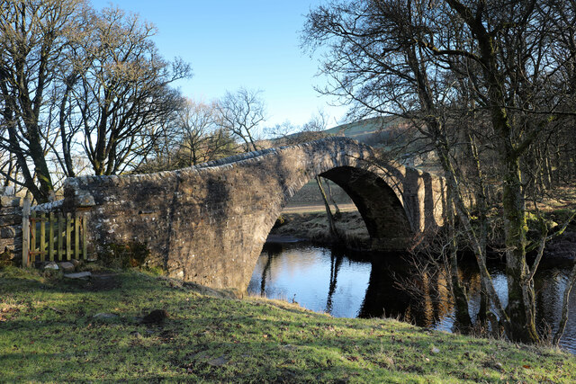
Low Hangers, Yorkshire (Wood, Forest) is a picturesque woodland area located in the county of Yorkshire, England. Spread across a vast expanse, it is characterized by its dense canopy of trees, diverse flora and fauna, and tranquil atmosphere. The woodland is situated in close proximity to the village of Low Hangers, contributing to its name.

The wood is predominantly composed of deciduous trees such as oak, beech, and ash, which create a vibrant display of colors during autumn. The forest floor is adorned with a carpet of wildflowers, including bluebells, primroses, and wood anemones, adding to the area's natural beauty.

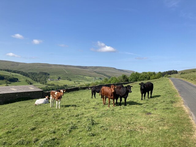
Low Hangers Wood is renowned for its biodiversity, providing a habitat for a wide range of wildlife species. Birdwatchers can spot various avian species, including woodpeckers, owls, and thrushes, while mammals like badgers, foxes, and deer can also be found in the area. The woodland's tranquil environment makes it an ideal spot for nature lovers and photographers seeking solitude and a chance to capture the beauty of the natural world.

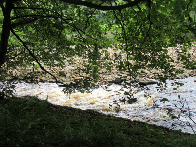
The wood offers several walking trails and footpaths, allowing visitors to explore its wonders at their own pace. These paths wind through the forest, offering glimpses of hidden streams, small waterfalls, and charming bridges. Additionally, designated picnic areas and benches are available, providing an opportunity for visitors to relax and enjoy a picnic surrounded by nature.

Overall, Low Hangers, Yorkshire (Wood, Forest) is a captivating woodland area that offers a serene escape from the hustle and bustle of everyday life, inviting visitors to immerse themselves in the splendor of nature.

If you have any feedback on the listing, please let us know in the comments section below.
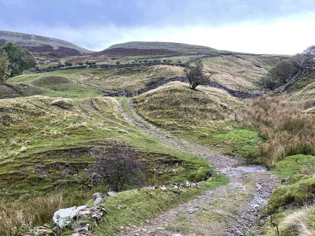
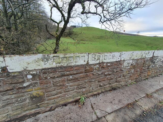
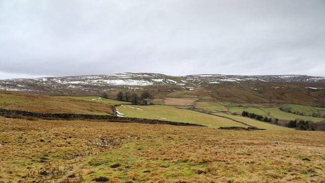
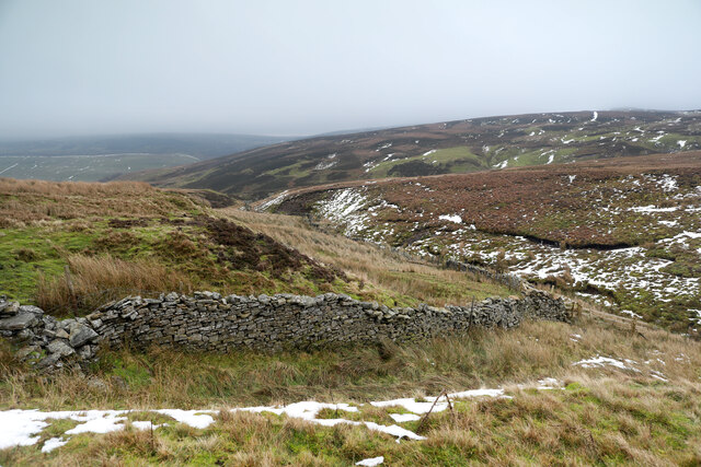
Low Hangers Images

Images are sourced within 2km of 54.37248/-2.0764228 or Grid Reference SD9597. Thanks to Geograph Open Source API. All images are credited.

Potting Ford This minor ford near Gunnerside is found on the bridleway leading up to Potting.
Potting Ford
This minor ford near Gunnerside is found on the bridleway leading up to Potting.
Potting Ford This is a second ford at Potting on the bridleways above Gunnerside.
Potting Ford
This is a second ford at Potting on the bridleways above Gunnerside.
Barf End Ford This ford beside the waterfall is found at Barf End above Gunnerside.
Barf End Ford
This ford beside the waterfall is found at Barf End above Gunnerside.
Loaning House Ford This is another ford on the bridleways above Gunnerside.
Loaning House Ford
This is another ford on the bridleways above Gunnerside.
Old Bridge Marker on Gunnerside Bridge, Melbecks parish Bridge Marker on the outside of the south parapet of Gunnerside Bridge over Gunnerside Beck. Melbecks parish.

Milestone Society National ID: YN_MELB01br
Old Bridge Marker on Gunnerside Bridge, Melbecks parish
Bridge Marker on the outside of the south parapet of Gunnerside Bridge over Gunnerside Beck. Melbecks parish. Milestone Society National ID: YN_MELB01br
Old Bridge Marker on Oxnop Bridge, Muker parish Bridge Marker inscribed in the coping stones on the south parapet of Oxnop Bridge, on Oxnop Beck. On the B6270 Guning Lane. Muker parish. Inscribed OXNOP (effaced) BRIDGE.

Milestone Society National ID: YN_MUKER01br
Old Bridge Marker on Oxnop Bridge, Muker parish
Bridge Marker inscribed in the coping stones on the south parapet of Oxnop Bridge, on Oxnop Beck. On the B6270 Guning Lane. Muker parish. Inscribed OXNOP (effaced) BRIDGE. Milestone Society National ID: YN_MUKER01br
Hill Top There must be a viewpoint in the main dale (Swaledale) below, from where this farmhouse appears to be on top of a hill, but from each of the roads on either side of Oxnop Gill, it seems to be down in the valley and since these are the only ways to get to the farm, the name seems somehow wrong. The tops of the moors, Oxnop Common in the view, and Crackpot Moor behind the photographer, are 150 to 200m higher than Hill Top.
Hill Top
There must be a viewpoint in the main dale (Swaledale) below, from where this farmhouse appears to be on top of a hill, but from each of the roads on either side of Oxnop Gill, it seems to be down in the valley and since these are the only ways to get to the farm, the name seems somehow wrong. The tops of the moors, Oxnop Common in the view, and Crackpot Moor behind the photographer, are 150 to 200m higher than Hill Top.
Track above Satron Side The sign on the access gate says it is a grouse moor, it looks like a grouse moor, there are certainly grouse, but the track serves none of the usual wildlife breeding/murdering infrastructure like grouse butts, shooting huts or even trays of medicated grit to counteract the parasites inevitable when a gamebird population is artificially pushed beyond the land's natural carrying capacity. Quite refreshing, really, seems almost wild. Experience an hour or so later shows that the track is also less of a scar than it may appear in this view, being invisible from ten metres away when heading back onto it from the open moor. It leads only to a small turning circle in a bleak bit of bog next to a grassy lump of limestone.
Track above Satron Side
The sign on the access gate says it is a grouse moor, it looks like a grouse moor, there are certainly grouse, but the track serves none of the usual wildlife breeding/murdering infrastructure like grouse butts, shooting huts or even trays of medicated grit to counteract the parasites inevitable when a gamebird population is artificially pushed beyond the land's natural carrying capacity. Quite refreshing, really, seems almost wild. Experience an hour or so later shows that the track is also less of a scar than it may appear in this view, being invisible from ten metres away when heading back onto it from the open moor. It leads only to a small turning circle in a bleak bit of bog next to a grassy lump of limestone.
Turning circle at Ned Gate The <a href="https://www.geograph.org.uk/photo/7066401">SD9496 : Track above Satron Side</a> leads to this turning circle in a rather undistinguished bit of moorland with no shooting infrastructure in sight. The map shows a row of grouse butts up the hill (to the right of this view) but they weren't in evidence today and beyond this point the continuing tracks left by a four-wheel drive vehicle fade out pretty quickly. There were really very few grouse about either, despite the (broken) sign on the access gate explicitly saying that this was a grouse moor. Perhaps it has fallen into disuse ?
Turning circle at Ned Gate
The SD9496 : Track above Satron Side leads to this turning circle in a rather undistinguished bit of moorland with no shooting infrastructure in sight. The map shows a row of grouse butts up the hill (to the right of this view) but they weren't in evidence today and beyond this point the continuing tracks left by a four-wheel drive vehicle fade out pretty quickly. There were really very few grouse about either, despite the (broken) sign on the access gate explicitly saying that this was a grouse moor. Perhaps it has fallen into disuse ?
Bloody Wall and Bloody Vale There must be something up here that gave the locals a hard time, for them to have felt the need to swear at these features when giving them names. They don't look like the sort of places that light up red catching the rising or setting sun which is often an excuse for this type of nomenclature. The stream just here is Black Gutter which, when joined by Tarn Sike (draining from Summer Lodge Tarn) becomes Croft Beck.
Bloody Wall and Bloody Vale
There must be something up here that gave the locals a hard time, for them to have felt the need to swear at these features when giving them names. They don't look like the sort of places that light up red catching the rising or setting sun which is often an excuse for this type of nomenclature. The stream just here is Black Gutter which, when joined by Tarn Sike (draining from Summer Lodge Tarn) becomes Croft Beck.
Black Gutter The eroding south bank of Black Gutter readily shows why it is so named as the scree is very dark. It appears to be part of the Main Chert, which interbeds into sandstones and shales, with a small coal seam in places below the Little Limestone, but that doesn't seem to be the outcrop here. Impending loss of visibility and distance from any paths precluded my having time for a closer look. The stream flows east, to be fed by the outlet of Summer Lodge Tarn and becomes Croft Beck, in the interestingly named Bloody Vale.
Black Gutter
The eroding south bank of Black Gutter readily shows why it is so named as the scree is very dark. It appears to be part of the Main Chert, which interbeds into sandstones and shales, with a small coal seam in places below the Little Limestone, but that doesn't seem to be the outcrop here. Impending loss of visibility and distance from any paths precluded my having time for a closer look. The stream flows east, to be fed by the outlet of Summer Lodge Tarn and becomes Croft Beck, in the interestingly named Bloody Vale.
Ivelet bridge Any way into or out of Ivelet involves narrow roads, but most people in anything bigger than a family car who know the place will choose to use the approach from Gunnerside rather than this bridge, which is also too weak to support anything heavy. I'd just watched a nervous driver of a Transit Van take the best part of a minute to edge his way across, watching both mirrors - clearly not a local. There's quite a sharp bend coming from the left, often many walkers on the bridge and road, and the turn out onto the main road has dreadful visibility so it really is better avoided !
Ivelet bridge
Any way into or out of Ivelet involves narrow roads, but most people in anything bigger than a family car who know the place will choose to use the approach from Gunnerside rather than this bridge, which is also too weak to support anything heavy. I'd just watched a nervous driver of a Transit Van take the best part of a minute to edge his way across, watching both mirrors - clearly not a local. There's quite a sharp bend coming from the left, often many walkers on the bridge and road, and the turn out onto the main road has dreadful visibility so it really is better avoided !
River Swale near Strands A very narrow section of the River Swale near Strands.
River Swale near Strands
A very narrow section of the River Swale near Strands.
Looking across Swaledale towards Satron
Cattle near the road above Shoregill Head
Farm buildings at Dyke Heads
Road above Shoregill Head
Bridge over Shore Gill
Show me another place!

Low Hangers is located at Grid Ref: SD9597 (Lat: 54.37248, Lng: -2.0764228)

Division: North Riding

Administrative County: North Yorkshire

District: Richmondshire

Police Authority: North Yorkshire

What 3 Words

///script.handy.campus. Near Bowes, Co. Durham

Related Wikis

Gunnerside

Gunnerside is a village in North Yorkshire, England. It is situated in Swaledale, on the B6270 road, 3 miles (5 km) east of Muker and 6 miles (10 km) west...

Satron

Satron is a hamlet in Swaledale, North Yorkshire, England. It lies 0.6 miles (1 km) south west of Gunnerside on the opposite bank of the River Swale. It...

Ivelet

Ivelet is a hamlet in the Yorkshire Dales, North Yorkshire, England about a mile west of Gunnerside in Swaledale. Ivelet Bridge crosses the River Swale...

Crackpot, North Yorkshire

Crackpot is a village in Swaledale, North Yorkshire, England. Its name derives from the Old English kraka (crow) and the Viking word pot (usually a pit...

Nearby Amenities

Located within 500m of 54.37248,-2.0764228
Access: yes
Barrier: cattle_grid
Lat/Long: 54.3751015/-2.080253
Barrier: stile
Lat/Long: 54.3768638/-2.0769703
Power: pole
Lat/Long: 54.3740133/-2.0814022
Power: pole
Lat/Long: 54.3720539/-2.0687744
Power: pole
Lat/Long: 54.3719453/-2.0699814
Power: pole
Lat/Long: 54.3721594/-2.0710972
Power: pole
Lat/Long: 54.3724054/-2.0723806
Power: pole
Lat/Long: 54.3725453/-2.0731142
Power: pole
Lat/Long: 54.3727/-2.073931
Power: pole
Lat/Long: 54.3729023/-2.0749864
Power: pole
Lat/Long: 54.3731132/-2.0760781
Power: pole
Lat/Long: 54.3732945/-2.0770061
Power: pole
Lat/Long: 54.3734273/-2.0777451
Power: pole
Lat/Long: 54.3736632/-2.0791465
Power: pole
Lat/Long: 54.3738639/-2.0804675
Power: pole
Lat/Long: 54.3742912/-2.083151
Power: pole
Lat/Long: 54.372091/-2.0687838
Ford: yes
Lat/Long: 54.3758388/-2.0781697
The data included in this document is from www.openstreetmap.org. The data is made available under ODbL.

Have you been to Low Hangers?

Leave your review of Low Hangers below (or comments, questions and feedback).