Cross Roads

Settlement in Devon West Devon

England

Cross Roads

Over the fields to Lew Wood The view is north over a hedge, then beyond and above Coryton Barton to Lew Wood. On the lower left of the photo, there is a benchmark on the stone gatepost just above the lower hinge. <span class="nowrap"><a title="https://www.bench-marks.org.uk/bm160299" rel="nofollow ugc noopener" href="https://www.bench-marks.org.uk/bm160299">Link</a><img style="margin-left:2px;" alt="External link" title="External link - shift click to open in new window" src="https://s1.geograph.org.uk/img/external.png" width="10" height="10"/></span>
Over the fields to Lew Wood Credit: Neville Goodman

Cross Roads is a small village located in the county of Devon, in the southwestern part of England. Situated approximately 10 miles northeast of the city of Exeter, Cross Roads falls within the administrative district of East Devon. It is nestled in a picturesque rural setting, surrounded by rolling hills, lush green fields, and idyllic countryside.

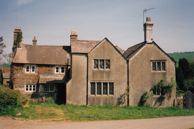
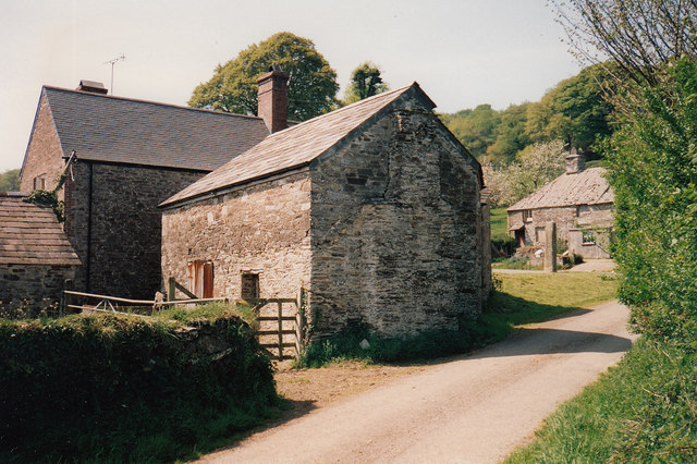
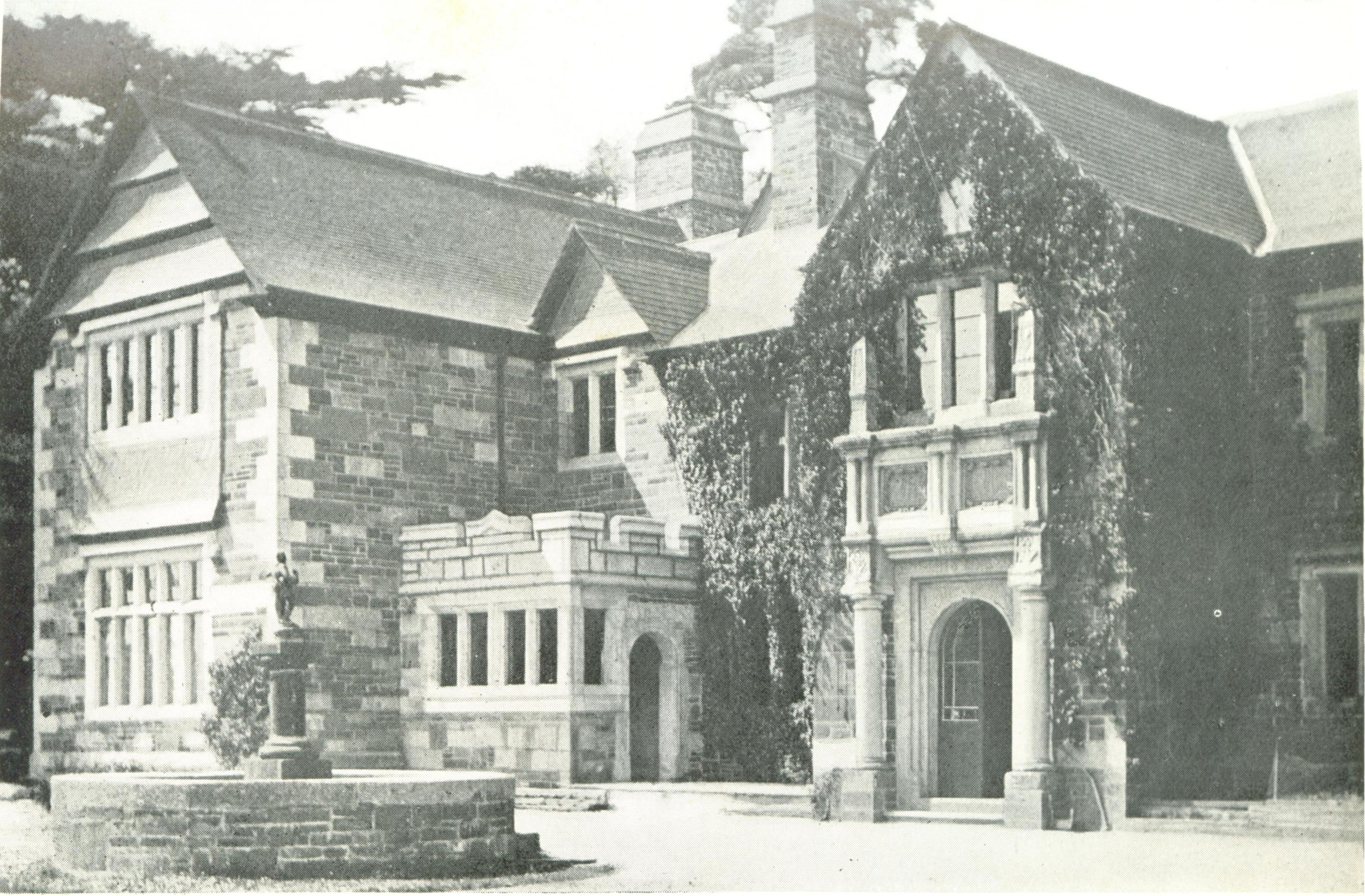
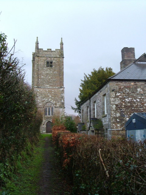
With a population of around 500 residents, Cross Roads is a close-knit community that offers a tranquil and peaceful environment. The village is characterized by its charming thatched-roof cottages, traditional stone buildings, and a quaint village green, which serves as a focal point for various community events and gatherings.

Despite its small size, Cross Roads boasts a number of amenities for its residents. The village has a primary school, providing education for local children, and a village hall that serves as a hub for social activities and events. Additionally, there is a local pub, offering a friendly atmosphere and the opportunity to enjoy traditional English fare.

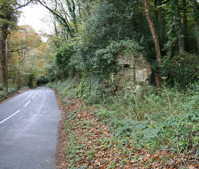
The surrounding area of Cross Roads is rich in natural beauty, making it an ideal location for outdoor enthusiasts. Numerous walking and cycling trails crisscross the countryside, providing breathtaking views and opportunities to explore the nearby moors and woodlands.

Overall, Cross Roads, Devon, offers a serene and picturesque setting, coupled with a strong sense of community. Its proximity to larger towns and cities allows residents to enjoy the tranquility of village life while still having access to urban amenities.

If you have any feedback on the listing, please let us know in the comments section below.
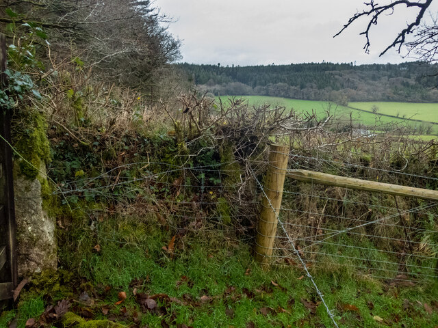
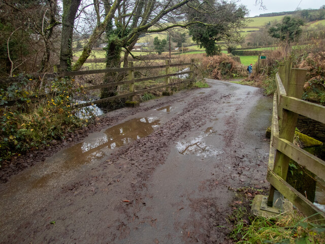
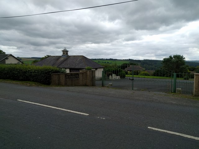
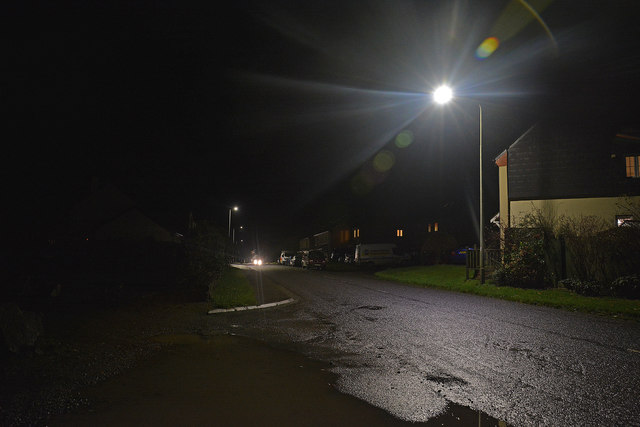
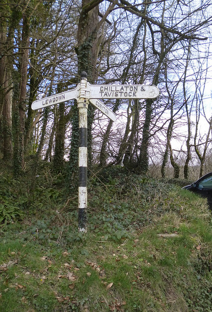
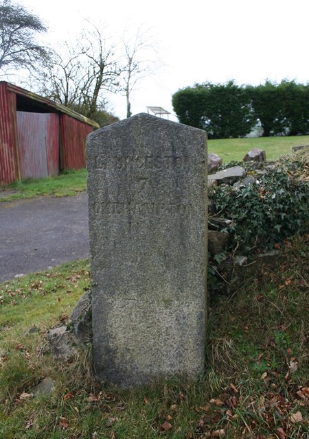
Cross Roads Images

Images are sourced within 2km of 50.653003/-4.1940227 or Grid Reference SX4586. Thanks to Geograph Open Source API. All images are credited.

Over the fields to Lew Wood The view is north over a hedge, then beyond and above Coryton Barton to Lew Wood. On the lower left of the photo, there is a benchmark on the stone gatepost just above the lower hinge. <span class="nowrap"><a title="https://www.bench-marks.org.uk/bm160299" rel="nofollow ugc noopener" href="https://www.bench-marks.org.uk/bm160299">Link</a><img style="margin-left:2px;" alt="External link" title="External link - shift click to open in new window" src="https://s1.geograph.org.uk/img/external.png" width="10" height="10"/></span>
Over the fields to Lew Wood
The view is north over a hedge, then beyond and above Coryton Barton to Lew Wood. On the lower left of the photo, there is a benchmark on the stone gatepost just above the lower hinge. LinkExternal link
Bridge over the River Lew This bridge over the River Lew is near the Dower House <a href="https://www.geograph.org.uk/photo/5723279">SX4686 : Lewtrenchard: Dower House at Lew Mill</a>. There used to be a cut benchmark on the left hand (NE) parapet, but the parapet has been replaced -- perhaps washed away in a flood sometime? <span class="nowrap"><a title="https://www.bench-marks.org.uk/bm160323" rel="nofollow ugc noopener" href="https://www.bench-marks.org.uk/bm160323">Link</a><img style="margin-left:2px;" alt="External link" title="External link - shift click to open in new window" src="https://s1.geograph.org.uk/img/external.png" width="10" height="10"/></span>
Bridge over the River Lew
This bridge over the River Lew is near the Dower House SX4686 : Lewtrenchard: Dower House at Lew Mill. There used to be a cut benchmark on the left hand (NE) parapet, but the parapet has been replaced -- perhaps washed away in a flood sometime? LinkExternal link
Overgrown Lane Middle Raddon Walking from East Raddon then passing Middle Raddon, there is a track entrance on the right. It is marked on the map, going through eventually to a minor road a little south of Lewdown. About 100m along it, there is a benchmark on a gatepost (according to the OS). We fought our way through nettles and brambles - it was December; it would have been impenetrable in summer. We found the gate, but not the gatepost. There is another benchmark further along, which has the description of being in "OVERGROWN LANE". I don't know if that is its proper name (there is nothing on the map), or if that's what the OS surveyors thought. <span class="nowrap"><a title="https://www.bench-marks.org.uk/bm160326" rel="nofollow ugc noopener" href="https://www.bench-marks.org.uk/bm160326">Link</a><img style="margin-left:2px;" alt="External link" title="External link - shift click to open in new window" src="https://s1.geograph.org.uk/img/external.png" width="10" height="10"/></span>
Overgrown Lane Middle Raddon
Walking from East Raddon then passing Middle Raddon, there is a track entrance on the right. It is marked on the map, going through eventually to a minor road a little south of Lewdown. About 100m along it, there is a benchmark on a gatepost (according to the OS). We fought our way through nettles and brambles - it was December; it would have been impenetrable in summer. We found the gate, but not the gatepost. There is another benchmark further along, which has the description of being in "OVERGROWN LANE". I don't know if that is its proper name (there is nothing on the map), or if that's what the OS surveyors thought. LinkExternal link
Lewtrenchard Manor This Jacobean manor house is now an upmarket hotel. We had an excellent afternoon tea here.
Lewtrenchard Manor
This Jacobean manor house is now an upmarket hotel. We had an excellent afternoon tea here.
Detail of carved knife showing IXL feature A curious detail, only just visible in the photo, was added to the knife blade - the letters IXL which Hems adopted for his own self-promotion (inditing his proud boast... namely:- "I excel"). The letters, with an asterisk as in I*XL, were initially a corporate mark formally registered to his mother's Wostenholm family who ran a large and very successful Sheffield firm of cutlers. <a href="https://www.geograph.org.uk/photo/3360192">SX4387 : Bench end - St. John the Baptist</a>

<span class="nowrap"><a title="www.eggintongroup.co.uk/history/the-history-of-george-wostenholm.html" rel="nofollow ugc noopener" href="http://www.eggintongroup.co.uk/history/the-history-of-george-wostenholm.html">Link</a><img style="margin-left:2px;" alt="External link" title="External link - shift click to open in new window" src="https://s1.geograph.org.uk/img/external.png" width="10" height="10"/></span>

Harry Hems as a young boy had been unsuccessfully apprenticed to his grandparent's firm of cutlers but abandoned it to take up an apprenticeship with a Sheffield woodcarver.
Detail of carved knife showing IXL feature
A curious detail, only just visible in the photo, was added to the knife blade - the letters IXL which Hems adopted for his own self-promotion (inditing his proud boast... namely:- "I excel"). The letters, with an asterisk as in I*XL, were initially a corporate mark formally registered to his mother's Wostenholm family who ran a large and very successful Sheffield firm of cutlers. SX4387 : Bench end - St. John the Baptist LinkExternal link Harry Hems as a young boy had been unsuccessfully apprenticed to his grandparent's firm of cutlers but abandoned it to take up an apprenticeship with a Sheffield woodcarver.
Entrance to Jethro's
Lewdown : The Redcliffes A road heading out from Lewdown.
Lewdown : The Redcliffes
A road heading out from Lewdown.
Lewdown : The Redcliffes A road heading into Lewdown.
Lewdown : The Redcliffes
A road heading into Lewdown.
Lewtrenchard: Dower House at Lew Mill
Lewtrenchard: Lew Mill Buildings, formerly a water mill
Lewtrenchard: Lew Mill
Buildings, formerly a water mill
Thrushelton: view towards the church
Old Direction Sign - Signpost by ruined toll house, Coryton Parish Ball finial - 3 arms; Devon compass points by the UC road, in parish of Coryton (West Devon District), Coryton Barton, by ruins of tollhouse, under trees.

Surveyed

Milestone Society National ID: DV_SX4584
Old Direction Sign - Signpost by ruined toll house, Coryton Parish
Ball finial - 3 arms; Devon compass points by the UC road, in parish of Coryton (West Devon District), Coryton Barton, by ruins of tollhouse, under trees. Surveyed Milestone Society National ID: DV_SX4584
Old Milestone by the former A30, Lewdown, Lewtrenchard Carved stone post by the UC road (was A30), in parish of LEWTRENCHARD (WEST DEVON District), Lewdown, 50m West of Victory Hall, by path, under hedge, on North side of road. Launceston gable, erected by the Launceston turnpike trust in the 18th century. 

Inscription reads:- : LAUNCESTON / 8 / OKEHAMPTON 10½ :  

Milestone Society National ID: DV_LAOK08
Old Milestone by the former A30, Lewdown, Lewtrenchard
Carved stone post by the UC road (was A30), in parish of LEWTRENCHARD (WEST DEVON District), Lewdown, 50m West of Victory Hall, by path, under hedge, on North side of road. Launceston gable, erected by the Launceston turnpike trust in the 18th century. Inscription reads:- : LAUNCESTON / 8 / OKEHAMPTON 10½ : Milestone Society National ID: DV_LAOK08
Old Milestone near Lobhill Cross, Thrushelton Carved stone post by the UC road (was A30), in parish of THRUSHELTON (WEST DEVON District), just East of Lobhill Cross, 50m up (West) from Lobhill Lodge, in hedge bank, on North side of road. Launceston gable, erected by the Launceston turnpike trust in the 19th century. 

Inscription reads:-  : LAUNCESTON / 9 / OKEHAMPTON 9½ : 

Milestone Society National ID: DV_LAOK09.
Old Milestone near Lobhill Cross, Thrushelton
Carved stone post by the UC road (was A30), in parish of THRUSHELTON (WEST DEVON District), just East of Lobhill Cross, 50m up (West) from Lobhill Lodge, in hedge bank, on North side of road. Launceston gable, erected by the Launceston turnpike trust in the 19th century. Inscription reads:- : LAUNCESTON / 9 / OKEHAMPTON 9½ : Milestone Society National ID: DV_LAOK09.
Old Milestone in Stowford Parish, West Devon Carved stone post by the UC road (was A30), in parish of STOWFORD (WEST DEVON District), Royal Exchange B&B car park, 50m West of minor road to Stowford, on grass verge by small wall, close to telegraph pole, on North side of road. Launceston gable, erected by the Launceston turnpike trust in the 18th century. 

Inscription reads:-
LAUNCESTON
7
OKEHAMPTON 11½
Carved benchmark on lower front face.

Devon & Dartmoor HER listed.
HER Number: MDV39608 <span class="nowrap"><a title="https://www.heritagegateway.org.uk/Gateway/Results_Single.aspx?uid=MDV39608&resourceID=104" rel="nofollow ugc noopener" href="https://www.heritagegateway.org.uk/Gateway/Results_Single.aspx?uid=MDV39608&resourceID=104">Link</a><img style="margin-left:2px;" alt="External link" title="External link - shift click to open in new window" src="https://s1.geograph.org.uk/img/external.png" width="10" height="10"/></span>

Milestone Society National ID: DV_LAOK07
Old Milestone in Stowford Parish, West Devon
Carved stone post by the UC road (was A30), in parish of STOWFORD (WEST DEVON District), Royal Exchange B&B car park, 50m West of minor road to Stowford, on grass verge by small wall, close to telegraph pole, on North side of road. Launceston gable, erected by the Launceston turnpike trust in the 18th century. Inscription reads:- LAUNCESTON 7 OKEHAMPTON 11½ Carved benchmark on lower front face. Devon & Dartmoor HER listed. HER Number: MDV39608 LinkExternal link Milestone Society National ID: DV_LAOK07
Old Boundary Marker by Lobhillcross, Lewtrenchard parish Parish Boundary Marker by the UC road (was A30), in parish of Lewtrenchard (West Devon District), Lobhillcross, 50m West of Lobhill lodge, on grass verge/bank above path by fence.

Devon & Dartmoor HER.
HER Number: MDV59500 <span class="nowrap"><a title="https://www.heritagegateway.org.uk/Gateway/Results_Single.aspx?uid=MDV59500&resourceID=104" rel="nofollow ugc noopener" href="https://www.heritagegateway.org.uk/Gateway/Results_Single.aspx?uid=MDV59500&resourceID=104">Link</a><img style="margin-left:2px;" alt="External link" title="External link - shift click to open in new window" src="https://s1.geograph.org.uk/img/external.png" width="10" height="10"/></span>

Carved benchmark on lower East face.

Surveyed

Milestone Society National ID: DV_LAEX07pb
Old Boundary Marker by Lobhillcross, Lewtrenchard parish
Parish Boundary Marker by the UC road (was A30), in parish of Lewtrenchard (West Devon District), Lobhillcross, 50m West of Lobhill lodge, on grass verge/bank above path by fence. Devon & Dartmoor HER. HER Number: MDV59500 LinkExternal link Carved benchmark on lower East face. Surveyed Milestone Society National ID: DV_LAEX07pb
Old Toll House west of Coryton Barton Toll House in the parish of Coryton (West Devon District), ruin of tollhouse, Coryton Barton junction, beside the River Lew.

Devon & Dartmoor HER.
HER Number: MDV112457 <span class="nowrap"><a title="https://www.heritagegateway.org.uk/Gateway/Results_Single.aspx?uid=MDV112457&resourceID=104" rel="nofollow ugc noopener" href="https://www.heritagegateway.org.uk/Gateway/Results_Single.aspx?uid=MDV112457&resourceID=104">Link</a><img style="margin-left:2px;" alt="External link" title="External link - shift click to open in new window" src="https://s1.geograph.org.uk/img/external.png" width="10" height="10"/></span>

Surveyed

Milestone Society National ID: DV.COR
Old Toll House west of Coryton Barton
Toll House in the parish of Coryton (West Devon District), ruin of tollhouse, Coryton Barton junction, beside the River Lew. Devon & Dartmoor HER. HER Number: MDV112457 LinkExternal link Surveyed Milestone Society National ID: DV.COR
A flooded quarry On the map, this looks as if it's an ornamental lake in the grounds of the hotel. Far from it. It's an old quarry (Lew Quarry), well fenced off. I tried to look up some information on the internet, but couldn't get past the adverts for the various self-catering cottages in the vicinity.
A flooded quarry
On the map, this looks as if it's an ornamental lake in the grounds of the hotel. Far from it. It's an old quarry (Lew Quarry), well fenced off. I tried to look up some information on the internet, but couldn't get past the adverts for the various self-catering cottages in the vicinity.
Show me another place!

Cross Roads is located at Grid Ref: SX4586 (Lat: 50.653003, Lng: -4.1940227)

Administrative County: Devon

District: West Devon

Police Authority: Devon and Cornwall

What 3 Words

///sprinkle.doubt.ranges. Near Lifton, Devon

Nearby Locations

Lewtrenchard Cross Roads

Related Wikis

Lewtrenchard

Lewtrenchard is a village and civil parish in the West Devon district, in the county of Devon, England. Most of the larger village of Lewdown is in the...

Thrushelton

Thrushelton or Thruselton is a village and civil parish about 2 and a half miles north of Coryton railway station, in the West Devon district, in the county...

Stowford

Stowford is a village and civil parish in the district of West Devon in the English county of Devon. It is situated to the west of Dartmoor. Stowford is...

Coryton, Devon

Coryton is a hamlet and civil parish in the West Devon district of Devon, England, to the north west of Tavistock. Coryton is in the valley of the River...

Nearby Amenities

Located within 500m of 50.653003,-4.1940227
Give Way
Lat/Long: 50.6556396/-4.1905575
Generator Method: photovoltaic
Generator Output Electricity: yes
Generator Source: solar
Generator Type: solar_photovoltaic_panel
Location: roof
Power: generator
Lat/Long: 50.653695/-4.1935238
Generator Method: photovoltaic
Generator Output Electricity: yes
Generator Source: solar
Generator Type: solar_photovoltaic_panel
Location: roof
Power: generator
Lat/Long: 50.6486373/-4.1929914
Generator Method: photovoltaic
Generator Output Electricity: yes
Generator Source: solar
Generator Type: solar_photovoltaic_panel
Location: roof
Power: generator
Lat/Long: 50.6486195/-4.1931487
Generator Method: photovoltaic
Generator Output Electricity: yes
Generator Source: solar
Generator Type: solar_photovoltaic_panel
Location: roof
Power: generator
Lat/Long: 50.6487181/-4.193894
Addr City: Lewtrenchard
Addr Housename: Hightrees
Lat/Long: 50.656694/-4.1940376
Addr City: Lewtrenchard
Addr Housenumber: 2
Lat/Long: 50.6558862/-4.1906673
Addr City: Lewtrenchard
Addr Housename: Wyefield
Lat/Long: 50.6558403/-4.1901708
Addr City: Lewtrenchard
Addr Housenumber: 1
Lat/Long: 50.6558454/-4.1907808
The data included in this document is from www.openstreetmap.org. The data is made available under ODbL.

Have you been to Cross Roads?

Leave your review of Cross Roads below (or comments, questions and feedback).