Near Barley Croft Wood

Wood, Forest in Yorkshire Craven

England

Near Barley Croft Wood

Old Boundary Marker on Elslack Lane Parish Boundary Marker set in a dry stone wall on the east side of Elslack Lane, 40 metres south of Elslack Bridge. Inscribed THORNTON / B and ELSLACK / B on opposite faces. On the former boundary of Elslack and Thornton in Craven parishes, but now entirely in Elslack parish. Grade II Listed details <span class="nowrap"><a title="https://historicengland.org.uk/listing/the-list/list-entry/1316762" rel="nofollow ugc noopener" href="https://historicengland.org.uk/listing/the-list/list-entry/1316762">Link</a><img style="margin-left:2px;" alt="External link" title="External link - shift click to open in new window" src="https://s1.geograph.org.uk/img/external.png" width="10" height="10"/></span>.

Milestone Society National ID: YW_THCELS01pb
Old Boundary Marker on Elslack Lane Credit: M Hatton

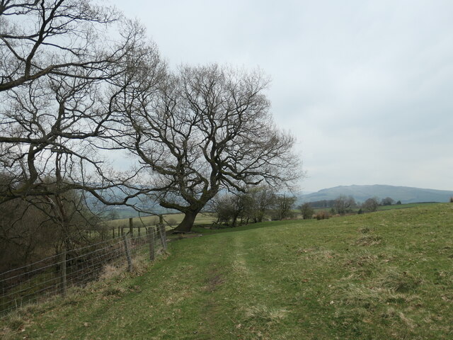
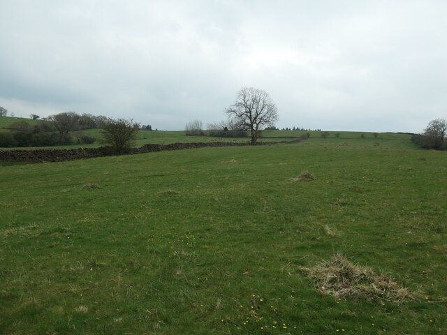
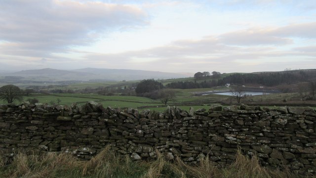
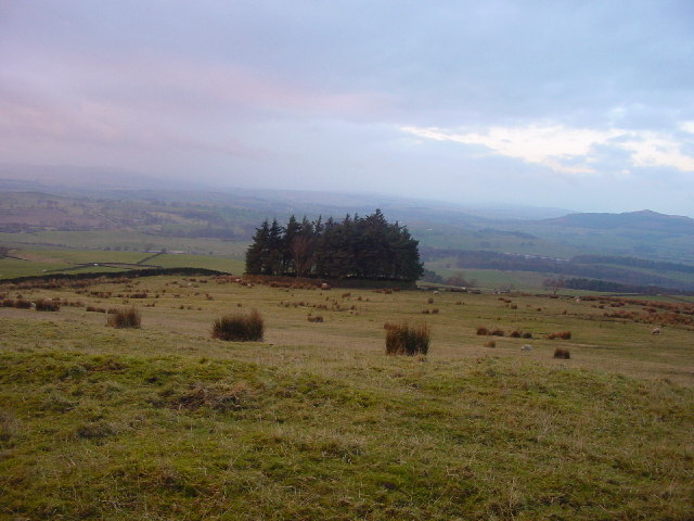
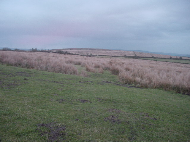
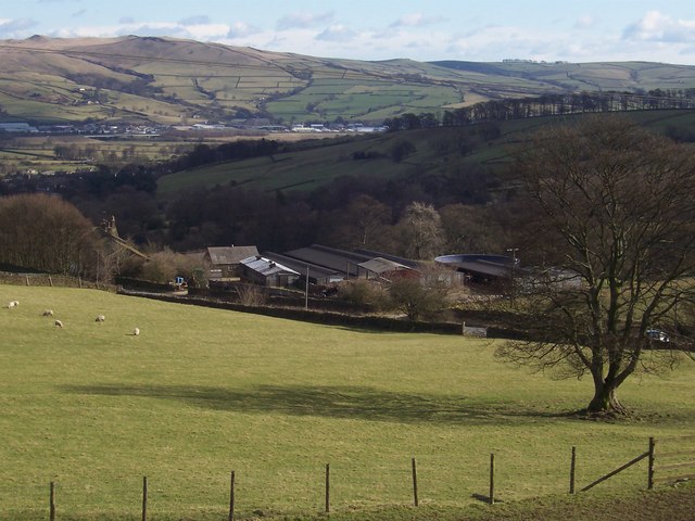
Near Barley Croft Wood is a picturesque woodland located in Yorkshire, England. Covering an area of approximately 60 acres, it is a haven for nature enthusiasts and those seeking a tranquil escape from the hustle and bustle of everyday life.

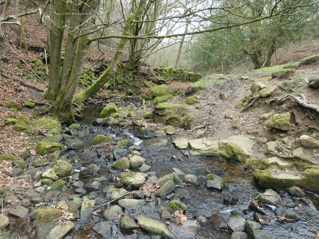
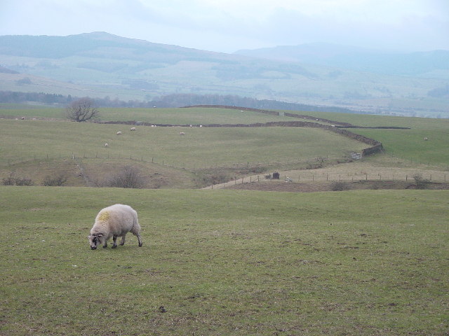
The wood is primarily made up of native broadleaf trees, including oak, beech, and ash, creating a diverse and vibrant ecosystem. The dense canopy of trees provides ample shade, making it an ideal spot for walking and exploring on a hot summer day.

Within the wood, there is an abundance of wildlife, with various species of birds, mammals, and insects calling it home. Birdwatchers can expect to spot woodpeckers, owls, and thrushes, among others. Squirrels and rabbits are commonly seen scurrying around, while if lucky, visitors might even catch a glimpse of a deer or fox.

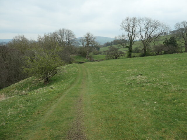
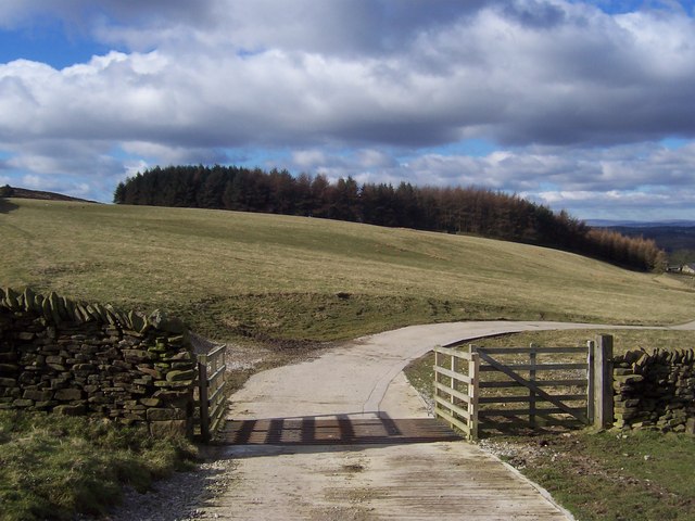
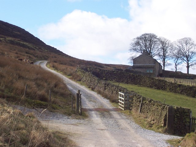
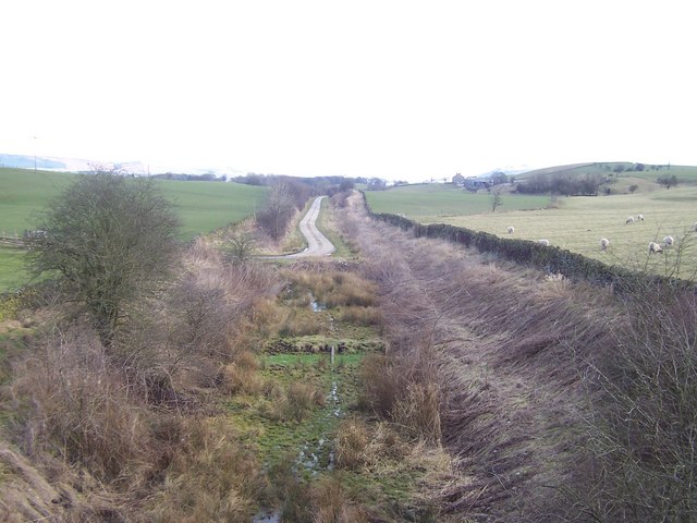
The wood is crisscrossed by a network of well-maintained footpaths, allowing visitors to easily navigate and appreciate the natural beauty that surrounds them. These paths lead to a small pond nestled within the wood, offering a peaceful spot to sit and observe the local flora and fauna.

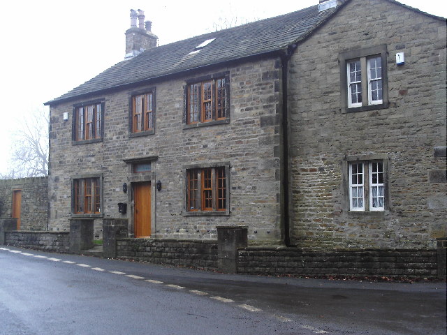
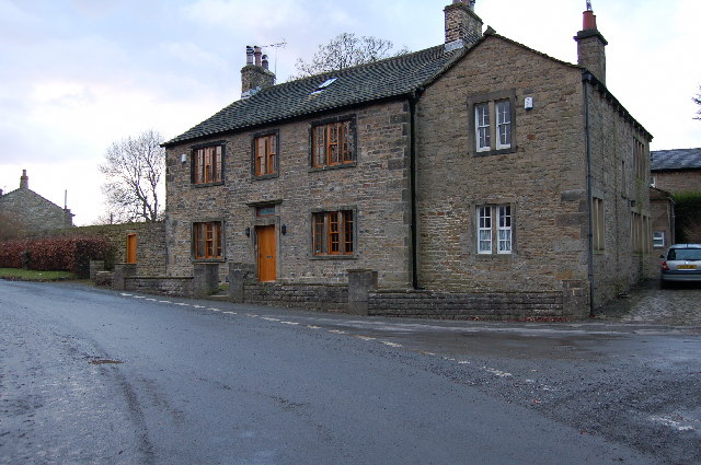
Near Barley Croft Wood is a popular destination for both locals and tourists alike, providing a serene and enchanting environment for relaxation and enjoyment of the great outdoors. Whether one is a nature lover, a keen photographer, or simply seeking solace in nature, this woodland offers a serene and rejuvenating experience for all who visit.

If you have any feedback on the listing, please let us know in the comments section below.

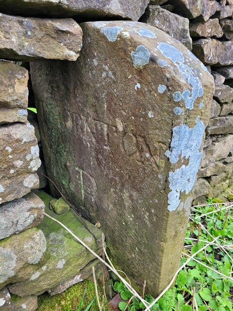
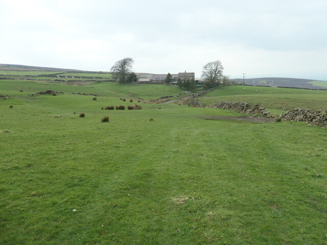
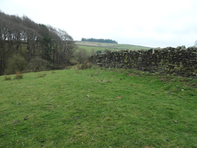
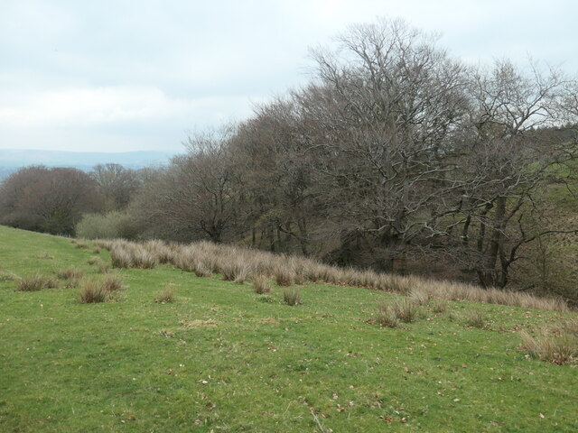
Near Barley Croft Wood Images

Images are sourced within 2km of 53.942949/-2.0827321 or Grid Reference SD9449. Thanks to Geograph Open Source API. All images are credited.

Old Boundary Marker on Elslack Lane Parish Boundary Marker set in a dry stone wall on the east side of Elslack Lane, 40 metres south of Elslack Bridge. Inscribed THORNTON / B and ELSLACK / B on opposite faces. On the former boundary of Elslack and Thornton in Craven parishes, but now entirely in Elslack parish. Grade II Listed details <span class="nowrap"><a title="https://historicengland.org.uk/listing/the-list/list-entry/1316762" rel="nofollow ugc noopener" href="https://historicengland.org.uk/listing/the-list/list-entry/1316762">Link</a><img style="margin-left:2px;" alt="External link" title="External link - shift click to open in new window" src="https://s1.geograph.org.uk/img/external.png" width="10" height="10"/></span>.

Milestone Society National ID: YW_THCELS01pb
Old Boundary Marker on Elslack Lane
Parish Boundary Marker set in a dry stone wall on the east side of Elslack Lane, 40 metres south of Elslack Bridge. Inscribed THORNTON / B and ELSLACK / B on opposite faces. On the former boundary of Elslack and Thornton in Craven parishes, but now entirely in Elslack parish. Grade II Listed details LinkExternal link. Milestone Society National ID: YW_THCELS01pb
The upper valley of Catlow Gill Looking north-west towards Gawthorpe House.
The upper valley of Catlow Gill
Looking north-west towards Gawthorpe House.
Step stile in a drystone wall On the public footpath Between Gawthorpe House and Carleton-in-Craven. it was easier to use the nearby gateway.
Step stile in a drystone wall
On the public footpath Between Gawthorpe House and Carleton-in-Craven. it was easier to use the nearby gateway.
The steep wooded valley of Catlow Gill A narrow groove in the farmland.
The steep wooded valley of Catlow Gill
A narrow groove in the farmland.
Public footpath crossing Catlow Gill Described in guides and on maps as stepping stones.
Public footpath crossing Catlow Gill
Described in guides and on maps as stepping stones.
Trees above Catlow Gill Alongside the public footpath to Carleton-in-Craven.
Trees above Catlow Gill
Alongside the public footpath to Carleton-in-Craven.
Farmland south and east of Catlow Gill The field rises from 155  to 185 metres above sea level.
Farmland south and east of Catlow Gill
The field rises from 155 to 185 metres above sea level.
Public footpath on the south side of Catlow Gill Heading east to Carleton-in-Craven.
Public footpath on the south side of Catlow Gill
Heading east to Carleton-in-Craven.
Elslack reservoir View of Elslack reservoir taken from adjacent public road
Elslack reservoir
View of Elslack reservoir taken from adjacent public road
Elslack The Grange, a large house in the middle of the village.
Elslack
The Grange, a large house in the middle of the village.
Grazing at Mitton House
Copse Near Mitton House This tiny, round copse is only just visible on the 1:25000 OS map.
Copse Near Mitton House
This tiny, round copse is only just visible on the 1:25000 OS map.
Rough Pasture Poor, wet soils and windswept fellside here do not support many sheep.
Rough Pasture
Poor, wet soils and windswept fellside here do not support many sheep.
The Grange Elslack
The Grange Elslack
Disused Railway, nr. Elslack This looks east along the line of the former railway between Colne and Skipton
Disused Railway, nr. Elslack
This looks east along the line of the former railway between Colne and Skipton
Yellison Wood Tract of woodland above Carleton in Craven - about a mile to the west
Yellison Wood
Tract of woodland above Carleton in Craven - about a mile to the west
Higher Scarcliff Track leading up to remote dwelling on the edge of Elslack Moor.
Higher Scarcliff
Track leading up to remote dwelling on the edge of Elslack Moor.
Glen Farm This shows the farm with Carlow Gill behind on its descent to the Aire Valley in the distance
Glen Farm
This shows the farm with Carlow Gill behind on its descent to the Aire Valley in the distance
Show me another place!

Near Barley Croft Wood is located at Grid Ref: SD9449 (Lat: 53.942949, Lng: -2.0827321)

Division: West Riding

Administrative County: North Yorkshire

District: Craven

Police Authority: North Yorkshire

What 3 Words

///disputes.lecturing.plug. Near Skipton, North Yorkshire

Related Wikis

Fresh Radio

Fresh Radio was an Independent Local Radio station broadcasting to the Yorkshire Dales in northern England on two medium wave (AM) frequencies and three...

Broughton, Craven

Broughton is a village and civil parish in the Craven district of North Yorkshire, England. The village is on the A59 road approximately 3 miles (5 km...

Elslack railway station

Elslack railway station once served the small village of Elslack in North Yorkshire, England. The station was built by the Leeds and Bradford Extension...

Moor Music Festival

The Moor Music Festival was an annual music festival held initially on a farm in Addingham Moorside, near the town of Ilkley, West Yorkshire. For the 2009...

Elslack

Elslack is a village and civil parish in the Craven district of North Yorkshire, England, close to the border with Lancashire and 4 miles west of Skipton...

Carleton-in-Craven

Carleton-in-Craven is a small village and civil parish in the Craven district of North Yorkshire, England, and situated just over 1.5 miles (2.4 km) south...

Stirton with Thorlby

Stirton with Thorlby is a civil parish in the Craven district of North Yorkshire, England. The parish includes the settlements of Stirton and Thorlby....

Staincliffe Wapentake

Staincliffe, also known as Staincliff, was a wapentake of the West Riding of Yorkshire, England. The wapentake was named from a place called Staincliffe...

Nearby Amenities

Located within 500m of 53.942949,-2.0827321
Barrier: cattle_grid
Lat/Long: 53.9428796/-2.0776675
Land Rover Experience
Description: Yellison Farm Barns
Lat/Long: 53.9428142/-2.0783195
Barrier: stile
Material: stone
Stile: stepover
Lat/Long: 53.9395706/-2.08264
Barrier: stile
Material: stone
Step Count: 6
Stile: stepover
Lat/Long: 53.9393634/-2.0849779
Ford: yes
Lat/Long: 53.9458195/-2.0805721
Ford: yes
Lat/Long: 53.9455417/-2.0806861
Barrier: stile
Material: wood
Step Count: 1
Stile: stepover
Lat/Long: 53.945692/-2.0811186
Note: no bridge over stream here
Lat/Long: 53.9457204/-2.0811407
The data included in this document is from www.openstreetmap.org. The data is made available under ODbL.

Have you been to Near Barley Croft Wood?

Leave your review of Near Barley Croft Wood below (or comments, questions and feedback).