Cally Hill Plantation

Wood, Forest in Gloucestershire Cotswold

England

Cally Hill Plantation

Watercombe Farm
Watercombe Farm Credit: P Gaskell

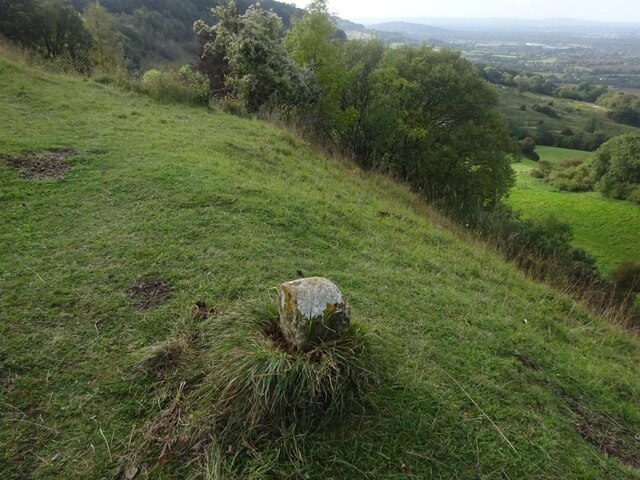
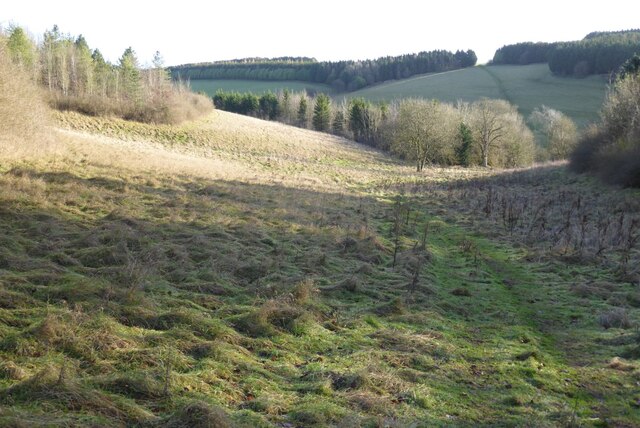
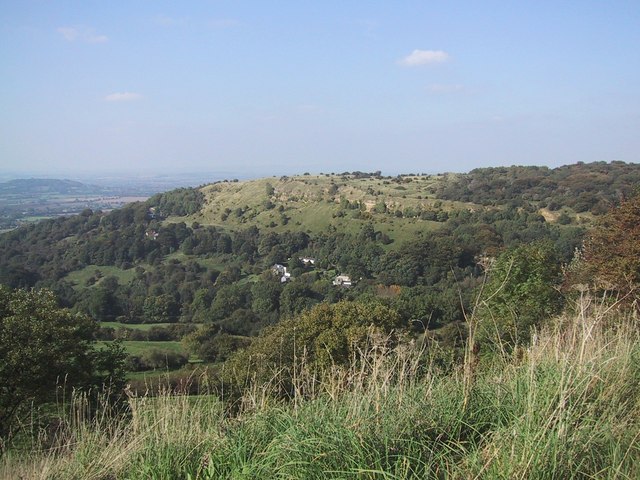
Cally Hill Plantation is a picturesque woodland located in Gloucestershire, England. Spread across a sprawling area, this plantation is renowned for its beautiful woodlands and vibrant flora. It is situated near the village of Cally Hill, adding to the rural charm of the surroundings.

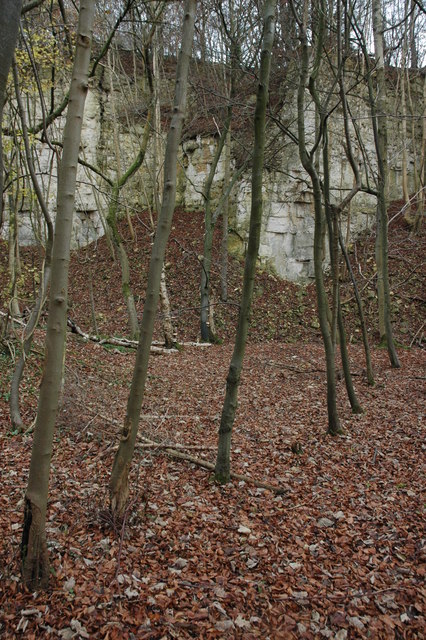
The woodlands at Cally Hill Plantation are predominantly composed of a variety of trees, including oak, beech, and ash. These trees form dense canopies that provide shade and shelter to numerous plant and animal species. The plantation is also home to an array of wildflowers, ferns, and mosses, adding color and beauty to the landscape.

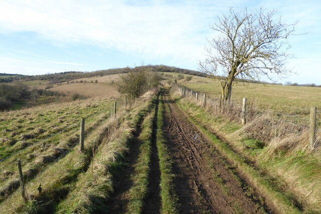
The forest is crisscrossed by a network of well-maintained walking trails, offering visitors the opportunity to explore its natural wonders. These trails vary in length and difficulty, catering to both casual strollers and avid hikers. The plantation is a popular destination for nature enthusiasts, offering a peaceful and tranquil environment away from the hustle and bustle of city life.

Cally Hill Plantation is not only known for its natural beauty but also its rich biodiversity. It provides a habitat for numerous species of birds, mammals, and insects. Birdwatchers can spot a wide range of avian species, including woodpeckers, owls, and various songbirds.

Overall, Cally Hill Plantation in Gloucestershire is a haven for nature lovers, offering a serene escape into the wonders of the woodland. Its diverse flora and fauna, coupled with its well-maintained trails, make it an ideal destination for outdoor activities and exploration.

If you have any feedback on the listing, please let us know in the comments section below.

Cally Hill Plantation Images

Images are sourced within 2km of 51.834816/-2.0797296 or Grid Reference SO9415. Thanks to Geograph Open Source API. All images are credited.

Watercombe Farm
Watercombe Farm
Boundary Stone, Barrow Wake, Birdlip The boundary between Cowley Parish to the SE (including Birdlip) and Badgeworth (NE) runs along the lip of a very steep escarpment. The inscription would have been C M 1857 like others along the same ridge. See <a title="https://www.geograph.org.uk/discuss/index.php?&action=vthread&forum=11&topic=32582" href="https://www.geograph.org.uk/discuss/index.php?&action=vthread&forum=11&topic=32582">Link</a>

Inscription: ?85?

Milestone Society National ID: GL_BADCOW03pb
Boundary Stone, Barrow Wake, Birdlip
The boundary between Cowley Parish to the SE (including Birdlip) and Badgeworth (NE) runs along the lip of a very steep escarpment. The inscription would have been C M 1857 like others along the same ridge. See Link Inscription: ?85? Milestone Society National ID: GL_BADCOW03pb
Manx Loaghtan sheep Manx Loaghtan sheep in a field at Coberley.
Manx Loaghtan sheep
Manx Loaghtan sheep in a field at Coberley.
Manx Loaghtan sheep Manx Loaghtan sheep in a field at Coberley.
Manx Loaghtan sheep
Manx Loaghtan sheep in a field at Coberley.
Manx Loaghtan sheep Manx Loaghtan sheep in a field at Coberley.
Manx Loaghtan sheep
Manx Loaghtan sheep in a field at Coberley.
Minor country road No through road to Birdlip Radio Station.
Minor country road
No through road to Birdlip Radio Station.
Beech trees Beech trees near Birdlip Radio Station.
Beech trees
Beech trees near Birdlip Radio Station.
The Gloucestershire Way The Gloucestershire Way from a track approaching Rushwood Kennels.
The Gloucestershire Way
The Gloucestershire Way from a track approaching Rushwood Kennels.
The Gloucestershire Way The Gloucestershire Way crossing a field between forestry and entering the valley above Coberley known as Coldwell Bottom.
The Gloucestershire Way
The Gloucestershire Way crossing a field between forestry and entering the valley above Coberley known as Coldwell Bottom.
Coldwell Bottom The Gloucestershire Way long distance footpath follows this path above the valley on the right which is called Coldwell Bottom.
Coldwell Bottom
The Gloucestershire Way long distance footpath follows this path above the valley on the right which is called Coldwell Bottom.
Path and gate above Coldwell Bottom The Gloucestershire Way follows this right of way above Coldwell Bottom.
Path and gate above Coldwell Bottom
The Gloucestershire Way follows this right of way above Coldwell Bottom.
Coldwell Bottom View across Coldwell Bottom to the Churn valley beyond, from the Gloucestershire Way.
Coldwell Bottom
View across Coldwell Bottom to the Churn valley beyond, from the Gloucestershire Way.
Gloucestershire Way Gloucestershire Way with Coldwell Bottom below on the left.
Gloucestershire Way
Gloucestershire Way with Coldwell Bottom below on the left.
A junction of paths The right of way on the left passing through the gate is the route of the Gloucestershire Way, alternatively there is a right of way on the right which eventually rejoins the Gloucestershire Way.
A junction of paths
The right of way on the left passing through the gate is the route of the Gloucestershire Way, alternatively there is a right of way on the right which eventually rejoins the Gloucestershire Way.
A junction of rights of way Continuing along this right of way passes Cuckoopen Barn Farm.  The path on the left, out of view is the route of the Gloucestershire Way.  This is almost exactly the same view as when I was last here almost fourteen years ago to the day <a href="https://www.geograph.org.uk/photo/653006">SO9515 : Footpath junction near Coberley</a>.
A junction of rights of way
Continuing along this right of way passes Cuckoopen Barn Farm. The path on the left, out of view is the route of the Gloucestershire Way. This is almost exactly the same view as when I was last here almost fourteen years ago to the day SO9515 : Footpath junction near Coberley.
The Gloucestershire Way The Gloucestershire Way to the west of Coberley and above Coldwell Bottom which is out of view on the left.
The Gloucestershire Way
The Gloucestershire Way to the west of Coberley and above Coldwell Bottom which is out of view on the left.
Dowman's Farm Dowman's Farm in the village of Coberley.
Dowman's Farm
Dowman's Farm in the village of Coberley.
Footpath approaching Dowman's Farm Footpath crossing field approaching Dowman's Farm at Coberley.
Footpath approaching Dowman's Farm
Footpath crossing field approaching Dowman's Farm at Coberley.
Show me another place!

Cally Hill Plantation is located at Grid Ref: SO9415 (Lat: 51.834816, Lng: -2.0797296)

Administrative County: Gloucestershire

District: Cotswold

Police Authority: Gloucestershire

What 3 Words

///immediate.sand.pots. Near Shurdington, Gloucestershire

Related Wikis

Nearby Amenities

Located within 500m of 51.834816,-2.0797296
Natural: spring
Source: OS OpenData StreetView
Lat/Long: 51.8337112/-2.0790147
Animal Boarding
Rushwood Kennels
Lat/Long: 51.8366589/-2.0845545
Rushwood Kennels
Power: pole
Transformer: distribution
Voltage Primary: 11000
Lat/Long: 51.8364682/-2.0847691
Power: pole
Lat/Long: 51.8363767/-2.0842856
Power: pole
Lat/Long: 51.8362886/-2.0838186
Power: pole
Lat/Long: 51.83616/-2.0831403
Shab Hill Plantation
Power: pole
Transformer: distribution
Voltage Primary: 11000
Lat/Long: 51.8360282/-2.0824587
Power: pole
Lat/Long: 51.8359085/-2.0818428
Power: pole
Lat/Long: 51.8353433/-2.0818572
Power: pole
Lat/Long: 51.8347263/-2.0819125
Power: pole
Lat/Long: 51.8340894/-2.0818773
Power: pole
Lat/Long: 51.8331886/-2.0819005
Power: pole
Lat/Long: 51.8322422/-2.0819233
Power: pole
Lat/Long: 51.8315738/-2.081944
Power: pole
Lat/Long: 51.8309184/-2.0819611
The data included in this document is from www.openstreetmap.org. The data is made available under ODbL.

Have you been to Cally Hill Plantation?

Leave your review of Cally Hill Plantation below (or comments, questions and feedback).