Sherwood Moor

Wood, Forest in Wiltshire

England

Sherwood Moor

Old Milestone by the A4, London Road, Bremhill parish Stone post (plate lost) by the A4, in parish of Bremhill (North Wiltshire District), London Road, 80m West of Lysley Arms PH, under hedge, on North side of road. Bath limestone with iron plate, erected by the Calne turnpike trust in the 19th century. 

Inscription once read:-
(To
(Bath)
(15)

Grade II listed. 
List Entry Number: 1261289 <span class="nowrap"><a title="https://historicengland.org.uk/listing/the-list/list-entry/1261289" rel="nofollow ugc noopener" href="https://historicengland.org.uk/listing/the-list/list-entry/1261289">Link</a><img style="margin-left:2px;" alt="External link" title="External link - shift click to open in new window" src="https://s1.geograph.org.uk/img/external.png" width="10" height="10"/></span>

Milestone Society National ID: WI_LB_BACN15
Old Milestone by the A4, London Road, Bremhill parish Credit: Abigail Newton

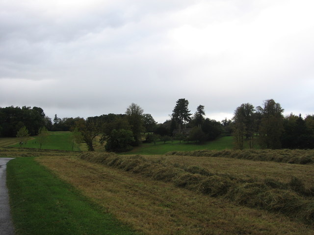
Sherwood Moor is a picturesque woodland located in the county of Wiltshire, England. Situated in the southern part of the county, this ancient forest covers an area of approximately 500 acres. The Moor is characterized by its dense and diverse vegetation, including a variety of tree species such as oak, beech, and birch, creating a rich and vibrant woodland ecosystem.

The forest is known for its tranquil and peaceful atmosphere, making it a popular destination for nature lovers, hikers, and wildlife enthusiasts. Its well-maintained network of walking trails offers visitors the opportunity to explore the forest's natural beauty, while also providing access to stunning viewpoints that overlook the surrounding countryside.

Sherwood Moor is home to a wide range of wildlife, including deer, squirrels, and a variety of bird species. The forest's diverse habitat provides ample opportunities for birdwatching, with sightings of woodpeckers, owls, and various songbirds being common.

In addition to its natural beauty, Sherwood Moor also has historical significance. The forest has been in existence for centuries and has witnessed various events throughout history. The remnants of ancient forts and burial mounds can still be found within its boundaries, offering visitors a glimpse into the area's rich cultural heritage.

Overall, Sherwood Moor in Wiltshire is a captivating woodland that combines natural beauty, tranquility, and historical significance. Whether it's exploring the forest's trails, observing wildlife, or immersing oneself in its peaceful ambiance, Sherwood Moor offers a rewarding experience for all who visit.

If you have any feedback on the listing, please let us know in the comments section below.

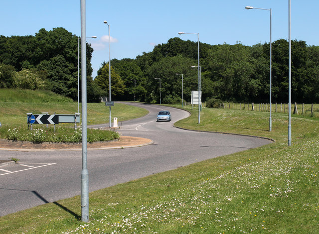
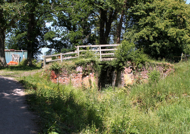
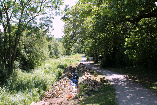
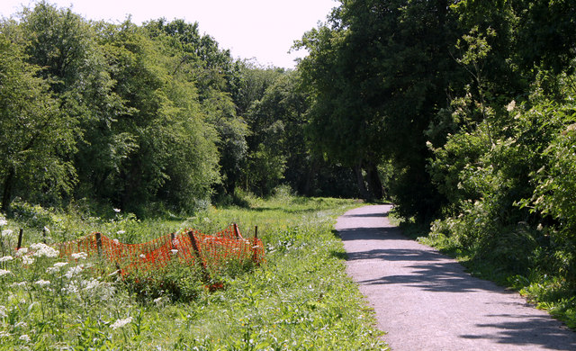
Sherwood Moor Images

Images are sourced within 2km of 51.428336/-2.0837788 or Grid Reference ST9469. Thanks to Geograph Open Source API. All images are credited.
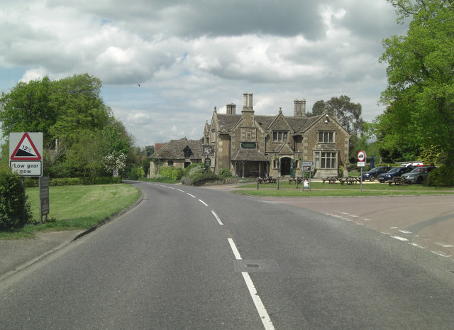
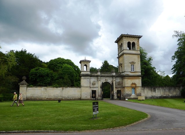
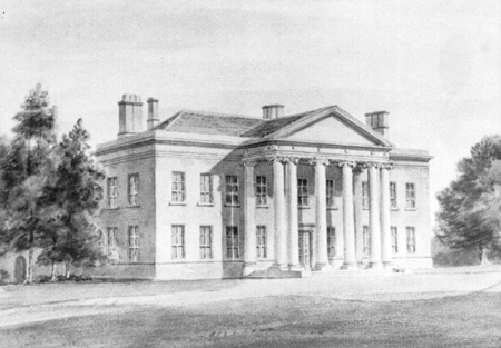
Old Milestone by the A4, London Road, Bremhill parish Stone post (plate lost) by the A4, in parish of Bremhill (North Wiltshire District), London Road, 80m West of Lysley Arms PH, under hedge, on North side of road. Bath limestone with iron plate, erected by the Calne turnpike trust in the 19th century. 

Inscription once read:-
(To
(Bath)
(15)

Grade II listed. 
List Entry Number: 1261289 <span class="nowrap"><a title="https://historicengland.org.uk/listing/the-list/list-entry/1261289" rel="nofollow ugc noopener" href="https://historicengland.org.uk/listing/the-list/list-entry/1261289">Link</a><img style="margin-left:2px;" alt="External link" title="External link - shift click to open in new window" src="https://s1.geograph.org.uk/img/external.png" width="10" height="10"/></span>

Milestone Society National ID: WI_LB_BACN15
Old Milestone by the A4, London Road, Bremhill parish
Stone post (plate lost) by the A4, in parish of Bremhill (North Wiltshire District), London Road, 80m West of Lysley Arms PH, under hedge, on North side of road. Bath limestone with iron plate, erected by the Calne turnpike trust in the 19th century. Inscription once read:- (To (Bath) (15) Grade II listed. List Entry Number: 1261289 LinkExternal link Milestone Society National ID: WI_LB_BACN15
Bowood House, Wiltshire The entrance to Bowood in Derry Hill, Calne, Wiltshire.
Bowood House, Wiltshire
The entrance to Bowood in Derry Hill, Calne, Wiltshire.
Bowood House and gardens [41] Looking across the golf course to the clubrooms and hotel. Seen from the footpath.
Bowood is a Georgian country house of circa 1754 with interiors by Robert Adam and a garden designed by Lancelot 'Capability' Brown. The existing house is only a small part of the original building which was mostly derelict after use by the RAF and as a school and it was demolished in 1956. Bowood is the home of the Marquis of Lansdowne and it has been open to the public since 1975. The house is listed, grade I, with much detail at: <span class="nowrap"><a title="https://historicengland.org.uk/listing/the-list/list-entry/1253268" rel="nofollow ugc noopener" href="https://historicengland.org.uk/listing/the-list/list-entry/1253268">Link</a><img style="margin-left:2px;" alt="External link" title="External link - shift click to open in new window" src="https://s1.geograph.org.uk/img/external.png" width="10" height="10"/></span> The garden, amounting to some 550 hectares, is on the Register of Historic Parks and Gardens, grade I, with much history and detail at: <span class="nowrap"><a title="https://historicengland.org.uk/listing/the-list/list-entry/1000336" rel="nofollow ugc noopener" href="https://historicengland.org.uk/listing/the-list/list-entry/1000336">Link</a><img style="margin-left:2px;" alt="External link" title="External link - shift click to open in new window" src="https://s1.geograph.org.uk/img/external.png" width="10" height="10"/></span>
Bowood House and gardens [41]
Looking across the golf course to the clubrooms and hotel. Seen from the footpath. Bowood is a Georgian country house of circa 1754 with interiors by Robert Adam and a garden designed by Lancelot 'Capability' Brown. The existing house is only a small part of the original building which was mostly derelict after use by the RAF and as a school and it was demolished in 1956. Bowood is the home of the Marquis of Lansdowne and it has been open to the public since 1975. The house is listed, grade I, with much detail at: LinkExternal link The garden, amounting to some 550 hectares, is on the Register of Historic Parks and Gardens, grade I, with much history and detail at: LinkExternal link
Bowood House and gardens [42] A closer look at the clubhouse, seen from the footpath.
Bowood is a Georgian country house of circa 1754 with interiors by Robert Adam and a garden designed by Lancelot 'Capability' Brown. The existing house is only a small part of the original building which was mostly derelict after use by the RAF and as a school and it was demolished in 1956. Bowood is the home of the Marquis of Lansdowne and it has been open to the public since 1975. The house is listed, grade I, with much detail at: <span class="nowrap"><a title="https://historicengland.org.uk/listing/the-list/list-entry/1253268" rel="nofollow ugc noopener" href="https://historicengland.org.uk/listing/the-list/list-entry/1253268">Link</a><img style="margin-left:2px;" alt="External link" title="External link - shift click to open in new window" src="https://s1.geograph.org.uk/img/external.png" width="10" height="10"/></span> The garden, amounting to some 550 hectares, is on the Register of Historic Parks and Gardens, grade I, with much history and detail at: <span class="nowrap"><a title="https://historicengland.org.uk/listing/the-list/list-entry/1000336" rel="nofollow ugc noopener" href="https://historicengland.org.uk/listing/the-list/list-entry/1000336">Link</a><img style="margin-left:2px;" alt="External link" title="External link - shift click to open in new window" src="https://s1.geograph.org.uk/img/external.png" width="10" height="10"/></span>
Bowood House and gardens [42]
A closer look at the clubhouse, seen from the footpath. Bowood is a Georgian country house of circa 1754 with interiors by Robert Adam and a garden designed by Lancelot 'Capability' Brown. The existing house is only a small part of the original building which was mostly derelict after use by the RAF and as a school and it was demolished in 1956. Bowood is the home of the Marquis of Lansdowne and it has been open to the public since 1975. The house is listed, grade I, with much detail at: LinkExternal link The garden, amounting to some 550 hectares, is on the Register of Historic Parks and Gardens, grade I, with much history and detail at: LinkExternal link
Wilts & Berks Canal near Pewsham Re-watered section of the Wilts & Berks canal between Pewsham and Reybridge. Completed with funding through Viridor and others.
Wilts & Berks Canal near Pewsham
Re-watered section of the Wilts & Berks canal between Pewsham and Reybridge. Completed with funding through Viridor and others.
2011 : Entrance to Lackham College of Agriculture <a href="https://www.geograph.org.uk/photo/206400">ST9270 : Lackham House</a> was taken from a similar viewpoint in 2006.
2011 : Entrance to Lackham College of Agriculture
ST9270 : Lackham House was taken from a similar viewpoint in 2006.
2011 : Restoration progress at Pewsham Locks Restoration of the Wilts & Berks Canal is being undertaken by the Wilts & Berks Canal Trust for more information see <span class="nowrap"><a title="http://www.wbct.org.uk/" rel="nofollow ugc noopener" href="http://www.wbct.org.uk/">Link</a><img style="margin-left:2px;" alt="External link" title="External link - shift click to open in new window" src="https://s1.geograph.org.uk/img/external.png" width="10" height="10"/></span>
2011 : Restoration progress at Pewsham Locks
Restoration of the Wilts & Berks Canal is being undertaken by the Wilts & Berks Canal Trust for more information see LinkExternal link
2011 : A4 roundabout at the end of King Henry Drive Calne is away to the left.
Not a pretty sight but it is there.
2011 : A4 roundabout at the end of King Henry Drive
Calne is away to the left. Not a pretty sight but it is there.
2011 : A4 King's Roundabout and Pewsham Way Heading toward Calne.
The roundabout is at the end of King Henry Drive.
2011 : A4 King's Roundabout and Pewsham Way
Heading toward Calne. The roundabout is at the end of King Henry Drive.
2011 : Top Lock, Pewsham Locks Three locks here in process of restoration by <span class="nowrap"><a title="http://www.wbct.org.uk/" rel="nofollow ugc noopener" href="http://www.wbct.org.uk/">Link</a><img style="margin-left:2px;" alt="External link" title="External link - shift click to open in new window" src="https://s1.geograph.org.uk/img/external.png" width="10" height="10"/></span> a closer look at the lock chamber in <a href="https://www.geograph.org.uk/photo/1252459">ST9371 : Upper Lock at Pewsham Locks</a>.
2011 : Top Lock, Pewsham Locks
Three locks here in process of restoration by LinkExternal link a closer look at the lock chamber in ST9371 : Upper Lock at Pewsham Locks.
2011 : The restoration situation below Pewsham Locks Restoration work carried out by the Wilts & Berks Canal Trust.
2011 : The restoration situation below Pewsham Locks
Restoration work carried out by the Wilts & Berks Canal Trust.
2011 : Job to be done, Wilts & Berks canal South of Pewsham locks.
<span class="nowrap"><a title="http://www.wbct.org.uk/" rel="nofollow ugc noopener" href="http://www.wbct.org.uk/">Link</a><img style="margin-left:2px;" alt="External link" title="External link - shift click to open in new window" src="https://s1.geograph.org.uk/img/external.png" width="10" height="10"/></span> are working on it.
2011 : Job to be done, Wilts & Berks canal
South of Pewsham locks. LinkExternal link are working on it.
Queenwood Queenwood, located on the edge of Bowood's golf course, can be rented for short stays. <span class="nowrap"><a title="https://www.bowood.org/bowood-hotel-resort/queenwood/" rel="nofollow ugc noopener" href="https://www.bowood.org/bowood-hotel-resort/queenwood/">Link</a><img style="margin-left:2px;" alt="External link" title="External link - shift click to open in new window" src="https://s1.geograph.org.uk/img/external.png" width="10" height="10"/></span>
Queenwood
Queenwood, located on the edge of Bowood's golf course, can be rented for short stays. LinkExternal link
Lansdown Arms
Lansdown Arms
Approaching King's Roundabout and King Henry Drive, Chippenham  Viewed along the A4 Pewsham Way.
Approaching King's Roundabout and King Henry Drive, Chippenham
Viewed along the A4 Pewsham Way.
Monks Way houses, Chippenham Viewed from the corner of King Henry Drive.
Monks Way houses, Chippenham
Viewed from the corner of King Henry Drive.
The Golden Gate entrance to Bowood House Now the entrance to the Golf Club
The Golden Gate entrance to Bowood House
Now the entrance to the Golf Club
Start of bridleway A bridleway starts at the A4 on the edge of Pewsham.  Probably not used by horse riders as the bridleway runs west for only a short distance before ending when it make a T junction with a footpath that runs to Pewsham Locks.
Start of bridleway
A bridleway starts at the A4 on the edge of Pewsham. Probably not used by horse riders as the bridleway runs west for only a short distance before ending when it make a T junction with a footpath that runs to Pewsham Locks.
Show me another place!

Sherwood Moor is located at Grid Ref: ST9469 (Lat: 51.428336, Lng: -2.0837788)

Unitary Authority: Wiltshire

Police Authority: Wiltshire

What 3 Words

///afford.value.pushed. Near Lacock, Wiltshire

Related Wikis

Cocklemore Brook

The Cocklemore Brook is a short tributary of the Bristol Avon, some 2.5 miles (4.0 km) long. It rises near Studley in Wiltshire, England, and flows in...

Pewsham

Pewsham is a small village and former civil parish just south-east of the town of Chippenham on the A4 national route towards Calne in Wiltshire, southwestern...

Derry Hill

Derry Hill is a village in the English county of Wiltshire, in the civil parish of Calne Without. It has an elevated position at the northern edge of the...

Bowden Hill

Bowden Hill is a village in Wiltshire, England, in Lacock parish about 3+1⁄2 miles (6 km) south of Chippenham and 1+1⁄2 miles (2.4 km) to the east of Lacock...

Bewley Common

Bewley Common is a hamlet in Wiltshire, England. It lies in the civil parish of Lacock, west of Bowden Hill and about 1 mile (1.6 km) east of Lacock village...

Abbeyfield School, Chippenham

Abbeyfield School is a coeducational secondary school and sixth form in Chippenham, Wiltshire, England. == History == The school was built to serve the...

History of Lacock

Lacock, England was first mentioned in the Domesday Book in 1086 with a population of less than 200, two small mills and a vineyard. The village's main...

Spye Park

Spye Park is a former country estate in Bromham parish in Wiltshire, England. It lies north of Chittoe, about 1.5 miles (2.4 km) north-west of Bromham...

Nearby Amenities

Located within 500m of 51.428336,-2.0837788
Barrier: stile
Lat/Long: 51.430887/-2.0841272
Nocketts Hill
Natural: hill
Lat/Long: 51.4302408/-2.0780394
Barrier: cattle_grid
Lat/Long: 51.4312655/-2.0865998
Barrier: cattle_grid
Lat/Long: 51.4301147/-2.0863975
The data included in this document is from www.openstreetmap.org. The data is made available under ODbL.

Have you been to Sherwood Moor?

Leave your review of Sherwood Moor below (or comments, questions and feedback).