Cocklake Plantations

Wood, Forest in Durham

England

Cocklake Plantations

Presser Pumping Station near the top of Bale Hill Consett Water Company established in 1859 merged and became the Weardale and Consett Water Company in 1902. Some time late in the 19th or early 20th century one of the two former companies had taken over the engine house of closed Derwent Lead Mines and developed this Grade II Listed pumping house to supply water to Consett. It is reported that they started paying rent to the estate in 1902 and the rent in 1911 was £360.
Presser Pumping Station near the top of Bale Hill Credit: Jo and Steve Turner

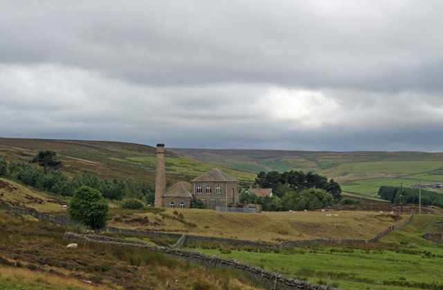
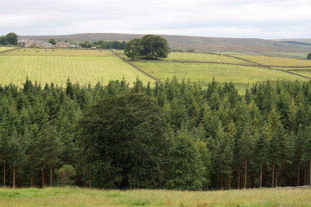
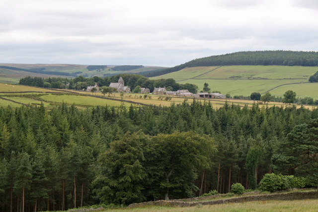
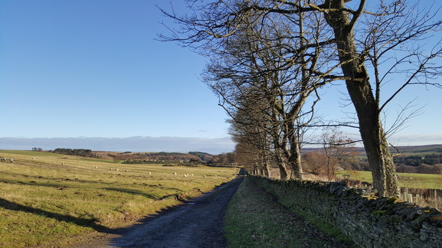
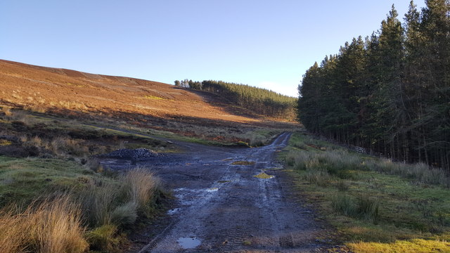
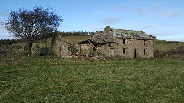
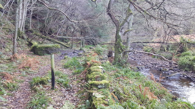
Cocklake Plantations, located in Durham, Wood, Forest, is a picturesque and expansive woodland area covering approximately 500 acres. Situated in the northeastern region of England, this plantation offers visitors a serene and natural environment to explore and enjoy.

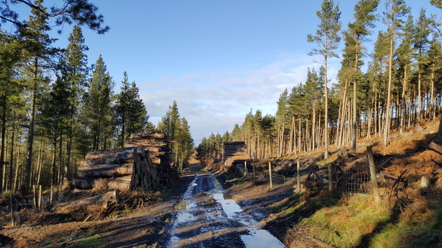
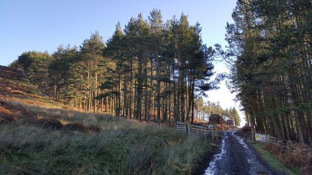
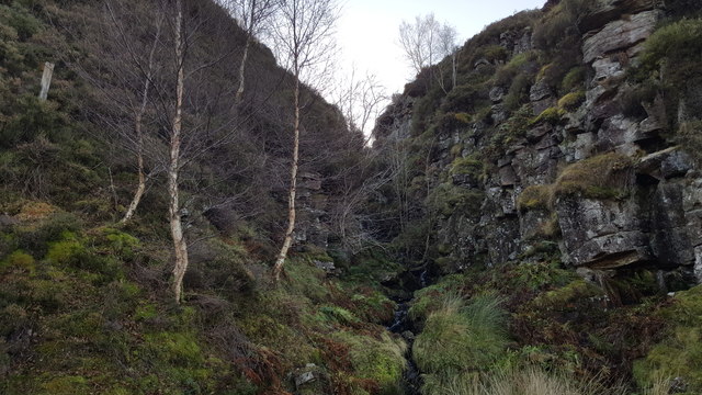
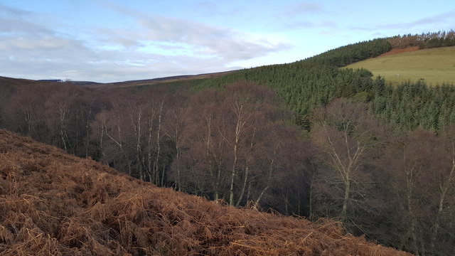
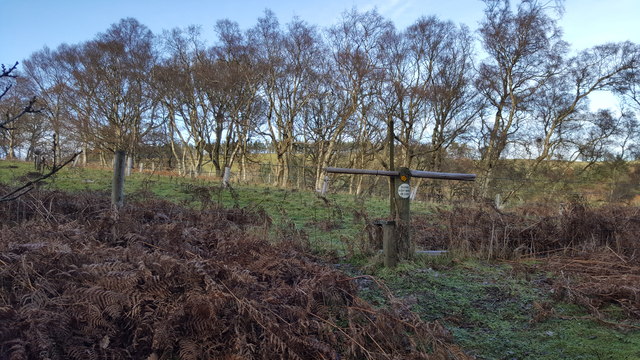
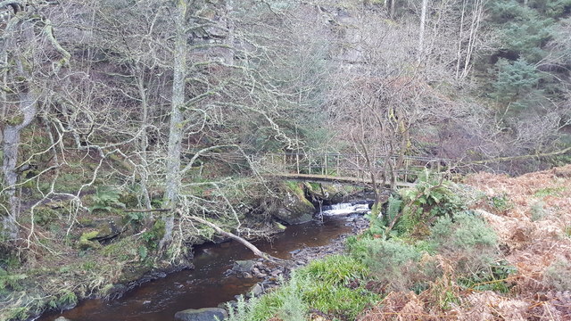
The woodlands of Cocklake Plantations are known for their diverse range of tree species, including oak, beech, ash, and pine. This rich variety of flora creates a vibrant and evergreen landscape, providing a habitat for numerous bird species, small mammals, and insects.

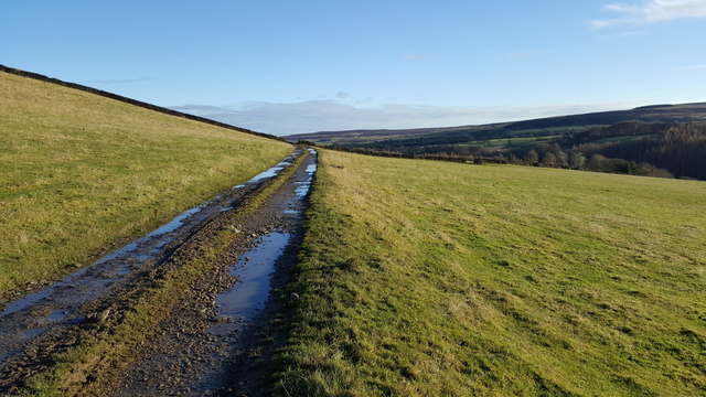
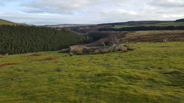
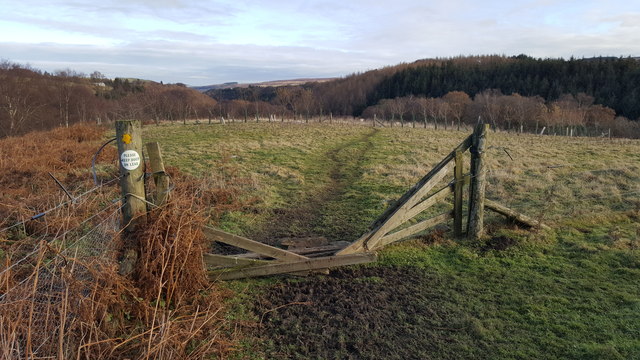
The plantation is a popular destination for nature enthusiasts and hikers, offering a network of well-maintained trails that wind through the woods. These trails cater to all levels of fitness, allowing visitors to choose between leisurely strolls or more challenging hikes. Along the way, visitors can discover several picturesque viewpoints that offer breathtaking vistas of the surrounding countryside.

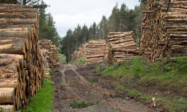
Furthermore, Cocklake Plantations is committed to sustainable forestry practices and conservation efforts. The plantation actively engages in responsible woodland management, ensuring the preservation and growth of its diverse ecosystem. This dedication to environmental stewardship has garnered recognition and awards from local conservation organizations.

For those seeking a tranquil escape from the hustle and bustle of city life, Cocklake Plantations in Durham provides a haven of natural beauty and tranquility. Whether it's a leisurely walk, birdwatching, or simply enjoying the peaceful surroundings, visitors are sure to find solace in the idyllic charm of this woodland paradise.

If you have any feedback on the listing, please let us know in the comments section below.

Cocklake Plantations Images

Images are sourced within 2km of 54.825022/-2.0940409 or Grid Reference NY9447. Thanks to Geograph Open Source API. All images are credited.

Presser Pumping Station near the top of Bale Hill Consett Water Company established in 1859 merged and became the Weardale and Consett Water Company in 1902. Some time late in the 19th or early 20th century one of the two former companies had taken over the engine house of closed Derwent Lead Mines and developed this Grade II Listed pumping house to supply water to Consett. It is reported that they started paying rent to the estate in 1902 and the rent in 1911 was £360.
Presser Pumping Station near the top of Bale Hill
Consett Water Company established in 1859 merged and became the Weardale and Consett Water Company in 1902. Some time late in the 19th or early 20th century one of the two former companies had taken over the engine house of closed Derwent Lead Mines and developed this Grade II Listed pumping house to supply water to Consett. It is reported that they started paying rent to the estate in 1902 and the rent in 1911 was £360.
View to East High House Farm from Bale Hill
Hunstanworth from Bale Hill Hunstanworth is one of the 'Thankful Villages' (a term popularised by the writer Arthur Mee in the 1930s) that suffered no fatalities during the Great War of 1914-1918. The unusual patterns in the roof tiles was a creation of architect Samuel Sanders Teulon who had been commissioned by Reverend Daniel Capper, landowner who would stay in Newbiggin Hall during the grouse shooting season, to build a new church, school, reading room, shop and workers' terraced cottages in 1863. The distinctive diamond-patterned, steep-pitched roofs and Victorian Gothic detail make Hunstanworth unique among the villages of the North Pennines. Closure of the local lead mines in the 1880s diminished the 800 strong population (778 in 1861) to just 200 by 1901. The population of the village in 2011 was 116. John Marius Wilson's Imperial Gazetteer of England and Wales of 1870-72 informs us that "the church was rebuilt in 1865, at a cost of £2,500".
Hunstanworth from Bale Hill
Hunstanworth is one of the 'Thankful Villages' (a term popularised by the writer Arthur Mee in the 1930s) that suffered no fatalities during the Great War of 1914-1918. The unusual patterns in the roof tiles was a creation of architect Samuel Sanders Teulon who had been commissioned by Reverend Daniel Capper, landowner who would stay in Newbiggin Hall during the grouse shooting season, to build a new church, school, reading room, shop and workers' terraced cottages in 1863. The distinctive diamond-patterned, steep-pitched roofs and Victorian Gothic detail make Hunstanworth unique among the villages of the North Pennines. Closure of the local lead mines in the 1880s diminished the 800 strong population (778 in 1861) to just 200 by 1901. The population of the village in 2011 was 116. John Marius Wilson's Imperial Gazetteer of England and Wales of 1870-72 informs us that "the church was rebuilt in 1865, at a cost of £2,500".
Timber stacks alongside estate road The road passes between Beldon High and Beldon Low Plantations on the north side of the valley of the Beldon Burn.
Timber stacks alongside estate road
The road passes between Beldon High and Beldon Low Plantations on the north side of the valley of the Beldon Burn.
Track by Long Plantation
Track in grazing field between High and Low Beldon Plantations
Timber stacks either side of track in Low Beldon Plantation
Low Beldon Plantation
Castleberry Sike
Castleberry Sike
Sheepfold at Nookton East Park
Footpath between Nookton East Park and Gibraltar Banks
Natural Birch woodland and Low Beldon Pine Plantation beyond
Gibraltar Farmhouse, Nookton Fell In desperate need of a Grand Design
Gibraltar Farmhouse, Nookton Fell
In desperate need of a Grand Design
Footpath descending Gibraltar Banks
Stile on footpath at Gibraltar Banks
Footbridge over Nookton Burn at Gibraltar Banks
Show me another place!

Cocklake Plantations is located at Grid Ref: NY9447 (Lat: 54.825022, Lng: -2.0940409)

Unitary Authority: County Durham

Police Authority: Durham

What 3 Words

///moats.blackmail.strut. Near Stanhope, Co. Durham

Related Wikis

Ramshaw, Consett

Ramshaw is a small village in County Durham, in England. It is situated to the south of Hunstanworth, a few miles west of Consett. Lead mining was an important...

Townfield

Townfield is a village in County Durham, in England. It is situated just to the south of Hunstanworth and part of that parish, about 10 miles (16 km) west...

Beldon Burn

Beldon Burn is a headwater stream of the River Derwent in Northumberland and County Durham, England.It rises at Quickcleugh Moss as the Quickcleugh Burn...

Hunstanworth

Hunstanworth is a village in County Durham, England. It is situated approximately 10 miles to the west of Consett, south-west of the village of Blanchland...

Baybridge, Northumberland

Baybridge is a small village in Northumberland, England, just to the west of Blanchland and on the border with County Durham. It is situated to the west...

Blanchland

Blanchland is a village in Northumberland, England, on the County Durham boundary. The population of the civil parish at the 2011 census was 135.Set beside...

Blanchland Abbey

Blanchland Abbey at Blanchland, in the English county of Northumberland, was founded as a premonstratensian priory in 1165 by Walter de Bolbec II, and...

Lintzgarth

Lintzgarth is a village in the civil parish of Stanhope, in County Durham, England. It is situated to the west of Rookhope. The Lintzgarth smeltmill was...

Nearby Amenities

Located within 500m of 54.825022,-2.0940409
The data included in this document is from www.openstreetmap.org. The data is made available under ODbL.

Have you been to Cocklake Plantations?

Leave your review of Cocklake Plantations below (or comments, questions and feedback).