Big Wood

Wood, Forest in Dorset

England

Big Wood

From West Hill looking across to Houns-tout Cliff From West Hill above Chapman's Pool looking across to Houns-tout Cliff
From West Hill looking across to Houns-tout Cliff Credit: Shaun Ferguson

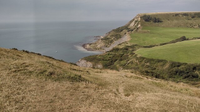
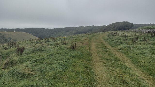
Big Wood is a picturesque forest located in the county of Dorset, England. Covering an area of approximately 100 acres, it is known for its natural beauty and diverse ecosystem. The woodland is predominantly composed of mature broadleaf trees, including oak, beech, and ash, which create a dense and verdant canopy throughout the forest.

Big Wood is a haven for wildlife, providing a sanctuary for numerous species. The forest is home to a variety of birds, such as woodpeckers, owls, and thrushes, making it a popular destination for birdwatchers. Small mammals like squirrels, rabbits, and foxes can also be spotted within its depths, adding to the woodland's charm.

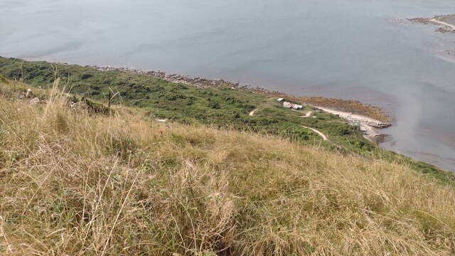
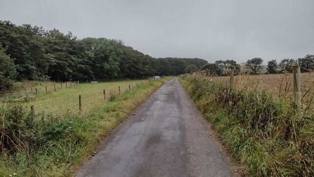
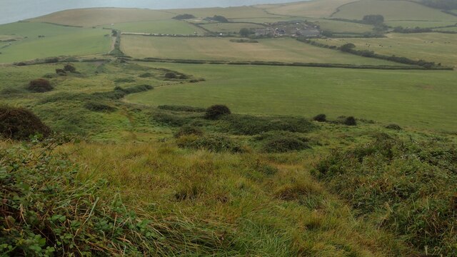
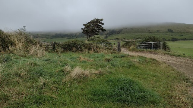
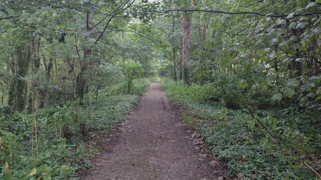
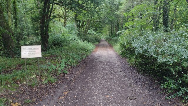
The forest offers a network of well-maintained footpaths and trails, allowing visitors to explore its enchanting surroundings. These paths lead through ancient woodlands, providing opportunities for peaceful walks and nature appreciation. The forest floor is adorned with a vibrant carpet of wildflowers during spring, enhancing the visual appeal of the area.

Big Wood is a cherished recreational spot for locals and tourists alike. Its tranquil atmosphere makes it an ideal destination for picnics, family outings, and nature photography. The forest is also a popular location for educational visits, where schoolchildren can learn about the importance of conservation and the diverse ecosystems found within woodlands.

Overall, Big Wood in Dorset is a captivating forest that offers an idyllic escape from the hustle and bustle of everyday life. With its lush vegetation, rich wildlife, and serene ambiance, it is a place of natural beauty that continues to captivate all who visit.

If you have any feedback on the listing, please let us know in the comments section below.

Big Wood Images

Images are sourced within 2km of 50.601735/-2.0855336 or Grid Reference SY9478. Thanks to Geograph Open Source API. All images are credited.

From West Hill looking across to Houns-tout Cliff From West Hill above Chapman's Pool looking across to Houns-tout Cliff
From West Hill looking across to Houns-tout Cliff
From West Hill above Chapman's Pool looking across to Houns-tout Cliff
Boat House and other buildings at Chapman's Pool From coast path at Emmetts Hill looking down to the Boat House and other buildings at Chapman's Pool
Boat House and other buildings at Chapman's Pool
From coast path at Emmetts Hill looking down to the Boat House and other buildings at Chapman's Pool
Road approaching Swyre Head car park Path and road approaching Swyre Head car park
Road approaching Swyre Head car park
Path and road approaching Swyre Head car park
Path down to Newfoundland copse Overgrown start on the path down to Newfoundland copse
Path down to Newfoundland copse
Overgrown start on the path down to Newfoundland copse
Path heading towards Kimmeridge Path going along across Smedmore Hill heading towards Kimmeridge
Path heading towards Kimmeridge
Path going along across Smedmore Hill heading towards Kimmeridge
Path coming down from Swyre Head Path coming down from Swyre Head heading down near Swalland Farm
Path coming down from Swyre Head
Path coming down from Swyre Head heading down near Swalland Farm
Path going past the drive to Swalland Farm Path going past the drive to Swalland Farm heading in the distance to a mist covered Swyre Head
Path going past the drive to Swalland Farm
Path going past the drive to Swalland Farm heading in the distance to a mist covered Swyre Head
South West Coast Path South West Coast Path passes the stile and path off to Swyre Head
South West Coast Path
South West Coast Path passes the stile and path off to Swyre Head
South West Coast Path South West Coast Path heading to Rope Lake Head
South West Coast Path
South West Coast Path heading to Rope Lake Head
South West Coast Path South West Coast Path heads down through the verdant Egmont Bight before climbing up to Hons-tout Cliff in the distance
South West Coast Path
South West Coast Path heads down through the verdant Egmont Bight before climbing up to Hons-tout Cliff in the distance
Path nearing Quarry Wood From Hans-tout Cliff the path nearing Quarry Wood with the obelisk to Lord Stowell across the valley
Path nearing Quarry Wood
From Hans-tout Cliff the path nearing Quarry Wood with the obelisk to Lord Stowell across the valley
Path passing through Quarry Wood From Hans-tout Cliff the path passing through Quarry Wood
Path passing through Quarry Wood
From Hans-tout Cliff the path passing through Quarry Wood
Path heading through The Plantation Path from car park heading through The Plantation of the Encombe Estate heading to Houns-tout Cliff
Path heading through The Plantation
Path from car park heading through The Plantation of the Encombe Estate heading to Houns-tout Cliff
Clavell's Hard, south-west coast path So-called because the short projection of rock is harder than the surrounding rock, which is easily eroded.
Clavell's Hard, south-west coast path
So-called because the short projection of rock is harder than the surrounding rock, which is easily eroded.
Private woodland road, Kingston A private woodland road through the Plantation at Kingston.
Private woodland road, Kingston
A private woodland road through the Plantation at Kingston.
Right of way crossing farmland, Kingston A public right of way crossing farmland to the south of Kingston.
Right of way crossing farmland, Kingston
A public right of way crossing farmland to the south of Kingston.
Chapman's Pool, Dorset
Cliffs east of Rope Lake Head
Show me another place!

Big Wood is located at Grid Ref: SY9478 (Lat: 50.601735, Lng: -2.0855336)

Unitary Authority: Dorset

Police Authority: Dorset

What 3 Words

///pounding.satellite.tomato. Near Corfe Castle, Dorset

Related Wikis

Encombe House

Encombe House is a privately owned, Grade II* listed country house built in 1735 on the Encombe Estate near the village of Kingston and about 1-mile (1...

Swyre Head

Swyre Head is the highest point of the Isle of Purbeck in Dorset, on the south coast of England. The hill Swyre Head lies about 2 kilometres (1 mi) southwest...

Egmont Bight

Egmont Bight is a shallow embayment at the southern end of the Encombe valley in Dorset, England. It is part of the Jurassic Coast. == Geology == The bay...

Smedmore Hill Settlement

The Smedmore Hill Settlement is an archaeological site about 2 miles (3.2 km) south-west of Corfe Castle, in Dorset, England. The site is a settlement...

Chapman's Pool

Chapman's Pool is a small cove to the west of Worth Matravers on the Isle of Purbeck, in Dorset, England. == Geology == The rocks that form the cove are...

Smedmore House

Smedmore House is a country house near Kimmeridge, Dorset, in England. It was originally built by Sir William Clavell around 1620, partially rebuilt by...

Kingston, Purbeck

Kingston is a small village on the Isle of Purbeck in the county of Dorset in southern England. == Location == Kingston is situated about two miles south...

Kimmeridge Ledges

Kimmeridge Ledges ( ) is a set of Kimmeridge clay ledges stretching out in to the sea on the Isle of Purbeck, a peninsula on the English Channel coast...

Have you been to Big Wood?

Leave your review of Big Wood below (or comments, questions and feedback).