Penchford Wood

Wood, Forest in Northumberland

England

Penchford Wood

The silvery road to High Shaw The Sun must have been at the optimum angle to reflect the wet road surface.
The silvery road to High Shaw Credit: Leanmeanmo

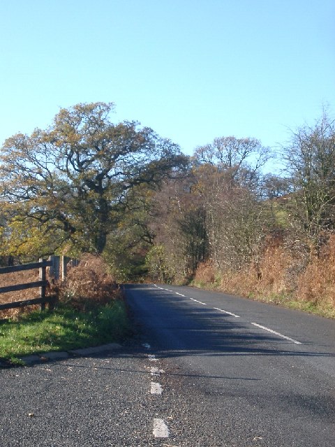
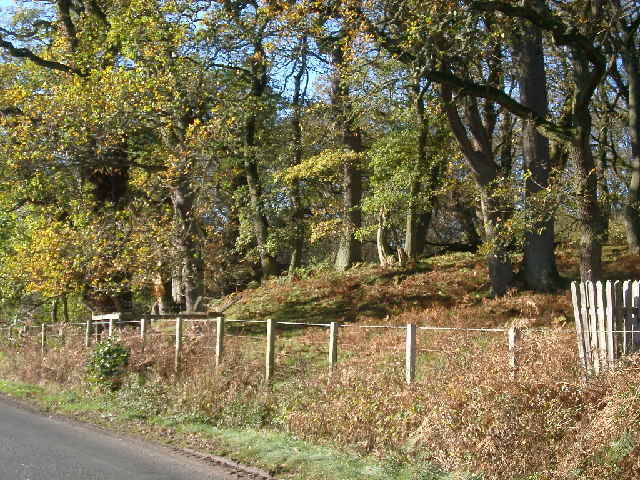
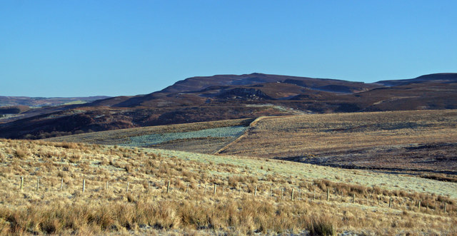
Penchford Wood is a picturesque woodland located in the county of Northumberland, England. Covering an area of approximately 100 acres, it is a haven of natural beauty and tranquility. The wood is situated near the village of Penchford, and is easily accessible by foot or car.

The woodland is predominantly composed of native tree species such as oak, ash, and birch, creating a diverse and varied ecosystem. The lush undergrowth is home to a range of flora including bluebells, foxgloves, and wild garlic, providing a vibrant display of colors throughout the seasons.

Penchford Wood is not only a place of natural beauty but also a sanctuary for wildlife. The wood is a haven for a variety of bird species, including woodpeckers, tawny owls, and nuthatches. It is also home to a range of small mammals such as badgers, foxes, and squirrels.

For nature enthusiasts, Penchford Wood offers a network of well-maintained footpaths and trails, allowing visitors to explore the woodland and enjoy its tranquil ambiance. The wood also features a picnic area, providing the perfect spot for visitors to relax and soak in the peaceful surroundings.

Penchford Wood is managed by the local authorities, who ensure the preservation of its natural beauty and the protection of its wildlife. It is a popular destination for both locals and tourists seeking a peaceful escape from the hustle and bustle of everyday life.

If you have any feedback on the listing, please let us know in the comments section below.

Penchford Wood Images

Images are sourced within 2km of 55.272797/-2.0959646 or Grid Reference NY9497. Thanks to Geograph Open Source API. All images are credited.

The silvery road to High Shaw The Sun must have been at the optimum angle to reflect the wet road surface.
The silvery road to High Shaw
The Sun must have been at the optimum angle to reflect the wet road surface.
Road and trees, B6341 taken from the Parking marked on the OS map
Road and trees, B6341
taken from the Parking marked on the OS map
Roadside, Grasslees Wood
No red flag today One of the flag poles from which red flags are flown. There is also a red light on the top so that it can be seen at night. The usual warning sign is on the right. Foreground is MOD road.
No red flag today
One of the flag poles from which red flags are flown. There is also a red light on the top so that it can be seen at night. The usual warning sign is on the right. Foreground is MOD road.
High Shaw Farm There are quite a few farms within the MOD ranges. How do they get in and out when the red flags are flying?
High Shaw Farm
There are quite a few farms within the MOD ranges. How do they get in and out when the red flags are flying?
Billsmoorfoot Car Park Northumberland National Park small car park with a few small benches where occasionally you can find people having a picnic.
Billsmoorfoot Car Park
Northumberland National Park small car park with a few small benches where occasionally you can find people having a picnic.
Footpath leading to Cloven Crag
Billsmoor Park
Billsmoor Park
Bend in the Road. The Boundary of Otterburn Range Danger Area Dunns Hide Woods to the right.
Bend in the Road. The Boundary of Otterburn Range Danger Area
Dunns Hide Woods to the right.
Billsmoor Park Seen from the B6341 Otterburn to Rothbury road. Simonside <a href="https://www.geograph.org.uk/gridref/NZ0298">NZ0298</a> can be seen on the skyline.
Billsmoor Park
Seen from the B6341 Otterburn to Rothbury road. Simonside NZ0298 can be seen on the skyline.
Dunns Farm Caravan Park
Barn at Grasslees On the B6341 Otterburn to Rothbury road which at this point also forms part of the Pennine Cycleway.
Barn at Grasslees
On the B6341 Otterburn to Rothbury road which at this point also forms part of the Pennine Cycleway.
High Shaw Bastle High Shaw is a well-preserved bastle of C16 or C17 date. It stands on gently sloping ground above the steep slopes of Watty's Sike. It is built from massive stone blocks and stands one-storey high. The upper storey may have been dismantled. The basement has a stone vault and has a hole for a ladder in the ceiling. Above the ground floor a chamfered string course - the only bastle to possess this feature. Triangular opening, probably a gun loop, in east end. Interior: walls c.64 inches thick. Segmental tunnel vault with ladder hole only c.12 inches square. Doorway is rebated and has drawbar holes. In west wall a roughly-made recess with a vertical shaft in the thickness of the wall and a well-dressed triangular opening through the wall, possibly a gun loop (cf exterior).
High Shaw Bastle
High Shaw is a well-preserved bastle of C16 or C17 date. It stands on gently sloping ground above the steep slopes of Watty's Sike. It is built from massive stone blocks and stands one-storey high. The upper storey may have been dismantled. The basement has a stone vault and has a hole for a ladder in the ceiling. Above the ground floor a chamfered string course - the only bastle to possess this feature. Triangular opening, probably a gun loop, in east end. Interior: walls c.64 inches thick. Segmental tunnel vault with ladder hole only c.12 inches square. Doorway is rebated and has drawbar holes. In west wall a roughly-made recess with a vertical shaft in the thickness of the wall and a well-dressed triangular opening through the wall, possibly a gun loop (cf exterior).
Black Hill View looking from the MOD range road across Loaning Burn towards Black Hill.
Black Hill
View looking from the MOD range road across Loaning Burn towards Black Hill.
Hogger's Cleugh View from MOD range road looking across Loaning Burn towards Hogger's Cleugh.
Hogger's Cleugh
View from MOD range road looking across Loaning Burn towards Hogger's Cleugh.
Laingshill Laingshill Farm near Otterburn.
Laingshill
Laingshill Farm near Otterburn.
Jock's Cleugh View looking across Jock's Cleugh towards Billsmoor Park.  The Simonside Hills are in the background.
Jock's Cleugh
View looking across Jock's Cleugh towards Billsmoor Park. The Simonside Hills are in the background.
High Carrick Moorland near High Carrick.
High Carrick
Moorland near High Carrick.
Show me another place!

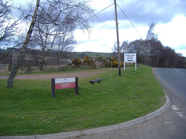
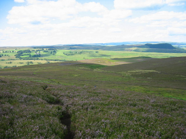
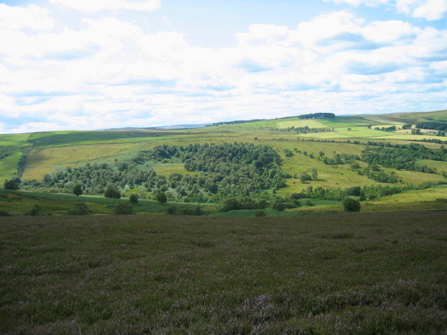
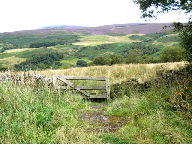
Penchford Wood is located at Grid Ref: NY9497 (Lat: 55.272797, Lng: -2.0959646)

Unitary Authority: Northumberland

Police Authority: Northumbria

What 3 Words

///took.equipment.richer. Near Otterburn, Northumberland

Nearby Locations

Penchford Wood

Related Wikis

Billsmoor Park and Grasslees Wood

Billsmoor Park and Grasslees Wood is the name given to a Site of Special Scientific Interest (SSSI) in Northumberland, North East England, designated in...

High Cove

High Cove is a major slip feature to the west of Grasslees Burn in the Simonside Hills, Northumberland, England. It contains several small rifts and caves...

Elsdon Castle

Elsdon Castle is a castle in the village of Elsdon about 10 miles (16 km) to the southwest of Rothbury, in Northumberland, England, and also known as Mote...

Elsdon Tower

Elsdon Tower is a Grade I listed medieval tower house converted for use as a Rectory situated at Elsdon, Northumberland. Originally part of the estate...

Nearby Amenities

Located within 500m of 55.272797,-2.0959646
Penchford
Place: locality
Lat/Long: 55.272128/-2.0926671
Power: pole
Lat/Long: 55.2686247/-2.0974647
Power: pole
Lat/Long: 55.2688028/-2.0964084
Power: pole
Lat/Long: 55.2689947/-2.0953593
Power: pole
Lat/Long: 55.2693218/-2.0942981
Power: pole
Lat/Long: 55.2696752/-2.0931836
Power: pole
Lat/Long: 55.2700313/-2.0920594
Power: pole
Lat/Long: 55.2703989/-2.0909565
Power: pole
Lat/Long: 55.2707425/-2.0898326
Power: pole
Lat/Long: 55.2707491/-2.089811
Power: pole
Lat/Long: 55.2711107/-2.0886771
Power: pole
Lat/Long: 55.275676/-2.0899911
Power: pole
Lat/Long: 55.2691567/-2.0950258
Barrier: fence
Lat/Long: 55.276764/-2.0942205
The data included in this document is from www.openstreetmap.org. The data is made available under ODbL.

Have you been to Penchford Wood?

Leave your review of Penchford Wood below (or comments, questions and feedback).