Aukside Plantation

Wood, Forest in Durham

England

Aukside Plantation

Rumours and Uttas Rumours coffee shop and the HQ of the Upper Teesdale Agricultural Support Services.
Rumours and Uttas Credit: Colin Kinnear

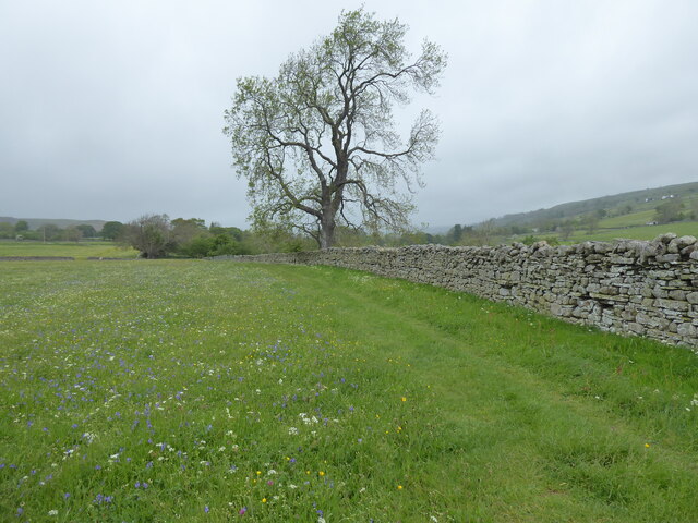
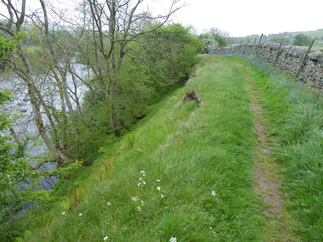
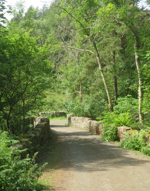
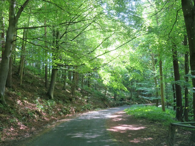
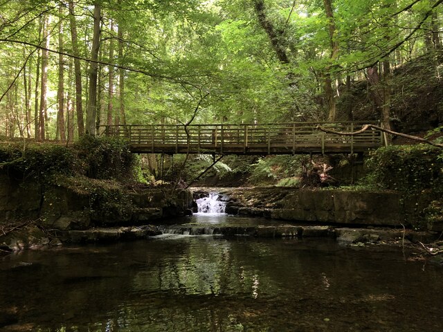
Aukside Plantation is a picturesque woodland located in Durham, England. Nestled in the heart of the countryside, this tranquil plantation covers an area of approximately 100 acres and is known for its abundant flora and fauna. The plantation is predominantly composed of a variety of native tree species, including oak, beech, ash, and birch, creating a diverse and vibrant woodland ecosystem.

The plantation offers an ideal habitat for numerous wildlife species. Bird enthusiasts will be delighted to spot a range of feathered inhabitants, such as woodpeckers, owls, and various songbirds. The woodland also attracts small mammals like rabbits, squirrels, and hedgehogs, adding to the rich biodiversity of the area.

Visitors to Aukside Plantation can enjoy a peaceful stroll along the well-maintained trails that wind through the woodland. The paths are surrounded by a carpet of wildflowers and ferns, providing a delightful sensory experience. Nature lovers can also explore the plantation's small pond, where they may encounter dragonflies, frogs, and other aquatic creatures.

Additionally, the plantation offers educational opportunities, hosting workshops and guided tours for schools and interested groups. These activities aim to inspire a deeper appreciation for nature and promote environmental conservation.

Aukside Plantation is a popular destination for locals and tourists alike, offering a serene escape from the hustle and bustle of the city. Its natural beauty, diverse wildlife, and educational programs make it an enchanting place for nature enthusiasts of all ages to explore and appreciate.

If you have any feedback on the listing, please let us know in the comments section below.

Aukside Plantation Images

Images are sourced within 2km of 54.635324/-2.0950423 or Grid Reference NY9326. Thanks to Geograph Open Source API. All images are credited.

Rumours and Uttas Rumours coffee shop and the HQ of the Upper Teesdale Agricultural Support Services.
Rumours and Uttas
Rumours coffee shop and the HQ of the Upper Teesdale Agricultural Support Services.
Entering Middleton-in-Teesdale on the B6282 Entering the village on a wet day
Entering Middleton-in-Teesdale on the B6282
Entering the village on a wet day
Former Methodist Chapel, Middleton-in-Teesdale Former Primitive Methodist Church, now a private dwelling
Former Methodist Chapel, Middleton-in-Teesdale
Former Primitive Methodist Church, now a private dwelling
The Pennine Way near Middleton-in-Teesdale
The Pennine Way near East Crossthwaite
The Pennine Way near Middle Crossthwaite
Heading into Middleton in Teesdale The B6282 dropping into Middleton from the direction of Eggleston.
Heading into Middleton in Teesdale
The B6282 dropping into Middleton from the direction of Eggleston.
Bridge at the road end Bridge over Hudeshope Beck at the point where the tarmac runs out and a footpath begins.
Bridge at the road end
Bridge over Hudeshope Beck at the point where the tarmac runs out and a footpath begins.
Road through the woods Heading south towards Middleton in Teesdale along the minor road above the Hudeshope Beck.
Road through the woods
Heading south towards Middleton in Teesdale along the minor road above the Hudeshope Beck.
Window tracery from former church Grade II listed C13th window tracery from former church of St Mary, set in the graveyard of the modern church.
Window tracery from former church
Grade II listed C13th window tracery from former church of St Mary, set in the graveyard of the modern church.
Footbridge across Hudeshope Beck
Skears Lime Kilns A group of 6 lime kilns of varying age adjacent to the former Skears Quarry.
Skears Lime Kilns
A group of 6 lime kilns of varying age adjacent to the former Skears Quarry.
West Crossthwaite The farm buildings at West Crossthwaite on the south side of the minor road to Holwick.
West Crossthwaite
The farm buildings at West Crossthwaite on the south side of the minor road to Holwick.
Dales Chapel, Middleton-in-Teesdale Former Primitive Methodist Chapel dated 1872.
Dales Chapel, Middleton-in-Teesdale
Former Primitive Methodist Chapel dated 1872.
Arch, Masterman Place, Middleton in Teesdale Archway over narrow road, dated 1823. By Ignatius Bonomi for the London Lead Company. Coursed squared sandstone with ashlar dressings. Classical style. High arch over entrance to new development by the company, providing housing for their most valued workers.
Grade II Listed (List Entry: 1203547) <span class="nowrap"><a title="https://historicengland.org.uk/listing/the-list/list-entry/1203547" rel="nofollow ugc noopener" href="https://historicengland.org.uk/listing/the-list/list-entry/1203547">Link</a><img style="margin-left:2px;" alt="External link" title="External link - shift click to open in new window" src="https://s1.geograph.org.uk/img/external.png" width="10" height="10"/></span>
Arch, Masterman Place, Middleton in Teesdale
Archway over narrow road, dated 1823. By Ignatius Bonomi for the London Lead Company. Coursed squared sandstone with ashlar dressings. Classical style. High arch over entrance to new development by the company, providing housing for their most valued workers. Grade II Listed (List Entry: 1203547) LinkExternal link
Arch, Masterman Place, Middleton in Teesdale See description here: <a href="https://www.geograph.org.uk/photo/7291750">NY9425 : Arch, Masterman Place, Middleton in Teesdale</a>
Arch, Masterman Place, Middleton in Teesdale
Dale View from Masterman Place
Show me another place!

Aukside Plantation is located at Grid Ref: NY9326 (Lat: 54.635324, Lng: -2.0950423)

Unitary Authority: County Durham

Police Authority: Durham

What 3 Words

///glass.unleashed.statement. Near Newbiggin, Co. Durham

Related Wikis

Aukside

Aukside is a small village in County Durham, in England. It is situated on the north side of Teesdale, a short distance from Middleton-in-Teesdale. It...

Middle Side

Middle Side is a village in County Durham, in England. It is situated on the north side of Teesdale between Middleton-in-Teesdale and Newbiggin. ��2�...

Dent Bank

Dent Bank is a small village in County Durham, in England. It is situated on the north side of Teesdale between Middleton-in-Teesdale and Newbiggin....

Middle Side and Stonygill Meadows

Middle Side and Stonygill Meadows is a Site of Special Scientific Interest in the Teesdale district of County Durham, England. It consists of two separate...

High Dyke, County Durham

High Dyke is a village in County Durham, in England. It is situated a short distance to the north of Middleton-in-Teesdale. == References ==

Middle Crossthwaite

Middle Crossthwaite is a Site of Special Scientific Interest in the Teesdale district of County Durham, England. It is situated on the south bank of the...

Park End Wood

Park End Wood is a Site of Special Scientific Interest in the Teesdale district of west County Durham, England. The site occupies a low hill of Whin Sill...

Snaisgill

Snaisgill is a hamlet in County Durham, in England. It is situated to the north of Middleton-in-Teesdale. The surrounding area was extensively mined for...

Nearby Amenities

Located within 500m of 54.635324,-2.0950423
Middle Side
Is In Valley: Teesdale
Old Name: Middleside
Place: hamlet
Source: OS 1:25k
Wikidata: Q6841596
Wikipedia: en:Middle Side
Lat/Long: 54.6324169/-2.1007256
Auk Side
Place: hamlet
Source: OS 1:25k
Wikidata: Q4821661
Wikipedia: en:Aukside
Lat/Long: 54.6356957/-2.0898251
Natural: spring
Source: OS 1:25k
Lat/Long: 54.637113/-2.0936666
Natural: spring
Source: OS 1:25k
Lat/Long: 54.632865/-2.0982371
Man Made: water_well
Source: OS 1:25k
Lat/Long: 54.6342063/-2.0986019
High Edge End
Building: yes
Source: OS 1:25k
Lat/Long: 54.6339331/-2.0924865
Generator Method: photovoltaic
Generator Output: small_installation
Generator Source: solar
Location: roof
Power: generator
Source: Bing
Lat/Long: 54.6322758/-2.0998694
Abandoned Man Made: kiln
Fixme: Confirm ruins exist on ground.
Product: lime
Resource: lime
Source: NLS-OS-NatGrid-110k-1940-60
Lat/Long: 54.6382757/-2.0943723
lime kiln
Archaeological Site: lime_kiln
Note: No trace on current imagery
Razed Historic: archaeological_site
Resource: lime
Source: NLS-OS-NatGrid-110k-1940-60
Lat/Long: 54.6371338/-2.093514
Power: pole
Lat/Long: 54.6371992/-2.089178
Power: pole
Lat/Long: 54.6369299/-2.0902187
Barrier: entrance
Lat/Long: 54.6371752/-2.0887685
Barrier: entrance
Lat/Long: 54.6342153/-2.0895658
The data included in this document is from www.openstreetmap.org. The data is made available under ODbL.

Have you been to Aukside Plantation?

Leave your review of Aukside Plantation below (or comments, questions and feedback).