Whitgreave's Wood

Wood, Forest in Staffordshire South Staffordshire

England

Whitgreave's Wood

Former colliery railway - Hilton Main South of the Bognop Road level crossing.
Former colliery railway - Hilton Main Credit: John M

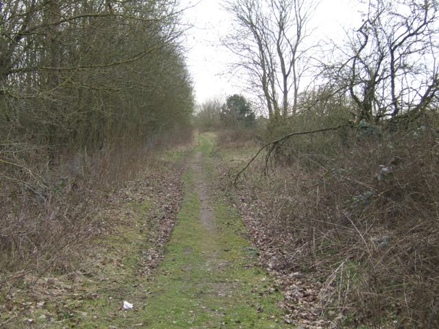
Whitgreave's Wood is a picturesque woodland located in Staffordshire, England. Stretching over an area of approximately 100 acres, it is a haven for nature enthusiasts and outdoor adventurers alike. The wood is situated near the small village of Whitgreave, and its serene atmosphere provides a welcome escape from the hustle and bustle of urban life.

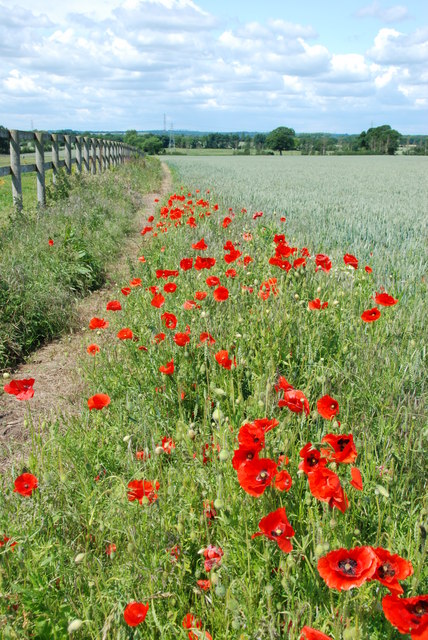
One of the defining features of Whitgreave's Wood is its diverse ecosystem. The forest is home to a wide array of flora and fauna, with towering oak and beech trees dominating the landscape. Bluebells and other wildflowers cover the forest floor during spring, creating a stunning carpet of colors. The wood is also a habitat for various bird species, including woodpeckers and tawny owls.

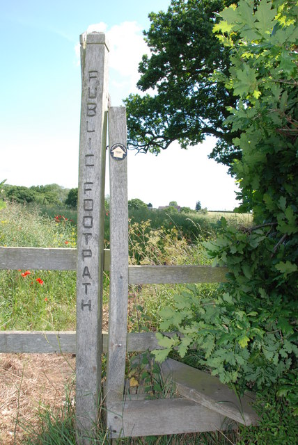
Visitors to Whitgreave's Wood can enjoy a range of activities. Walking and hiking trails crisscross the area, allowing visitors to explore the wood at their own pace. There are also designated picnic spots and benches where visitors can relax and take in the tranquil surroundings. Additionally, the wood is a popular destination for birdwatching and nature photography.

The management of Whitgreave's Wood is overseen by the local authorities, who work tirelessly to preserve its natural beauty and protect its wildlife. They conduct regular tree maintenance and ensure the trails are well-maintained for visitors' safety and convenience.

Overall, Whitgreave's Wood in Staffordshire offers a peaceful and idyllic retreat for nature lovers. With its stunning scenery, diverse wildlife, and various recreational opportunities, it is a must-visit destination for anyone seeking solace in nature's embrace.

If you have any feedback on the listing, please let us know in the comments section below.

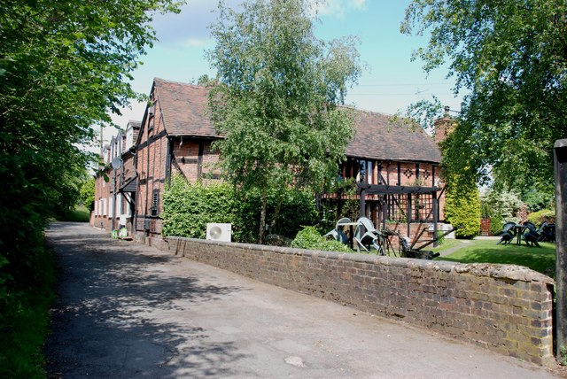
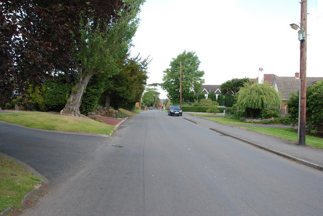
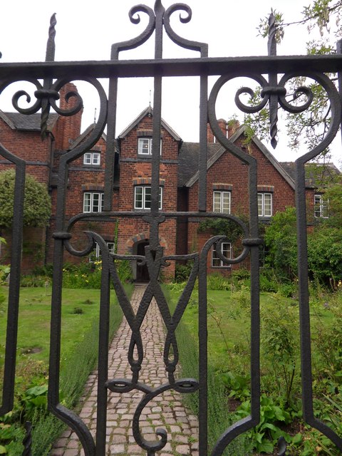
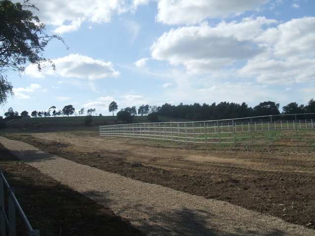
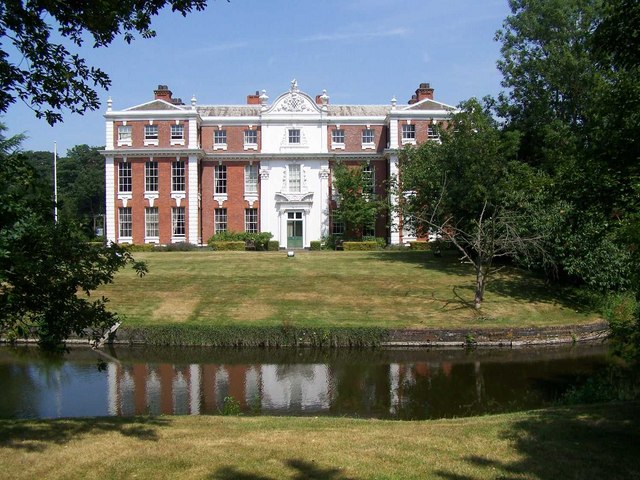
Whitgreave's Wood Images

Images are sourced within 2km of 52.639754/-2.0948445 or Grid Reference SJ9304. Thanks to Geograph Open Source API. All images are credited.

Former colliery railway - Hilton Main South of the Bognop Road level crossing.
Former colliery railway - Hilton Main
South of the Bognop Road level crossing.
Former colliery railway - Hilton Main Looking across the level crossing on Bognop Road into the colliery site at Hilton Main.
Former colliery railway - Hilton Main
Looking across the level crossing on Bognop Road into the colliery site at Hilton Main.
HMP Oakwood (previously known as Featherstone 2) Work is progressing steadily on the new 1605 bed Category B prison near Wolverhampton. Completion is expected in April 2012. The three cell blocks will each house 480 inmates. The new prison will share the former Royal Ordnance Factory site with the existing HMP Featherstone Prison and Brinsford Young Offenders Institution.

The prison operated by G4S had the distinction of receiving the worst ever report by the HM Inspector of Prisons in October 2013.
HMP Oakwood (previously known as Featherstone 2)
Work is progressing steadily on the new 1605 bed Category B prison near Wolverhampton. Completion is expected in April 2012. The three cell blocks will each house 480 inmates. The new prison will share the former Royal Ordnance Factory site with the existing HMP Featherstone Prison and Brinsford Young Offenders Institution. The prison operated by G4S had the distinction of receiving the worst ever report by the HM Inspector of Prisons in October 2013.
Public Bridleway, Featherstone Lane
Bridleway from Featherstone Lane
Footpath from Featherstone Lane
Entrance to Featherstone Lane
Featherstone Farm Hotel, Featherstone
Cat and Kittens Lane, Featherstone This road runs between the former ordnance site near Featherstone and the M54, hence the road sign.
Cat and Kittens Lane, Featherstone
This road runs between the former ordnance site near Featherstone and the M54, hence the road sign.
Baneberry Drive, Featherstone
Church Road, Shareshill
Moseley Gate The front gated entrance to Moseley Old Hall.
Moseley Gate
The front gated entrance to Moseley Old Hall.
Moseley Wall Moseley Old Hall front elevation viewed from Moseley Old Hall Lane.
Moseley Wall
Moseley Old Hall front elevation viewed from Moseley Old Hall Lane.
Moseley Old Hall The Knot garden to the side elevation of Moseley Old Hall.
Moseley Old Hall
The Knot garden to the side elevation of Moseley Old Hall.
Behind Moseley Rear elevation of Moseley Old Hall.
Behind Moseley
Rear elevation of Moseley Old Hall.
Moseley Knot Knot garden to the side of Moseley Old Hall.
Moseley Knot
Knot garden to the side of Moseley Old Hall.
Moseley Old Hall Front elevation.
Moseley Old Hall
Front elevation.
Extension to the crematorium The slopes of Bushbury Hill will be given up for an extension to the crematorium. The footpath to the hill will be diverted.
Extension to the crematorium
The slopes of Bushbury Hill will be given up for an extension to the crematorium. The footpath to the hill will be diverted.
Show me another place!

Whitgreave's Wood is located at Grid Ref: SJ9304 (Lat: 52.639754, Lng: -2.0948445)

Administrative County: Staffordshire

District: South Staffordshire

Police Authority: Staffordshire

What 3 Words

///tests.voice.fried. Near Featherstone, Staffordshire

Related Wikis

Featherstone, Staffordshire

Featherstone is a town in the district of South Staffordshire, England, near to the border with Wolverhampton. == History == Originally a farming community...

Moseley Old Hall

Moseley Old Hall is located in Fordhouses, north of Wolverhampton in the United Kingdom. It is notable as one of the hiding places of Charles II during...

Brinsford Lodge

Brinsford Lodge was a hall of residence for The Polytechnic, Wolverhampton (now the University of Wolverhampton) from the mid-1960s to the early 1980s...
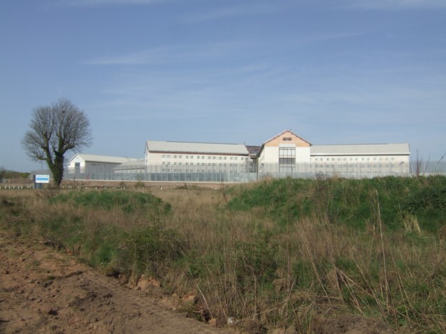
HM Prison Brinsford

HMP & YOI Prison Brinsford is an adult male Category B & C prison and Young Offenders Institution (YOI), located in the village of Featherstone (near Wolverhampton...

HM Prison Oakwood

HM Prison Oakwood is a Category C prison in Featherstone, Staffordshire, England. First opened in April 2012, the prison is operated by G4S and was primed...

Hilton Hall

Hilton Hall is an 18th-century mansion house now in use as an Office and Business Centre at Hilton, near Wolverhampton, in Staffordshire. It is a Grade...

HM Prison Featherstone

HM Prison Featherstone is a Category C men's prison, located in the village of Featherstone (near Wolverhampton), in Staffordshire, England. The prison...

Essington Hall Farmhouse

Essington Hall Farmhouse is a grade II listed building in Essington, Staffordshire. == See also == Listed buildings in Essington == References ==

Nearby Amenities

Located within 500m of 52.639754,-2.0948445
Motorway Junction
Featherstone Interchange
Exit To: Cannock A460
Ref: 1
Lat/Long: 52.6394268/-2.0946672
Note: 40 mph speed limit sign
Lat/Long: 52.6402812/-2.0890019
Power: tower
Source: bing
Lat/Long: 52.6357793/-2.0969702
Traffic Calming: hump
Lat/Long: 52.6431753/-2.0963976
Bus Stop
Whitgreave School
Bus: yes
Naptan AtcoCode: 3800C613701
Naptan Bearing: E
Naptan BusStopType: CUS
Naptan CommonName: Whitgreave School
Naptan Indicator: Opp
Naptan Landmark: Whitgreave Sch
Naptan Street: The Avenue
Naptan Verified: no
Public Transport: platform
Source: naptan_import
Lat/Long: 52.6434335/-2.0925554
Bus Stop
Whitgreave School
Bus: yes
Naptan AtcoCode: 3800C613702
Naptan Bearing: W
Naptan CommonName: Whitgreave School
Naptan Indicator: Adj
Naptan Landmark: Whitgreave Sch
Naptan Street: The Avenue
Naptan Verified: no
Public Transport: platform
Source: naptan_import
Lat/Long: 52.6433528/-2.0926561
Bus Stop
Brookhouse Close
Bus: yes
Naptan AtcoCode: 3800C614501
Naptan Bearing: W
Naptan CommonName: Brookhouse Close
Naptan Indicator: Adj
Naptan Landmark: Brookhouse Close
Naptan Street: Brookhouse Lane
Naptan Verified: no
Public Transport: platform
Source: naptan_import
Lat/Long: 52.6433838/-2.0948241
Bus Stop
Brookhouse Close
Bus: yes
Naptan AtcoCode: 3800C614502
Naptan Bearing: E
Naptan BusStopType: CUS
Naptan CommonName: Brookhouse Close
Naptan Indicator: Opp
Naptan Landmark: Brookhouse Clo
Naptan Street: Brook House Ln
Naptan Verified: no
Public Transport: platform
Source: naptan_import
Lat/Long: 52.6434647/-2.0948834
Bus Stop
Plover Close
Bus: yes
Naptan AtcoCode: 3800C614601
Naptan Bearing: N
Naptan CommonName: Plover Close
Naptan Indicator: Adj
Naptan Landmark: Plover Close
Naptan Street: Turnstone Drive
Naptan Verified: no
Public Transport: platform
Source: naptan_import
Lat/Long: 52.6438953/-2.0959593
Bus Stop
Hilton Cross
Bus: yes
Naptan AtcoCode: 3800C690601
Naptan Bearing: SW
Naptan CommonName: Hilton Services
Naptan Indicator: Adj
Naptan Landmark: Hilton Services
Naptan Street: Cannock Road
Naptan Verified: no
Public Transport: platform
Source: naptan_import
Lat/Long: 52.6372023/-2.0896868
Bus Stop
Hilton Cross
Bus: yes
Naptan AtcoCode: 3800C690602
Naptan Bearing: NE
Naptan CommonName: Hilton Services
Naptan Indicator: Opp
Naptan Landmark: Hilton Services
Naptan Street: Cannock Road
Naptan Verified: no
Public Transport: platform
Source: naptan_import
Lat/Long: 52.6362546/-2.090796
Power: tower
Source: OS 1:25k
Lat/Long: 52.6360795/-2.095879
Traffic Calming: hump
Lat/Long: 52.6437607/-2.0931601
Turning Circle
Lat/Long: 52.6430332/-2.0959544
Turning Circle
Lat/Long: 52.6434187/-2.0981723
Turning Circle
Lat/Long: 52.6428839/-2.0990661
Power: tower
Lat/Long: 52.6375735/-2.0980456
Power: tower
Lat/Long: 52.6394552/-2.0978391
Generator Method: photovoltaic
Generator Output Electricity: yes
Generator Source: solar
Generator Type: solar_photovoltaic_panel
Location: roof
Power: generator
Lat/Long: 52.6420072/-2.0985362
Generator Method: photovoltaic
Generator Output Electricity: yes
Generator Source: solar
Generator Type: solar_photovoltaic_panel
Location: roof
Power: generator
Lat/Long: 52.6441799/-2.0953658
Generator Method: photovoltaic
Generator Output Electricity: yes
Generator Source: solar
Generator Type: solar_photovoltaic_panel
Location: roof
Power: generator
Lat/Long: 52.6432115/-2.0977557
Generator Method: photovoltaic
Generator Output Electricity: yes
Generator Source: solar
Generator Type: solar_photovoltaic_panel
Location: roof
Power: generator
Lat/Long: 52.6435012/-2.0957011
Generator Method: photovoltaic
Generator Output Electricity: yes
Generator Source: solar
Generator Type: solar_photovoltaic_panel
Location: roof
Power: generator
Lat/Long: 52.6434898/-2.0954597
Generator Method: photovoltaic
Generator Output Electricity: yes
Generator Source: solar
Generator Type: solar_photovoltaic_panel
Location: roof
Power: generator
Lat/Long: 52.6436656/-2.0947194
Generator Method: photovoltaic
Generator Output Electricity: yes
Generator Source: solar
Generator Type: solar_photovoltaic_panel
Location: roof
Power: generator
Lat/Long: 52.643428/-2.0914283
Generator Method: photovoltaic
Generator Output Electricity: yes
Generator Source: solar
Generator Type: solar_photovoltaic_panel
Location: roof
Power: generator
Lat/Long: 52.6424564/-2.0920774
Traffic Calming: hump
Lat/Long: 52.6433311/-2.0913206
The data included in this document is from www.openstreetmap.org. The data is made available under ODbL.

Have you been to Whitgreave's Wood?

Leave your review of Whitgreave's Wood below (or comments, questions and feedback).