Baxtonlaw Plantation
Wood, Forest in Durham
England
Baxtonlaw Plantation
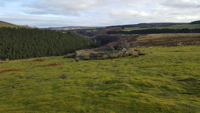
Baxtonlaw Plantation, located in Durham, is a picturesque woodland area known for its rich biodiversity and serene atmosphere. Covering several acres of land, this plantation is a significant natural heritage in the region. The plantation is situated in the heart of Durham's woodlands, providing a haven for wildlife and a sanctuary for nature enthusiasts.
The dense forest is mainly composed of native tree species, including oak, maple, and pine, which create a vibrant and diverse ecosystem. These trees provide shelter and sustenance for a variety of animals, such as deer, foxes, and numerous bird species. The plantation also features a small stream that meanders through the woodland, adding to the overall beauty of the area.
Baxtonlaw Plantation offers several walking trails, allowing visitors to explore its natural wonders. The trails are well-maintained and offer breathtaking views of the surrounding landscapes. Along the paths, hikers may encounter various species of wildflowers, adding splashes of color to the already enchanting scenery.
The plantation is committed to conservation efforts, implementing sustainable practices to protect its natural resources. It also offers educational programs and guided tours for individuals and groups interested in learning about the local flora and fauna.
Baxtonlaw Plantation, Durham, is a sanctuary for nature lovers, providing a tranquil retreat where visitors can immerse themselves in the beauty of the woodlands and appreciate the importance of preserving our natural heritage.
If you have any feedback on the listing, please let us know in the comments section below.
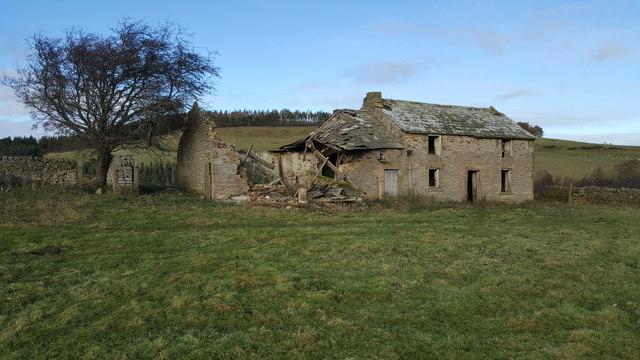
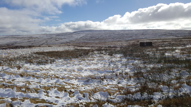
Baxtonlaw Plantation Images
Images are sourced within 2km of 54.818807/-2.1006871 or Grid Reference NY9347. Thanks to Geograph Open Source API. All images are credited.


Baxtonlaw Plantation is located at Grid Ref: NY9347 (Lat: 54.818807, Lng: -2.1006871)
Unitary Authority: County Durham
Police Authority: Durham
What 3 Words
///crumb.smarter.balanced. Near Stanhope, Co. Durham
Related Wikis

Ramshaw, Consett
Ramshaw is a small village in County Durham, in England. It is situated to the south of Hunstanworth, a few miles west of Consett. Lead mining was an important...
Townfield
Townfield is a village in County Durham, in England. It is situated just to the south of Hunstanworth and part of that parish, about 10 miles (16 km) west...

Beldon Burn
Beldon Burn is a headwater stream of the River Derwent in Northumberland and County Durham, England.It rises at Quickcleugh Moss as the Quickcleugh Burn...

Hunstanworth
Hunstanworth is a village in County Durham, England. It is situated approximately 10 miles to the west of Consett, south-west of the village of Blanchland...
Baybridge, Northumberland
Baybridge is a small village in Northumberland, England, just to the west of Blanchland and on the border with County Durham. It is situated to the west...

Blanchland
Blanchland is a village in Northumberland, England, on the County Durham boundary. The population of the civil parish at the 2011 census was 135.Set beside...

Lintzgarth
Lintzgarth is a village in the civil parish of Stanhope, in County Durham, England. It is situated to the west of Rookhope. The Lintzgarth smeltmill was...

Blanchland Abbey
Blanchland Abbey at Blanchland, in the English county of Northumberland, was founded as a premonstratensian priory in 1165 by Walter de Bolbec II, and...
Nearby Amenities
Located within 500m of 54.818807,-2.1006871Have you been to Baxtonlaw Plantation?
Leave your review of Baxtonlaw Plantation below (or comments, questions and feedback).