Park Road Woods

Wood, Forest in Worcestershire

England

Park Road Woods

Mural, Claycroft Place, Lye
Mural, Claycroft Place, Lye Credit: Alex McGregor

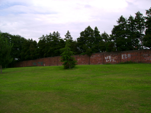
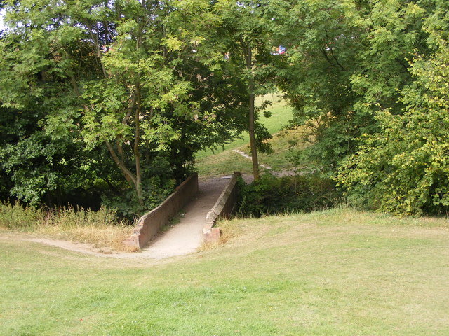
Park Road Woods is a picturesque woodland located in Worcestershire, England. Covering approximately 50 acres, it is a natural haven that offers visitors a tranquil escape from the hustle and bustle of everyday life. The woods are situated just off Park Road, near the village of Kempsey.

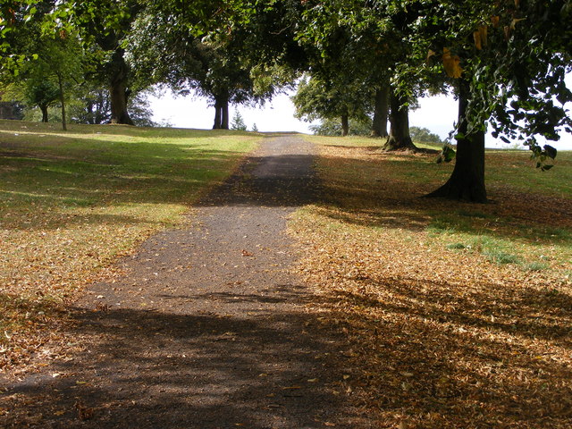
The woodland is characterized by a diverse range of tree species, including oak, beech, ash, and birch, which create a dense canopy overhead. This rich variety of trees supports a thriving ecosystem, providing a habitat for numerous bird species, small mammals, and insects. The woods are particularly renowned for their bluebell displays, which carpet the forest floor in a stunning sea of vibrant blue during the spring months.

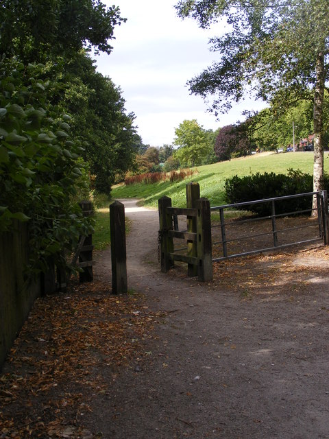
Visitors to Park Road Woods can enjoy leisurely walks along the well-maintained trails that wind through the forest. These paths meander through the woodland, offering breathtaking views and opportunities to spot wildlife. The peaceful ambiance of the woods makes it an ideal location for nature enthusiasts, photographers, and families looking to connect with nature.

In addition to its natural beauty, Park Road Woods also boasts a small picnic area, allowing visitors to relax and enjoy a meal amidst the serene surroundings. The woods are easily accessible, with ample parking available nearby, and are open to the public throughout the year.

Overall, Park Road Woods is a hidden gem in Worcestershire, offering a unique and enchanting woodland experience for visitors of all ages.

If you have any feedback on the listing, please let us know in the comments section below.

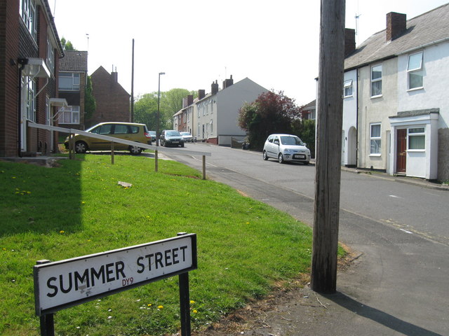
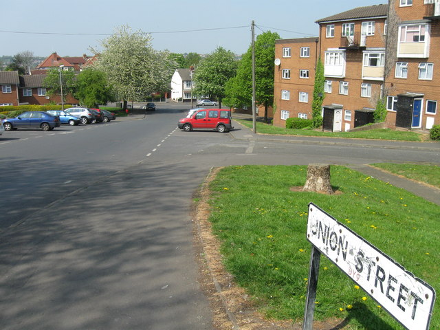
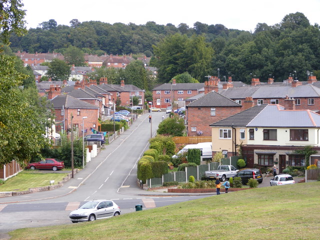
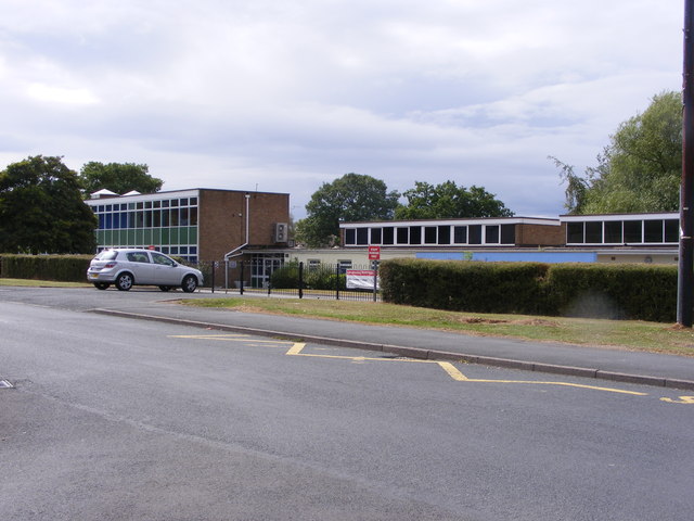
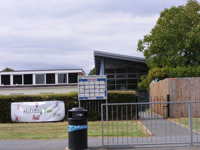
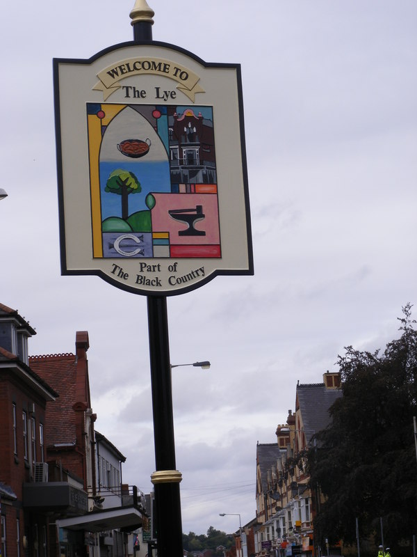
Park Road Woods Images

Images are sourced within 2km of 52.455093/-2.0953586 or Grid Reference SO9384. Thanks to Geograph Open Source API. All images are credited.

Mural, Claycroft Place, Lye
Summer Street, Lye
Summer Street, Lye
Union Street, Lye
Union Street, Lye
Roundabout on the A4036
Stevens Park The highest ground in Stevens Park, formerly home to swing sets.  A new playground has been constructed elsewhere in the park.
Stevens Park
The highest ground in Stevens Park, formerly home to swing sets. A new playground has been constructed elsewhere in the park.
Hodge Hill View The view down from Stevens Park Wollescote to the Dudley street.
Hodge Hill View
The view down from Stevens Park Wollescote to the Dudley street.
Park Gate The path alongside the brook in Stevens Park Wollescote.
Park Gate
The path alongside the brook in Stevens Park Wollescote.
Shaded Path The view up the path in Stevens Park, Wollescote.
Shaded Path
The view up the path in Stevens Park, Wollescote.
The Lye The High Street view of the new town sign in the Black Country.
The Lye
The High Street view of the new town sign in the Black Country.
The Old Bell at Lye The view from the High Street of a Black Country Pub.
The Old Bell at Lye
The view from the High Street of a Black Country Pub.
Trucks at The Hayes The view on the A458 near Lye of Daf trucks at Imperial Commercials.
Trucks at The Hayes
The view on the A458 near Lye of Daf trucks at Imperial Commercials.
Lye Approach The view down the High Street to the start of the Town centre.
Lye Approach
The view down the High Street to the start of the Town centre.
Hob Green School The Primary School in Hob Green Road, Dudley.
Hob Green School
The Primary School in Hob Green Road, Dudley.
Hob Green Children's Centre The centre next to the Primary School in Hob Green Road, Dudley.
Hob Green Children's Centre
The centre next to the Primary School in Hob Green Road, Dudley.
Stevens Park Bridge The bridge over the brook in the Wollescote Park at Dudley.
Stevens Park Bridge
The bridge over the brook in the Wollescote Park at Dudley.
Christ Church The back view of the Church in Lye from the Lye Bypass.
Christ Church
The back view of the Church in Lye from the Lye Bypass.
Lye Citadel The Salvation Army hall on High Street, Lye.
Lye Citadel
The Salvation Army hall on High Street, Lye.
Lye Cenotaph The High Street view of the first world war cenotaph outside Christ Church.
Lye Cenotaph
The High Street view of the first world war cenotaph outside Christ Church.
Show me another place!

Park Road Woods is located at Grid Ref: SO9384 (Lat: 52.455093, Lng: -2.0953586)

Unitary Authority: Dudley

Police Authority: West Midlands

What 3 Words

///waving.rock.kicked. Near Cradley Heath, West Midlands

Nearby Locations

Park Road Woods

Related Wikis

Cradley Town F.C.

Cradley Town Football Club is a football club based in Cradley, near Halesowen in the West Midlands. They are currently members of the Midland League Division...

Colley Gate

Colley Gate is an area within Cradley and also a road in Cradley in Halesowen, England. Colley Gate is the name of the road between Windmill Hill and Greenways...

Cradley, West Midlands

Cradley () is a village in the Black Country and Metropolitan Borough of Dudley near Halesowen and the banks of the River Stour. Colley Gate is the name...

Cradley High School

Cradley High School was a secondary school located in the Cradley area of Halesowen, which is a village in the West Midlands county of England. It is situated...

Lutley

Lutley is a hamlet near Halesowen in the Dudley district, in the county of the West Midlands, England. Lutley Mill is nearby in Halesowen and is also the...

Lye, West Midlands

Lye or The Lye is a town in the Dudley Metropolitan Borough, in the West Midlands county, England, 1 mile (1.6 km) east of Stourbridge and borders with...

Lye railway station

Lye railway station serves the Lye area of Stourbridge, in the West Midlands of England. The station is managed by West Midlands Trains, who provide the...

Wollescote

Wollescote is a residential area of Stourbridge, West Midlands, England . It is administered by the Metropolitan Borough of Dudley. It falls within the...

Related Videos

Hike And Learn History | Best Hiking Point,Dudley |Trail in UK🇬🇧Saltwell National Nature Reserve

I just discovered this one of the best trail to hike in UK. Hope you guys will enjoy with me . Let's Bwgin ! #trails #uktrails #hiking ...

Hiking Tracks In Dudley | Birmingham | UK 🇬🇧 Part 2 Saltwell local reserves

dudley #trails #hiking #winter2023 #oldest #train #statues #forest #walk #waterfall #saltwell #natural #nature #reserves #vlogs ...

Walking to heal

Me and my dog mish walking to heal.

Nearby Amenities

Located within 500m of 52.455093,-2.0953586
Bus Stop
Park Rd / Park Lane
NaPTANAreaCode: 43000811501
Bus: yes
Naptan AtcoCode: 43000811501
Naptan Bearing: SW
Naptan BusStopType: MKD
Naptan CommonName: Park Lane
Naptan Indicator: opp
Naptan NaptanCode: nwmdjmjd
Naptan PlusbusZoneRef: BHAMNWS
Naptan Status: ACT
Naptan StopType: BCT
Naptan Street: PARK RD
Naptan Towards: Stourbridge
Public Transport: platform
Route Ref: 9
Shelter: yes
Shelter Ref: 408420
Source: WMCA
Lat/Long: 52.458667/-2.0928219
Bus Stop
Park Rd / Hingley Rd
NaPTANAreaCode: 43000811601
Asset Ref: 408430
Bus: yes
Naptan AtcoCode: 43000811601
Naptan Bearing: E
Naptan BusStopType: MKD
Naptan CommonName: Hingley Rd
Naptan Indicator: adj
Naptan NaptanCode: nwmdjmjm
Naptan PlusbusZoneRef: BHAMNWS
Naptan Status: ACT
Naptan StopType: BCT
Naptan Street: PARK RD
Naptan Towards: Halesowen
Public Transport: platform
Route Ref: 9
Shelter: yes
Shelter Ref: 408430
Source: WMCA
Lat/Long: 52.4578399/-2.0977572
Bus Stop
Park Rd / Hingley Rd
Bus: yes
Naptan AtcoCode: 43000811602
Naptan Bearing: W
Naptan BusStopType: MKD
Naptan CommonName: Hingley Rd
Naptan Indicator: opp
Naptan NaptanCode: nwmdjmjp
Naptan PlusbusZoneRef: BHAMNWS
Naptan Status: ACT
Naptan StopType: BCT
Naptan Street: PARK RD
Naptan Towards: Stourbridge
Public Transport: platform
Route Ref: 9
Shelter: no
Source: WMCA
Lat/Long: 52.4576984/-2.0987853
Bus Stop
Two Gates Lane / High Park Rd
Bus: yes
Naptan AtcoCode: 43000813701
Naptan Bearing: SW
Naptan BusStopType: MKD
Naptan CommonName: High Park Rd
Naptan Indicator: adj
Naptan NaptanCode: nwmjtawd
Naptan PlusbusZoneRef: BHAMNWS
Naptan Status: ACT
Naptan StopType: BCT
Naptan Street: TWO GATES LANE
Naptan Towards: Stourbridge
Public Transport: platform
Route Ref: 142
Shelter: no
Source: WMCA
Towards: Stourbridge
Lat/Long: 52.454771/-2.0902846
Bus Stop
Two Gates / Humber Gardens
Bus: yes
Naptan AtcoCode: 43000813902
Naptan Bearing: SW
Naptan BusStopType: MKD
Naptan CommonName: Humber Gardens
Naptan Indicator: opp
Naptan NaptanCode: nwmtdgjm
Naptan PlusbusZoneRef: BHAMNWS
Naptan Status: ACT
Naptan StopType: BCT
Naptan Street: TWO GATES
Naptan Towards: Halesowen
Naptan Verified: no
Public Transport: platform
Route Ref: 13
Source: WMCA
Lat/Long: 52.4554687/-2.0881067
Bus Stop
High Park Rd / Two Gates Lane
Bus: yes
Naptan AtcoCode: 43008106001
Naptan Bearing: SE
Naptan BusStopType: MKD
Naptan CommonName: Two Gates Lane
Naptan Indicator: after
Naptan NaptanCode: nwmtjtjm
Naptan PlusbusZoneRef: BHAMNWS
Naptan Status: ACT
Naptan StopType: BCT
Naptan Street: HIGH PARK RD
Naptan Towards: Halesowen
Public Transport: platform
Route Ref: 13;142
Shelter: no
Source: WMCA
Towards: Halesowen
Lat/Long: 52.4545718/-2.0894213
Fast Food
McDonald's
Addr Postcode: B63 2RG
Addr Street: Park Road
Brand: McDonald's
Brand Wikidata: Q38076
Brand Wikipedia: en:McDonald's
Contact Website: https://www.mcdonalds.com/gb/en-gb/location/halesowen/halesowen---park-road/park-road/8261220.html
Cuisine: burger
Drive Through: yes
Fhrs Id: 501148
Source Addr: FHRS Open Data
Takeaway: yes
Lat/Long: 52.4579963/-2.0943682
Speed Camera
Source: survey
Lat/Long: 52.4577862/-2.0995394
Brand: National Grid
Brand Wikidata: Q1465461
Operator: National Grid Electricity Distribution Plc
Operator Old: Western Power Distribution
Operator Wikidata: Q7988183
Owner: National Grid Electricity Distribution (West Midlands) Plc
Owner Wikidata: Q114397791
Power: substation
Ref: 11039
Source: survey
Lat/Long: 52.4592469/-2.0942722
Post Box
Ref: B63 1141
Source: GPS Survey
Lat/Long: 52.4592237/-2.0924682
Barrier: bollard
Source: survey
Lat/Long: 52.4578128/-2.0908181
Grit Bin
Source: visual survey; estimate
Lat/Long: 52.4562311/-2.0888709
Grit Bin
Source: survey
Lat/Long: 52.456471/-2.0916973
Barrier: cycle_barrier
Source: survey
Lat/Long: 52.4589781/-2.0917707
Grit Bin
Source: survey
Lat/Long: 52.4570185/-2.0919628
Barrier: bollard
Source: survey
Lat/Long: 52.4580226/-2.091413
Grit Bin
Source: survey
Lat/Long: 52.4557948/-2.0909417
Bench
Source: survey
Lat/Long: 52.4557409/-2.0903426
Post Box
Ref: B63 106
Source: GPS Survey
Lat/Long: 52.4564564/-2.0914114
Barrier: bollard
Source: survey
Lat/Long: 52.4574294/-2.0908458
Bench
Source: survey
Lat/Long: 52.4548109/-2.0898644
Crossing
Crossing: traffic_signals
Source: survey
Lat/Long: 52.4550177/-2.0894616
Brand: National Grid
Brand Wikidata: Q1465461
Operator: National Grid Electricity Distribution Plc
Operator Old: Western Power Distribution
Operator Wikidata: Q7988183
Owner: National Grid Electricity Distribution (West Midlands) Plc
Owner Wikidata: Q114397791
Power: substation
Ref: 11359
Source: survey
Lat/Long: 52.4546719/-2.0894055
Man Made: tower
Source: survey
Tower Type: communication
Lat/Long: 52.456284/-2.0981558
Man Made: tower
Operator: T-Mobile
Ref: 99122
Tower Type: communication
Lat/Long: 52.4563608/-2.0977313
Grit Bin
Source: survey
Lat/Long: 52.4536892/-2.0915563
Man Made: tower
Operator: O2
Ref: cell_id_12358
Tower Type: communication
Lat/Long: 52.4561789/-2.0984012
Barrier: cycle_barrier
Source: survey
Lat/Long: 52.4546269/-2.0941829
Barrier: cycle_barrier
Source: survey
Lat/Long: 52.4551348/-2.0908996
Generator Method: photovoltaic
Generator Output Electricity: yes
Generator Source: solar
Generator Type: solar_photovoltaic_panel
Location: roof
Power: generator
Lat/Long: 52.4580013/-2.0921136
Generator Method: photovoltaic
Generator Output Electricity: yes
Generator Source: solar
Generator Type: solar_photovoltaic_panel
Location: roof
Power: generator
Lat/Long: 52.4570693/-2.0907739
Generator Method: photovoltaic
Generator Output Electricity: yes
Generator Source: solar
Generator Type: solar_photovoltaic_panel
Location: roof
Power: generator
Lat/Long: 52.4573137/-2.0905593
Generator Method: photovoltaic
Generator Output Electricity: yes
Generator Source: solar
Generator Type: solar_photovoltaic_panel
Location: roof
Power: generator
Lat/Long: 52.4573202/-2.0906639
Generator Method: photovoltaic
Generator Output Electricity: yes
Generator Source: solar
Generator Type: solar_photovoltaic_panel
Location: roof
Power: generator
Lat/Long: 52.4573227/-2.0907484
Generator Method: photovoltaic
Generator Output Electricity: yes
Generator Source: solar
Generator Type: solar_photovoltaic_panel
Location: roof
Power: generator
Lat/Long: 52.4559473/-2.0894341
Generator Method: photovoltaic
Generator Output Electricity: yes
Generator Source: solar
Generator Type: solar_photovoltaic_panel
Location: roof
Power: generator
Lat/Long: 52.4559285/-2.0891592
Generator Method: photovoltaic
Generator Output Electricity: yes
Generator Source: solar
Generator Type: solar_photovoltaic_panel
Location: roof
Power: generator
Lat/Long: 52.4559285/-2.0887998
Generator Method: photovoltaic
Generator Output Electricity: yes
Generator Source: solar
Generator Type: solar_photovoltaic_panel
Location: roof
Power: generator
Lat/Long: 52.4559228/-2.0887113
Generator Method: photovoltaic
Generator Output Electricity: yes
Generator Source: solar
Generator Type: solar_photovoltaic_panel
Location: roof
Power: generator
Lat/Long: 52.4561835/-2.0888159
Generator Method: photovoltaic
Generator Output Electricity: yes
Generator Source: solar
Generator Type: solar_photovoltaic_panel
Location: roof
Power: generator
Lat/Long: 52.4561132/-2.0881929
Generator Method: photovoltaic
Generator Output Electricity: yes
Generator Source: solar
Generator Type: solar_photovoltaic_panel
Location: roof
Power: generator
Lat/Long: 52.4560466/-2.0883384
Generator Method: photovoltaic
Generator Output Electricity: yes
Generator Source: solar
Generator Type: solar_photovoltaic_panel
Location: roof
Power: generator
Lat/Long: 52.45598/-2.0884725
Generator Method: photovoltaic
Generator Output Electricity: yes
Generator Source: solar
Generator Type: solar_photovoltaic_panel
Location: roof
Power: generator
Lat/Long: 52.4525736/-2.0902428
Access: private
Barrier: lift_gate
Lat/Long: 52.4573734/-2.1004964
Natural: spring
Source: OS
Lat/Long: 52.4551077/-2.0945764
The data included in this document is from www.openstreetmap.org. The data is made available under ODbL.

Have you been to Park Road Woods?

Leave your review of Park Road Woods below (or comments, questions and feedback).