Lethamhill Plantation

Wood, Forest in Northumberland

England

Lethamhill Plantation

B6354, Berryhill
B6354, Berryhill Credit: Richard Webb

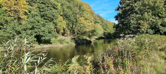
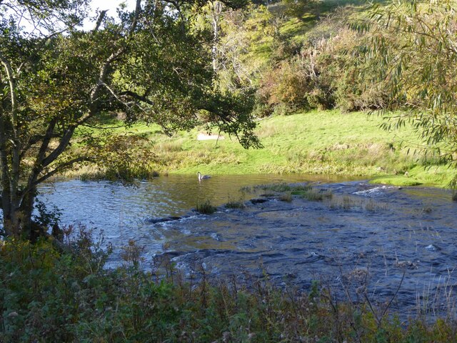
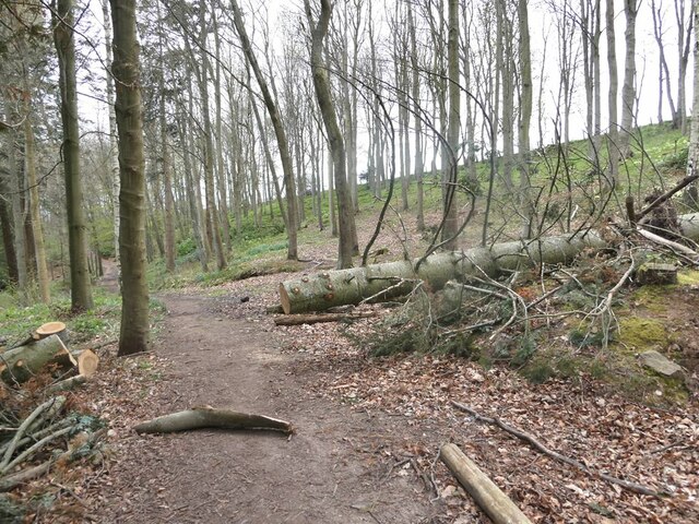
Lethamhill Plantation is a picturesque woodland located in Northumberland, England. Covering an area of approximately 100 acres, this enchanting plantation is a haven for nature enthusiasts and those seeking tranquility amidst the beauty of the great outdoors.

The plantation is predominantly composed of native broadleaf trees, such as oak, beech, and birch, which provide a rich habitat for a diverse range of flora and fauna. Walking through the plantation, visitors can enjoy the lush greenery and marvel at the sight of vibrant wildflowers that carpet the forest floor during spring and summer.

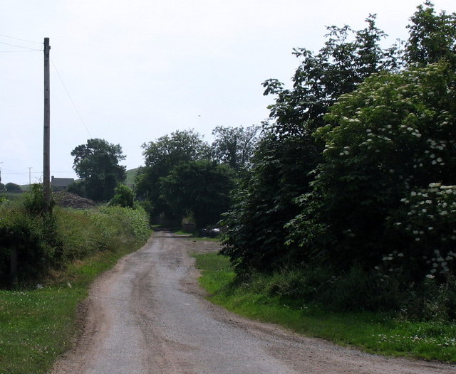
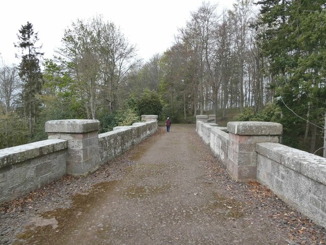
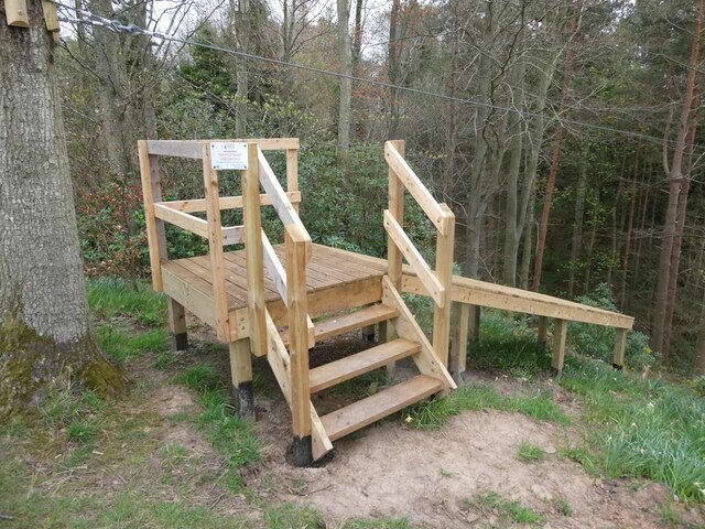
The woodland is crisscrossed by a network of well-maintained walking trails, allowing visitors to explore the plantation at their own pace. These trails wind through the woods, taking visitors past ancient trees, babbling brooks, and small ponds that are home to various aquatic species.

Lethamhill Plantation is not just a haven for wildlife, but also a popular destination for outdoor activities. It offers opportunities for hiking, bird watching, and even picnicking in designated areas. The plantation is also a favored spot for photographers, who are drawn to capture the captivating play of light and shadow among the trees.

Managed by the local council, Lethamhill Plantation is open to the public year-round, providing a serene escape from the hustle and bustle of everyday life. With its natural beauty and serene atmosphere, this woodland is a must-visit destination for anyone seeking a peaceful retreat in the heart of Northumberland.

If you have any feedback on the listing, please let us know in the comments section below.

Lethamhill Plantation Images

Images are sourced within 2km of 55.643378/-2.1057204 or Grid Reference NT9338. Thanks to Geograph Open Source API. All images are credited.

B6354, Berryhill
B6354, Berryhill
Barleymill Covert, Northumberland Looking northeast along the southern bank of the River Till in the vicinity of Barleymill Covert.
Barleymill Covert, Northumberland
Looking northeast along the southern bank of the River Till in the vicinity of Barleymill Covert.
View of the River Till View much improved by Storm Arwen blowing down the now logged tree beside the path.
View of the River Till
View much improved by Storm Arwen blowing down the now logged tree beside the path.
Young swan on the River Till By Barleymill Bank.
Young swan on the River Till
By Barleymill Bank.
Remains of Etal Barley Mill There are records of a mill here since at least the late 18th century.
Remains of Etal Barley Mill
There are records of a mill here since at least the late 18th century.
Rhodes Hill trig
Rhodes Hill trig
Climbing at Berry Hill Superb Northumberland sandstone provides great climbing in the area. The rock is weathered into strange flutings and arches - a friend said it's like climbing on a cathedral. The tracks below are from the sheep & cattle in the field
Climbing at Berry Hill
Superb Northumberland sandstone provides great climbing in the area. The rock is weathered into strange flutings and arches - a friend said it's like climbing on a cathedral. The tracks below are from the sheep & cattle in the field
Berryhill Crag A south facing sandstone crag with some good climbing potential
Berryhill Crag
A south facing sandstone crag with some good climbing potential
Lane to Berryhill farm and crags
Bridge over Grove Dene On the carriage drive from Ford to Etal.
Bridge over Grove Dene
On the carriage drive from Ford to Etal.
For the intrepid visitor End station of a zip wire over the deep gorge of Grove Dene on the Ford and Etal estate.
For the intrepid visitor
End station of a zip wire over the deep gorge of Grove Dene on the Ford and Etal estate.
Ford Castle Although a castle has existed on this site since the 13th century, what is seen here almost all dates from the 18th and 19th centuries. Grade I listed.
Ford Castle
Although a castle has existed on this site since the 13th century, what is seen here almost all dates from the 18th and 19th centuries. Grade I listed.
Parson's Tower, Ford A medieval pele tower on the Ford and Etal estate that once housed the local clergyman.
Parson's Tower, Ford
A medieval pele tower on the Ford and Etal estate that once housed the local clergyman.
Ford Castle Although a castle has existed on this site since the 13th century, what is seen here almost all dates from the 18th and 19th centuries. Grade I listed.
Ford Castle
Although a castle has existed on this site since the 13th century, what is seen here almost all dates from the 18th and 19th centuries. Grade I listed.
Gatehouse and courtyard, Ford Castle Although a castle has existed on this site since the 13th century, what is seen here almost all dates from the 18th and 19th centuries. The portcullis looks less than authentic. Grade I listed.
Gatehouse and courtyard, Ford Castle
Although a castle has existed on this site since the 13th century, what is seen here almost all dates from the 18th and 19th centuries. The portcullis looks less than authentic. Grade I listed.
Footpath in Castle Dene On the Ford Village and Castle Dene signed walk.
Footpath in Castle Dene
On the Ford Village and Castle Dene signed walk.
Gatehouse, Ford Castle Although a castle has existed on this site since the 13th century, what is seen here almost all dates from the 18th and 19th centuries. The portcullis looks less than authentic. Grade I listed.
Gatehouse, Ford Castle
Although a castle has existed on this site since the 13th century, what is seen here almost all dates from the 18th and 19th centuries. The portcullis looks less than authentic. Grade I listed.
Walled Garden, Ford Castle Outside corner of the garden.
Walled Garden, Ford Castle
Outside corner of the garden.
Show me another place!

Lethamhill Plantation is located at Grid Ref: NT9338 (Lat: 55.643378, Lng: -2.1057204)

Unitary Authority: Northumberland

Police Authority: Northumbria

What 3 Words

///divisible.crunches.relishing. Near Ford, Northumberland

Nearby Locations

Lethamhill Plantation

Related Wikis

Heatherslaw Mill

Heatherslaw Mill is a water mill situated on the Ford and Etal Estate, 7 miles north of the town of Wooler in the English county of Northumberland. It...

Ford Forge

Ford Forge (Ford Mill), Northumberland, England is located on the River Till between the villages of Ford and Etal. Buildings housing a water-powered forge...

Etal, Northumberland

Etal ( EE-təl) is a small village in the far north of the county of Northumberland, England, in the civil parish of Ford. It lies on a bridging point of...

Etal Castle

Etal Castle is a ruined medieval fortification in the village of Etal, Northumberland, England. It was built around 1341 by Robert Manners, and comprised...

Nearby Amenities

Located within 500m of 55.643378,-2.1057204
Post Box
Collection Times: Mo-Fr 12:00; Sa 10:00
Operator: Royal Mail
Post Box Type: lamp
Ref: TD12 91
Royal Cypher: scottish_crown
Lat/Long: 55.63916/-2.1078598
Barrier: bollard
Lat/Long: 55.6394702/-2.1078844
Power: pole
Lat/Long: 55.6402463/-2.1035111
Power: pole
Lat/Long: 55.6410734/-2.1034138
Power: pole
Lat/Long: 55.6416906/-2.1033558
Power: pole
Lat/Long: 55.6423255/-2.1032844
Power: pole
Lat/Long: 55.6429628/-2.1032219
Power: pole
Lat/Long: 55.6436883/-2.103146
Power: pole
Lat/Long: 55.6444638/-2.1030734
Power: pole
Lat/Long: 55.6447548/-2.1031931
Power: pole
Lat/Long: 55.644916/-2.1032556
Power: pole
Lat/Long: 55.6450399/-2.1026446
Power: pole
Lat/Long: 55.6451843/-2.1033293
Power: pole
Lat/Long: 55.645615/-2.1034654
Power: pole
Lat/Long: 55.6456322/-2.1022037
Power: pole
Lat/Long: 55.6459384/-2.1010445
Power: pole
Lat/Long: 55.6460835/-2.1036082
Power: pole
Lat/Long: 55.6463677/-2.1001092
Power: pole
Lat/Long: 55.6465407/-2.1037555
Power: pole
Lat/Long: 55.6469022/-2.1038537
Noexit: yes
Lat/Long: 55.6445209/-2.1041716
Noexit: yes
Lat/Long: 55.6446374/-2.1035574
Ford Forge
Place: hamlet
Lat/Long: 55.6392941/-2.1080999
Barrier: bollard
Lat/Long: 55.6394456/-2.1078746
Bicycle Parking
Capacity: 6
Lat/Long: 55.639042/-2.1076946
Bicycle Parking
Capacity: 4
Lat/Long: 55.6390723/-2.1078469
Heatherslaw Railway Station
Railway: station
Usage: tourism
Wheelchair: limited
Lat/Long: 55.6391023/-2.1067584
Barrier: bollard
Lat/Long: 55.6398431/-2.1072101
Barrier: bollard
Lat/Long: 55.6398652/-2.1071788
Barrier: bollard
Lat/Long: 55.6398628/-2.1071256
Barrier: bollard
Lat/Long: 55.6398349/-2.1071559
Power: pole
Lat/Long: 55.6394136/-2.1035995
Direction: 145
Generator Method: photovoltaic
Generator Output Electricity: yes
Generator Solar Modules: 20
Generator Source: solar
Generator Type: solar_photovoltaic_panel
Location: roof
Power: generator
Lat/Long: 55.6456318/-2.1014531
Direction: 145
Generator Method: photovoltaic
Generator Output Electricity: yes
Generator Solar Modules: 20
Generator Source: solar
Generator Type: solar_photovoltaic_panel
Location: roof
Power: generator
Lat/Long: 55.6457574/-2.1014638
Communication Mobile Phone: yes
Man Made: tower
Tower Type: communication
Lat/Long: 55.6456462/-2.1022423
Noexit: yes
Lat/Long: 55.6456999/-2.1010843
Power: pole
Lat/Long: 55.6447127/-2.1028881
The data included in this document is from www.openstreetmap.org. The data is made available under ODbL.

Have you been to Lethamhill Plantation?

Leave your review of Lethamhill Plantation below (or comments, questions and feedback).