Blacklake Plantation

Wood, Forest in Staffordshire Stafford

England

Blacklake Plantation

Sandon Road The view along the A520 road in Meir Heath, Staffordshire.
Sandon Road Credit: Gordon Griffiths

Blacklake Plantation is a lush and sprawling woodland located in Staffordshire, England. Covering an area of approximately 500 acres, this enchanting forest is a haven for nature enthusiasts and outdoor adventurers alike. Its name is derived from the presence of a beautiful black lake that lies within its boundaries, adding to the picturesque charm of the plantation.

The woodland is primarily composed of a diverse range of tree species, including oak, birch, beech, and pine. These majestic trees form a dense canopy, providing ample shade and shelter for the plethora of wildlife that call the plantation home. Visitors can expect to encounter an array of animals, such as deer, foxes, badgers, and a variety of bird species, making it a perfect spot for birdwatching and wildlife photography.

Blacklake Plantation offers an extensive network of walking trails, allowing visitors to explore its natural beauty at their own pace. These well-maintained paths wind through the woodland, providing stunning views of the lake, meandering streams, and vibrant wildflowers that dot the landscape. Additionally, the plantation boasts several picnic areas and benches strategically placed to offer visitors a chance to rest and soak in the serene surroundings.

The plantation is open to the public year-round and offers a range of activities, including guided nature walks, educational programs for schools, and conservation initiatives. It is managed by a dedicated team of forestry professionals who work tirelessly to preserve the natural ecosystem and create an enjoyable experience for visitors.

Blacklake Plantation is a true gem of Staffordshire, offering a peaceful retreat amidst nature's splendor. Whether seeking solace, embarking on an adventure, or simply appreciating the wonders of the natural world, this woodland sanctuary has something to offer for everyone.

If you have any feedback on the listing, please let us know in the comments section below.

Blacklake Plantation Images

Images are sourced within 2km of 52.951244/-2.1006463 or Grid Reference SJ9339. Thanks to Geograph Open Source API. All images are credited.
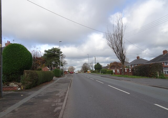
Sandon Road The view along the A520 road in Meir Heath, Staffordshire.
Sandon Road
The view along the A520 road in Meir Heath, Staffordshire.
Meir Heath Windmill Former windmill at Meir Heath built in the 18th century.  The building is Grade II listed, see: <span class="nowrap"><a title="https://historicengland.org.uk/listing/the-list/list-entry/1374182?section=official-list-entry" rel="nofollow ugc noopener" href="https://historicengland.org.uk/listing/the-list/list-entry/1374182?section=official-list-entry">Link</a><img style="margin-left:2px;" alt="External link" title="External link - shift click to open in new window" src="https://s1.geograph.org.uk/img/external.png" width="10" height="10"/></span>
Meir Heath Windmill
Former windmill at Meir Heath built in the 18th century. The building is Grade II listed, see: LinkExternal link
The Windmill The Windmill pub in Meir Heath, the pub is named after the former windmill which stand nearby <a href="https://www.geograph.org.uk/photo/7509105">SJ9240 : Meir Heath Windmill</a>.
The Windmill
The Windmill pub in Meir Heath, the pub is named after the former windmill which stand nearby SJ9240 : Meir Heath Windmill.
Water Tower at Meir Heath
Grindley Park Houses in the distance are Sandon Road.[Looking NNW]
Grindley Park
Houses in the distance are Sandon Road.[Looking NNW]
The Potters Bar On the Meir Park estate
The Potters Bar
On the Meir Park estate
Old Corn Windmill Tower This Wind Cornmill Tower stands in the carpark of the windmill inn at Meir Heath
Old Corn Windmill Tower
This Wind Cornmill Tower stands in the carpark of the windmill inn at Meir Heath
St. Francis, Meir Heath
St. Matthew's School, Rough Close, Meir Heath The school has a small church attached
St. Matthew's School, Rough Close, Meir Heath
The school has a small church attached
Meir Heath windmill The shell of this windmill was rescued and stabilised from a dilapidated state in 2002, when the concrete cap was repaired and the iron bands around the brickwork were restored. A local group was formed at that time to try and look after it. The mill stands in the carpark of a pub called, with great imagination, The Windmill.
Meir Heath windmill
The shell of this windmill was rescued and stabilised from a dilapidated state in 2002, when the concrete cap was repaired and the iron bands around the brickwork were restored. A local group was formed at that time to try and look after it. The mill stands in the carpark of a pub called, with great imagination, The Windmill.
Meir Heath milepost - detail Clearly (and I reckon incorrectly) telling us that it's in Normacot.
Meir Heath milepost - detail
Clearly (and I reckon incorrectly) telling us that it's in Normacot.
Meir Heath milepost in its setting Oddly, despite being in Meir Heath, this one has the name 'Normacot' on it (see <a href="https://www.geograph.org.uk/photo/1483524">SJ9240 : Meir Heath milepost - detail</a>), which is about 1.5 miles away to the northwest. Makes you wonder if it's been moved at some time in the past.
Meir Heath milepost in its setting
Oddly, despite being in Meir Heath, this one has the name 'Normacot' on it (see SJ9240 : Meir Heath milepost - detail), which is about 1.5 miles away to the northwest. Makes you wonder if it's been moved at some time in the past.
Normacot milepost in its setting
The Normacot milepost - detail As is the case with <a href="https://www.geograph.org.uk/photo/1483524">SJ9240 : Meir Heath milepost - detail</a>, this calls itself a Normacot milepost, despite being in Meir Heath. How this comes about on two different mileposts is a mystery to me.
The Normacot milepost - detail
As is the case with SJ9240 : Meir Heath milepost - detail, this calls itself a Normacot milepost, despite being in Meir Heath. How this comes about on two different mileposts is a mystery to me.
The church of St Francis of Assisi, Meir Heath
Restoration work underway on the Meir Heath windmill Yes - it does look exactly like they've deposited a small boat upside-down on the top. 
Update July 2011:- The plan is to make the mill waterproof, and so a Lime slurry waterproof render, suggested by the Stafford Borough Conservation Officer, will be eventually put onto the windmill tower. The Guttering will be aluminium and a soakaway French drain will be installed around the base. Thanks to Gill Swift, the Preservation Group Project Officer, for this detail.

The same mill structure a few months previously <a href="https://www.geograph.org.uk/photo/1403041">SJ9240 : Meir Heath windmill</a>
Restoration work underway on the Meir Heath windmill
Yes - it does look exactly like they've deposited a small boat upside-down on the top. Update July 2011:- The plan is to make the mill waterproof, and so a Lime slurry waterproof render, suggested by the Stafford Borough Conservation Officer, will be eventually put onto the windmill tower. The Guttering will be aluminium and a soakaway French drain will be installed around the base. Thanks to Gill Swift, the Preservation Group Project Officer, for this detail. The same mill structure a few months previously SJ9240 : Meir Heath windmill
The Meir Heath (East) milepost in its setting That lamppost is situated immediately in front of the old milepost; how insensitive is that?
The Meir Heath (East) milepost in its setting
That lamppost is situated immediately in front of the old milepost; how insensitive is that?
The Meir Heath (East) milepost - partial detail Who in their right mind would plant a lamppost directly in front of the old milepost? Honestly!
The Meir Heath (East) milepost - partial detail
Who in their right mind would plant a lamppost directly in front of the old milepost? Honestly!
Show me another place!

Blacklake Plantation is located at Grid Ref: SJ9339 (Lat: 52.951244, Lng: -2.1006463)

Administrative County: Staffordshire

District: Stafford

Police Authority: Staffordshire

What 3 Words

///match.piled.dried. Near Longton, Staffordshire

Related Wikis

Meir Heath Cricket Club

Meir Heath Cricket Club is a cricket club and ground in Meir Heath, Staffordshire. The first recorded match on the ground was in 1991, when Staffordshire...

Meir K.A. F.C.

Meir King's Arms Football Club was an association football club based in Stoke-on-Trent, England, established in 1972. Originally formed as the Sunday...

Meir Heath

Meir Heath is a village just to the south of Stoke-on-Trent, Staffordshire situated on a hilltop between Meir and Rough Close, 2+1⁄2 miles from Barlaston...

Barlaston and Rough Close Common

Barlaston and Rough Close Common is a local nature reserve, an area of heathland in Staffordshire, England, near Barlaston and about 3 miles (4.8 km) north...

RAF Meir

Royal Air Force Meir or more simply RAF Meir is a former Royal Air Force station located in Stoke-on-Trent, Staffordshire, England. The following units...

Ormiston Meridian Academy

Ormiston Meridian Academy is a co-educational secondary school located in the Meir area of the City of Stoke-on-Trent, Staffordshire, England. The school...

Lightwood, Stoke-on-Trent

Lightwood is a suburb of Stoke-on-Trent, Staffordshire, England. It is located to the south of Longton, and Lightwood Road runs from here to Rough Close...

Fulford, Staffordshire

Fulford is a village and civil parish about 5 miles (8 km) north east of Stone, in the Stafford district, in the county of Staffordshire, England. The...

Nearby Amenities

Located within 500m of 52.951244,-2.1006463
Power: pole
Lat/Long: 52.9476878/-2.1008783
Power: pole
Lat/Long: 52.9474614/-2.1017956
Power: pole
Source: Bing
Lat/Long: 52.9479365/-2.0999392
Power: pole
Source: Bing
Lat/Long: 52.9480432/-2.105877
Power: pole
Lat/Long: 52.9533923/-2.1064401
Power: pole
Source: Bing
Lat/Long: 52.9482403/-2.0986461
Power: pole
Source: Bing
Lat/Long: 52.9485587/-2.0952102
Power: pole
Source: Bing
Lat/Long: 52.9493813/-2.0941239
Power: pole
Source: Bing
Lat/Long: 52.9484068/-2.0968436
The data included in this document is from www.openstreetmap.org. The data is made available under ODbL.

Have you been to Blacklake Plantation?

Leave your review of Blacklake Plantation below (or comments, questions and feedback).