New Etal Covert

Wood, Forest in Northumberland

England

New Etal Covert

Round bales, Berryhill
Round bales, Berryhill Credit: Richard Webb

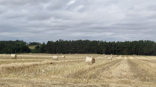
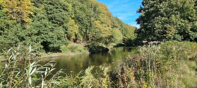
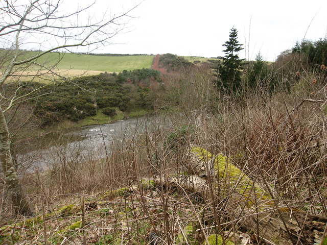
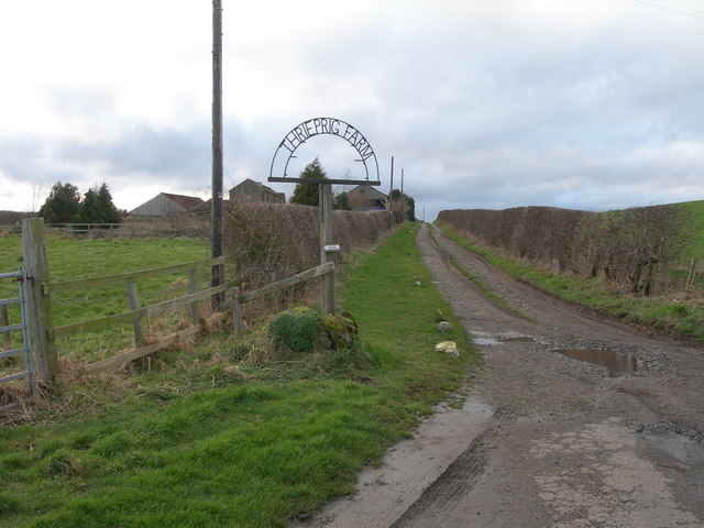
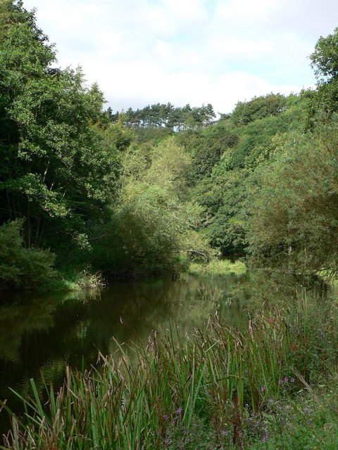
New Etal Covert is a serene woodland located in Northumberland, England. Situated near the village of Etal, this enchanting forest covers an area of approximately 100 acres. The woodland is predominantly composed of native tree species such as oak, birch, and beech, creating a diverse and lush landscape.

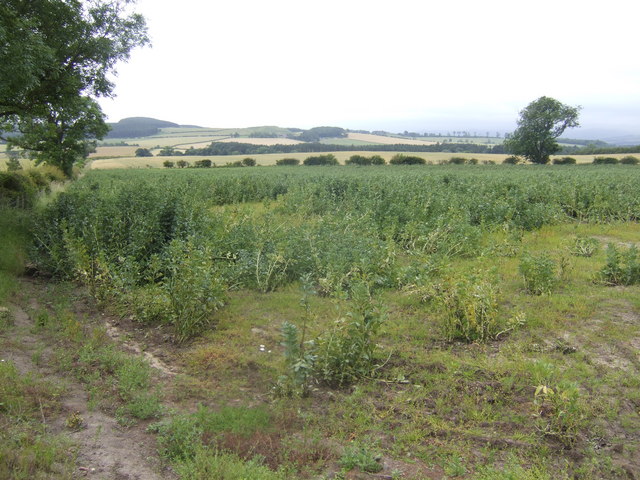
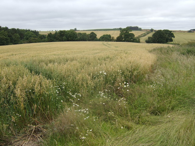
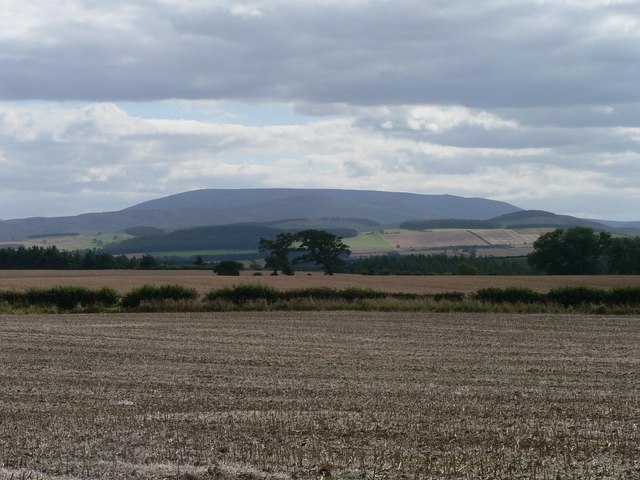
The forest is renowned for its natural beauty and is a popular destination for nature lovers and outdoor enthusiasts alike. Visitors can explore the numerous walking trails that wind their way through the woodland, offering breathtaking views of the surrounding countryside. The paths are well-maintained and accessible, making it suitable for individuals of all ages and abilities.

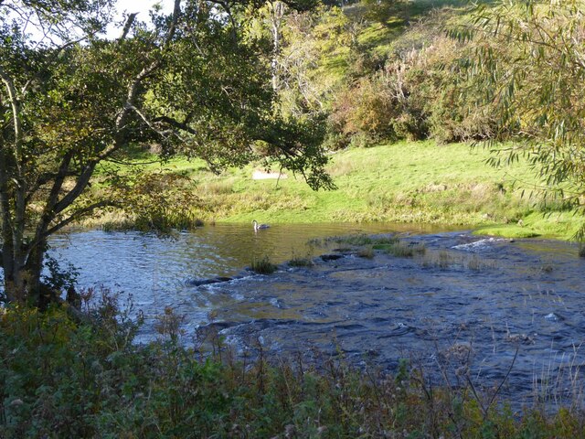
New Etal Covert is also home to a rich variety of wildlife, making it an ideal spot for birdwatching and animal spotting. Visitors may have the opportunity to catch a glimpse of native species such as red squirrels, roe deer, and a wide array of bird species including woodpeckers and owls.

For those seeking a peaceful retreat, the forest offers several picnic areas and benches where visitors can relax and soak in the tranquil atmosphere. The dense canopy of trees provides shade during hot summer days, making it a refreshing destination even in warmer weather.

Overall, New Etal Covert in Northumberland is a captivating woodland that offers visitors the chance to immerse themselves in nature, enjoy scenic walks, and discover the diverse wildlife that calls this forest home.

If you have any feedback on the listing, please let us know in the comments section below.

New Etal Covert Images

Images are sourced within 2km of 55.659633/-2.1231841 or Grid Reference NT9240. Thanks to Geograph Open Source API. All images are credited.

Round bales, Berryhill
B6354, Berryhill
B6354, Berryhill
Barleymill Covert, Northumberland Looking northeast along the southern bank of the River Till in the vicinity of Barleymill Covert.
Barleymill Covert, Northumberland
Looking northeast along the southern bank of the River Till in the vicinity of Barleymill Covert.
View of the River Till View much improved by Storm Arwen blowing down the now logged tree beside the path.
View of the River Till
View much improved by Storm Arwen blowing down the now logged tree beside the path.
Young swan on the River Till By Barleymill Bank.
Young swan on the River Till
By Barleymill Bank.
Remains of Etal Barley Mill There are records of a mill here since at least the late 18th century.
Remains of Etal Barley Mill
There are records of a mill here since at least the late 18th century.
River Till at Tiptoe, Northumberland
Climbing at Berry Hill Superb Northumberland sandstone provides great climbing in the area. The rock is weathered into strange flutings and arches - a friend said it's like climbing on a cathedral. The tracks below are from the sheep & cattle in the field
Climbing at Berry Hill
Superb Northumberland sandstone provides great climbing in the area. The rock is weathered into strange flutings and arches - a friend said it's like climbing on a cathedral. The tracks below are from the sheep & cattle in the field
Country road An old tree stands sentinel beside this country road midway between Fadden Hill and Grindon Rigg.
Country road
An old tree stands sentinel beside this country road midway between Fadden Hill and Grindon Rigg.
The road to Tiptoe It looks like the motorist has to leave the car before this sign and then tiptoe along the road.
The road to Tiptoe
It looks like the motorist has to leave the car before this sign and then tiptoe along the road.
Thrieprig Farm
Thrieprig Farm
View south from Duddo Hill Towards the Cheviots over the Till valley.
View south from Duddo Hill
Towards the Cheviots over the Till valley.
View towards Duddo Hill Oats, barley and wheat all in view.
View towards Duddo Hill
Oats, barley and wheat all in view.
Berryhill Crag A south facing sandstone crag with some good climbing potential
Berryhill Crag
A south facing sandstone crag with some good climbing potential
Tiptoe Farm near Etal Tiptoe Farm is famous for its potatoes and this is a view of a potato field.  The large hill in the background is The Cheviot which dominates almost any view South in the area.
Tiptoe Farm near Etal
Tiptoe Farm is famous for its potatoes and this is a view of a potato field. The large hill in the background is The Cheviot which dominates almost any view South in the area.
River Till near Tiptoe Farm The lovely wooded River Till is the only tributary of the River Tweed to be wholly in England.
River Till near Tiptoe Farm
The lovely wooded River Till is the only tributary of the River Tweed to be wholly in England.
Tindal House Farm Despite appearing to be derelict these cart sheds are still in use.
Tindal House Farm
Despite appearing to be derelict these cart sheds are still in use.
Heaton Moor House seen from one of the large arable fields in the area. The stubble is the remains of a wheat crop.
Heaton Moor
House seen from one of the large arable fields in the area. The stubble is the remains of a wheat crop.
Show me another place!

New Etal Covert is located at Grid Ref: NT9240 (Lat: 55.659633, Lng: -2.1231841)

Unitary Authority: Northumberland

Police Authority: Northumbria

What 3 Words

///bolts.imperious.patching. Near Ford, Northumberland

Related Wikis

Etal Castle

Etal Castle is a ruined medieval fortification in the village of Etal, Northumberland, England. It was built around 1341 by Robert Manners, and comprised...

Etal, Northumberland

Etal ( EE-təl) is a small village in the far north of the county of Northumberland, England, in the civil parish of Ford. It lies on a bridging point of...

Duddo Tower

Duddo Tower is a Scheduled Ancient Monument and a Grade II listed building comprising the ruinous remains of an ancient pele tower and 16th century tower...

Duddo

Duddo is a village and civil parish in Northumberland, about 8 miles (13 km) southwest of Berwick-upon-Tweed. == History == Duddo Five Stones is a stone...

Ford Forge

Ford Forge (Ford Mill), Northumberland, England is located on the River Till between the villages of Ford and Etal. Buildings housing a water-powered forge...

Heatherslaw Mill

Heatherslaw Mill is a water mill situated on the Ford and Etal Estate, 7 miles north of the town of Wooler in the English county of Northumberland. It...

Heaton Castle

Heaton Castle (anciently Heton) in the parish of Cornhill-on-Tweed, Northumberland, England, is a ruined historic castle near the Scottish border. It is...

Crookham, Northumberland

Crookham is a village on the River Till in Northumberland, in England. It is situated approximately 8 km (5.0 mi) to the east of Coldstream and 14 km...

Nearby Amenities

Located within 500m of 55.659633,-2.1231841
Tindal House
Place: locality
Lat/Long: 55.6621086/-2.1219174
Power: pole
Lat/Long: 55.6626398/-2.1183011
Power: pole
Lat/Long: 55.6626716/-2.1197395
The data included in this document is from www.openstreetmap.org. The data is made available under ODbL.

Have you been to New Etal Covert?

Leave your review of New Etal Covert below (or comments, questions and feedback).