West Plantation
Wood, Forest in Northumberland
England
West Plantation

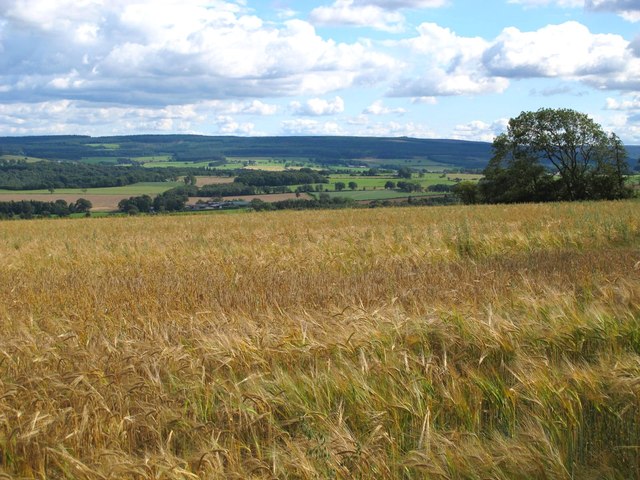
West Plantation is a picturesque woodland area located in the county of Northumberland, England. Situated in the northern part of the county, it covers a sprawling area of lush greenery and is renowned for its abundant woodlands and forests. The plantation is specifically located in the western part of the county, hence its name.
The landscape of West Plantation is characterized by a diverse range of tree species, including oak, beech, birch, and pine, among others. These trees create a dense canopy that provides a haven for a variety of wildlife, making it a popular spot for nature enthusiasts and birdwatchers. The plantation is also known for its vibrant flora, with carpets of wildflowers adding a burst of color to the surroundings during the spring and summer months.
Traversing the plantation, visitors will find a network of well-maintained footpaths and trails, allowing for peaceful walks and leisurely strolls through the woodland. These paths are suitable for all levels of fitness and offer opportunities for exploration and discovery.
West Plantation is managed by the local forestry commission, ensuring its preservation and sustainability. The commission periodically conducts conservation practices and tree management activities to maintain the health and vitality of the woodland.
In addition to its natural beauty, West Plantation offers several amenities for visitors, including picnic areas, benches, and informative signposts to enhance the overall experience. The plantation is easily accessible by car and provides ample parking facilities.
Whether it's for a tranquil nature retreat or an active day out, West Plantation in Northumberland offers a serene and captivating environment for all who venture into its woodlands.
If you have any feedback on the listing, please let us know in the comments section below.
West Plantation Images
Images are sourced within 2km of 54.95724/-2.1217557 or Grid Reference NY9262. Thanks to Geograph Open Source API. All images are credited.


West Plantation is located at Grid Ref: NY9262 (Lat: 54.95724, Lng: -2.1217557)
Unitary Authority: Northumberland
Police Authority: Northumbria
What 3 Words
///treatable.emptied.dignitary. Near Hexham, Northumberland
Nearby Locations
Related Wikis

St Joseph's Roman Catholic Middle School
St Joseph's Roman Catholic Middle School is one of the two middle schools in Hexham, Northumberland, England, the other being Hexham Middle School. The...
Queen Elizabeth High School, Hexham
Queen Elizabeth High School (QEHS) is a coeducational high school and sixth form located in Hexham, Northumberland, England. == History == The school was...

Dare Wilson Barracks
Dare Wilson Barracks, is a military installation in Hexham, Northumberland. The building is named after Major General Dare Wilson who was commissioned...

St Mary's Church, Hexham
St Mary's Church is a Roman Catholic Parish church in Hexham, Northumberland. It was built from 1828 to 1830 in the Gothic Revival style. It is located...

Queen's Hall, Hexham
The Queen's Hall, formerly Hexham Town Hall, is a municipal structure in Beaumont Street, Hexham, Northumberland, England. The structure, which was the...

Battle of Hexham
The Battle of Hexham, 15 May 1464, marked the end of significant Lancastrian resistance in the north of England during the early part of the reign of Edward...

Hexham
Hexham ( HEKS-əm) is a market town and civil parish in Northumberland, England, on the south bank of the River Tyne, formed by the confluence of the North...
Hexham Abbey
Hexham Abbey is a Grade I listed church dedicated to St Andrew, in the town of Hexham, Northumberland, in the North East of England. Originally built in...
Nearby Amenities
Located within 500m of 54.95724,-2.1217557Have you been to West Plantation?
Leave your review of West Plantation below (or comments, questions and feedback).