Stonehill Copse
Wood, Forest in Wiltshire
England
Stonehill Copse
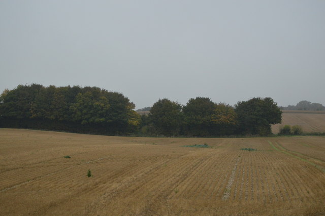
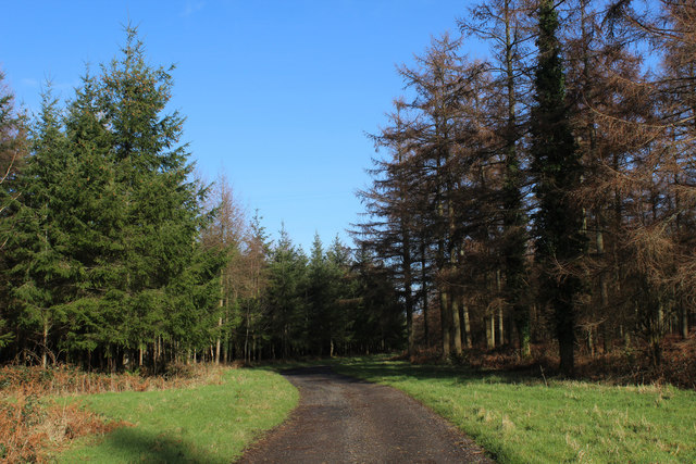
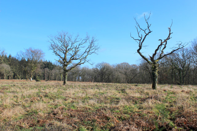
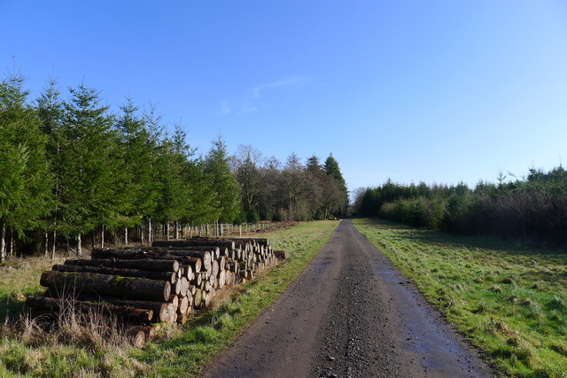
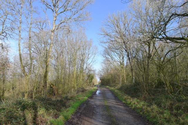
Stonehill Copse is a picturesque woodland located in the county of Wiltshire, England. Situated near the village of Stonehill, it covers an area of approximately 100 acres, making it a substantial forested area in the region. The copse is primarily composed of a diverse range of deciduous trees, including oak, beech, ash, and birch, which create a rich tapestry of greenery and provide a habitat for various wildlife species.
The forest floor is covered with a thick carpet of leaf litter, creating a natural mulch that supports a variety of ground-dwelling plants and fungi. Bluebells, primroses, and wild garlic are just a few of the flowering plants that bloom during the spring, adding vibrant colors to the woodland.
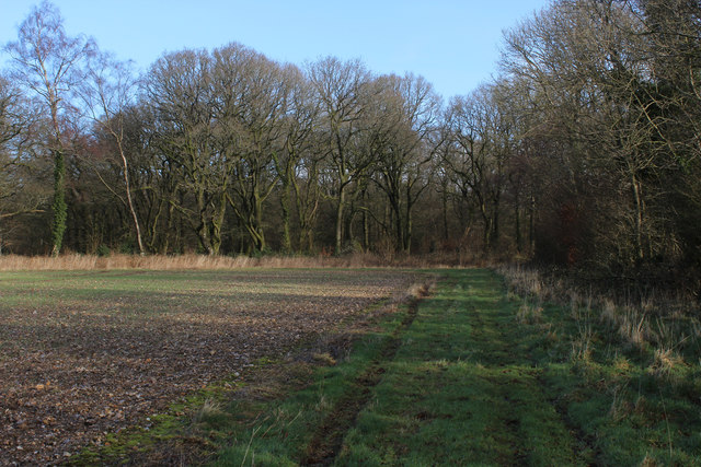
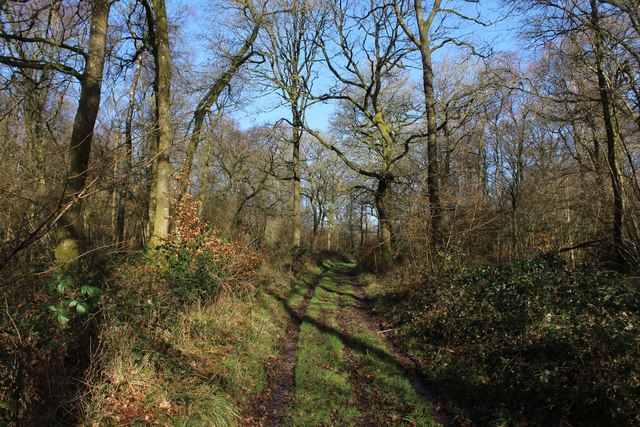
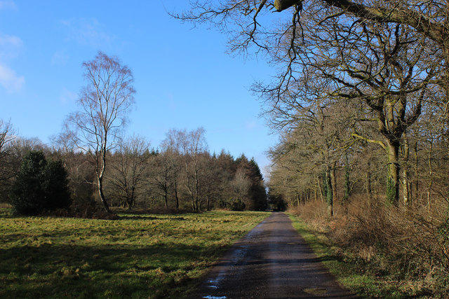
Stonehill Copse is crisscrossed by a network of well-maintained footpaths and trails, allowing visitors to explore the forest at their leisure. The paths wind through the dense undergrowth, providing glimpses of sunlight streaming through the canopy above. These walking trails are popular among hikers, nature enthusiasts, and dog walkers, offering a tranquil escape from the hustle and bustle of daily life.
The copse is also home to a diverse array of wildlife. Woodpeckers, owls, and various songbirds can be heard throughout the forest, while deer, foxes, and squirrels are frequently spotted darting between the trees. The abundance of flora and fauna in Stonehill Copse contributes to its status as a designated Site of Special Scientific Interest (SSSI), highlighting its ecological importance.
Overall, Stonehill Copse is a natural haven in the heart of Wiltshire, offering visitors a chance to immerse themselves in the beauty of a woodland ecosystem and experience the tranquility of nature.
If you have any feedback on the listing, please let us know in the comments section below.
Stonehill Copse Images
Images are sourced within 2km of 51.129181/-2.1220334 or Grid Reference ST9136. Thanks to Geograph Open Source API. All images are credited.


Stonehill Copse is located at Grid Ref: ST9136 (Lat: 51.129181, Lng: -2.1220334)
Unitary Authority: Wiltshire
Police Authority: Wiltshire
What 3 Words
///highlighted.enthused.tinkle. Near Chicklade, Wiltshire
Nearby Locations
Related Wikis

1963 BAC One-Eleven test crash
The 1963 BAC One-Eleven test crash was a fatal accident of a British Aircraft Corporation prototype aircraft on 22 October 1963, near Chicklade in Wiltshire...

Great Ridge Wood
Great Ridge Wood, formerly also known as Chicklade Wood, is one of the largest woodlands in southern Wiltshire, England. Mostly within the parishes of...

Tytherington Down
Tytherington Down (grid reference ST912385) is a 5.9 hectares (15 acres) biological Site of Special Scientific Interest in Wiltshire, England, notified...
Chicklade
Chicklade is a small village and civil parish in Wiltshire, South West England. The village is on the A303 road, about 7 miles (11 km) south of Warminster...

Berwick St Leonard
Berwick St Leonard is a small village and civil parish in Wiltshire, England, about 8 miles (13 km) southeast of Warminster and 14 miles (23 km) west of...

St Leonard's Church, Berwick St Leonard
St Leonard's Church in Berwick St Leonard, Wiltshire, England, was built in the 12th century. It is recorded in the National Heritage List for England...

Hindon, Wiltshire
Hindon is a village and civil parish in Wiltshire, England, about 16 miles (26 km) west of Salisbury and 9.6 miles (15.4 km) south of Warminster. It is...

Pertwood
Pertwood is an ancient settlement and former civil parish, near Warminster in the county of Wiltshire in the west of England. Its land and houses now lie...
Have you been to Stonehill Copse?
Leave your review of Stonehill Copse below (or comments, questions and feedback).