Stockport Little Moor

Wood, Forest in Cheshire

England

Stockport Little Moor

Castle Chambers 
In 2010 the ground floor of Castle Chambers was occupied by Louisa's Pantry <a href="https://www.geograph.org.uk/photo/2138815">SJ8990 : Castle Chambers</a> and the adjacent Park Chambers by a laptop and PC repair business. 

 By 2013 the cafe had become Rootz Bistro <a href="https://www.geograph.org.uk/photo/3430013">SJ8990 : Castle Chambers</a> but the computer business was still going strong and still there in 2014 although the cafe had by then become Hunga Busta Diner <a href="https://www.geograph.org.uk/photo/4160922">SJ8990 : Hunga Busta Diner</a>.

By 2016 <a href="https://www.geograph.org.uk/photo/5315811">SJ8990 : Castle Chambers</a> the cafe had become The Allotment and the PC business had moved out. 

Come 2019 and the vegan cafe had been transformed into a Viking themed tapas bar called Vinabod and Park Chambers was   occupied by a hair salon called Heaven <a href="https://www.geograph.org.uk/photo/6179485">SJ8990 : Castle Chambers</a>.

In 2020 The tapas bar was being transformed into something else again <a href="https://www.geograph.org.uk/photo/6420434">SJ8990 : Castle Chambers</a>.

Following the easing of restrictions around the coronavirus pandemic in 2021 the cafe/bar has re-opened as The Glass Spider but the hairdresser next door had gone and been replaced by a shop selling vintage glass bottles <a href="https://www.geograph.org.uk/photo/6856665">SJ8990 : Castle Chambers</a>.

Now in January 2024 the whole lot has closed down in readiness no doubt for some future revival.
Castle Chambers Credit: Gerald England

Stockport Little Moor, located in Cheshire, England, is a charming wooded area known for its scenic beauty and diverse wildlife. Covering an approximate area of 50 acres, this small forest offers a tranquil retreat for nature enthusiasts and hikers alike.

The woodland consists of a mix of mature trees, including oak, birch, and beech, which provide a dense canopy that offers shade and shelter to numerous species of flora and fauna. Bluebells, wood anemones, and wild garlic are some of the common wildflowers that bloom in abundance during the spring season, adding a colorful touch to the forest floor.

Home to a variety of wildlife, Stockport Little Moor provides a habitat for mammals such as foxes, rabbits, and squirrels. Bird watchers can spot a range of species, including woodpeckers, jays, and thrushes, as they flit between the branches. The forest is also frequented by butterflies, dragonflies, and other insects, making it an ideal spot for nature photography and exploration.

The forest is crisscrossed by several well-marked trails, offering visitors the opportunity to enjoy peaceful walks amidst the natural surroundings. The paths wind through the woods, passing by small streams and clearings, providing glimpses of the diverse ecosystem that thrives within the forest.

Stockport Little Moor is easily accessible, with parking available nearby and public transport links within walking distance. It is a popular location for local residents and visitors seeking a peaceful escape from the hustle and bustle of urban life, offering a serene natural retreat in the heart of Cheshire.

If you have any feedback on the listing, please let us know in the comments section below.

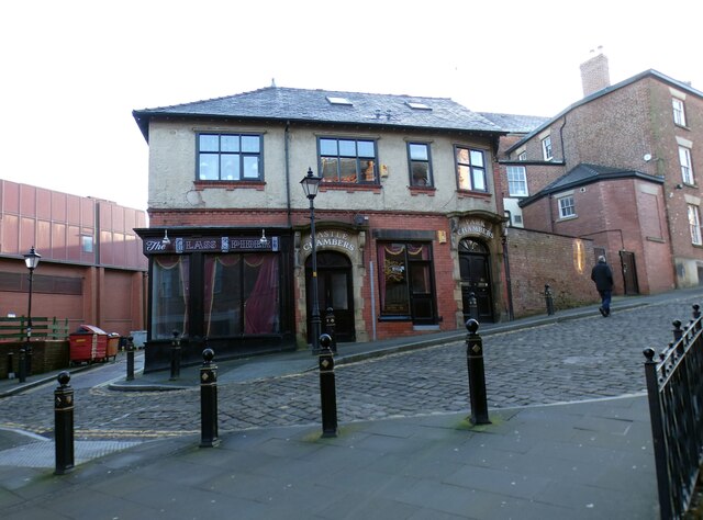
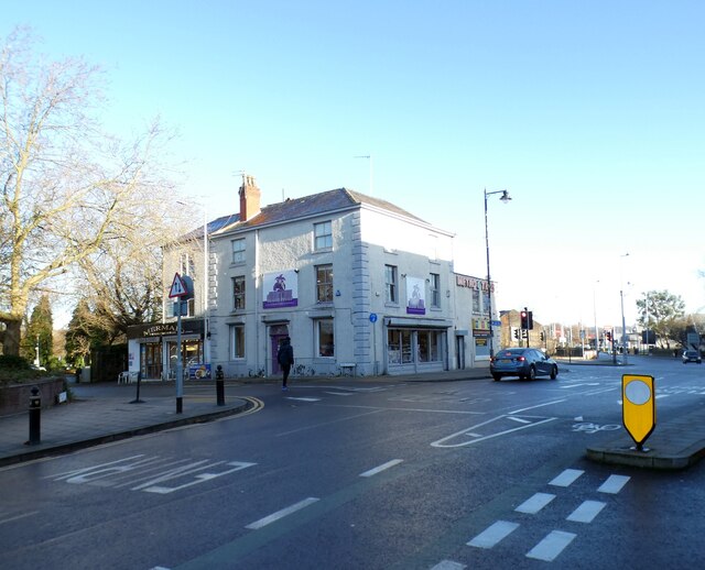
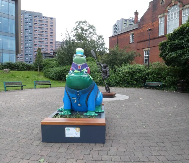
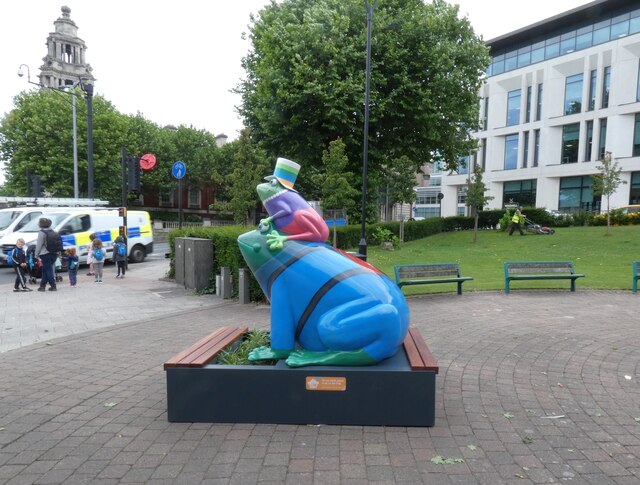
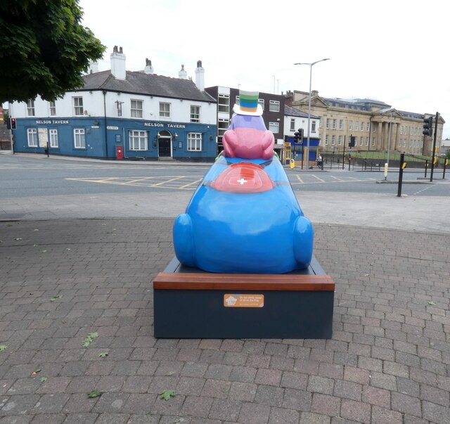
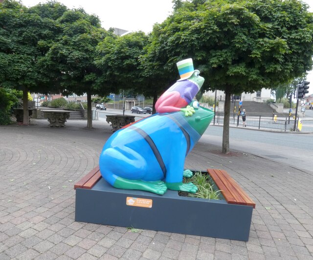
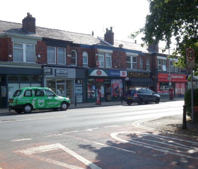
Stockport Little Moor Images

Images are sourced within 2km of 53.404902/-2.131589 or Grid Reference SJ9189. Thanks to Geograph Open Source API. All images are credited.

Castle Chambers 
In 2010 the ground floor of Castle Chambers was occupied by Louisa's Pantry <a href="https://www.geograph.org.uk/photo/2138815">SJ8990 : Castle Chambers</a> and the adjacent Park Chambers by a laptop and PC repair business. 

 By 2013 the cafe had become Rootz Bistro <a href="https://www.geograph.org.uk/photo/3430013">SJ8990 : Castle Chambers</a> but the computer business was still going strong and still there in 2014 although the cafe had by then become Hunga Busta Diner <a href="https://www.geograph.org.uk/photo/4160922">SJ8990 : Hunga Busta Diner</a>.

By 2016 <a href="https://www.geograph.org.uk/photo/5315811">SJ8990 : Castle Chambers</a> the cafe had become The Allotment and the PC business had moved out. 

Come 2019 and the vegan cafe had been transformed into a Viking themed tapas bar called Vinabod and Park Chambers was   occupied by a hair salon called Heaven <a href="https://www.geograph.org.uk/photo/6179485">SJ8990 : Castle Chambers</a>.

In 2020 The tapas bar was being transformed into something else again <a href="https://www.geograph.org.uk/photo/6420434">SJ8990 : Castle Chambers</a>.

Following the easing of restrictions around the coronavirus pandemic in 2021 the cafe/bar has re-opened as The Glass Spider but the hairdresser next door had gone and been replaced by a shop selling vintage glass bottles <a href="https://www.geograph.org.uk/photo/6856665">SJ8990 : Castle Chambers</a>.

Now in January 2024 the whole lot has closed down in readiness no doubt for some future revival.
Castle Chambers
In 2010 the ground floor of Castle Chambers was occupied by Louisa's Pantry SJ8990 : Castle Chambers and the adjacent Park Chambers by a laptop and PC repair business. By 2013 the cafe had become Rootz Bistro SJ8990 : Castle Chambers but the computer business was still going strong and still there in 2014 although the cafe had by then become Hunga Busta Diner SJ8990 : Hunga Busta Diner. By 2016 SJ8990 : Castle Chambers the cafe had become The Allotment and the PC business had moved out. Come 2019 and the vegan cafe had been transformed into a Viking themed tapas bar called Vinabod and Park Chambers was occupied by a hair salon called Heaven SJ8990 : Castle Chambers. In 2020 The tapas bar was being transformed into something else again SJ8990 : Castle Chambers. Following the easing of restrictions around the coronavirus pandemic in 2021 the cafe/bar has re-opened as The Glass Spider but the hairdresser next door had gone and been replaced by a shop selling vintage glass bottles SJ8990 : Castle Chambers. Now in January 2024 the whole lot has closed down in readiness no doubt for some future revival.
Bus Stops on Warren Street 
The stops on Warren Street serve several busy routes out of town. Behind the stops is the former Sainsbury's store <a href="https://www.geograph.org.uk/photo/6662963">SJ8990 : Sainsbury's, Stockport</a>.On the left is the former home of hairdressers Toni&Guy <a href="https://www.geograph.org.uk/photo/6638547">SJ8990 : Warren Street</a> from 1999 - 2020. Hairdressers Team Purple took over for a short period but now a sign says that La Vida cafe is coming here soon.
Bus Stops on Warren Street
The stops on Warren Street serve several busy routes out of town. Behind the stops is the former Sainsbury's store SJ8990 : Sainsbury's, Stockport.On the left is the former home of hairdressers Toni&Guy SJ8990 : Warren Street from 1999 - 2020. Hairdressers Team Purple took over for a short period but now a sign says that La Vida cafe is coming here soon.
Former Kings Arms Hotel 
The building at the end of Warren Street was originally the Kings Arms Hotel. Metro Taxis <a href="https://www.geograph.org.uk/photo/3390401">SJ8990 : Corner of Warren Street and Knightsbridge</a> and the Mermaid Café <a href="https://www.geograph.org.uk/photo/2762282">SJ8990 : Mermaid on King Street East</a> still occupy part of the building. The corner section hosted Cash Generator until they moved out in 2017 <a href="https://www.geograph.org.uk/photo/5690807">SJ8990 : Warren Street</a>. In 2019 it became a Sofa Clearance Centre <a href="https://www.geograph.org.uk/photo/6141599">SJ8990 : Sofa Clearance Centre</a>. Now it is Jester Game Store.
Former Kings Arms Hotel
The building at the end of Warren Street was originally the Kings Arms Hotel. Metro Taxis SJ8990 : Corner of Warren Street and Knightsbridge and the Mermaid Café SJ8990 : Mermaid on King Street East still occupy part of the building. The corner section hosted Cash Generator until they moved out in 2017 SJ8990 : Warren Street. In 2019 it became a Sofa Clearance Centre SJ8990 : Sofa Clearance Centre. Now it is Jester Game Store.
 Dr Frog "Keeping us all fit, healthy and on our toes, Dr Frog is always on hand to help in a crisis. No matter what the time of day, Dr Frog's caring ways and professional guidance will put you at ease - a real tonic just when you need one!"

Sponsored by Carecall <span class="nowrap"><a title="https://www.carecall24.co.uk/" rel="nofollow ugc noopener" href="https://www.carecall24.co.uk/">Link</a><img style="margin-left:2px;" alt="External link" title="External link - shift click to open in new window" src="https://s1.geograph.org.uk/img/external.png" width="10" height="10"/></span> and created by Toubie Jack it is one of 21 frogs installed across the town centre as part of Stockport's Gigantic Leap Frog Art Trail.

In the background is the Memorial to James Conway <a href="https://www.geograph.org.uk/photo/5802842">SJ8989 : Memorial to James Conway</a>.
Dr Frog
"Keeping us all fit, healthy and on our toes, Dr Frog is always on hand to help in a crisis. No matter what the time of day, Dr Frog's caring ways and professional guidance will put you at ease - a real tonic just when you need one!" Sponsored by Carecall LinkExternal link and created by Toubie Jack it is one of 21 frogs installed across the town centre as part of Stockport's Gigantic Leap Frog Art Trail. In the background is the Memorial to James Conway SJ8989 : Memorial to James Conway.
Dr Frog  
"Keeping us all fit, healthy and on our toes, Dr Frog is always on hand to help in a crisis. No matter what the time of day, Dr Frog's caring ways and professional guidance will put you at ease - a real tonic just when you need one!"

Sponsored by Carecall <span class="nowrap"><a title="https://www.carecall24.co.uk/" rel="nofollow ugc noopener" href="https://www.carecall24.co.uk/">Link</a><img style="margin-left:2px;" alt="External link" title="External link - shift click to open in new window" src="https://s1.geograph.org.uk/img/external.png" width="10" height="10"/></span> and created by Toubie Jack it is one of 21 frogs installed across the town centre as part of Stockport's Gigantic Leap Frog Art Trail.
Dr Frog
"Keeping us all fit, healthy and on our toes, Dr Frog is always on hand to help in a crisis. No matter what the time of day, Dr Frog's caring ways and professional guidance will put you at ease - a real tonic just when you need one!" Sponsored by Carecall LinkExternal link and created by Toubie Jack it is one of 21 frogs installed across the town centre as part of Stockport's Gigantic Leap Frog Art Trail.
 Dr Frog "Keeping us all fit, healthy and on our toes, Dr Frog is always on hand to help in a crisis. No matter what the time of day, Dr Frog's caring ways and professional guidance will put you at ease - a real tonic just when you need one!"

Sponsored by Carecall <span class="nowrap"><a title="https://www.carecall24.co.uk/" rel="nofollow ugc noopener" href="https://www.carecall24.co.uk/">Link</a><img style="margin-left:2px;" alt="External link" title="External link - shift click to open in new window" src="https://s1.geograph.org.uk/img/external.png" width="10" height="10"/></span> and created by Toubie Jack it is one of 21 frogs installed across the town centre as part of Stockport's Gigantic Leap Frog Art Trail.

Under the trees in the background  are four Grade II listed <span class="nowrap"><a title="https://historicengland.org.uk/listing/the-list/list-entry/1356848" rel="nofollow ugc noopener" href="https://historicengland.org.uk/listing/the-list/list-entry/1356848">Link</a><img style="margin-left:2px;" alt="External link" title="External link - shift click to open in new window" src="https://s1.geograph.org.uk/img/external.png" width="10" height="10"/></span> Corinthian Columns <a href="https://www.geograph.org.uk/photo/5802796">SJ8989 : Four Corinthian capitals</a>. One is hidden by the sculpture.
Dr Frog
"Keeping us all fit, healthy and on our toes, Dr Frog is always on hand to help in a crisis. No matter what the time of day, Dr Frog's caring ways and professional guidance will put you at ease - a real tonic just when you need one!" Sponsored by Carecall LinkExternal link and created by Toubie Jack it is one of 21 frogs installed across the town centre as part of Stockport's Gigantic Leap Frog Art Trail. Under the trees in the background are four Grade II listed LinkExternal link Corinthian Columns SJ8989 : Four Corinthian capitals. One is hidden by the sculpture.
Cale Green Post Office 
On the A5102, Bramhall Lane, between Direct Dry Cleaners and Caldwell's butchers.
Cale Green Post Office
On the A5102, Bramhall Lane, between Direct Dry Cleaners and Caldwell's butchers.
Memorial Hall 
The Memorial Hall inside Stockport War Memorial Art Gallery.
Memorial Hall
The Memorial Hall inside Stockport War Memorial Art Gallery.
Their Names  (1) 
One of the name plaques in the Memorial Hall inside Stockport War Memorial Art Gallery.

This one lists men from the Cheshire Regiment who died in the First World War.
Their Names (1)
One of the name plaques in the Memorial Hall inside Stockport War Memorial Art Gallery. This one lists men from the Cheshire Regiment who died in the First World War.
Their Names  (2) 
One of the name plaques in the Memorial Hall inside Stockport War Memorial Art Gallery.

This one lists men from the Cheshire Regiment who died in the First World War.
Their Names (2)
One of the name plaques in the Memorial Hall inside Stockport War Memorial Art Gallery. This one lists men from the Cheshire Regiment who died in the First World War.
Their Names  (3) One of the name plaques in the Memorial Hall inside Stockport War Memorial Art Gallery.

This one lists men from the Cheshire and Manchester Regiments who died in the First World War.
Their Names (3)
One of the name plaques in the Memorial Hall inside Stockport War Memorial Art Gallery. This one lists men from the Cheshire and Manchester Regiments who died in the First World War.
Their Names  (4) One of the name plaques in the Memorial Hall inside Stockport War Memorial Art Gallery.

This one lists local servicemen killed in the service of the Crown since 1945.
Their Names (4)
One of the name plaques in the Memorial Hall inside Stockport War Memorial Art Gallery. This one lists local servicemen killed in the service of the Crown since 1945.
Their Names  (5) One of the name plaques in the Memorial Hall inside Stockport War Memorial Art Gallery.

This one lists members of the Army killed in World War Two.
Their Names (5)
One of the name plaques in the Memorial Hall inside Stockport War Memorial Art Gallery. This one lists members of the Army killed in World War Two.
Their Names  (6) One of the name plaques in the Memorial Hall inside Stockport War Memorial Art Gallery.

This one lists members of the Royal Navy & Royal Marines. the Royal Air Force, the Merchant Navy and Civil Defence & Civilians killed in World War Two.
Their Names (6)
One of the name plaques in the Memorial Hall inside Stockport War Memorial Art Gallery. This one lists members of the Royal Navy & Royal Marines. the Royal Air Force, the Merchant Navy and Civil Defence & Civilians killed in World War Two.
Their Names (7) One of the name plaques in the Memorial Hall inside Stockport War Memorial Art Gallery.

This one lists members of the Army killed in World War Two.
Their Names (7)
One of the name plaques in the Memorial Hall inside Stockport War Memorial Art Gallery. This one lists members of the Army killed in World War Two.
Their Names  (8) One of the name plaques in the Memorial Hall inside Stockport War Memorial Art Gallery.

This one lists local servicemen killed in the service of the Crown since 1945.
Their Names (8)
One of the name plaques in the Memorial Hall inside Stockport War Memorial Art Gallery. This one lists local servicemen killed in the service of the Crown since 1945.
Their Names (9) One of the name plaques in the Memorial Hall inside Stockport War Memorial Art Gallery.

This one lists men from the Lancashire, Scottish and Welsh Regiments who died in the First World War.
Their Names (9)
One of the name plaques in the Memorial Hall inside Stockport War Memorial Art Gallery. This one lists men from the Lancashire, Scottish and Welsh Regiments who died in the First World War.
Show me another place!

Stockport Little Moor is located at Grid Ref: SJ9189 (Lat: 53.404902, Lng: -2.131589)

Unitary Authority: Stockport

Police Authority: Greater Manchester

What 3 Words

///tens.pools.owner. Near Bredbury, Manchester

Related Wikis

Battersby Hats

Battersby Hats was the trading name of Battersby & Co, a hat manufacturer of Stockport, England. The firm once had a capacity of 12,000 hats per week but...

Offerton School

Offerton School was a state comprehensive secondary school located north of the A626 road near the River Goyt in Offerton, a suburb of Stockport, Greater...

Pear New Mill

Pear New Mill is a former Edwardian cotton spinning mill on the northern bank of the River Goyt in Bredbury, Stockport, Greater Manchester, England. It...

Vernon Park

Vernon Park is the oldest country park in Stockport, Greater Manchester, England. The Victorian park contains the Vernon Park Museum. == History == Vernon...

Stockport Rural District

Stockport was a rural district in the administrative county of Cheshire from 1894 to 1904. The district was the successor to the Stockport Rural Sanitary...

Offerton Park

Offerton Park is an estate and former civil parish in the Metropolitan Borough of Stockport, Greater Manchester, England, south-east of Stockport town...

Stockport

Stockport is an industrial town in Greater Manchester, England, 7 miles (11 km) south-east of Manchester, 9 miles (14 km) south-west of Ashton-under-Lyne...

Offerton, Greater Manchester

Offerton is a suburb of Stockport, Greater Manchester, England. Historically in Cheshire, it includes Bosden Farm, Foggbrook and the Offerton Estate. Offerton...

Nearby Amenities

Located within 500m of 53.404902,-2.131589
Traffic Signals
Lat/Long: 53.4044622/-2.1378579
Crossing
Crossing: traffic_signals
Lat/Long: 53.4028195/-2.1376254
Noexit: yes
Lat/Long: 53.4047439/-2.1385719
Turning Circle
Lat/Long: 53.4061877/-2.1356016
Turning Circle
Lat/Long: 53.4049436/-2.1325473
Turning Circle
Lat/Long: 53.4031661/-2.1283906
Turning Circle
Lat/Long: 53.4026005/-2.1294164
Turning Circle
Lat/Long: 53.4073504/-2.1373576
Bus Stop
Woodbank Estate, Graham Road / near Offerton Lane
Bus: yes
Naptan AtcoCode: 1800SG05971
Naptan Bearing: SW
Naptan CommonName: Graham Road/Offerton Lane
Naptan Indicator: Opp House 1a
Naptan Landmark: OPPOSITE HOUSE
Naptan NaptanCode: manjajmw
Naptan Notes: INDICATOR AMENDED
Naptan PlusbusZoneRef: MNCRPIC
Naptan ShortCommonName: Offerton Lane
Naptan Street: GRAHAM ROAD
Naptan Verified: no
Network: TfGM
Operator: TfGM
Public Transport: platform
Source: naptan_import
Lat/Long: 53.4046807/-2.137362
Bus Stop
Offerton, Marple Road / opposite Offerton Fold
Bus: yes
Naptan AtcoCode: 1800SG13781
Naptan Bearing: SE
Naptan CommonName: Marple Road/Offerton Fold
Naptan Indicator: O/s House 15
Naptan Landmark: HOUSE 15
Naptan NaptanCode: manjdpma
Naptan PlusbusZoneRef: MNCRPIC
Naptan ShortCommonName: Offerton Fold
Naptan Street: MARPLE ROAD
Naptan Verified: no
Network: TfGM
Operator: TfGM
Public Transport: platform
Source: naptan_import
Lat/Long: 53.4007331/-2.1287859
Bus Stop
Little Moor, Ludlow Road / near Beverley Road
Bus: yes
Naptan AtcoCode: 1800SG13791
Naptan Bearing: SW
Naptan CommonName: Ludlow Road/Beverley Road
Naptan Indicator: O/s House 44
Naptan Landmark: HOUSE 44
Naptan NaptanCode: manjdpmd
Naptan PlusbusZoneRef: MNCRPIC
Naptan ShortCommonName: Beverley Road
Naptan Street: LUDLOW ROAD
Naptan Verified: no
Network: TfGM
Operator: TfGM
Public Transport: platform
Source: naptan_import
Lat/Long: 53.4068071/-2.1328862
Bus Stop
Little Moor, Ludlow Road / opposite Beverley Road
Bus: yes
Naptan AtcoCode: 1800SG13801
Naptan Bearing: NE
Naptan CommonName: Ludlow Road/Beverley Road
Naptan Indicator: O/s House 39
Naptan Landmark: O/S HOUSE 39
Naptan NaptanCode: manjdpmg
Naptan PlusbusZoneRef: MNCRPIC
Naptan ShortCommonName: Beverley Road
Naptan Street: LUDLOW ROAD
Naptan Verified: no
Network: TfGM
Operator: TfGM
Public Transport: platform
Source: naptan_import
Lat/Long: 53.40669/-2.1331265
Bus Stop
Little Moor, Bideford Road / near Ilfracombe Road
Bus: yes
Naptan AtcoCode: 1800SG13811
Naptan Bearing: NW
Naptan CommonName: Bideford Road/Ilfracombe Road
Naptan Indicator: O/s House 52
Naptan Landmark: HOUSE 52
Naptan NaptanCode: manjdpmj
Naptan PlusbusZoneRef: MNCRPIC
Naptan ShortCommonName: Ilfracombe Road
Naptan Street: BIDEFORD ROAD
Naptan Verified: no
Network: TfGM
Operator: TfGM
Public Transport: platform
Source: naptan_import
Lat/Long: 53.406299/-2.1289585
Bus Stop
Little Moor, Bideford Road / opposite Ilfracombe Road
Bus: yes
Naptan AtcoCode: 1800SG13821
Naptan Bearing: SE
Naptan CommonName: Bideford Road/Ilfracombe Road
Naptan Indicator: O/s House 71
Naptan Landmark: O/S HOUSE 71
Naptan NaptanCode: manjdpmp
Naptan PlusbusZoneRef: MNCRPIC
Naptan ShortCommonName: Ilfracombe Road
Naptan Street: BIDEFORD ROAD
Naptan Verified: no
Network: TfGM
Operator: TfGM
Public Transport: platform
Source: naptan_import
Lat/Long: 53.4062634/-2.1286124
Bus Stop
Little Moor, Ilfracombe Road / near Clovelly Road
Bus: yes
Naptan AtcoCode: 1800SG13831
Naptan Bearing: N
Naptan CommonName: Ilfracombe Road/Clovelly Road
Naptan Indicator: O/s House 9
Naptan Landmark: HOUSE 9
Naptan NaptanCode: manjdpmt
Naptan PlusbusZoneRef: MNCRPIC
Naptan ShortCommonName: Clovelly Road
Naptan Street: Ilfracombe Road
Naptan Verified: no
Network: TfGM
Operator: TfGM
Public Transport: platform
Source: naptan_import
Lat/Long: 53.4044291/-2.1291484
Bus Stop
Little Moor, Ilfracombe Road / opposite Clovelly Road
Bus: yes
Naptan AtcoCode: 1800SG13841
Naptan Bearing: S
Naptan CommonName: Ilfracombe Road/Clovelly Road
Naptan Indicator: O/s House 14
Naptan Landmark: HOUSE 14
Naptan NaptanCode: manjdpmw
Naptan PlusbusZoneRef: MNCRPIC
Naptan ShortCommonName: Clovelly Road
Naptan Street: Ilfracombe Road
Naptan Verified: no
Network: TfGM
Operator: TfGM
Public Transport: platform
Source: naptan_import
Lat/Long: 53.4042675/-2.1289825
Bus Stop
Little Moor, Woodlands Drive / at Woodbank Estate
Bus: yes
Naptan AtcoCode: 1800SG13851
Naptan Bearing: E
Naptan CommonName: Woodlands Drive/Woodbank Estate
Naptan Indicator: Park Gates
Naptan Landmark: PARK
Naptan NaptanCode: manjdpta
Naptan PlusbusZoneRef: MNCRPIC
Naptan ShortCommonName: Woodbank Estate
Naptan Street: WOODLANDS DRIVE
Naptan Verified: no
Network: TfGM
Operator: TfGM
Public Transport: platform
Source: naptan_import
Lat/Long: 53.4039007/-2.127402
Bus Stop
Little Moor, Woodlands Park Road / near Montagu Road
Bus: yes
Naptan AtcoCode: 1800SG13861
Naptan Bearing: W
Naptan CommonName: Woodlands Park Road/Montagu Road
Naptan Indicator: O/s House 6
Naptan Landmark: HOUSE 6
Naptan NaptanCode: manjdptd
Naptan PlusbusZoneRef: MNCRPIC
Naptan ShortCommonName: Montagu Road
Naptan Street: Woodlands Pk Road
Naptan Verified: no
Network: TfGM
Operator: TfGM
Public Transport: platform
Source: naptan_import
Lat/Long: 53.4033622/-2.1266333
Bus Stop
Offerton, Hempshaw Lane / opposite Finger Post
Bus: yes
Naptan AtcoCode: 1800SG08341
Naptan Bearing: E
Naptan CommonName: Hempshaw Lane/Finger Post
Naptan Indicator: Op House 440
Naptan Landmark: MILL
Naptan NaptanCode: manjdagt
Naptan PlusbusZoneRef: MNCRPIC
Naptan ShortCommonName: Finger Post
Naptan Street: HEMPSHAW LANE
Naptan Verified: no
Network: TfGM
Operator: TfGM
Public Transport: platform
Source: naptan_import
Lat/Long: 53.4014014/-2.1359226
Bus Stop
Offerton, Offerton Lane / near Offerton Fold
Bus: yes
Naptan AtcoCode: 1800SG08351
Naptan Bearing: NW
Naptan CommonName: Offerton Lane/Offerton Fold
Naptan Indicator: Op House 95
Naptan Landmark: OP HOUSE 95
Naptan NaptanCode: manjdagw
Naptan PlusbusZoneRef: MNCRPIC
Naptan ShortCommonName: Offerton Fold
Naptan Street: OFFERTON LANE
Naptan Verified: no
Network: TfGM
Operator: TfGM
Public Transport: platform
Source: naptan_import
Lat/Long: 53.4014649/-2.130869
Bus Stop
Offerton, Offerton Lane / opposite Offerton Fold
Bus: yes
Naptan AtcoCode: 1800SG08361
Naptan Bearing: SE
Naptan CommonName: Offerton Lane/Offerton Fold
Naptan Indicator: O/s House 97
Naptan Landmark: HOUSE 97
Naptan NaptanCode: manjdaja
Naptan PlusbusZoneRef: MNCRPIC
Naptan ShortCommonName: Offerton Fold
Naptan Street: OFFERTON LANE
Naptan Verified: no
Network: TfGM
Public Transport: platform
Source: naptan_import
Lat/Long: 53.4013986/-2.1303876
Bus Stop
Woodbank Estate, Offerton Lane / opposite Strawberry Gardens
Bus: yes
Naptan AtcoCode: 1800SG08371
Naptan Bearing: SE
Naptan CommonName: Offerton Lane/Strawberry Gardens
Naptan Indicator: O/s House 57
Naptan Landmark: HOUSE 57
Naptan NaptanCode: manjdajd
Naptan PlusbusZoneRef: MNCRPIC
Naptan ShortCommonName: Strawberry Garden
Naptan Street: OFFERTON LANE
Naptan Verified: no
Network: TfGM
Public Transport: platform
Source: naptan_import
Lat/Long: 53.4027527/-2.1333097
Bus Stop
Woodbank Estate, Offerton Lane / opposite St Alban's Church
Bus: yes
Naptan AtcoCode: 1800SG08381
Naptan Bearing: NW
Naptan CommonName: Offerton Lane/St Alban's Church
Naptan Indicator: Opp St Albans C
Naptan Landmark: CHURCH
Naptan NaptanCode: manjdajg
Naptan PlusbusZoneRef: MNCRPIC
Naptan ShortCommonName: St Alban's Church
Naptan Street: OFFERTON LANE
Naptan Verified: no
Network: TfGM
Public Transport: platform
Source: naptan_import
Lat/Long: 53.4030931/-2.1343336
Bus Stop
Woodbank Estate, Offerton Lane / outside Health Centre
Bus: yes
Naptan AtcoCode: 1800SG08391
Naptan Bearing: NW
Naptan CommonName: Offerton Lane/Health Centre
Naptan Indicator: Gardeners Arms
Naptan Landmark: HEALTH CENTRE
Naptan NaptanCode: manjdajm
Naptan PlusbusZoneRef: MNCRPIC
Naptan ShortCommonName: Health Centre
Naptan Street: OFFERTON LANE
Naptan Verified: no
Network: TfGM
Public Transport: platform
Source: naptan_import
Lat/Long: 53.403738/-2.1363061
Bus Stop
(not in use) Offerton, Banks Lane / opposite Harold Street
Bus: yes
Naptan AtcoCode: 1800SG09301
Naptan Bearing: N
Naptan CommonName: Banks Lane/Harold Street
Naptan Indicator: Church
Naptan Landmark: HOUSE 50
Naptan NaptanCode: manjdgda
Naptan PlusbusZoneRef: MNCRPIC
Naptan ShortCommonName: Harold Street
Naptan Street: BANKS LANE
Naptan Verified: no
Network: TfGM
Operator: TfGM
Public Transport: platform
Source: naptan_import
Lat/Long: 53.4025948/-2.1377464
Bus Stop
Offerton, Hempshaw Lane / near Walley Road
Bus: yes
Naptan AtcoCode: 1800SG09331
Naptan Bearing: W
Naptan CommonName: Hempshaw Lane/Post Office
Naptan Indicator: Post Office
Naptan Landmark: POST OFFICE
Naptan NaptanCode: manjdgdm
Naptan PlusbusZoneRef: MNCRPIC
Naptan ShortCommonName: Post Office
Naptan Street: HEMPSHAW LANE
Naptan Verified: no
Network: TfGM
Public Transport: platform
Source: naptan_import
Lat/Long: 53.4012519/-2.1347284
Bus Stop
Woodbank Estate, Turncroft Lane / opposite George Street East
Bench: no
Bin: no
Bus: yes
Departures Board: no
Naptan AtcoCode: 1800SG44771
Naptan Bearing: S
Naptan CommonName: Turncroft Lane/George Street East
Naptan Indicator: House 271
Naptan Landmark: HOUSE 271
Naptan NaptanCode: manjmgdp
Naptan PlusbusZoneRef: MNCRPIC
Naptan ShortCommonName: George St East
Naptan Street: TURNCROFT LANE
Naptan Verified: no
Network: TfGM
Operator: TfGM
Public Transport: platform
Shelter: no
Source: naptan_import
Tactile Paving: yes
Lat/Long: 53.4057199/-2.1388403
Turning Circle
Lat/Long: 53.4005009/-2.1323045
Turning Circle
Lat/Long: 53.4021959/-2.1275016
Turning Circle
Lat/Long: 53.4026764/-2.1266436
Turning Circle
Lat/Long: 53.4045343/-2.1299777
Turning Circle
Lat/Long: 53.4053746/-2.1319059
Turning Circle
Lat/Long: 53.4057408/-2.1296463
Turning Circle
Lat/Long: 53.4057512/-2.1329917
Turning Circle
Lat/Long: 53.4066415/-2.1320834
Barrier: bollard
Lat/Long: 53.4061657/-2.1371877
Post Office
Lat/Long: 53.401225/-2.1347064
Crossing
Crossing: traffic_signals
Crossing Ref: pelican
Kerb: lowered
Tactile Paving: yes
Lat/Long: 53.4049162/-2.138615
Barrier: bollard
Lat/Long: 53.4065197/-2.1375153
Crossing
Crossing Island: yes
Kerb: lowered
Tactile Paving: yes
Lat/Long: 53.4011086/-2.1299634
Crossing
Crossing: traffic_signals
Crossing Ref: puffin
Kerb: lowered
Tactile Paving: yes
Lat/Long: 53.4029944/-2.1340222
Post Box
Collection Times: Mo-Fr 17:15; Sa 11:45
Drive Through: no
Operator: Royal Mail
Operator Wikidata: Q638098
Post Box Type: pillar
Ref: SK2 247
Royal Cypher: EIIR
Royal Cypher Wikidata: Q33102113
Lat/Long: 53.4057548/-2.1343893
Nisha off-licence & Grocers
Addr City: Stockport
Addr Housenumber: 12
Addr Postcode: SK2 5BG
Addr Street: Ludlow Road
Fhrs Id: 68594
Opening Hours: Mo-Fr 07:00-13:00, 14:00-19:30; Sa, Su, PH 07:00-19:30
Shop: convenience
Source Addr: fhrs opendata
Lat/Long: 53.4056809/-2.1344247
Bus Stop
Woodbank Estate, Offerton Lane / opposite Health Centre
Bus: yes
Naptan AtcoCode: 1800SG17471
Naptan Bearing: SE
Naptan CommonName: Health Centre
Naptan Indicator: opp
Naptan Landmark: HEALTH CENTRE
Naptan LocalityName: Woodbank Estate
Naptan NaptanCode: mantpawp
Naptan PlusbusZoneRef: MNCRPIC
Naptan ShortCommonName: Health Centre
Naptan Street: Offerton Lane
Public Transport: platform
Source: naptan_import
Lat/Long: 53.4037806/-2.1360443
Bus Stop
Offerton, Marple Road / near Offerton Fold
Bus: yes
Naptan AtcoCode: 1800SG13771
Naptan Bearing: NW
Naptan CommonName: Offerton Fold
Naptan Indicator: nr
Naptan Landmark: SANDWICH SHOP
Naptan LocalityName: Offerton
Naptan NaptanCode: manjdpjw
Naptan PlusbusZoneRef: MNCRPIC
Naptan ShortCommonName: Offerton Fold
Naptan Street: Marple Road
Network: TfGM
Operator: TfGM
Public Transport: platform
Source: naptan_import
Lat/Long: 53.4008313/-2.1294939
Little Moor
Place: neighbourhood
Lat/Long: 53.4049772/-2.1306291
Traffic Calming: hump
Lat/Long: 53.4054495/-2.1387195
Addr City: Stockport
Addr Housenumber: 187
Addr Postcode: SK1 4JG
Addr Street: Hall Street
Lat/Long: 53.4052364/-2.1390162
Addr City: Stockport
Addr Housenumber: 189
Addr Postcode: SK1 4JG
Addr Street: Hall Street
Lat/Long: 53.4052069/-2.1389631
Addr City: Stockport
Addr Housenumber: 191
Addr Postcode: SK1 4JG
Addr Street: Hall Street
Lat/Long: 53.4051821/-2.1389082
Addr City: Stockport
Addr Housenumber: 193
Addr Postcode: SK1 4JG
Addr Street: Hall Street
Lat/Long: 53.4051487/-2.1388831
Addr City: Stockport
Addr Housenumber: 195
Addr Postcode: SK1 4JG
Addr Street: Hall Street
Lat/Long: 53.4051254/-2.1388353
Addr City: Stockport
Addr Housenumber: 197
Addr Postcode: SK1 4JG
Addr Street: Hall Street
Lat/Long: 53.4051014/-2.1387886
Addr City: Stockport
Addr Housenumber: 199
Addr Postcode: SK1 4JG
Addr Street: Hall Street
Lat/Long: 53.405076/-2.1387372
Waste Basket
Lat/Long: 53.4056711/-2.1387831
Noexit: yes
Lat/Long: 53.4075764/-2.1375326
Noexit: yes
Lat/Long: 53.4076589/-2.1371458
Noexit: yes
Lat/Long: 53.4073336/-2.1378162
Noexit: yes
Lat/Long: 53.4073543/-2.1377392
Noexit: yes
Lat/Long: 53.4073647/-2.1376773
Noexit: yes
Lat/Long: 53.4073821/-2.1375909
Noexit: yes
Lat/Long: 53.4073978/-2.1375191
Noexit: yes
Lat/Long: 53.4074166/-2.1374403
Noexit: yes
Lat/Long: 53.407435/-2.1373627
Addr City: Stockport
Addr Housenumber: 1
Addr Postcode: SK1 4BL
Addr Street: Grendale Avenue
Lat/Long: 53.4073416/-2.1379019
Addr City: Stockport
Addr Housenumber: 3
Addr Postcode: SK1 4BL
Addr Street: Grendale Avenue
Lat/Long: 53.4073536/-2.1378289
Addr City: Stockport
Addr Housenumber: 5
Addr Postcode: SK1 4BL
Addr Street: Grendale Avenue
Lat/Long: 53.4073711/-2.13775
Addr City: Stockport
Addr Housenumber: 7
Addr Postcode: SK1 4BL
Addr Street: Grendale Avenue
Lat/Long: 53.4073867/-2.1376806
Addr City: Stockport
Addr Housenumber: 9
Addr Postcode: SK1 4BL
Addr Street: Grendale Avenue
Lat/Long: 53.4074023/-2.1375998
Addr City: Stockport
Addr Housenumber: 11
Addr Postcode: SK1 4BL
Addr Street: Grendale Avenue
Lat/Long: 53.4074191/-2.1375277
Addr City: Stockport
Addr Housenumber: 13
Addr Postcode: SK1 4BL
Addr Street: Grendale Avenue
Lat/Long: 53.4074354/-2.1374499
Addr City: Stockport
Addr Housenumber: 15
Addr Postcode: SK1 4BL
Addr Street: Grendale Avenue
Lat/Long: 53.4074513/-2.1373786
Noexit: yes
Lat/Long: 53.4074379/-2.1372937
Noexit: yes
Lat/Long: 53.4073954/-2.137269
Noexit: yes
Lat/Long: 53.4073514/-2.1372429
Noexit: yes
Lat/Long: 53.4072929/-2.1370705
Noexit: yes
Lat/Long: 53.4072387/-2.1370463
Addr City: Stockport
Addr Housenumber: 17
Addr Postcode: SK1 4BL
Addr Street: Grendale Avenue
Lat/Long: 53.4074435/-2.1372639
Addr City: Stockport
Addr Housenumber: 19
Addr Postcode: SK1 4BL
Addr Street: Grendale Avenue
Lat/Long: 53.4074042/-2.1372409
Addr City: Stockport
Addr Housenumber: 36
Addr Postcode: SK1 4BL
Addr Street: Grendale Avenue
Lat/Long: 53.4073536/-2.1372069
Addr City: Stockport
Addr Housenumber: 34
Addr Postcode: SK1 4BL
Addr Street: Grendale Avenue
Lat/Long: 53.4073119/-2.1371861
Noexit: yes
Lat/Long: 53.4072616/-2.1373469
Noexit: yes
Lat/Long: 53.4072474/-2.1374243
Noexit: yes
Lat/Long: 53.4072296/-2.1374994
Noexit: yes
Lat/Long: 53.4071967/-2.1376388
Noexit: yes
Lat/Long: 53.4071814/-2.1377181
Noexit: yes
Lat/Long: 53.4071633/-2.1377866
Noexit: yes
Lat/Long: 53.4070777/-2.1381831
Noexit: yes
Lat/Long: 53.4071073/-2.1380446
Noexit: yes
Lat/Long: 53.4071416/-2.1378929
Addr City: Stockport
Addr Housenumber: 32
Addr Postcode: SK1 4BL
Addr Street: Grendale Avenue
Lat/Long: 53.4072553/-2.1372559
Addr City: Stockport
Addr Housenumber: 30
Addr Postcode: SK1 4BL
Addr Street: Grendale Avenue
Lat/Long: 53.4072406/-2.137326
Addr City: Stockport
Addr Housenumber: 28
Addr Postcode: SK1 4BL
Addr Street: Grendale Avenue
Lat/Long: 53.4072227/-2.1374138
Addr City: Stockport
Addr Housenumber: 26
Addr Postcode: SK1 4BL
Addr Street: Grendale Avenue
Lat/Long: 53.4072071/-2.1374801
Addr City: Stockport
Addr Housenumber: 24
Addr Postcode: SK1 4BL
Addr Street: Grendale Avenue
Lat/Long: 53.4071905/-2.1375594
Addr City: Stockport
Addr Housenumber: 22
Addr Postcode: SK1 4BL
Addr Street: Grendale Avenue
Lat/Long: 53.4071749/-2.137628
Addr City: Stockport
Addr Housenumber: 20
Addr Postcode: SK1 4BL
Addr Street: Grendale Avenue
Lat/Long: 53.4071561/-2.137705
Addr City: Stockport
Addr Housenumber: 18
Addr Postcode: SK1 4BL
Addr Street: Grendale Avenue
Lat/Long: 53.4071414/-2.1377759
Addr City: Stockport
Addr Housenumber: 16
Addr Postcode: SK1 4BL
Addr Street: Grendale Avenue
Lat/Long: 53.4071175/-2.1378798
Addr City: Stockport
Addr Housenumber: 14
Addr Postcode: SK1 4BL
Addr Street: Grendale Avenue
Lat/Long: 53.4071005/-2.1379515
Addr City: Stockport
Addr Housenumber: 12
Addr Postcode: SK1 4BL
Addr Street: Grendale Avenue
Lat/Long: 53.4070826/-2.1380331
Addr City: Stockport
Addr Housenumber: 10
Addr Postcode: SK1 4BL
Addr Street: Grendale Avenue
Lat/Long: 53.4070707/-2.1380994
Addr City: Stockport
Addr Housenumber: 8
Addr Postcode: SK1 4BL
Addr Street: Grendale Avenue
Lat/Long: 53.4070528/-2.1381802
Noexit: yes
Lat/Long: 53.4059925/-2.1381153
Noexit: yes
Lat/Long: 53.4059981/-2.1380721
Noexit: yes
Lat/Long: 53.4060757/-2.1380084
Noexit: yes
Lat/Long: 53.4061195/-2.1380359
Noexit: yes
Lat/Long: 53.4062093/-2.1380079
Noexit: yes
Lat/Long: 53.4062329/-2.1380973
Noexit: yes
Lat/Long: 53.4062553/-2.1381097
Noexit: yes
Lat/Long: 53.4060693/-2.1386958
Noexit: yes
Lat/Long: 53.4060132/-2.1385632
Noexit: yes
Lat/Long: 53.4061389/-2.1386893
Noexit: yes
Lat/Long: 53.4061653/-2.1386742
Noexit: yes
Lat/Long: 53.4061688/-2.1384862
Noexit: yes
Lat/Long: 53.4061761/-2.1384465
Noexit: yes
Lat/Long: 53.4061918/-2.13837
Noexit: yes
Lat/Long: 53.4060421/-2.1383962
Noexit: yes
Lat/Long: 53.4060598/-2.1382984
Addr City: Stockport
Addr Housenumber: 14
Addr Postcode: SK1 4BB
Addr Street: Little Moor Lane
Lat/Long: 53.4063971/-2.1379907
Addr City: Stockport
Addr Housenumber: 12
Addr Postcode: SK1 4BB
Addr Street: Little Moor Lane
Lat/Long: 53.4063792/-2.138074
Addr City: Stockport
Addr Housenumber: 10
Addr Postcode: SK1 4BB
Addr Street: Little Moor Lane
Lat/Long: 53.4063665/-2.1381558
Addr City: Stockport
Addr Housenumber: 8
Addr Postcode: SK1 4BB
Addr Street: Little Moor Lane
Lat/Long: 53.4063237/-2.1384236
Addr City: Stockport
Addr Housenumber: 6
Addr Postcode: SK1 4BB
Addr Street: Little Moor Lane
Lat/Long: 53.4063095/-2.1384968
Addr City: Stockport
Addr Housenumber: 4
Addr Postcode: SK1 4BB
Addr Street: Little Moor Lane
Lat/Long: 53.4062944/-2.1385741
Addr City: Stockport
Addr Housenumber: 2
Addr Postcode: SK1 4BB
Addr Street: Little Moor Lane
Lat/Long: 53.4062798/-2.13866
Addr City: Stockport
Addr Housenumber: 1
Addr Postcode: SK1 4BF
Addr Street: Palace Close
Lat/Long: 53.4061683/-2.1380122
Addr City: Stockport
Addr Housenumber: 3
Addr Postcode: SK1 4BF
Addr Street: Palace Close
Lat/Long: 53.4061168/-2.1379891
Addr City: Stockport
Addr Housenumber: 5
Addr Postcode: SK1 4BF
Addr Street: Palace Close
Lat/Long: 53.4060737/-2.1379691
Addr City: Stockport
Addr Housenumber: 7
Addr Postcode: SK1 4BF
Addr Street: Palace Close
Lat/Long: 53.4060369/-2.1382672
Addr City: Stockport
Addr Housenumber: 9
Addr Postcode: SK1 4BF
Addr Street: Palace Close
Lat/Long: 53.4060172/-2.1383781
Addr City: Stockport
Addr Housenumber: 11
Addr Postcode: SK1 4BF
Addr Street: Palace Close
Lat/Long: 53.4060039/-2.1384967
D Connolly & Sons Funeral Services
Addr City: Stockport
Addr Housenumber: 267-269
Addr Postcode: SK1 4BN
Addr Street: Turncroft Lane
Shop: funeral_directors
Lat/Long: 53.4059296/-2.1388452
Fast Food
Foody Box
Addr City: Stockport
Addr Housenumber: 271
Addr Postcode: SK1 4BN
Addr Street: Turncroft Lane
Cuisine: burger;pizza;milkshakes
Lat/Long: 53.4057601/-2.1387394
Fast Food
Golden Star
Addr City: Stockport
Addr Housenumber: 273
Addr Postcode: SK1 4BN
Addr Street: Turncroft Lane
Cuisine: chinese;fish_and_chips
Lat/Long: 53.4056922/-2.1386817
The Lap Of Luxury
Addr City: Stockport
Addr Housenumber: 275
Addr Postcode: SK1 4BN
Addr Street: Turncroft Lane
Shop: pet_grooming
Lat/Long: 53.405643/-2.1386437
Addr City: Stockport
Addr Housenumber: 277
Addr Postcode: SK1 4BN
Addr Street: Turncroft Lane
Lat/Long: 53.4055264/-2.1385486
Noexit: yes
Lat/Long: 53.4055632/-2.1382999
Noexit: yes
Lat/Long: 53.4048266/-2.1391012
Noexit: yes
Lat/Long: 53.4048007/-2.1390486
Addr City: Stockport
Addr Housenumber: 184
Addr Postcode: SK1 4JG
Addr Street: Hall Street
Lat/Long: 53.4050299/-2.1390976
Addr City: Stockport
Addr Housenumber: 186
Addr Postcode: SK1 4JG
Addr Street: Hall Street
Lat/Long: 53.404996/-2.1390272
Addr City: Stockport
Addr Housenumber: 188
Addr Postcode: SK1 4JG
Addr Street: Hall Street
Lat/Long: 53.4049708/-2.1389763
Addr City: Stockport
Addr Housenumber: 190
Addr Postcode: SK1 4JG
Addr Street: Hall Street
Lat/Long: 53.4049444/-2.1389246
Addr City: Stockport
Addr Housenumber: 192
Addr Postcode: SK1 4JG
Addr Street: Hall Street
Lat/Long: 53.4049192/-2.1388757
Addr City: Stockport
Addr Housenumber: 194
Addr Postcode: SK1 4JG
Addr Street: Hall Street
Lat/Long: 53.4048892/-2.138818
Addr City: Stockport
Addr Housenumber: 196
Addr Postcode: SK1 4JG
Addr Street: Hall Street
Lat/Long: 53.404854/-2.1387463
Addr City: Stockport
Addr Housenumber: 198
Addr Postcode: SK1 4JG
Addr Street: Hall Street
Lat/Long: 53.4048201/-2.1386819
Connor's CakeBox
Addr City: Stockport
Addr Housenumber: 200
Addr Postcode: SK1 4JG
Addr Street: Hall Street
Shop: pastry
Lat/Long: 53.4047881/-2.1386182
Access: private
Barrier: bollard
Lat/Long: 53.4041233/-2.1382216
Noexit: yes
Lat/Long: 53.4045843/-2.1389893
Noexit: yes
Lat/Long: 53.4045234/-2.1390366
Noexit: yes
Lat/Long: 53.4045032/-2.1390553
Addr City: Stockport
Addr Housenumber: 4
Addr Postcode: SK1 4JQ
Addr Street: Hampson Street
Lat/Long: 53.4045896/-2.1390432
Addr City: Stockport
Addr Housenumber: 6
Addr Postcode: SK1 4JQ
Addr Street: Hampson Street
Lat/Long: 53.404554/-2.1390852
Noexit: yes
Lat/Long: 53.4045281/-2.1386649
Noexit: yes
Lat/Long: 53.4044538/-2.1387411
Noexit: yes
Lat/Long: 53.4043948/-2.1388097
Noexit: yes
Lat/Long: 53.4043563/-2.1388534
Noexit: yes
Lat/Long: 53.4041794/-2.1385388
Noexit: yes
Lat/Long: 53.4041261/-2.1386322
Noexit: yes
Lat/Long: 53.4040777/-2.1387192
Noexit: yes
Lat/Long: 53.403984/-2.1389145
Addr City: Stockport
Addr Housenumber: 3
Addr Postcode: SK1 4JQ
Addr Street: Hampson Street
Lat/Long: 53.4044963/-2.138652
Addr City: Stockport
Addr Housenumber: 5
Addr Postcode: SK1 4JQ
Addr Street: Hampson Street
Lat/Long: 53.4044356/-2.1387122
Addr City: Stockport
Addr Housenumber: 7
Addr Postcode: SK1 4JQ
Addr Street: Hampson Street
Lat/Long: 53.4043787/-2.1387775
Addr City: Stockport
Addr Housenumber: 9
Addr Postcode: SK1 4JQ
Addr Street: Hampson Street
Lat/Long: 53.4043172/-2.1388454
Addr City: Stockport
Addr Housenumber: 11
Addr Postcode: SK1 4JQ
Addr Street: Hampson Street
Lat/Long: 53.4041489/-2.1384823
Addr City: Stockport
Addr Housenumber: 13
Addr Postcode: SK1 4JQ
Addr Street: Hampson Street
Lat/Long: 53.4041/-2.1385879
Addr City: Stockport
Addr Housenumber: 15
Addr Postcode: SK1 4JQ
Addr Street: Hampson Street
Lat/Long: 53.4040473/-2.1386782
Addr City: Stockport
Addr Housenumber: 1
Addr Postcode: SK1 4JH
Addr Street: Little Moor Cottages
Lat/Long: 53.404127/-2.1389656
Addr City: Stockport
Addr Housenumber: 2
Addr Postcode: SK1 4JH
Addr Street: Little Moor Cottages
Lat/Long: 53.4041469/-2.1390163
Addr City: Stockport
Addr Housenumber: 23
Addr Postcode: SK1 4JB
Addr Street: Knowsley Crescent
Lat/Long: 53.4037174/-2.1388453
Addr City: Stockport
Addr Housenumber: 25
Addr Postcode: SK1 4JB
Addr Street: Knowsley Crescent
Lat/Long: 53.4036699/-2.1388439
Noexit: yes
Lat/Long: 53.4031646/-2.1381375
Noexit: yes
Lat/Long: 53.4037267/-2.1363607
Noexit: yes
Lat/Long: 53.4034461/-2.1368483
Noexit: yes
Lat/Long: 53.4037575/-2.1367081
Noexit: yes
Lat/Long: 53.4039907/-2.138302
Noexit: yes
Lat/Long: 53.4039407/-2.1381597
Noexit: yes
Lat/Long: 53.403877/-2.1382152
Noexit: yes
Lat/Long: 53.4037201/-2.1386052
Noexit: yes
Lat/Long: 53.4033877/-2.1381844
Noexit: yes
Lat/Long: 53.4036431/-2.1378941
Noexit: yes
Lat/Long: 53.4037092/-2.1379554
Noexit: yes
Lat/Long: 53.4037519/-2.1379874
Noexit: yes
Lat/Long: 53.4037931/-2.1380224
Noexit: yes
Lat/Long: 53.403834/-2.1380336
Noexit: yes
Lat/Long: 53.403085/-2.1382671
Addr City: Stockport
Addr Housenumber: 10
Addr Postcode: SK1 4JT
Addr Street: Banks Lane
Lat/Long: 53.403952/-2.138334
Addr City: Stockport
Addr Housenumber: 12
Addr Postcode: SK1 4JT
Addr Street: Banks Lane
Lat/Long: 53.4039009/-2.1382877
Addr City: Stockport
Addr Housenumber: 14
Addr Postcode: SK1 4JT
Addr Street: Banks Lane
Lat/Long: 53.4038633/-2.1382508
Addr City: Stockport
Addr Housenumber: 16
Addr Postcode: SK1 4JT
Addr Street: Banks Lane
Lat/Long: 53.4038261/-2.1381019
Addr City: Stockport
Addr Housenumber: 18
Addr Postcode: SK1 4JT
Addr Street: Banks Lane
Lat/Long: 53.4037797/-2.1380577
Addr City: Stockport
Addr Housenumber: 20
Addr Postcode: SK1 4JT
Addr Street: Banks Lane
Lat/Long: 53.403735/-2.1380208
Addr City: Stockport
Addr Housenumber: 22
Addr Postcode: SK1 4JT
Addr Street: Banks Lane
Lat/Long: 53.4036922/-2.1379873
Addr City: Stockport
Addr Housenumber: 24
Addr Postcode: SK1 4JT
Addr Street: Banks Lane
Lat/Long: 53.4036066/-2.1380671
Addr City: Stockport
Addr Housenumber: 26
Addr Postcode: SK1 4JT
Addr Street: Banks Lane
Lat/Long: 53.4035691/-2.1380356
Addr City: Stockport
Addr Housenumber: 28
Addr Postcode: SK1 4JT
Addr Street: Banks Lane
Lat/Long: 53.4035363/-2.1380067
Addr City: Stockport
Addr Housenumber: 30
Addr Postcode: SK1 4JT
Addr Street: Banks Lane
Lat/Long: 53.4034987/-2.1379786
Addr City: Stockport
Addr Housenumber: 34
Addr Postcode: SK1 4JT
Addr Street: Banks Lane
Lat/Long: 53.4034191/-2.1377479
Addr City: Stockport
Addr Housenumber: 36
Addr Postcode: SK1 4JT
Addr Street: Banks Lane
Lat/Long: 53.4033524/-2.1377311
Addr City: Stockport
Addr Housenumber: 38
Addr Postcode: SK1 4JT
Addr Street: Banks Lane
Lat/Long: 53.403292/-2.1377244
Addr City: Stockport
Addr Housenumber: 40
Addr Postcode: SK1 4JT
Addr Street: Banks Lane
Lat/Long: 53.4032277/-2.1377318
Addr City: Stockport
Addr Housenumber: 42
Addr Postcode: SK1 4JT
Addr Street: Banks Lane
Lat/Long: 53.4031729/-2.1377264
Addr City: Stockport
Addr Housenumber: 46
Addr Postcode: SK1 4JX
Addr Street: Banks Lane
Lat/Long: 53.4026089/-2.1380064
Addr City: Stockport
Addr Housenumber: 48
Addr Postcode: SK1 4JX
Addr Street: Banks Lane
Lat/Long: 53.4025549/-2.1379642
Addr City: Stockport
Addr Housenumber: 50
Addr Postcode: SK1 4JX
Addr Street: Banks Lane
Lat/Long: 53.4025229/-2.1379528
Addr City: Stockport
Addr Housenumber: 52
Addr Postcode: SK1 4JX
Addr Street: Banks Lane
Lat/Long: 53.4024809/-2.1379273
Addr City: Stockport
Addr Housenumber: 56
Addr Postcode: SK1 4JX
Addr Street: Banks Lane
Lat/Long: 53.4023766/-2.137757
Addr City: Stockport
Addr Housenumber: 58
Addr Postcode: SK1 4JX
Addr Street: Banks Lane
Lat/Long: 53.402343/-2.1377335
Addr City: Stockport
Addr Housenumber: 60
Addr Postcode: SK1 4JX
Addr Street: Banks Lane
Lat/Long: 53.4023094/-2.1377141
Addr City: Stockport
Addr Housenumber: 62
Addr Postcode: SK1 4JX
Addr Street: Banks Lane
Lat/Long: 53.4022747/-2.137696
Addr City: Stockport
Addr Housenumber: 64
Addr Postcode: SK1 4JX
Addr Street: Banks Lane
Lat/Long: 53.4022399/-2.1376705
Addr City: Stockport
Addr Housenumber: 52
Addr Postcode: SK1 4PZ
Addr Street: Marsland Terrace
Lat/Long: 53.402814/-2.1381967
Addr City: Stockport
Addr Housenumber: 54
Addr Postcode: SK1 4PZ
Addr Street: Marsland Terrace
Lat/Long: 53.402774/-2.1382
Addr City: Stockport
Addr Housenumber: 56
Addr Postcode: SK1 4PZ
Addr Street: Marsland Terrace
Lat/Long: 53.4028032/-2.1380766
Addr City: Stockport
Addr Housenumber: 58
Addr Postcode: SK1 4PZ
Addr Street: Marsland Terrace
Lat/Long: 53.4027712/-2.1380813
Addr City: Stockport
Addr Housenumber: 60
Addr Postcode: SK1 4PZ
Addr Street: Marsland Terrace
Lat/Long: 53.4027948/-2.1379492
Addr City: Stockport
Addr Housenumber: 62
Addr Postcode: SK1 4PZ
Addr Street: Marsland Terrace
Lat/Long: 53.4027604/-2.1379586
Bicycle Parking
Access: yes
Bicycle Parking: stands
Capacity: 3
Covered: no
Fee: no
Lat/Long: 53.4092943/-2.1327179
Offerton Cricket Club
Club: sport
Leisure: sports_centre
Sport: cricket
Lat/Long: 53.4051236/-2.1241842
Parking
Access: customers
Parking: surface
Surface: asphalt
Lat/Long: 53.4086128/-2.1311771
Stockport Harriers & Athletics Club
Club: sport
Sport: athletics;running
Website: https://stockportharriers.co.uk/
Lat/Long: 53.4087639/-2.1309853
The data included in this document is from www.openstreetmap.org. The data is made available under ODbL.

Have you been to Stockport Little Moor?

Leave your review of Stockport Little Moor below (or comments, questions and feedback).