Coronation Wood
Wood, Forest in Northumberland
England
Coronation Wood
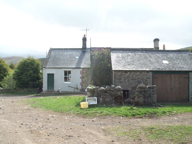
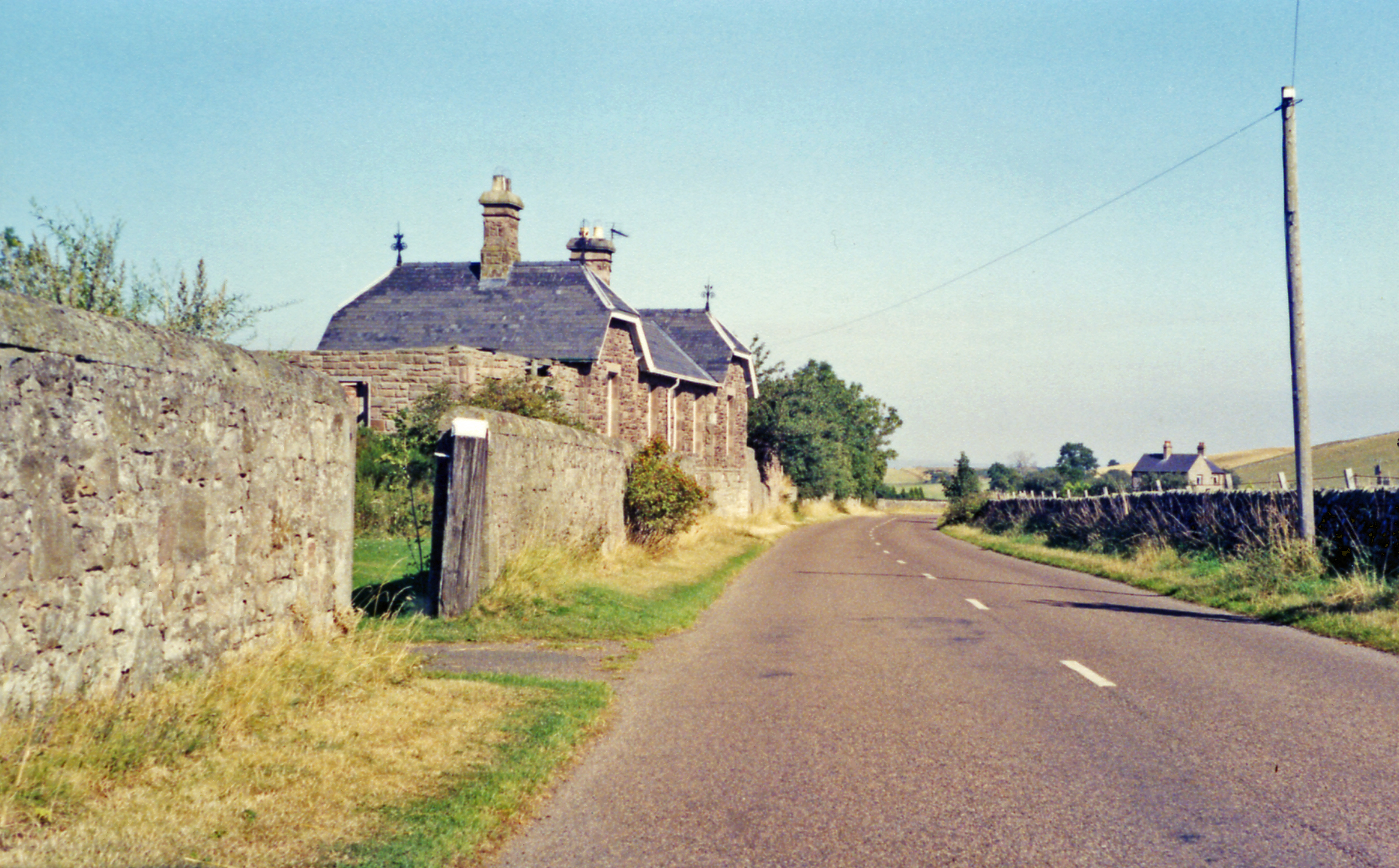
![Medieval Pele Tower "A long quadrangular house at Old Yeavering has walls five feet thick and is probably a medieval pele.
The building is now used as a farm outbuilding and is in reasonable condition."
Hence the reason for the independently supported roof.
Source: Heritagegateway.org.uk. (2012). Heritage Gateway - Results. Monument Number 3875. [online] Available at: <span class="nowrap"><a title="https://www.heritagegateway.org.uk/Gateway/Results_Single.aspx?uid=c4c0a494-2a11-418f-8a59-907a52a8cc6c&amp;resourceID=19191" rel="nofollow ugc noopener" href="https://www.heritagegateway.org.uk/Gateway/Results_Single.aspx?uid=c4c0a494-2a11-418f-8a59-907a52a8cc6c&amp;resourceID=19191">Link</a><img style="margin-left:2px;" alt="External link" title="External link - shift click to open in new window" src="https://s1.geograph.org.uk/img/external.png" width="10" height="10"/></span> [Accessed 21 Jun. 2022].](https://s1.geograph.org.uk/geophotos/07/20/59/7205989_3f408b45.jpg)
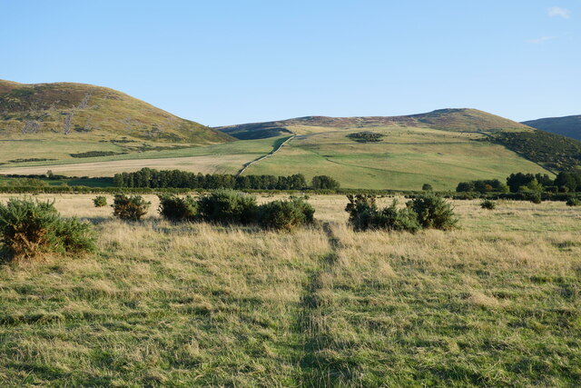
Coronation Wood is a picturesque woodland located in Northumberland, England. Covering an area of approximately 100 acres, it is a natural haven that offers a tranquil escape from the hustle and bustle of daily life. The wood is named after the coronation of Queen Elizabeth II, which took place in 1953.
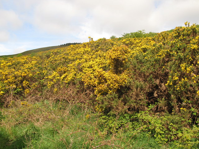
The woodland is primarily composed of mixed deciduous trees, including oak, beech, and birch, creating a diverse and vibrant ecosystem. These trees provide a dense canopy, allowing only dappled sunlight to filter through, creating an enchanting atmosphere. The forest floor is carpeted with a rich variety of wildflowers, ferns, and mosses, adding to the overall beauty of the wood.
Coronation Wood is a popular destination for nature enthusiasts and avid walkers. The well-maintained pathways meander through the wood, offering breathtaking views and the opportunity to observe the local wildlife. Birdwatchers can spot a range of species, including woodpeckers, owls, and various songbirds.
In addition to its natural beauty, the wood also has historical significance. It is believed to have been part of an ancient hunting ground, and there are remnants of old stone structures that once served as shelters for hunters. These historical features add an extra layer of intrigue to the woodland.
Coronation Wood is easily accessible by foot or bike, with several well-marked entrances for visitors to enter. It is a cherished natural gem in Northumberland, providing a peaceful retreat for both locals and tourists alike.
If you have any feedback on the listing, please let us know in the comments section below.
Coronation Wood Images
Images are sourced within 2km of 55.565028/-2.1397104 or Grid Reference NT9130. Thanks to Geograph Open Source API. All images are credited.


Coronation Wood is located at Grid Ref: NT9130 (Lat: 55.565028, Lng: -2.1397104)
Unitary Authority: Northumberland
Police Authority: Northumbria
What 3 Words
///confining.reveal.lessening. Near Kirknewton, Northumberland
Nearby Locations
Related Wikis

Kirknewton, Northumberland
Kirknewton is a Northumbrian village in the north of the county of Northumberland, about 6 miles (10 km) from the town of Wooler and roughly the same distance...
Kirknewton (Northumberland) railway station
Kirknewton railway station served the village of Kirknewton, Northumberland, England from 1887 to 1953 on the Cornhill Branch. == History == The station...

Westnewton, Northumberland
Westnewton is a small hamlet comprising around 8 houses and a manse to the west of the village of Kirknewton, in the civil parish of Kirknewton, in the...

Bowmont Water
Bowmont Water is a stream in the Scottish Borders and Northumberland, England. It rises in the Cheviot Hills and flows by Mowhaugh, Town Yetholm, and Kirk...
Nearby Amenities
Located within 500m of 55.565028,-2.1397104Have you been to Coronation Wood?
Leave your review of Coronation Wood below (or comments, questions and feedback).