Churchill Wood

Wood, Forest in Worcestershire Wychavon

England

Churchill Wood

Hay bales near Broughton Hackett Hay bales in a field between Broughton Hackett and Bredicot, Thrift Wood can be seen on the hill in the background.
Hay bales near Broughton Hackett Credit: Philip Halling

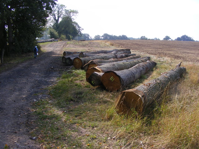
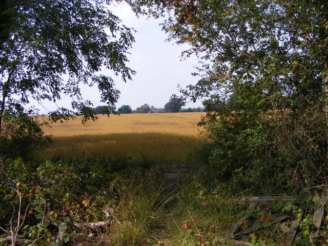
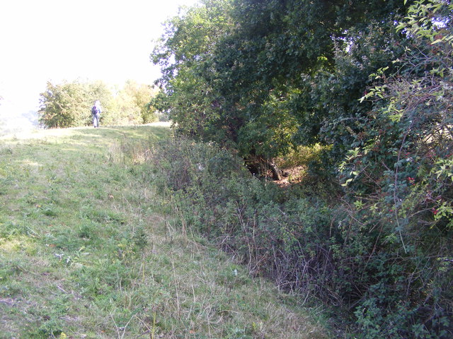
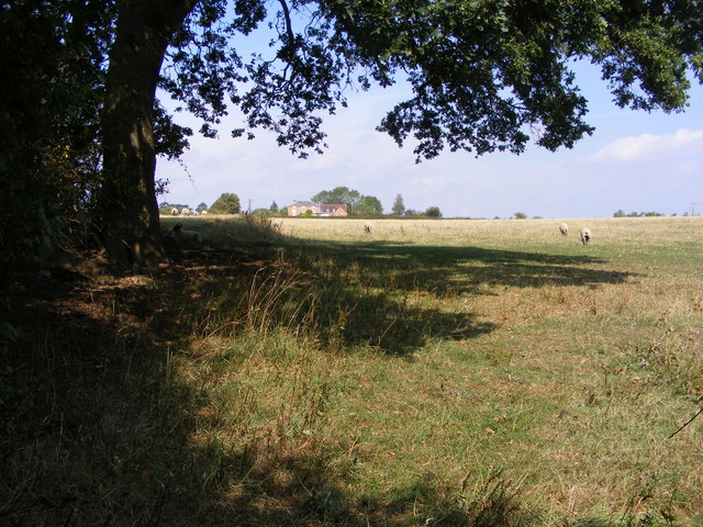
Churchill Wood is a picturesque woodland located in the county of Worcestershire, England. Situated in the district of Wood, Forest, this woodland is renowned for its natural beauty and diverse wildlife. Covering an area of approximately 50 acres, Churchill Wood is a popular destination for nature enthusiasts, hikers, and families looking to enjoy the outdoors.

The woodland is characterized by a mix of deciduous and coniferous trees, creating a rich and varied landscape. Ancient oak and beech trees dominate the forest, providing a majestic canopy that filters sunlight and creates a tranquil atmosphere. The forest floor is covered in a thick layer of moss, adding to the enchanting ambiance of the wood.

Churchill Wood is home to a wide array of wildlife, making it a haven for nature lovers. Visitors can spot various bird species, including woodpeckers, owls, and songbirds, as well as small mammals such as squirrels and hedgehogs. The wood is also known to host a diverse range of insects, with butterflies and dragonflies being particularly abundant during the warmer months.

The woodland offers several walking trails that wind through its enchanting scenery. These trails provide an opportunity for visitors to explore the wood at their own pace, taking in the sights and sounds of nature. Additionally, there are picnic areas and benches scattered throughout the wood, providing a perfect spot to rest and enjoy a packed lunch while surrounded by the beauty of Churchill Wood.

Overall, Churchill Wood in Worcestershire is a captivating destination for nature enthusiasts, offering a serene escape from the bustle of everyday life. With its stunning flora and fauna, it is a place where visitors can connect with nature and appreciate the wonders of the natural world.

If you have any feedback on the listing, please let us know in the comments section below.

Churchill Wood Images

Images are sourced within 2km of 52.188718/-2.1288979 or Grid Reference SO9154. Thanks to Geograph Open Source API. All images are credited.

Hay bales near Broughton Hackett Hay bales in a field between Broughton Hackett and Bredicot, Thrift Wood can be seen on the hill in the background.
Hay bales near Broughton Hackett
Hay bales in a field between Broughton Hackett and Bredicot, Thrift Wood can be seen on the hill in the background.
Church View The view towards Crowle Church.
Church View
The view towards Crowle Church.
Tree View The view west from Thrift Wood Hill near Crowle.
Tree View
The view west from Thrift Wood Hill near Crowle.
Path to Thrift Wood The Footpath view up hill near Crowle.
Path to Thrift Wood
The Footpath view up hill near Crowle.
Thrift Wood View
Thrift Wood View
Under the Rails The footpath passes under the Birmingham to Cheltenham railway line near Bredicot.
Under the Rails
The footpath passes under the Birmingham to Cheltenham railway line near Bredicot.
High Speed Crossing The footpath passes over the track on the Birmingham to Cheltenham line, frequently used by the Virgin trains near Bredicot.
High Speed Crossing
The footpath passes over the track on the Birmingham to Cheltenham line, frequently used by the Virgin trains near Bredicot.
St James Scene The 13th Century church of St James the Less at Bredicot.
St James Scene
The 13th Century church of St James the Less at Bredicot.
The Old Rectory The view next to St James the Less Church at Bredicot.
The Old Rectory
The view next to St James the Less Church at Bredicot.
Felled Trees The view alongside the footpath near Churchill Wood.
Felled Trees
The view alongside the footpath near Churchill Wood.
Out of the Wood The view from the Marshes Wood near Sneachill.
Out of the Wood
The view from the Marshes Wood near Sneachill.
Churchill Church The view of St Michael Church in the village of Churchill.
Churchill Church
The view of St Michael Church in the village of Churchill.
Moat View The view of the Moat bank at Churchill village.
Moat View
The view of the Moat bank at Churchill village.
Broughton Hackett Church The view of St Leonard's church in the Worcestershire village.
Broughton Hackett Church
The view of St Leonard's church in the Worcestershire village.
Field view The view towards Crowle from the footpath near Broughton Hackett.
Field view
The view towards Crowle from the footpath near Broughton Hackett.
Pub Footpath The footpath in Crowle near The Old Chequers Pub.
Pub Footpath
The footpath in Crowle near The Old Chequers Pub.
Thrift Wood Hill The view down the hill side near Crowle.
Thrift Wood Hill
The view down the hill side near Crowle.
Clover Path The footpath view near Thrift Wood, Crowle.
Clover Path
The footpath view near Thrift Wood, Crowle.
Show me another place!

Churchill Wood is located at Grid Ref: SO9154 (Lat: 52.188718, Lng: -2.1288979)

Administrative County: Worcestershire

District: Wychavon

Police Authority: West Mercia

What 3 Words

///woods.bonds.plot. Near Worcester, Worcestershire

Related Wikis

A422 road

The A422 is an "A" road for east–west journeys in south central England, connecting the county towns of Bedford and Worcester by way of Milton Keynes,...

Bredicot railway station

Bredicot railway station served the village of Bredicot, Worcestershire, England, from 1845 to 1855 on the Birmingham and Gloucester Railway. == History... ==

Bredicot

Bredicot is a small village and civil parish in Worcestershire, England, about 4 miles (6.4 km) east of Worcester. It was formerly (as described in 1868...

Broughton Hackett

Broughton Hackett is a village and civil parish in the Wychavon district of the county of Worcestershire, England. It is about 5 miles east of the city...

Spetchley railway station

Spetchley railway station was an intermediate stop on the Birmingham and Gloucester Railway, opened in 1840. Besides the village of Spetchley, it served...

Churchill, Wychavon

Churchill or Churchill by Spetchley is a village and civil parish 4 miles (6.4 km) from Worcester, in the Wychavon district, in the county of Worcestershire...

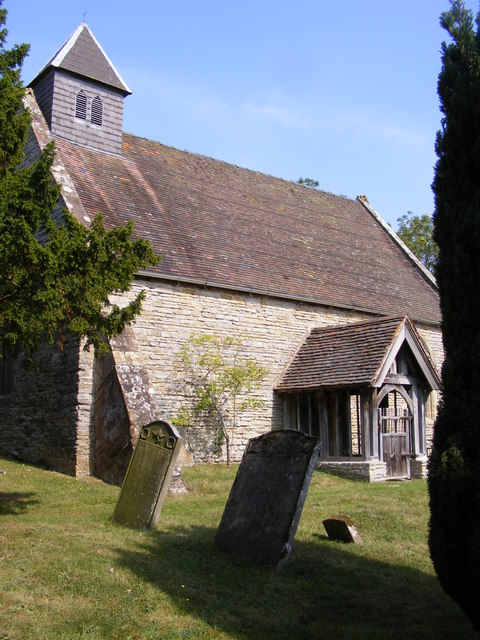
St Michael's Church, Churchill

St Michael's Church is a redundant Anglican church in the village of Churchill in Oswaldslow, Worcestershire, England. It is recorded in the National...

Spetchley

Spetchley is a hamlet and civil parish in Worcestershire, England, that lies in the district of Wychavon, half a mile from Worcester, along the A44 road...

Nearby Amenities

Located within 500m of 52.188718,-2.1288979
Bunks Hall
Power: pole
Transformer: distribution
Voltage Primary: 11000
Lat/Long: 52.1846585/-2.1318693
Power: pole
Lat/Long: 52.1879803/-2.1356352
Power: pole
Lat/Long: 52.1885764/-2.134797
Power: pole
Lat/Long: 52.1893862/-2.1344684
Power: pole
Lat/Long: 52.1902133/-2.1341345
Power: pole
Lat/Long: 52.19101/-2.1338193
Power: pole
Lat/Long: 52.1919423/-2.1334425
Power: pole
Lat/Long: 52.1928006/-2.1318881
Power: pole
Lat/Long: 52.1927397/-2.1305577
Power: pole
Lat/Long: 52.1926748/-2.1292005
Power: pole
Lat/Long: 52.1926131/-2.1278326
Power: pole
Lat/Long: 52.1925391/-2.1263762
Churchill Woods Farm
Power: pole
Transformer: distribution
Voltage Primary: 11000
Lat/Long: 52.1873159/-2.1253194
Power: pole
Lat/Long: 52.1880502/-2.1248916
Power: pole
Lat/Long: 52.1888995/-2.1244088
Power: pole
Lat/Long: 52.1897496/-2.1239246
Power: pole
Lat/Long: 52.1904197/-2.1242492
Power: pole
Lat/Long: 52.1911086/-2.1245898
Power: pole
Lat/Long: 52.1918041/-2.1249425
Power: pole
Lat/Long: 52.192489/-2.1252872
The data included in this document is from www.openstreetmap.org. The data is made available under ODbL.

Have you been to Churchill Wood?

Leave your review of Churchill Wood below (or comments, questions and feedback).