Alder Coppice

Wood, Forest in Staffordshire

England

Alder Coppice

New Year on Northway The Northway Estate in Sedgley on New Year's Day.
New Year on Northway Credit: Gordon Griffiths

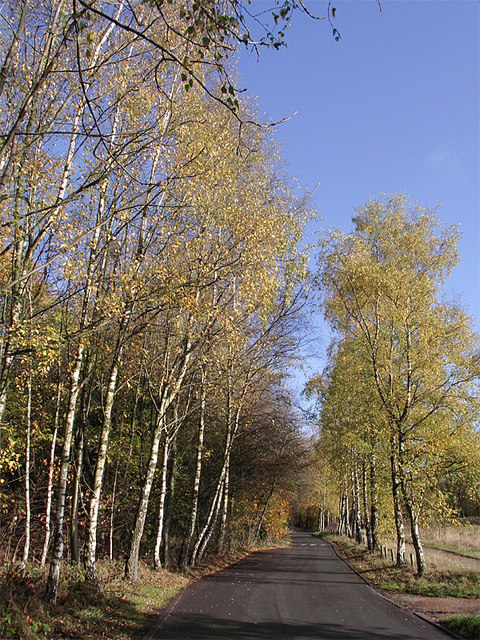
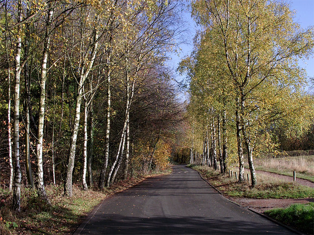
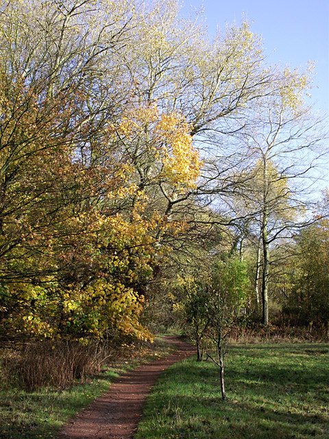
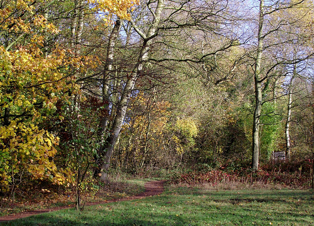
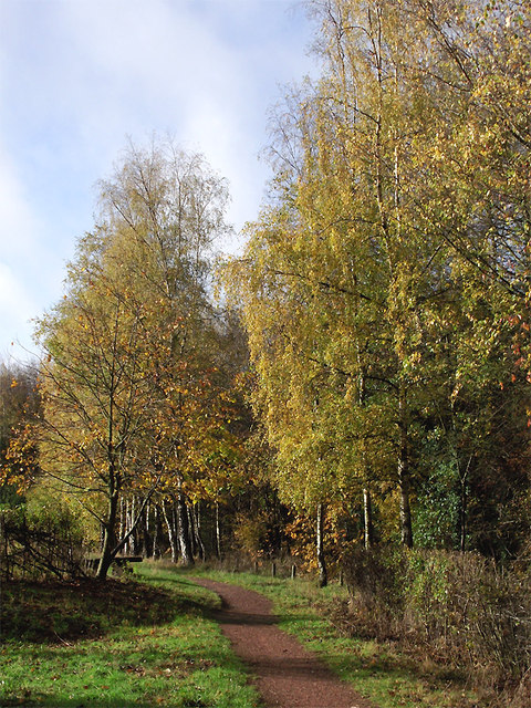
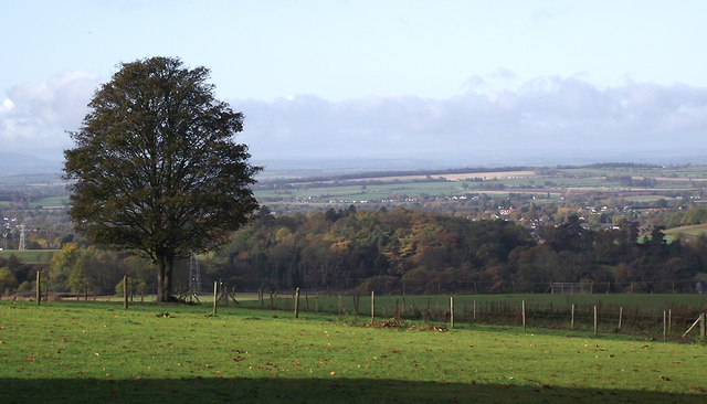
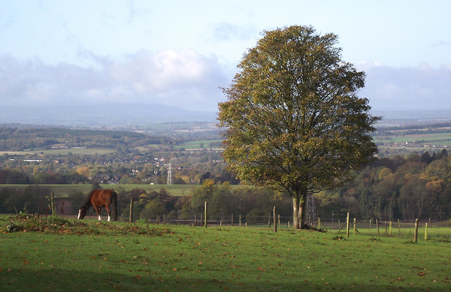
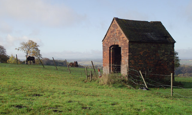
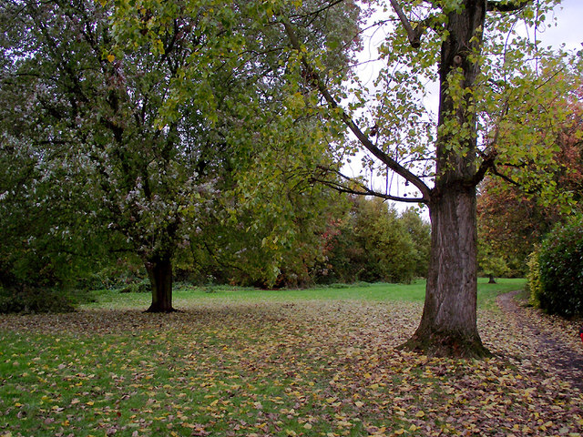
Alder Coppice is a woodland area located in Staffordshire, England. It is a prime example of a coppiced woodland, characterized by the practice of periodically cutting back trees to ground level to stimulate new growth. The site covers an area of approximately 50 acres and is home to a diverse range of flora and fauna.

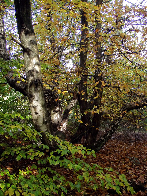
The dominant tree species in Alder Coppice is the alder (Alnus glutinosa), from which the woodland derives its name. These trees thrive in the wet and marshy conditions found in the area due to the site's proximity to the River Trent. The coppicing management technique employed in the woodland not only promotes the growth of alder but also allows for the development of a rich understory of shrubs and herbs.

Walking through Alder Coppice, visitors can expect to encounter a variety of wildlife. The woodland provides habitat for numerous bird species, including the great spotted woodpecker, chiffchaff, and tawny owl. Mammals such as badgers, foxes, and deer are also present, as are a range of insects and amphibians.

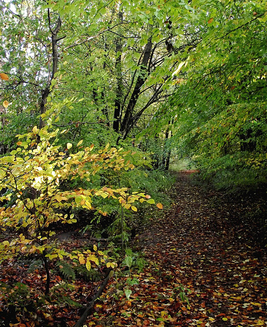
The site is popular among nature enthusiasts and offers several walking trails for visitors to explore. These paths wind through the woodland, providing opportunities to observe the diverse plant life and spot wildlife along the way. Additionally, Alder Coppice serves as an educational resource, with organized nature walks and workshops regularly held to promote the understanding and appreciation of the natural environment.

Overall, Alder Coppice in Staffordshire is a thriving woodland ecosystem, boasting a unique array of plant and animal species. Its accessibility and educational initiatives make it a valuable resource for both local residents and visitors interested in experiencing the beauty of nature.

If you have any feedback on the listing, please let us know in the comments section below.

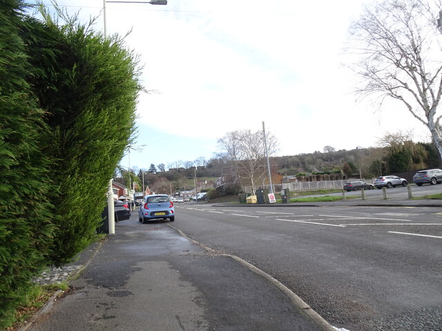
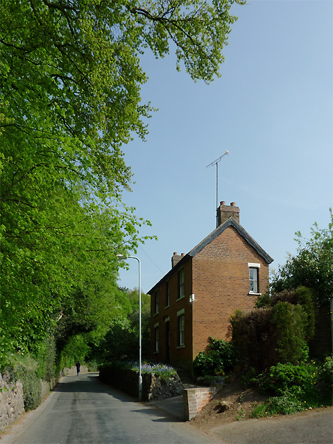
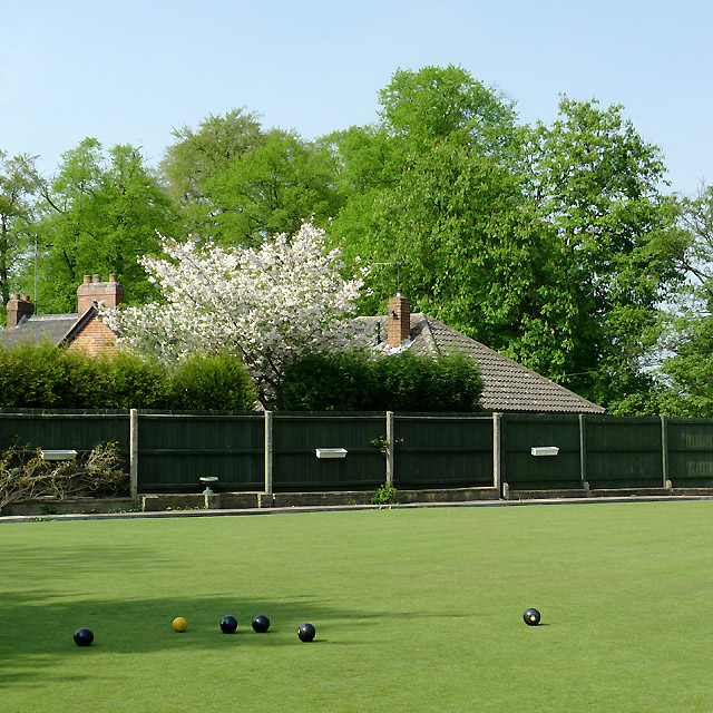
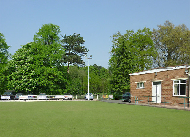
Alder Coppice Images

Images are sourced within 2km of 52.550764/-2.1328045 or Grid Reference SO9194. Thanks to Geograph Open Source API. All images are credited.

New Year on Northway The Northway Estate in Sedgley on New Year's Day.
New Year on Northway
The Northway Estate in Sedgley on New Year's Day.
Northway View The Northway Estate in Sedgley on New Year's Day.
Northway View
The Northway Estate in Sedgley on New Year's Day.
Christmas on Northway The Northway Estate in Sedgley on Christmas Day.
Christmas on Northway
The Northway Estate in Sedgley on Christmas Day.
Manor Road in Penn, Wolverhampton The austere looking house on the right is The Hollies. Muchall Park is behind the mature trees on the left. The single track lane links the A449 Penn Road with Mount Road by Penn Cricket Club.
Manor Road in Penn, Wolverhampton
The austere looking house on the right is The Hollies. Muchall Park is behind the mature trees on the left. The single track lane links the A449 Penn Road with Mount Road by Penn Cricket Club.
The green at Penn Bowling Club, Wolverhampton Penn Bowling and Social Club is a well run club for local people. In addition to the bowling, activities include darts, dominoes, poker, bingo, crib, pool, salsa dancing and (of course) large screen TV to watch football. Oh, nearly forgot! It has a bar too, which serves Banks's Bitter and Mild, plus three guest real ales - all superbly kept.

update August 2018 - There is a defibrillator stationed here by the main entrance to the club.

<a href="https://www.geograph.org.uk/photo/2733190">SO8995 : The Penn Bowling Club  handpumps, Wolverhampton</a> 

I think they sell lager, too. ;-)
The green at Penn Bowling Club, Wolverhampton
Penn Bowling and Social Club is a well run club for local people. In addition to the bowling, activities include darts, dominoes, poker, bingo, crib, pool, salsa dancing and (of course) large screen TV to watch football. Oh, nearly forgot! It has a bar too, which serves Banks's Bitter and Mild, plus three guest real ales - all superbly kept. update August 2018 - There is a defibrillator stationed here by the main entrance to the club. SO8995 : The Penn Bowling Club handpumps, Wolverhampton I think they sell lager, too. ;-)
Penn Bowling Club, Wolverhampton The image shows part of the green and club buildings, with the mature deciduous trees of Muchall Park as the backdrop.

Penn Bowling and Social Club is a well run club for local people. In addition to the bowling, regular activities include darts, dominoes, poker, crib, pool, bingo, salsa dancing and (of course) large screen TV to watch football. Oh, nearly forgot! It has a good bar too, which serves Banks's Bitter and Mild, plus three hand-pulled guest real ales - all superbly kept. People occasionally drink lager, I'm told. ;-)

update August 2018 - There is a defibrillator stationed here by the main entrance to the club.
Penn Bowling Club, Wolverhampton
The image shows part of the green and club buildings, with the mature deciduous trees of Muchall Park as the backdrop. Penn Bowling and Social Club is a well run club for local people. In addition to the bowling, regular activities include darts, dominoes, poker, crib, pool, bingo, salsa dancing and (of course) large screen TV to watch football. Oh, nearly forgot! It has a good bar too, which serves Banks's Bitter and Mild, plus three hand-pulled guest real ales - all superbly kept. People occasionally drink lager, I'm told. ;-) update August 2018 - There is a defibrillator stationed here by the main entrance to the club.
A449 Dual Carriageway, Penn Where the Tesco store is over the road, the site used to be a Petrol Station until a few years ago.
A449 Dual Carriageway, Penn
Where the Tesco store is over the road, the site used to be a Petrol Station until a few years ago.
The Road to Gospel End near Sedgley The private road is in Baggeridge Country Park and links the car parks to Woodhouse Lane (A463) near Gospel End.
The Road to Gospel End near Sedgley
The private road is in Baggeridge Country Park and links the car parks to Woodhouse Lane (A463) near Gospel End.
The Road to Gospel End near Sedgley The private road is in Baggeridge Country Park and links the car parks to Woodhouse Lane (A463) near Gospel End.
The Road to Gospel End near Sedgley
The private road is in Baggeridge Country Park and links the car parks to Woodhouse Lane (A463) near Gospel End.
Pathway in Baggeridge Country Park near Sedgley This is at the north end of Upper Meadow, looking towards Gospel End.
Pathway in Baggeridge Country Park near Sedgley
This is at the north end of Upper Meadow, looking towards Gospel End.
Pathway in Baggeridge Country Park near Sedgley This is at the north end of Upper Meadow, looking towards Gospel End.
Pathway in Baggeridge Country Park near Sedgley
This is at the north end of Upper Meadow, looking towards Gospel End.
Pathway in Baggeridge Country Park near Sedgley This is at the north end of Upper Meadow, looking away from Gospel End. The driveway from the A453 Wodehouse Road passes through the birch trees on the right.
Pathway in Baggeridge Country Park near Sedgley
This is at the north end of Upper Meadow, looking away from Gospel End. The driveway from the A453 Wodehouse Road passes through the birch trees on the right.
Farmland and woodland near Gospel End, Staffordshire Looking towards Wombourne past deciduous woodland at The Foxhills. Beyond the nearby fields is the wide valley occupied by the Smestow Brook.
Farmland and woodland near Gospel End, Staffordshire
Looking towards Wombourne past deciduous woodland at The Foxhills. Beyond the nearby fields is the wide valley occupied by the Smestow Brook.
Pasture and woodland near Gospel End, Staffordshire Looking towards Wombourne past deciduous woodland at The Foxhills. Beyond the nearby fields is the wide valley occupied by the Smestow Brook.
Pasture and woodland near Gospel End, Staffordshire
Looking towards Wombourne past deciduous woodland at The Foxhills. Beyond the nearby fields is the wide valley occupied by the Smestow Brook.
Farm outhouse in pasture near Gospel End, Staffordshire Beyond the nearby fields is the wide valley occupied by the Smestow Brook.
Farm outhouse in pasture near Gospel End, Staffordshire
Beyond the nearby fields is the wide valley occupied by the Smestow Brook.
Woodland in Baggeridge Country Park near Sedgley This is by a partly overgrown track north-east of Heather Cottage.
Woodland in Baggeridge Country Park near Sedgley
This is by a partly overgrown track north-east of Heather Cottage.
Woodland track in Baggeridge Country Path The track north-east from Heather Cottage is not all as well defined as this.
Woodland track in Baggeridge Country Path
The track north-east from Heather Cottage is not all as well defined as this.
Woodlands Walk in Penn, Wolverhampton This is a surprisingly secluded strip of open grass and woodland just off the busy A449 dual carriageway of Penn Road and enclosed between Lancaster Gardens and Wells Road. To find it, follow the footpath alongside the Roebuck public house.
Woodlands Walk in Penn, Wolverhampton
This is a surprisingly secluded strip of open grass and woodland just off the busy A449 dual carriageway of Penn Road and enclosed between Lancaster Gardens and Wells Road. To find it, follow the footpath alongside the Roebuck public house.
Show me another place!

Alder Coppice is located at Grid Ref: SO9194 (Lat: 52.550764, Lng: -2.1328045)

Unitary Authority: Dudley

Police Authority: West Midlands

What 3 Words

///newly.bumpy.folds. Near Wolverhampton, West Midlands

Related Wikis

Alder Coppice

Alder Coppice is a local nature reserve in West Midlands, England. It is near Sedgley, next to the Northway Estate, in the Metropolitan Borough of Dudley...

Sedgley Park School, Wolverhampton

Sedgley Park School was a Roman Catholic Academy located on the outskirts of Wolverhampton, then part of Staffordshire. The school was founded by William...

Colton Hills Community School

Colton Hills Community School is a mixed secondary school and sixth form situated in the Goldthorn Park area of Wolverhampton, West Midlands, England....

Beacon Hill, Sedgley

Beacon Hill in Sedgley, England, is one of the highest points in the West Midlands, at 237 metres (778 ft) above sea level. From the summit, Wolverhampton...

Sedgley

Sedgley is a town in the north of the Metropolitan Borough of Dudley, in the West Midlands, England.Historically part of Staffordshire, Sedgley is on the...

Goldthorn Park

Goldthorn Park is a suburb of Wolverhampton, West Midlands. It is situated 1½ miles south of the city centre within the Blakenhall ward. It mostly consists...

Sedgley Urban District

Sedgley urban district was a local government district within Staffordshire, which was created in 1894 from the western half of the manor of Sedgley (the...

Sarah Hughes Brewery

Sarah Hughes Brewery in Sedgley, in the Black Country of England, dates from the Victorian era. It was bought by Sarah Hughes in 1921 and brewed until...

Nearby Amenities

Located within 500m of 52.550764,-2.1328045
Bus Stop
Northway / Alderdale Avenue
Bus: yes
Naptan AtcoCode: 43000850101
Naptan Bearing: NE
Naptan BusStopType: MKD
Naptan CommonName: Alderdale Avenue
Naptan Indicator: adj
Naptan NaptanCode: nwmjwjad
Naptan PlusbusZoneRef: BHAMNWS
Naptan Status: ACT
Naptan StopType: BCT
Naptan Street: NORTHWAY
Naptan Towards: Wolverhampton
Naptan Verified: no
Public Transport: platform
Route Ref: 27;27A
Source: WMCA
Lat/Long: 52.5531373/-2.1290134
Bus Stop
Northway / Alderdale Avenue
NaPTANAreaCode: 43000850102
Bus: yes
Naptan AtcoCode: 43000850102
Naptan Bearing: S
Naptan BusStopType: MKD
Naptan CommonName: Alderdale Avenue
Naptan Indicator: opp
Naptan NaptanCode: nwmjwjag
Naptan PlusbusZoneRef: BHAMNWS
Naptan Status: ACT
Naptan StopType: BCT
Naptan Street: NORTHWAY
Naptan Towards: Sedgley
Naptan Verified: no
Public Transport: platform
Route Ref: 27;27A
Shelter: yes
Shelter Ref: 404101
Source: WMCA
Lat/Long: 52.5529355/-2.1289699
Bus Stop
Northway / Otterstone Close
Bus: yes
Naptan AtcoCode: 43000850201
Naptan Bearing: N
Naptan BusStopType: MKD
Naptan CommonName: Otterstone Close
Naptan Indicator: opp
Naptan Landmark: NUL
Naptan NaptanCode: nwmjwjaj
Naptan PlusbusZoneRef: BHAMNWS
Naptan Status: ACT
Naptan StopType: BCT
Naptan Street: NORTHWAY
Naptan Towards: Wolverhampton
Public Transport: platform
Route Ref: 27;27A
Shelter: no
Source: WMCA
Towards: Wolverhampton
Lat/Long: 52.5509794/-2.1282255
Bus Stop
Northway / Long Meadow Drive
Bus: yes
Naptan AtcoCode: 43000850301
Naptan Bearing: E
Naptan BusStopType: MKD
Naptan CommonName: Long Meadow Drive
Naptan Indicator: adj
Naptan Landmark: The Cabin
Naptan NaptanCode: nwmjwjap
Naptan PlusbusZoneRef: BHAMNWS
Naptan Status: ACT
Naptan StopType: BCT
Naptan Street: NORTHWAY
Naptan Towards: Wolverhampton
Naptan Verified: no
Public Transport: platform
Route Ref: 27;27A
Source: WMCA
Lat/Long: 52.5488146/-2.1314019
Bus Stop
Northway / Long Meadow Drive
NaPTANAreaCode: 43000850302
Bus: yes
Naptan AtcoCode: 43000850302
Naptan Bearing: W
Naptan BusStopType: MKD
Naptan CommonName: Long Meadow Drive
Naptan Indicator: opp
Naptan Landmark: The Cabin
Naptan NaptanCode: nwmjwjat
Naptan PlusbusZoneRef: BHAMNWS
Naptan Status: ACT
Naptan StopType: BCT
Naptan Street: NORTHWAY
Naptan Towards: Sedgley
Naptan Verified: no
Public Transport: platform
Route Ref: 27;27A
Shelter: yes
Shelter Ref: 404102
Source: WMCA
Lat/Long: 52.5487024/-2.131494
Bus Stop
Northway / Alderbrook Close
Bus: yes
Naptan AtcoCode: 43000850801
Naptan Bearing: NE
Naptan BusStopType: MKD
Naptan CommonName: Alderbrook Close
Naptan Indicator: adj
Naptan NaptanCode: nwmjwjdw
Naptan Status: ACT
Naptan StopType: BCT
Naptan Street: NORTHWAY
Naptan Towards: Wolverhampton
Naptan Verified: no
Public Transport: platform
Route Ref: 27;27A
Source: WMCA
Lat/Long: 52.5478261/-2.1346125
Bus Stop
Northway / Alderbrook Close
Bus: yes
Naptan AtcoCode: 43000850802
Naptan Bearing: SW
Naptan BusStopType: MKD
Naptan CommonName: Alderbrook Close
Naptan Indicator: opp
Naptan NaptanCode: nwmjwjga
Naptan Status: ACT
Naptan StopType: BCT
Naptan Street: NORTHWAY
Naptan Towards: Sedgley
Naptan Verified: no
Public Transport: platform
Route Ref: 27;27A
Source: WMCA
Lat/Long: 52.5475831/-2.1348035
Incline: down
Note: 12%
Source: survey
Lat/Long: 52.5540769/-2.1279051
Brand: National Grid
Brand Wikidata: Q1465461
Operator: National Grid Electricity Distribution Plc
Operator Old: Western Power Distribution
Operator Wikidata: Q7988183
Owner: National Grid Electricity Distribution (West Midlands) Plc
Owner Wikidata: Q114397791
Power: substation
Ref: 11872
Source: survey
Lat/Long: 52.547691/-2.1294216
Barrier: bollard
Source: survey
Lat/Long: 52.5523501/-2.1316784
Power: tower
Source: survey
Lat/Long: 52.5536112/-2.1314281
Barrier: bollard
Source: survey
Lat/Long: 52.5466701/-2.1347055
Bus Stop
Northway / Otterstone Close
Bus: yes
Naptan AtcoCode: 43000850202
Naptan Bearing: S
Naptan BusStopType: MKD
Naptan CommonName: Otterstone Close
Naptan Indicator: adj
Naptan NaptanCode: nwmjwjam
Naptan PlusbusZoneRef: BHAMNWS
Naptan Status: ACT
Naptan StopType: BCT
Naptan Street: NORTHWAY
Naptan Towards: Sedgley
Public Transport: platform
Route Ref: 27;27A
Shelter: no
Source: WMCA
Towards: Dudley
Lat/Long: 52.5497963/-2.1280475
Power Historic: tower
Source: OS 1:25k
Lat/Long: 52.5530149/-2.1387651
Power: tower
Source: bing
Lat/Long: 52.5534558/-2.1356533
Ford: yes
Lat/Long: 52.5510916/-2.1355168
Generator Method: photovoltaic
Generator Output Electricity: yes
Generator Source: solar
Generator Type: solar_photovoltaic_panel
Location: roof
Power: generator
Lat/Long: 52.5478729/-2.13819
Generator Method: photovoltaic
Generator Output Electricity: yes
Generator Source: solar
Generator Type: solar_photovoltaic_panel
Location: roof
Power: generator
Lat/Long: 52.5484503/-2.1376106
Generator Method: photovoltaic
Generator Output Electricity: yes
Generator Source: solar
Generator Type: solar_photovoltaic_panel
Location: roof
Power: generator
Lat/Long: 52.548235/-2.1269971
Generator Method: photovoltaic
Generator Output Electricity: yes
Generator Source: solar
Generator Type: solar_photovoltaic_panel
Location: roof
Power: generator
Lat/Long: 52.5488793/-2.1317419
Generator Method: photovoltaic
Generator Output Electricity: yes
Generator Source: solar
Generator Type: solar_photovoltaic_panel
Location: roof
Power: generator
Lat/Long: 52.5488777/-2.1315756
Generator Method: photovoltaic
Generator Output Electricity: yes
Generator Source: solar
Generator Type: solar_photovoltaic_panel
Location: roof
Power: generator
Lat/Long: 52.5499297/-2.1292475
Generator Method: photovoltaic
Generator Output Electricity: yes
Generator Source: solar
Generator Type: solar_photovoltaic_panel
Location: roof
Power: generator
Lat/Long: 52.5536416/-2.1301433
Generator Method: photovoltaic
Generator Output Electricity: yes
Generator Source: solar
Generator Type: solar_photovoltaic_panel
Location: roof
Power: generator
Lat/Long: 52.5539302/-2.1314281
Generator Method: photovoltaic
Generator Output Electricity: yes
Generator Source: solar
Generator Type: solar_photovoltaic_panel
Location: roof
Power: generator
Lat/Long: 52.5539417/-2.1318734
Generator Method: photovoltaic
Generator Output Electricity: yes
Generator Source: solar
Generator Type: solar_photovoltaic_panel
Location: roof
Power: generator
Lat/Long: 52.553242/-2.1325171
Generator Method: photovoltaic
Generator Output Electricity: yes
Generator Source: solar
Generator Type: solar_photovoltaic_panel
Location: roof
Power: generator
Lat/Long: 52.5526712/-2.1295023
Generator Method: photovoltaic
Generator Output Electricity: yes
Generator Source: solar
Generator Type: solar_photovoltaic_panel
Location: roof
Power: generator
Lat/Long: 52.5496279/-2.1290571
Generator Method: photovoltaic
Generator Output Electricity: yes
Generator Source: solar
Generator Type: solar_photovoltaic_panel
Location: roof
Power: generator
Lat/Long: 52.5499248/-2.1299207
Generator Method: photovoltaic
Generator Output Electricity: yes
Generator Source: solar
Generator Type: solar_photovoltaic_panel
Location: roof
Power: generator
Lat/Long: 52.5499117/-2.1303043
Generator Method: photovoltaic
Generator Output Electricity: yes
Generator Source: solar
Generator Type: solar_photovoltaic_panel
Location: roof
Power: generator
Lat/Long: 52.5498612/-2.1305832
The data included in this document is from www.openstreetmap.org. The data is made available under ODbL.

Have you been to Alder Coppice?

Leave your review of Alder Coppice below (or comments, questions and feedback).