Ferns Plantation

Wood, Forest in Dorset

England

Ferns Plantation

South Tarrant Hinton Down
South Tarrant Hinton Down Credit: Paul Barnett

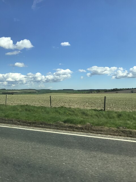
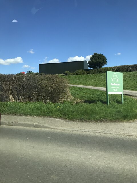
Ferns Plantation, located in Dorset, is a picturesque woodland area renowned for its lush greenery and diverse range of fern species. Situated in the heart of the county, this woodland covers an extensive area and offers a tranquil escape for nature enthusiasts and hikers alike.

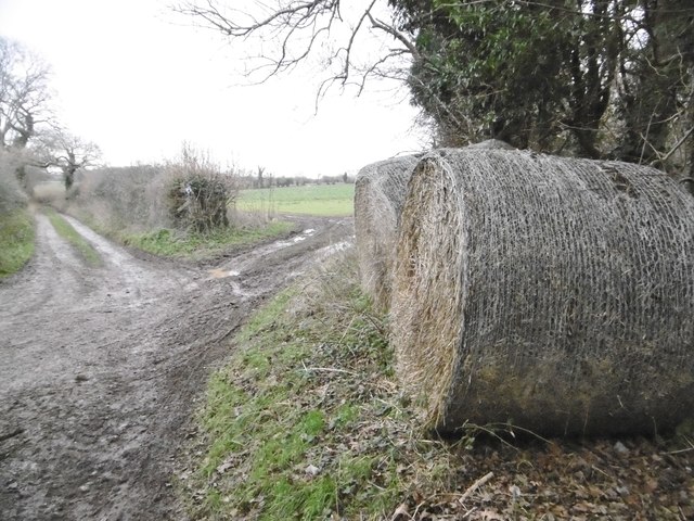
The plantation is characterized by its dense forest cover, dominated by tall, mature trees that provide ample shade and a cool, refreshing atmosphere. The woodland floor is carpeted with a rich variety of ferns, hence the name "Ferns Plantation." Visitors can witness a spectacular display of ferns, ranging from common species like the bracken fern to more unique and rare varieties. The diverse collection of ferns creates a visually stunning landscape, especially during the spring and summer months when the plants are in full bloom.

The plantation offers a well-maintained network of walking trails, allowing visitors to explore the woodland at their own pace. These trails are suitable for all levels of fitness and provide a chance to admire the natural beauty of the area while spotting various wildlife species, including birds, squirrels, and butterflies.

Ferns Plantation is not only a haven for nature lovers but also serves as an important ecological habitat. The woodland provides a sanctuary for many native plant and animal species, contributing to the overall biodiversity of the region. It is carefully managed to preserve its natural state and protect the delicate balance of the ecosystem.

In conclusion, Ferns Plantation in Dorset is a captivating woodland that showcases the beauty of ferns while providing a serene environment for visitors to enjoy nature at its finest.

If you have any feedback on the listing, please let us know in the comments section below.

Ferns Plantation Images

Images are sourced within 2km of 50.894891/-2.1284712 or Grid Reference ST9110. Thanks to Geograph Open Source API. All images are credited.

South Tarrant Hinton Down
Manor Farm from minor road
Signage for The Anvil Inn
Entrance to Archway Nursery School off A354
Tarrant Gunville, bales Next to the farm road and bridleway to Home Farm, on the Jubilee Trail.
Tarrant Gunville, bales
Next to the farm road and bridleway to Home Farm, on the Jubilee Trail.
Tarrant Gunville, farm road Farm road and bridleway towards Home Farm, on the Jubilee Trail.
Tarrant Gunville, farm road
Farm road and bridleway towards Home Farm, on the Jubilee Trail.
Tarrant Gunville, bridleway junction Left, to Home Farm and the village, on the Jubilee Trail; ahead, across cropland to North Tarrant Hinton Down.
Tarrant Gunville, bridleway junction
Left, to Home Farm and the village, on the Jubilee Trail; ahead, across cropland to North Tarrant Hinton Down.
Tarrant Gunville, Home Farm Farmhouse with camping, café and farm shop, on the Jubilee Trail. An excellent pit stop: <span class="nowrap"><a title="http://www.homefarmshop.co.uk/" rel="nofollow ugc noopener" href="http://www.homefarmshop.co.uk/">Link</a><img style="margin-left:2px;" alt="External link" title="External link - shift click to open in new window" src="https://s1.geograph.org.uk/img/external.png" width="10" height="10"/></span>
Tarrant Gunville, Home Farm
Farmhouse with camping, café and farm shop, on the Jubilee Trail. An excellent pit stop: LinkExternal link
Tarrant Gunville, bridleway crossroads Ahead, to Home Farm and the village; left, through the gate, to Ashmore Wood; right, to Pimperne Wood.
Tarrant Gunville, bridleway crossroads
Ahead, to Home Farm and the village; left, through the gate, to Ashmore Wood; right, to Pimperne Wood.
Tarrant Gunville, farm track Through Pimperne Wood.
Tarrant Gunville, farm track
Through Pimperne Wood.
Iwerne Stepleton, Ash Down
Tarrant Gunville, farm track Track and footpath towards Pimperne; right, Gunville Down.
Tarrant Gunville, farm track
Track and footpath towards Pimperne; right, Gunville Down.
Tarrant Gunville, notice On a track into Pimperne Fox Warren.
Tarrant Gunville, notice
On a track into Pimperne Fox Warren.
Iwerne Stepleton, track Gamekeeper's track into Pimperne Fox Warren.
Iwerne Stepleton, track
Gamekeeper's track into Pimperne Fox Warren.
Tarrant Gunville, Jubilee Trail On the long distance path through woodland, towards the village. <span class="nowrap"><a title="https://www.ldwa.org.uk/ldp/members/show_path.php?path_name=Jubilee+Trail+(Dorset)" rel="nofollow ugc noopener" href="https://www.ldwa.org.uk/ldp/members/show_path.php?path_name=Jubilee+Trail+(Dorset)">Link</a><img style="margin-left:2px;" alt="External link" title="External link - shift click to open in new window" src="https://s1.geograph.org.uk/img/external.png" width="10" height="10"/></span>
Tarrant Gunville, Jubilee Trail
On the long distance path through woodland, towards the village. LinkExternal link
Gunville Down Stubble with tractor tracks.
Gunville Down
Stubble with tractor tracks.
Tarrant Gunville, marker On the bridleway towards Home Farm and the village; part of the Jubilee Trail. <span class="nowrap"><a title="https://www.ldwa.org.uk/ldp/members/show_path.php?path_name=Jubilee+Trail+(Dorset)" rel="nofollow ugc noopener" href="https://www.ldwa.org.uk/ldp/members/show_path.php?path_name=Jubilee+Trail+(Dorset)">Link</a><img style="margin-left:2px;" alt="External link" title="External link - shift click to open in new window" src="https://s1.geograph.org.uk/img/external.png" width="10" height="10"/></span>
Tarrant Gunville, marker
On the bridleway towards Home Farm and the village; part of the Jubilee Trail. LinkExternal link
Benchmark on Home Farm Dairy, near Tarrant Gunville Ordnance Survey benchmark, described on database at <span class="nowrap"><a title="http://www.bench-marks.org.uk/bm49146" rel="nofollow ugc noopener" href="http://www.bench-marks.org.uk/bm49146">Link</a><img style="margin-left:2px;" alt="External link" title="External link - shift click to open in new window" src="https://s1.geograph.org.uk/img/external.png" width="10" height="10"/></span>. See also <a href="https://www.geograph.org.uk/photo/5204835">ST9112 : Home Farm Dairy, near Tarrant Gunville</a>. The building is still on a dairy farm, but is now a cafe/farm shop.
Benchmark on Home Farm Dairy, near Tarrant Gunville
Ordnance Survey benchmark, described on database at LinkExternal link. See also ST9112 : Home Farm Dairy, near Tarrant Gunville. The building is still on a dairy farm, but is now a cafe/farm shop.
Show me another place!

Ferns Plantation is located at Grid Ref: ST9110 (Lat: 50.894891, Lng: -2.1284712)

Unitary Authority: Dorset

Police Authority: Dorset

What 3 Words

///intro.dumplings.hears. Near Pimperne, Dorset

Related Wikis

Pimperne

Pimperne ( PIM-pərn) is a village and civil parish in north Dorset, England, situated on Cranborne Chase two miles (three kilometres) northeast of the...

Pimperne Hundred

Pimperne Hundred was a hundred in the county of Dorset, England, containing the following parishes: Bryanston Durweston Fifehead Neville Hammoon Hazelbury...

Great Dorset Steam Fair

The Great Dorset Steam Fair (abbreviated GDSF, and since 2010 also known as The National Heritage Show) is an annual show featuring steam-powered vehicles...

Tarrant Gunville

Tarrant Gunville is a village and civil parish in north Dorset, England, situated at the head of the Tarrant Valley on Cranborne Chase five miles (eight...

Nearby Amenities

Located within 500m of 50.894891,-2.1284712
Addr City: Pimperne
Addr Housename: Bluebell Cottage
Addr Street: Newfield Farm
Lat/Long: 50.8987008/-2.132075
Addr City: Pimperne
Addr Housename: Rose Cottage
Addr Street: Newfield Farm
Lat/Long: 50.8985921/-2.1320038
Addr City: Pimperne
Addr Housename: Lilac Cottage
Addr Street: Newfield Farm
Lat/Long: 50.8985272/-2.1319579
Addr City: Pimperne
Addr Housename: Forget-me-not Cottage
Addr Street: Newfield Farm
Lat/Long: 50.8984494/-2.1319025
The data included in this document is from www.openstreetmap.org. The data is made available under ODbL.

Have you been to Ferns Plantation?

Leave your review of Ferns Plantation below (or comments, questions and feedback).