Swinhopeburn Wood

Wood, Forest in Durham

England

Swinhopeburn Wood

Embankment on the former Bishop Auckland to Wearhead branch line Similar view in image <a href="https://www.geograph.org.uk/photo/6117873">NY8837 : Low embankment on the former Bishop Auckland to Wearhead branch line</a> but a different season.
Embankment on the former Bishop Auckland to Wearhead branch line Credit: Clive Nicholson

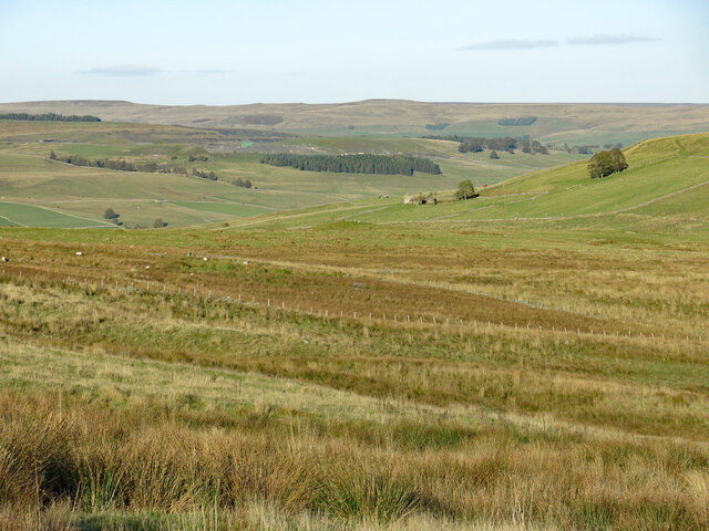
Swinhopeburn Wood, located in Durham, is a picturesque forest that covers an area of approximately 100 acres. It is nestled within the North Pennines Area of Outstanding Natural Beauty, offering visitors a tranquil and idyllic escape from the bustling city life.

The wood is predominantly made up of native broadleaf trees, including oak, ash, and birch, which create a dense canopy that provides shade and shelter for a wide variety of wildlife. The forest floor is adorned with a vibrant carpet of bluebells and wildflowers during the spring, enhancing the natural beauty of the area.

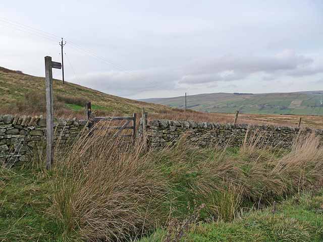
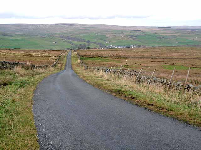
Swinhopeburn Wood is crisscrossed with a network of well-maintained footpaths and trails, allowing visitors to explore the woodland at their own pace. These paths lead visitors through the heart of the forest, meandering alongside babbling brooks and through peaceful glades. The wood also boasts a small stream, which adds to the tranquility of the surroundings.

The forest is home to a diverse range of wildlife, including roe deer, badgers, and a multitude of bird species. Birdwatchers will particularly enjoy their visit, as Swinhopeburn Wood provides an excellent habitat for woodland birds such as woodpeckers, owls, and warblers.

The wood is open to the public throughout the year, offering a range of recreational activities such as walking, picnicking, and nature watching. It is a popular destination for families, nature enthusiasts, and photographers, who are all drawn to the natural beauty and peaceful atmosphere that Swinhopeburn Wood has to offer.

If you have any feedback on the listing, please let us know in the comments section below.

Swinhopeburn Wood Images

Images are sourced within 2km of 54.730029/-2.1452184 or Grid Reference NY9037. Thanks to Geograph Open Source API. All images are credited.

Embankment on the former Bishop Auckland to Wearhead branch line Similar view in image <a href="https://www.geograph.org.uk/photo/6117873">NY8837 : Low embankment on the former Bishop Auckland to Wearhead branch line</a> but a different season.
Embankment on the former Bishop Auckland to Wearhead branch line
Embankment on the former Bishop Auckland to Wearhead branch The disused line embankment between Daddry Shield and St. John's Chapel.
Embankment on the former Bishop Auckland to Wearhead branch
The disused line embankment between Daddry Shield and St. John's Chapel.
Small waterfall on the River Wear upstream of Daddry Shield bridge
Former trackbed of the Weardale branch line This section is now part of the Weardale Way walking trail.
Former trackbed of the Weardale branch line
This section is now part of the Weardale Way walking trail.
River Wear upstream near Daddry Shield Extensive areas of stones and boulders are exposed due to the low water level in the river in this view from the Weardale Way on its south side.
[Note: as this image upload was made, (28 April 2022), 1:50 000 OS mapping, depending on how it was accessed on the Geograph website showed the route of the Weardale Way on different sides of the river at the location.]
River Wear upstream near Daddry Shield
Extensive areas of stones and boulders are exposed due to the low water level in the river in this view from the Weardale Way on its south side. [Note: as this image upload was made, (28 April 2022), 1:50 000 OS mapping, depending on how it was accessed on the Geograph website showed the route of the Weardale Way on different sides of the river at the location.]
Old railway bed on south side of River Wear The grassed and slightly raised route of the disused Weardale Railway is apparent to the right of the riverside path; the track once reached Wearhead.
Old railway bed on south side of River Wear
The grassed and slightly raised route of the disused Weardale Railway is apparent to the right of the riverside path; the track once reached Wearhead.
Daddry Shield from the Weardale Way Small village seen from the long distance footpath, but not visited.
Daddry Shield from the Weardale Way
Small village seen from the long distance footpath, but not visited.
Weardale Way from Daddryshield Bridge Looking upriver, the long distance footpath is squeezed between a barbed wire fence and the riverbank.
Weardale Way from Daddryshield Bridge
Looking upriver, the long distance footpath is squeezed between a barbed wire fence and the riverbank.
River Wear between Daddry Shield and Westgate A 77 mile route following the River Wear from the sea at the Lindesfarne Memorial, Sunderland to the headwaters in the east Pennines, keeping as close as is possible to the river. It visits Lumley Castle, Durham (where the Castle and Cathedral forms a World Heritage Site), Bishop Auckland and Stanhope. After Stanhope the Way makes a northward loop to Rookhope to take in part of a tributary, Rookhope Burn.
River Wear between Daddry Shield and Westgate
A 77 mile route following the River Wear from the sea at the Lindesfarne Memorial, Sunderland to the headwaters in the east Pennines, keeping as close as is possible to the river. It visits Lumley Castle, Durham (where the Castle and Cathedral forms a World Heritage Site), Bishop Auckland and Stanhope. After Stanhope the Way makes a northward loop to Rookhope to take in part of a tributary, Rookhope Burn.
The Weardale Way by the Wear at Bridge End A 77 mile route following the River Wear from the sea at the Lindesfarne Memorial, Sunderland to the headwaters in the east Pennines, keeping as close as is possible to the river. It visits Lumley Castle, Durham (where the Castle and Cathedral forms a World Heritage Site), Bishop Auckland and Stanhope. After Stanhope the Way makes a northward loop to Rookhope to take in part of a tributary, Rookhope Burn.
The Weardale Way by the Wear at Bridge End
A 77 mile route following the River Wear from the sea at the Lindesfarne Memorial, Sunderland to the headwaters in the east Pennines, keeping as close as is possible to the river. It visits Lumley Castle, Durham (where the Castle and Cathedral forms a World Heritage Site), Bishop Auckland and Stanhope. After Stanhope the Way makes a northward loop to Rookhope to take in part of a tributary, Rookhope Burn.
The Weardale Way downstream of Daddry Shield
Swin Hope below Swinside House Looking north east from just to the south of <a href="https://www.geograph.org.uk/photo/2691160">NY8935 : Swinside House</a> (photographed by Oliver Dixon) across the valley towards the ruined farmhouse at <a href="https://www.geograph.org.uk/photo/6217773">NY9036 : Far New Close (3)</a>.
Swin Hope below Swinside House
Looking north east from just to the south of NY8935 : Swinside House (photographed by Oliver Dixon) across the valley towards the ruined farmhouse at NY9036 : Far New Close (3).
River Wear above Daddry Shield Fast flowing upland river at this point with the Weardale way path following the riverbank to the left.
River Wear above Daddry Shield
Fast flowing upland river at this point with the Weardale way path following the riverbank to the left.
Bouseteams at Daddryshield Burn There are extensive surface remains in the valley of the Daddryshield Burn and the adjacent Greenlaws Hush. The collapsing bays seen here on both sides of the stream are bouseteams which were used to store mined ore, every mining partnership having is own bay.
Bouseteams at Daddryshield Burn
There are extensive surface remains in the valley of the Daddryshield Burn and the adjacent Greenlaws Hush. The collapsing bays seen here on both sides of the stream are bouseteams which were used to store mined ore, every mining partnership having is own bay.
Farmhouse at Glenwhelt Glenwhelt is a farm in Weardale, close to Westgate. The road descends to Westgate having crossed from Teesdale via Swindale; it's also the route of the long distance walk, 'A Pennine Journey'.
Farmhouse at Glenwhelt
Glenwhelt is a farm in Weardale, close to Westgate. The road descends to Westgate having crossed from Teesdale via Swindale; it's also the route of the long distance walk, 'A Pennine Journey'.
Footpath at Ramshaw Well Head This footpath gets off to a bad start by crossing an unbridged ditch before reaching the gate.
Footpath at Ramshaw Well Head
This footpath gets off to a bad start by crossing an unbridged ditch before reaching the gate.
Descent to Westgate The final descent into Weardale on the mountain road between Newbiggin (Teesdale) and Westgate (Weardale).
Descent to Westgate
The final descent into Weardale on the mountain road between Newbiggin (Teesdale) and Westgate (Weardale).
Entrance to Daddry Shield
Show me another place!

Swinhopeburn Wood is located at Grid Ref: NY9037 (Lat: 54.730029, Lng: -2.1452184)

Unitary Authority: County Durham

Police Authority: Durham

What 3 Words

///constants.adopting.stowing. Near Stanhope, Co. Durham

Related Wikis

Westgate-in-Weardale railway station

Westgate-in-Weardale railway station served the village of Westgate, County Durham, England, from 1895 to 1965 on the Weardale Railway. == History == The...

Westgate Methodist Chapel

Westgate Methodist Chapel stands on the A689 road in the village of Westgate, some 5 miles (8 km) west of Stanhope, County Durham, England (grid reference...

Westgate, County Durham

Westgate is a village in the civil parish of Stanhope, in County Durham, England. It is situated in Weardale between St John's Chapel and Eastgate. In...

North Pennines

The North Pennines is the northernmost section of the Pennine range of hills which runs north–south through northern England. It lies between Carlisle...

Daddry Shield

Daddry Shield is a village in the civil parish of Stanhope, in County Durham, England. It is situated on the south side of the River Wear in Weardale,...

A689 road

The A689 is a road in northern England that runs east from the A595, 3.1 miles (5.0 km) to the west of Carlisle in Cumbria, to Hartlepool in County Durham...

Brotherlee

Brotherlee is a small village in the civil parish of Stanhope, in County Durham, England situated on the south side of Weardale, between Stanhope and Daddry...

Slit Woods

Slitt Woods is a Site of Special Scientific Interest in the Wear Valley district of County Durham, England. It occupies the valley of Middlehope Burn,...

Nearby Amenities

Located within 500m of 54.730029,-2.1452184
Power: pole
Lat/Long: 54.7323046/-2.1397514
The data included in this document is from www.openstreetmap.org. The data is made available under ODbL.

Have you been to Swinhopeburn Wood?

Leave your review of Swinhopeburn Wood below (or comments, questions and feedback).