Billinside Plantation

Wood, Forest in Yorkshire Richmondshire

England

Billinside Plantation

Cragdale Water Pennine beck tumbling down over limestone outcrops into Raydale.
Cragdale Water Credit: Gordon Hatton

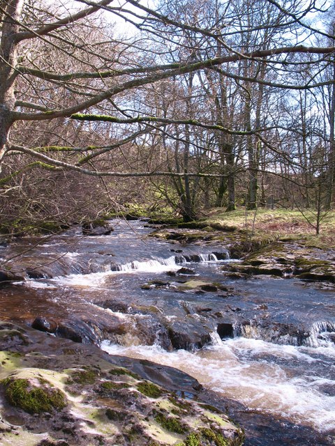
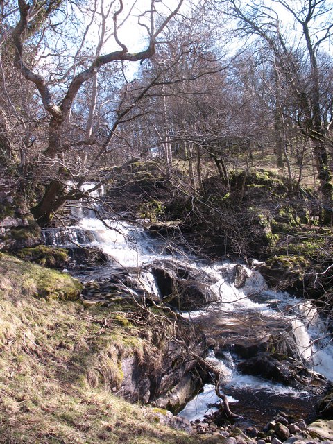
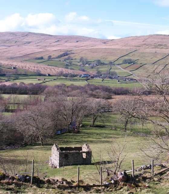
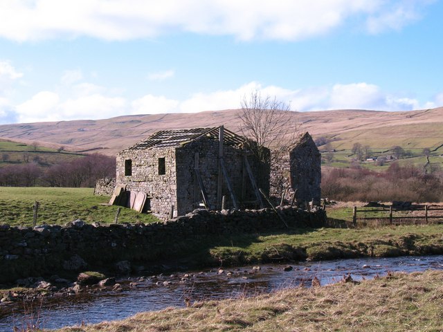
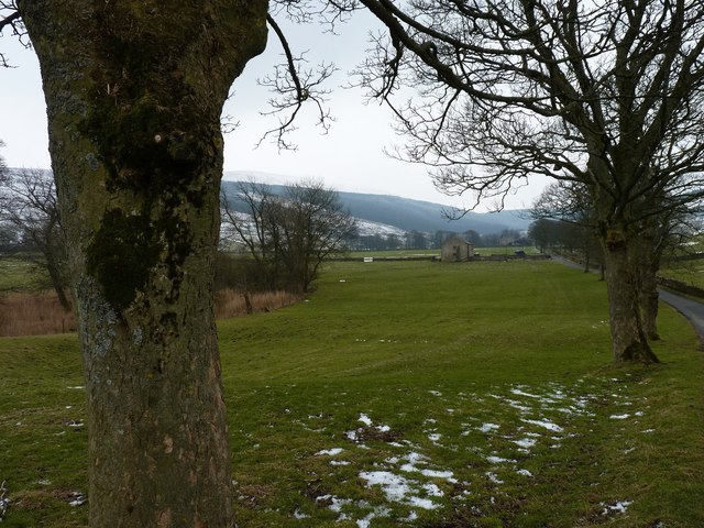
Billinside Plantation is a picturesque woodland area located in Yorkshire, England. Covering a vast expanse, it is nestled within the charming landscape of the Yorkshire Dales. The plantation is characterized by its dense growth of various tree species, creating a stunning forested environment.

The woodland is predominantly composed of native trees such as oak, beech, and birch, which thrive in the fertile soil of the region. This diverse mix of tree species not only enhances the visual appeal of the plantation but also provides a habitat for an array of wildlife. Visitors to Billinside Plantation may encounter various bird species, including woodpeckers and owls, as well as small mammals like deer, squirrels, and rabbits.

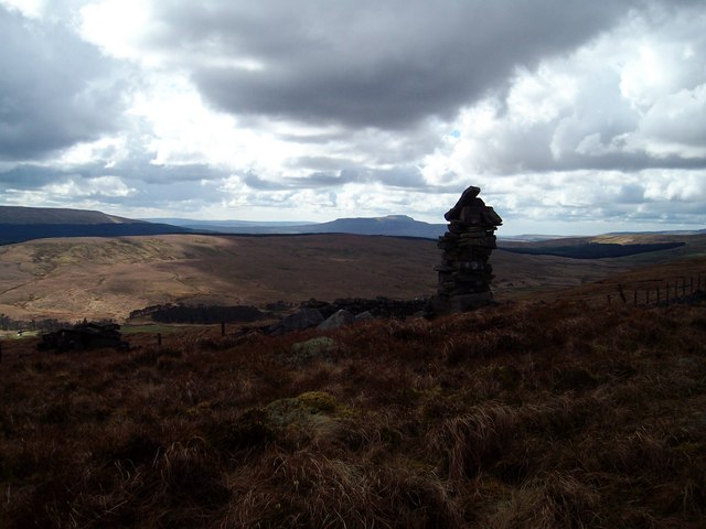
The plantation offers a tranquil escape for nature enthusiasts and outdoor enthusiasts alike. Its well-maintained walking trails provide visitors with the opportunity to explore the enchanting woodland at their own pace. The serene atmosphere and captivating beauty of the surroundings make it an ideal destination for those seeking relaxation or a peaceful retreat.

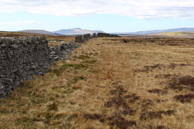
Furthermore, Billinside Plantation has historical significance, as it was once an important timber resource during the industrial revolution. The area was actively managed for forestry purposes and supplied wood for various industries. Today, remnants of this industrial past can still be seen in the form of old structures and pathways, adding a touch of nostalgia to the plantation.

Overall, Billinside Plantation in Yorkshire is a remarkable woodland that combines natural beauty, biodiversity, and a touch of history. Its scenic trails, diverse flora and fauna, and peaceful ambiance make it a must-visit destination for nature lovers and history enthusiasts alike.

If you have any feedback on the listing, please let us know in the comments section below.

Billinside Plantation Images

Images are sourced within 2km of 54.249748/-2.147007 or Grid Reference SD9083. Thanks to Geograph Open Source API. All images are credited.

Cragdale Water Pennine beck tumbling down over limestone outcrops into Raydale.
Cragdale Water
Pennine beck tumbling down over limestone outcrops into Raydale.
Cascading waters A section of Cragdale Water tumbling down over limestone outcrops.
Cascading waters
A section of Cragdale Water tumbling down over limestone outcrops.
Awaiting repair A roofless stone barn near Stalling Busk. Many of the roof slates are stacked against the gable wall, and there is a chance that the barn may be repaired.
Awaiting repair
A roofless stone barn near Stalling Busk. Many of the roof slates are stacked against the gable wall, and there is a chance that the barn may be repaired.
Park Scar A fine waterfall dropping over a limestone outcrop. Unusually, the waterfall is not a 'force', whilst the beck is Cragdale Water - quite possibly the only 'water' in the Yorkshire Dales. The fall is well off the beaten track, but visitors to Raydale Preserves at Stalling Busk can take a farm trail which passes close by.
Park Scar
A fine waterfall dropping over a limestone outcrop. Unusually, the waterfall is not a 'force', whilst the beck is Cragdale Water - quite possibly the only 'water' in the Yorkshire Dales. The fall is well off the beaten track, but visitors to Raydale Preserves at Stalling Busk can take a farm trail which passes close by.
Duerley Barns Two stone barns in poor condition, at the side of Cragdale Water.
Duerley Barns
Two stone barns in poor condition, at the side of Cragdale Water.
Yockenthwaite Moor Boundary fence on Yockenthwaite Moor.
Yockenthwaite Moor
Boundary fence on Yockenthwaite Moor.
High Lane at Bank Wood
Barn between the trees Close to Raydale Lodge.
Barn between the trees
Close to Raydale Lodge.
Raydale House Now a country house with holiday accommodation, Raydale House is not only reputed to be haunted by "Auld 'opper" but was also the scene of the Raydale Riot, when in 1617 Sir Thomas Metcalfe of Nappa Hall besieged the house with 60 armed men in a dispute with his tenant, William Robinson of Worton.
Raydale House
Now a country house with holiday accommodation, Raydale House is not only reputed to be haunted by "Auld 'opper" but was also the scene of the Raydale Riot, when in 1617 Sir Thomas Metcalfe of Nappa Hall besieged the house with 60 armed men in a dispute with his tenant, William Robinson of Worton.
Small Plantation at Shaw Side
Public Footpath off High Lane
Cattle grazing above Stalling Busk
Raydale View over Raydale from High Lane. Marsett is at centre-right, about 2/3 up the picture. Wether Fell is in the distance.
Raydale
View over Raydale from High Lane. Marsett is at centre-right, about 2/3 up the picture. Wether Fell is in the distance.
Grouse Butt high above Upper Raydale Remote shooting station on high moorland between Wensleydale and Wharfedale
Grouse Butt high above Upper Raydale
Remote shooting station on high moorland between Wensleydale and Wharfedale
Broken Wall high above Upper Raydale A randon broken dry stone wall snakes across moorland - without any clear purpose or enclosure
Broken Wall high above Upper Raydale
A randon broken dry stone wall snakes across moorland - without any clear purpose or enclosure
On Cragdale Moor Large expanse of moorland on the watershed between Wharfedale and Wensleydale
On Cragdale Moor
Large expanse of moorland on the watershed between Wharfedale and Wensleydale
Boundary Wall on Cragdale Moor Following a dry stone wall beside Long Gill over rough moorland
Boundary Wall on Cragdale Moor
Following a dry stone wall beside Long Gill over rough moorland
Long Gill House Merits an entry onto the definitive map, but turns out to be almost a total ruin above Cragdale Water.
Long Gill House
Merits an entry onto the definitive map, but turns out to be almost a total ruin above Cragdale Water.
Show me another place!

Billinside Plantation is located at Grid Ref: SD9083 (Lat: 54.249748, Lng: -2.147007)

Division: North Riding

Administrative County: North Yorkshire

District: Richmondshire

Police Authority: North Yorkshire

What 3 Words

///level.youths.plunge. Near Leyburn, North Yorkshire

Nearby Locations

Billinside Plantation

Related Wikis

St Matthew's Church, Stalling Busk

St Matthew's Church, Stalling Busk is a Grade II listed parish church in the Church of England in Stalling Busk, North Yorkshire. == History == The church...

Stalling Busk

Stalling Busk is one of three settlements around Semer Water in the Richmondshire district of North Yorkshire in the small dale of Raydale just off...

Marsett

Marsett is one of three settlements in around Semer Water in Raydale, a small side dale off Wensleydale in North Yorkshire, England. Marsett is only a...

Fleet Moss

Fleet Moss is a upland area separating Wharfedale from Wensleydale in North Yorkshire, England. The area is 1,850 ft (560 m) above sea level (although...

Nearby Amenities

Located within 500m of 54.249748,-2.147007
Billinside Moor
Is In: UK, England, Yorkshire, North Yorkshire, Wharfedale, Yorkshire Dales
Natural: moor
Source: NPE
Lat/Long: 54.2501272/-2.1417024
The data included in this document is from www.openstreetmap.org. The data is made available under ODbL.

Have you been to Billinside Plantation?

Leave your review of Billinside Plantation below (or comments, questions and feedback).