Maidford Brake

Wood, Forest in Wiltshire

England

Maidford Brake

Bremilham Church in Cowage Farmyard Bremilham Church in Cowage Farmyard, used once a year on Rogation Sunday
Bremilham Church in Cowage Farmyard Credit: Robin Somes

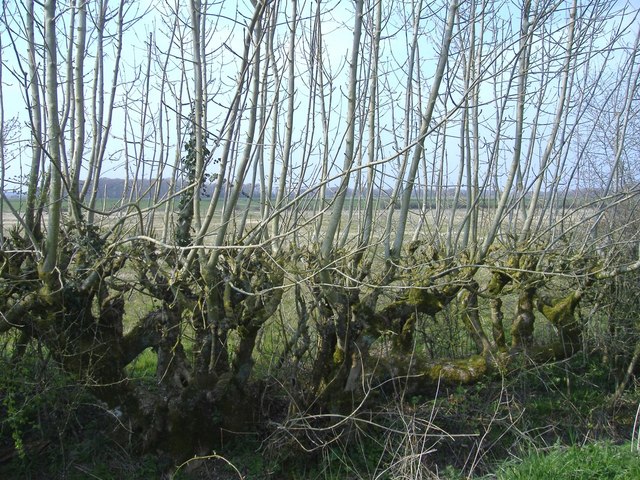
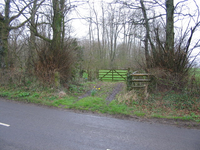
Maidford Brake is a picturesque woodland located in the county of Wiltshire, England. It is situated near the village of Maidford and covers an area of approximately 100 acres. The woodland is known for its dense foliage, tall trees, and diverse range of plant and animal species.

The forest is primarily composed of broadleaf trees, including oak, beech, and ash, which create a lush canopy overhead. The forest floor is covered in a thick layer of fallen leaves, providing a natural carpet for visitors to walk on. There are also several clearings within the woodland, offering tranquil spots for picnics or relaxation.

Maidford Brake is a haven for wildlife, attracting a wide variety of bird species. Birdwatchers can spot woodpeckers, owls, and various songbirds within the forest. The woodland is also home to mammals such as deer, foxes, and badgers, making it an ideal location for nature enthusiasts.

Visitors to Maidford Brake can enjoy several walking trails that wind through the woodland, allowing them to explore its natural beauty. These trails vary in length and difficulty, catering to both casual strollers and avid hikers. Along the way, there are informative signs providing information about the flora and fauna found in the area.

Overall, Maidford Brake is a peaceful and enchanting woodland that offers a welcome escape from the hustle and bustle of everyday life. Its natural beauty and abundant wildlife make it a must-visit destination for those seeking a connection with nature in Wiltshire.

If you have any feedback on the listing, please let us know in the comments section below.

Maidford Brake Images

Images are sourced within 2km of 51.558618/-2.1510069 or Grid Reference ST8984. Thanks to Geograph Open Source API. All images are credited.

Bremilham Church in Cowage Farmyard Bremilham Church in Cowage Farmyard, used once a year on Rogation Sunday
Bremilham Church in Cowage Farmyard
Bremilham Church in Cowage Farmyard, used once a year on Rogation Sunday
Cowage farmhouse A view across the meadows.
Cowage farmhouse
A view across the meadows.
Field of rape, Court Farm
Ford, at Court Farm, Hullavington
Byway, from Foxley to Corston
Ash hedge An old hedge responds to severe cutting, with vigorous new growth.
Ash hedge
An old hedge responds to severe cutting, with vigorous new growth.
Tree-lined byway
Tree-lined byway
Forgotten corner
Forgotten corner
King's Heath
King's Heath
Track to Cowage Grove
Stony ground
Stony ground
Bremilham Church The smallest church in Britain still in service is located at Cowage farm, in Foxley, on the outskirts of Malmesbury, Wiltshire.

It is barely 4 metres long by 3.6 metres wide and holds one service a year at Rogationtide.
Bremilham Church
The smallest church in Britain still in service is located at Cowage farm, in Foxley, on the outskirts of Malmesbury, Wiltshire. It is barely 4 metres long by 3.6 metres wide and holds one service a year at Rogationtide.
All Saints, Norton A view looking south across the graveyard towards the church of All Saints at Norton. For some reason, the OS map does not show this church as having a tower.
All Saints, Norton
A view looking south across the graveyard towards the church of All Saints at Norton. For some reason, the OS map does not show this church as having a tower.
The church at Foxley A view looking north to the church at Foxley.
The church at Foxley
A view looking north to the church at Foxley.
Footpath into Maidford Clump. A view looking northeast across the lane from Norton to the overgrown stile at the start of the public footpath into Maidford Clump. Luckily, the second gate is on a latch, although the post holding black and yellow directional sign is broken and lying on the ground.
Footpath into Maidford Clump.
A view looking northeast across the lane from Norton to the overgrown stile at the start of the public footpath into Maidford Clump. Luckily, the second gate is on a latch, although the post holding black and yellow directional sign is broken and lying on the ground.
Ewe looking at me? A slightly menacing look from one of a pair of animals in a field at Foxley.
Ewe looking at me?
A slightly menacing look from one of a pair of animals in a field at Foxley.
Fosse Way fields A broad expanse of farmland, east of the Fosse Way. Here, a short stretch of the famous Roman road is metalled.
Fosse Way fields
A broad expanse of farmland, east of the Fosse Way. Here, a short stretch of the famous Roman road is metalled.
Foxley Manor farm Situated at the west end of Foxley hamlet.
Foxley Manor farm
Situated at the west end of Foxley hamlet.
Show me another place!

Maidford Brake is located at Grid Ref: ST8984 (Lat: 51.558618, Lng: -2.1510069)

Unitary Authority: Wiltshire

Police Authority: Wiltshire

What 3 Words

///spider.cringes.sparks. Near Norton, Wiltshire

Related Wikis

Norton, Wiltshire

Norton is a small village and civil parish in Wiltshire, England, about 3.5 miles (5.6 km) south-west of Malmesbury. The parish includes the hamlets of...

Hullavington railway station

Hullavington railway station served the civil parish of Hullavington, Wiltshire, England from 1903 to 1965 on the South Wales Main Line. == History... ==

Bremilham

Bremilham, also known as Cowage or Cowich, is a small settlement and former civil parish in north Wiltshire, England. It is near the hamlet of Foxley in...

Hullavington

Hullavington is a village and civil parish in Wiltshire, England, just to the north of the M4 motorway. The village lies about 4 miles (6 km) southwest...

Whatley Manor

Whatley Manor is a hotel, restaurant and spa housed in a former farm and estate buildings, near Easton Grey in the southern Cotswolds, about 2 miles (3...

Corston, Wiltshire

Corston is a small village on the A429 road in Wiltshire, England, in the civil parish of St Paul Malmesbury Without, approximately 3 miles (4.8 km) south...

St Paul Malmesbury Without

St Paul Malmesbury Without is a civil parish surrounding Malmesbury, Wiltshire, England. Its main settlements are the village of Corston and the hamlets...

Easton Grey

Easton Grey is a small village and civil parish in north Wiltshire, England, on the county boundary with Gloucestershire. The village lies just south of...

Nearby Amenities

Located within 500m of 51.558618,-2.1510069
Material: wood
Power: pole
Lat/Long: 51.5591236/-2.1440586
Material: wood
Power: pole
Lat/Long: 51.5583565/-2.1451986
Material: wood
Power: pole
Lat/Long: 51.5575678/-2.1463197
Material: wood
Power: pole
Lat/Long: 51.5567873/-2.1474409
Material: wood
Power: pole
Lat/Long: 51.5559685/-2.1486291
Material: wood
Power: pole
Lat/Long: 51.5551847/-2.1497718
Material: wood
Power: pole
Lat/Long: 51.5541274/-2.1512818
Power: pole
Lat/Long: 51.5630512/-2.1519084
Power: pole
Lat/Long: 51.5627754/-2.1510057
Power: pole
Lat/Long: 51.5625053/-2.1501953
Power: pole
Lat/Long: 51.562151/-2.1490554
Power: pole
Lat/Long: 51.5618081/-2.1479369
The data included in this document is from www.openstreetmap.org. The data is made available under ODbL.

Have you been to Maidford Brake?

Leave your review of Maidford Brake below (or comments, questions and feedback).