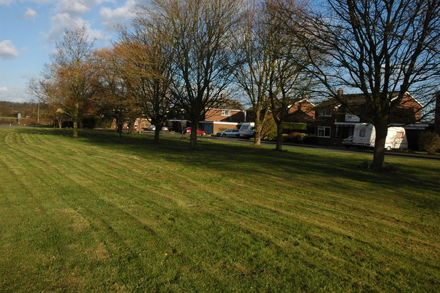
Salt Baths Covert

Wood, Forest in Worcestershire Malvern Hills

England

Salt Baths Covert

Path into Croome Park The entrance path from the car park and reception into Croome Park.
Path into Croome Park Credit: Philip Halling

Salt Baths Covert, located in Worcestershire, England, is a picturesque woodland area known for its natural beauty and historical significance. Nestled within the larger Wood, Forest region, Salt Baths Covert offers visitors a tranquil escape from the hustle and bustle of everyday life.

The covert is characterized by its dense cover of trees, predominantly consisting of oak, beech, and birch. These ancient woodlands provide a haven for a diverse array of flora and fauna, making it a popular spot for nature enthusiasts and wildlife photographers. Bluebells, primroses, and wild garlic carpet the forest floor during spring, creating a serene and colorful atmosphere.

The area's name, Salt Baths Covert, is derived from its historical association with salt production. In the past, this covert was home to salt pans, where brine was evaporated to extract salt. These salt baths played a crucial role in the local economy, attracting trade and industry to the region.

Today, Salt Baths Covert offers a range of recreational activities for visitors. The forest is crisscrossed with walking trails, allowing hikers and walkers to explore the enchanting woodland at their own pace. Additionally, the area is a popular spot for birdwatching, with species such as woodpeckers, tawny owls, and various migratory birds being spotted throughout the year.

Salt Baths Covert is not only a natural treasure but also a place of historical significance, making it a must-visit destination for those seeking a blend of nature and heritage.

If you have any feedback on the listing, please let us know in the comments section below.

Salt Baths Covert Images

Images are sourced within 2km of 52.090049/-2.1567235 or Grid Reference SO8943. Thanks to Geograph Open Source API. All images are credited.

Path into Croome Park The entrance path from the car park and reception into Croome Park.
Path into Croome Park
The entrance path from the car park and reception into Croome Park.
Dry Arch Bridge, Croome Park View through the Dry Arch Bridge on a cold and frosty January day.
Dry Arch Bridge, Croome Park
View through the Dry Arch Bridge on a cold and frosty January day.
Tree in Croome Park Tree reflected in the partially frozen lake in Croome Park.
Tree in Croome Park
Tree reflected in the partially frozen lake in Croome Park.
View from the Grotto The lake in Croome Park viewed from within the Grotto.
View from the Grotto
The lake in Croome Park viewed from within the Grotto.
Frozen lake Frozen lake in Croome Park, Croome Court can be seen through the trees.
Frozen lake
Frozen lake in Croome Park, Croome Court can be seen through the trees.
Frozen lake in Croome Park Trees reflected in the frozen lake in Croome Park.  Croome Court can be seen in the background.
Frozen lake in Croome Park
Trees reflected in the frozen lake in Croome Park. Croome Court can be seen in the background.
The old main road The old A4104 has now become a parking lot and storage space at this end. Still a right of way, but barely accessible over a large mound of earth.
The old main road
The old A4104 has now become a parking lot and storage space at this end. Still a right of way, but barely accessible over a large mound of earth.
Landing strip near Woodmancote This marker denotes the eastern end of the private grass landing strip to the north of the village. Large barns serving as hangars on the left. The Malvern Hills in the distance (the Worcestershire Beacon is just above the wind sock).
See <a href="https://www.geograph.org.uk/photo/2448255">SO9043 : Landing strip near Woodmancote</a> for the reverse view.
Landing strip near Woodmancote
This marker denotes the eastern end of the private grass landing strip to the north of the village. Large barns serving as hangars on the left. The Malvern Hills in the distance (the Worcestershire Beacon is just above the wind sock). See SO9043 : Landing strip near Woodmancote for the reverse view.
Path to woodland near Porter's Ashbed Looking north-west to an isolated wood near the Defford airfield. The landowner kindly allows access to this wood and several other private paths nearby. The public footpath ends at the corner of the wood, but a sign there reads "Visitors are permitted to enjoy this space, so long as dogs are kept under control and no wildlife, timber or flora are disturbed. No horse riding or motor vehicles please". I found the area most relaxing and at this time of year there are bluebells flowering in the wood.
Path to woodland near Porter's Ashbed
Looking north-west to an isolated wood near the Defford airfield. The landowner kindly allows access to this wood and several other private paths nearby. The public footpath ends at the corner of the wood, but a sign there reads "Visitors are permitted to enjoy this space, so long as dogs are kept under control and no wildlife, timber or flora are disturbed. No horse riding or motor vehicles please". I found the area most relaxing and at this time of year there are bluebells flowering in the wood.
Seat at the end of the landing strip At the west end of the light aircraft landing strip is a seat with a view across flat farmland to the Malvern Hills.
Seat at the end of the landing strip
At the west end of the light aircraft landing strip is a seat with a view across flat farmland to the Malvern Hills.
Landing strip near Woodmancote View east from the end of the grass runway. The large barns serving as hangars are beyond the oilseed rape crop on the right. 
See <a href="https://www.geograph.org.uk/photo/2446965">SO9143 : Landing strip near Woodmancote</a> for the other end of the strip.
Landing strip near Woodmancote
View east from the end of the grass runway. The large barns serving as hangars are beyond the oilseed rape crop on the right. See SO9143 : Landing strip near Woodmancote for the other end of the strip.
Track north of Woodmancote Heading north to the landing strip hangars just behind the farmhouse.
Track north of Woodmancote
Heading north to the landing strip hangars just behind the farmhouse.
Slip road at Elm Lodge Farm Somewhat unusually, a dedicated east to south slip road exists at the junction of the A4104 and Bourne Road.
Slip road at Elm Lodge Farm
Somewhat unusually, a dedicated east to south slip road exists at the junction of the A4104 and Bourne Road.
Bourne Road
Bourne Road
Bourne Road and adjoining farmland
Defford radio telescope The satellite receiving dish can also be seen in <a href="https://www.geograph.org.uk/photo/1834887">SO9044 : The former Defford airfield and radio telescope</a>, which gives historical background about the airfield. On the left is a remaining radome. Viewed from the railway line between Bromsgrove and Tewkesbury.
Defford radio telescope
The satellite receiving dish can also be seen in SO9044 : The former Defford airfield and radio telescope, which gives historical background about the airfield. On the left is a remaining radome. Viewed from the railway line between Bromsgrove and Tewkesbury.
Into the sunset A car heads west towards Upton on the A4104 at Woodmancote.
Into the sunset
A car heads west towards Upton on the A4104 at Woodmancote.
Footpath to Woodmancote Brake Looking south from the A4104.
Footpath to Woodmancote Brake
Looking south from the A4104.
Show me another place!

Salt Baths Covert is located at Grid Ref: SO8943 (Lat: 52.090049, Lng: -2.1567235)

Administrative County: Worcestershire

District: Malvern Hills

Police Authority: West Mercia

What 3 Words

///palettes.sized.indicates. Near Eckington, Worcestershire

Nearby Locations

Salt Baths Covert

Related Wikis

Dunstall Common

Dunstall Common is a village in Worcestershire, England.

RAF Defford

Royal Air Force Defford, or more simply RAF Defford, is a former Royal Air Force station located 1.1 miles (1.8 km) northwest of Defford, Worcestershire...
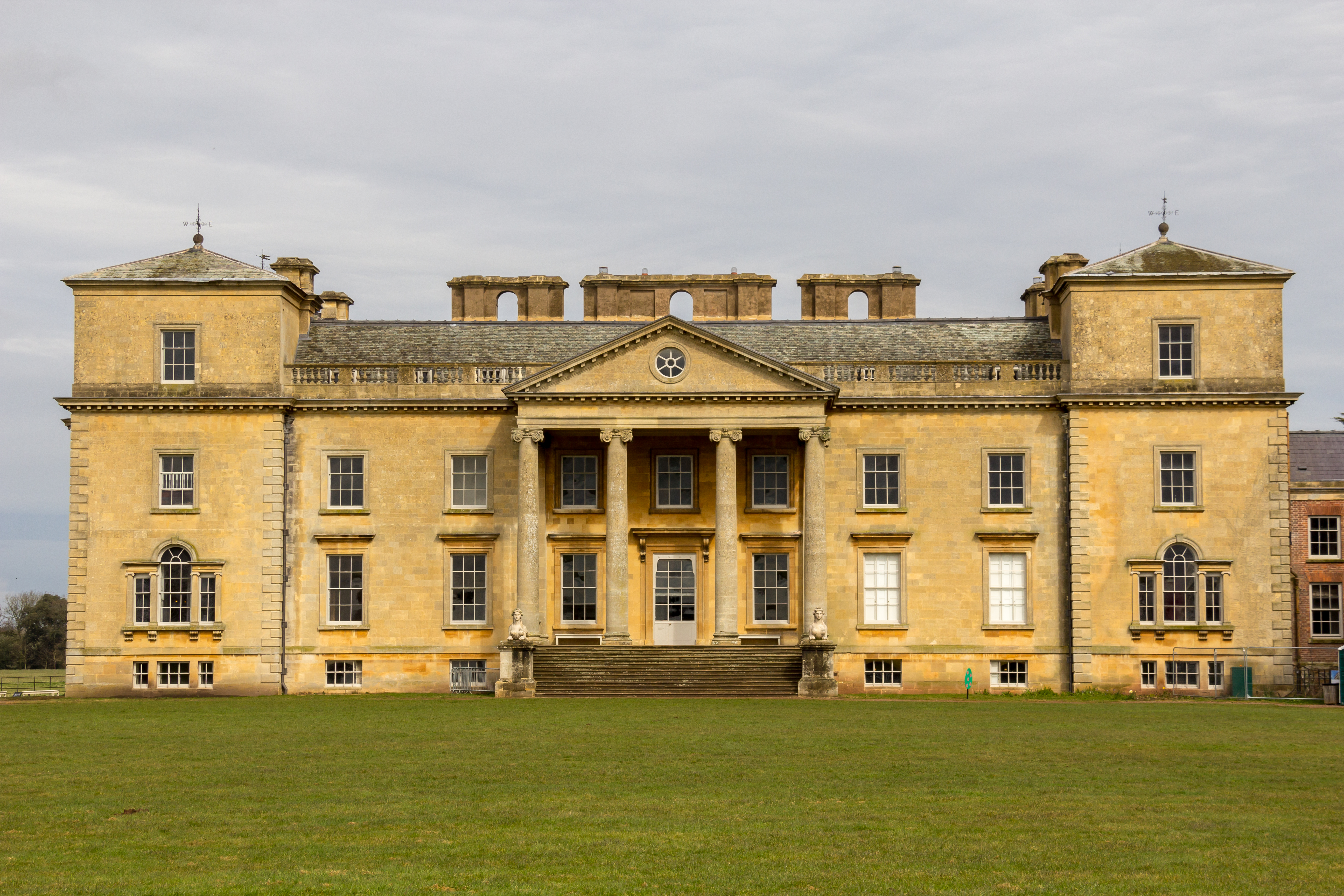
Croome Court

Croome Court is a mid-18th-century Neo-Palladian mansion surrounded by extensive landscaped parkland at Croome D'Abitot, near Upton-upon-Severn in south...

Horewell Forest

Horewell Forest was a royal forest, i. e. a royal game preserve. In the west, it bordered the river Severn, and Strensham in the south and extended to...

St Mary Magdalene's Church, Croome D'Abitot

St Mary Magdalene's Church is a former Anglican church in the grounds of Croome Court, at Croome D'Abitot, Worcestershire, England. It is recorded in...

Croome D'Abitot

Croome D'Abitot is a village and civil parish, which shares a joint parish council with Severn Stoke, in the Malvern Hills District in the county of Worcestershire...

Besford railway station

Besford railway station served the village of Besford, Worcestershire, England, from 1841 to 1846 on the Birmingham and Gloucester Railway. == History... ==

Baughton

Baughton is a hamlet in Worcestershire, England. The Population of Baughton is 193. The population as a whole is older than the national average and the...

Nearby Amenities

Located within 500m of 52.090049,-2.1567235
Barrier: stile
Foot: yes
Lat/Long: 52.0888686/-2.1620313
Barrier: stile
Foot: yes
Lat/Long: 52.0906438/-2.1629449
Location Transition: yes
Power: pole
Lat/Long: 52.0878544/-2.1603584
Power: pole
Lat/Long: 52.0879846/-2.1616325
Power: pole
Lat/Long: 52.0881329/-2.163097
MSF Defford Mill
Power: transformer
Transformer: distribution
Voltage Primary: 11000
Lat/Long: 52.0879755/-2.1597214
The data included in this document is from www.openstreetmap.org. The data is made available under ODbL.

Have you been to Salt Baths Covert?

Leave your review of Salt Baths Covert below (or comments, questions and feedback).